Category:Historical information signs in New Jersey
Jump to navigation
Jump to search
States of the United States: California · Florida · New Jersey · New York · Vermont · Virginia · West Virginia
Subcategories
This category has the following 2 subcategories, out of 2 total.
Media in category "Historical information signs in New Jersey"
The following 142 files are in this category, out of 142 total.
-
 1 Reinman Road, Warren Township, NJ - area view.jpg 2,674 × 1,783; 2.25 MB
-
 157 Main Street, Andover, NJ.jpg 1,566 × 1,566; 1.59 MB
-
-

-

-

-

-
 211 Cornelia Street, Boonton, NJ - information sign.jpg 2,591 × 2,591; 2.32 MB
-
 326 Clove Road, Millville, Sussex County, NJ - information sign.jpg 3,554 × 1,999; 3.91 MB
-
 4A Normandy Parkway, Morris Township, NJ - information sign.jpg 2,984 × 1,989; 2.71 MB
-
 6.28.10PeterUrbanMarkerByLuigiNovi.jpg 830 × 1,007; 218 KB
-
 Abbott's Farm, Hamilton Township, NJ - information sign.jpg 2,311 × 3,083; 1.87 MB
-
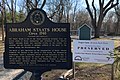 Abraham Staats House, NJ - information sign.jpg 2,305 × 1,536; 1.4 MB
-
 Allentown Mill.JPG 2,288 × 1,712; 767 KB
-
 BattleofBB.jpg 1,409 × 1,056; 1.01 MB
-
 Bay Head Historic District (3).JPG 2,288 × 1,712; 1.97 MB
-
 Baylor Massacre Historic Site 1778 jeh.jpg 4,000 × 3,000; 1.87 MB
-
 Beattystown, NJ - information sign.jpg 3,809 × 2,539; 2.79 MB
-
 Belleville Rolling Mill sign jeh.JPG 1,643 × 1,237; 745 KB
-
 Binghamton plaque.JPG 512 × 683; 159 KB
-
 Bishop Janes United Methodist Church, Basking Ridge, NJ.jpg 3,030 × 2,021; 2.78 MB
-
 Blairstown, NJ - historic district sign.jpg 2,002 × 2,670; 2.2 MB
-
 Bloomfield New Jersey Green Historic District Plaque 1987.jpg 1,840 × 3,264; 2.52 MB
-
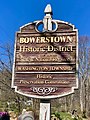 Bowerstown, NJ - historic district sign.jpg 2,316 × 3,088; 2.84 MB
-
 Camden & Amboy Railroad historical marker.jpg 1,840 × 1,873; 758 KB
-
 Camden and Amboy Railroad Memorial, Spotswood, NJ.jpg 3,636 × 2,424; 5.34 MB
-
 Chairville, NJ.jpg 2,272 × 1,704; 2.02 MB
-
 Chestnut Ridge Road, Montvale, NJ - Eckerson House, historical information.jpg 2,405 × 3,608; 3.21 MB
-
 Christ Church, New Brunswick, NJ - information sign.jpg 2,634 × 3,952; 3.16 MB
-
 Christ Church, New Brunswick, NJ - parish information sign.jpg 4,004 × 2,668; 3.14 MB
-
 Christopher Vought House, Annandale, NJ.jpg 2,459 × 1,639; 1.75 MB
-
 Clarksburg Methodist Episcopal Church.JPG 2,288 × 1,712; 772 KB
-
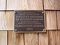 Clarksburg School.JPG 2,288 × 1,712; 876 KB
-
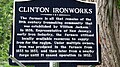 Clinton Ironworks, West Milford, NJ - information sign.jpg 1,920 × 1,080; 765 KB
-
 Columbus Park, Piscataway, NJ - Battle of Quibbletown information sign.jpg 2,849 × 1,899; 1.32 MB
-
 Combs Hollow, NJ - historic district sign.jpg 2,963 × 1,976; 2.4 MB
-
 Combs Hollow, NJ - house information sign.jpg 2,489 × 2,489; 2.05 MB
-
 Cooper Mill.JPG 3,648 × 2,736; 3.18 MB
-
 Cranberry Mills, Cranbury, NJ - information sign.jpg 3,290 × 2,193; 3.44 MB
-
 Cranetown, Montclair, NJ - information sign.jpg 2,084 × 1,389; 1.15 MB
-
 Derrick Van Veghten House, Finderne, NJ - information sign.jpg 1,202 × 1,602; 674 KB
-
 East Millstone, NJ - historic district sign.jpg 3,155 × 2,103; 2.23 MB
-
 Edgewater Vriessendael.JPG 416 × 616; 140 KB
-
 ExplosionAtLibertyPlaque.jpg 2,816 × 2,112; 2.39 MB
-
 Fairview Avenue, Long Valley, NJ - Old Stone Union Church information sign.jpg 3,001 × 1,999; 1.96 MB
-
 Finesville, NJ - information sign.jpg 3,183 × 2,122; 1.75 MB
-
 Finns Point Rear Range Light, Pennsville Township, NJ - information sign.jpg 3,075 × 2,050; 1.44 MB
-
 First Congregational Church, Chester, NJ - information sign.jpg 3,397 × 2,263; 3.76 MB
-
 First Reformed Church, New Brunswick, NJ - information sign.jpg 2,142 × 3,214; 1.78 MB
-
 Ford Mansion, Morristown, NJ - looking north.jpg 2,138 × 1,426; 1.43 MB
-
 Fosterfields, Morris Township, NJ - information sign.jpg 2,310 × 3,465; 2.92 MB
-
 German Valley, Long Valley, NJ - information sign.jpg 1,523 × 2,287; 1.61 MB
-
 Griggstown 01 by MNK.jpg 800 × 600; 241 KB
-
 HEDGES-FISH HOMESTEAD, MORRIS COUNTY.jpg 2,784 × 1,848; 620 KB
-
 Henry Guest House, New Brunswick, NJ - information sign.jpg 1,724 × 2,586; 1.21 MB
-
 Holcombe House, Lambertville, NJ - information sign.jpg 2,548 × 1,697; 1.32 MB
-
 Imlaydale, NJ - historic district view.jpg 3,330 × 2,220; 2.77 MB
-
 Information sign, Village Store, Harbourton, NJ.jpg 2,784 × 1,848; 662 KB
-
 Jersey Homesteads (Roosevelt), N.J. marker.jpg 1,224 × 1,632; 991 KB
-
 John Haring Jr house Westwood BCHS marker jeh.jpg 2,700 × 3,600; 1.52 MB
-
 John Hart's cave marker.jpg 246 × 777; 79 KB
-
 John's CoE JC sign jeh.jpg 1,812 × 3,011; 912 KB
-
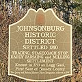 Johnsonburg Historic District information sign.jpg 1,483 × 1,483; 949 KB
-
 Jones Tavern, Annandale, NJ.jpg 1,975 × 1,317; 1,011 KB
-
 Joseph Turner House, NJ - information sign.jpg 2,890 × 1,927; 1.89 MB
-
 Lake Musconetcong, Netcong, NJ - information sign.jpg 3,169 × 2,113; 2.47 MB
-
 Lamington Black Cemetery, NJ - entrance gate.jpg 3,775 × 2,516; 4.11 MB
-
 Ledgewood, NJ - Morris Canal, Inclined Plane 3 East - information sign.jpg 2,841 × 2,841; 2.79 MB
-
 Liberty Corner, NJ - historic district sign.jpg 2,543 × 1,695; 1.21 MB
-
 Lime kiln, Fairmount, NJ.jpg 3,328 × 2,219; 3.86 MB
-
 Linvale Methodist Episcopal Church sign, Linvale, NJ.jpg 633 × 844; 310 KB
-
 Macculloch Hall, Morristown, NJ - information sign.jpg 2,351 × 1,567; 1.94 MB
-
 Main Street Canal Store, Port Murray, NJ - Morris Canal.jpg 2,815 × 1,876; 1.84 MB
-
 Market Square, City Hall Park, Perth Amboy, NJ - information sign.jpg 2,281 × 3,422; 1.32 MB
-
 Mary RCC High St sign jeh.jpg 3,477 × 2,057; 552 KB
-
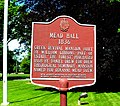 Mead Hall sign Drew U jeh.jpg 2,464 × 2,177; 1.12 MB
-
 Methodist Episcopal Church, Hibernia, NJ - information sign.jpg 2,185 × 2,185; 1.4 MB
-
 Middlebrook Encampment - information sign - 1777 Redoubt.jpg 857 × 1,286; 543 KB
-
 Middlebrook Encampment Redoubt - information sign - Revolutionary War.jpg 879 × 1,318; 571 KB
-
 Middlebrook Encampment Sign.jpg 594 × 396; 154 KB
-
 Millville Historic District sign, Montague Grange, Millville, Sussex County, NJ.jpg 3,846 × 2,163; 4.7 MB
-
 Morris Canal, Inclined Plane 5 West, Port Murray, NJ - information sign.jpg 2,303 × 3,071; 3.04 MB
-
 Morris Canal, Inclined Plane 7 West, Bowerstown, NJ - information sign.jpg 3,017 × 2,011; 3.18 MB
-
 Morris Canal, Inclined Plane 9 West, Port Warren, NJ - information sign.jpg 1,376 × 2,065; 1 MB
-
 Morris Canal, Lock 10 West, Green's Bridge, NJ - area view.jpg 3,309 × 2,206; 2 MB
-
 Morris Canal, Lock 8 West, Pohatcong Township, NJ - area view.jpg 3,297 × 2,198; 2.81 MB
-
 Navesink Military Reservation, Battery 219, gun site.jpg 3,264 × 2,177; 2.96 MB
-
 Neshanic Station, NJ - historic district sign.jpg 3,246 × 2,164; 2.71 MB
-
 New Germantown, Oldwick, NJ - historical information.jpg 1,564 × 1,042; 640 KB
-
 New Hampton, NJ - information signs.jpg 3,280 × 2,186; 2.94 MB
-
 New Jersey Brigade information sign, Bernardsville, NJ.jpg 884 × 588; 353 KB
-
 NJ 57 westbound Concrete Mile start April 2020.jpg 3,114 × 2,155; 1.24 MB
-
 Oak Summit School, Kingwood Township, NJ.jpg 2,678 × 1,783; 1.86 MB
-
 Old Mine Road information plaque by Decker Ferry House, Flatbrookville, NJ.jpg 2,288 × 1,712; 826 KB
-
 Old Mine Road information plaque by Pahaquarry Copper Mine, NJ.jpg 2,527 × 1,685; 1.62 MB
-
 Old Newton Burial Ground, Newton, NJ - entrance.jpg 4,032 × 2,268; 4.77 MB
-
 Old Tree at the Church.JPG 800 × 600; 170 KB
-
 Old York Road sign large.JPG 1,224 × 1,632; 789 KB
-
 Parsley's Ferry, NJ - information sign.jpg 1,400 × 1,400; 1,000 KB
-
 PITTSTOWN HISTORIC DISTRICT, HUNTERDON COUNTY.jpg 2,784 × 1,848; 511 KB
-
 Pleasant Valley, Warren County, NJ - historic district sign.jpg 2,505 × 3,340; 2.49 MB
-
 Port Colden, NJ - historic district view.jpg 3,142 × 2,093; 2.85 MB
-
 Potterstown, NJ - information sign.jpg 2,417 × 1,611; 1.31 MB
-
 Presbyterian Church Cemetery sign, Basking Ridge, NJ.jpg 2,688 × 1,792; 2.07 MB
-
 Presbyterian Church Cemetery sign, Mount Airy, NJ.jpg 1,486 × 1,981; 938 KB
-
 Presbyterian Church on the Green, Morristown, NJ - information sign.jpg 2,714 × 3,618; 3.31 MB
-
 Quaker Meeting House, Quakertown, NJ - area view.jpg 3,294 × 2,197; 3.41 MB
-
 Quarry Office, Clinton, NJ.jpg 2,894 × 1,929; 2.28 MB
-
 RARITAN LANDING ARCH. SITE, MIDDLESEX COUNTY, NJ.jpg 436 × 540; 124 KB
-
 Raritan Water sign.jpg 1,640 × 2,446; 1.4 MB
-
 READINGTON VILLAGE H.D., HUNTERDON COUNTY.jpg 2,784 × 1,848; 480 KB
-
 Richwood Academy Cultural Center sign, Richwood, NJ.jpg 2,670 × 1,780; 1.31 MB
-
 Riegelsville, NJ - information sign.jpg 2,096 × 2,096; 1.62 MB
-
 Rockaway Valley Railroad, Washington Valley, NJ - information sign.jpg 1,384 × 1,384; 846 KB
-
 Rockleigh Historic District sign.jpg 858 × 1,287; 569 KB
-
 Rutherfurd Hall, Allamuchy Township, NJ - information sign.jpg 2,418 × 2,418; 1.9 MB
-
 Salter's Mill, Imlaystown, NJ - information signs.jpg 2,990 × 1,993; 1.28 MB
-
 Salter's Mill.JPG 2,288 × 1,712; 860 KB
-
 Saxtonville Tavern with information sign.jpg 2,183 × 1,455; 1.58 MB
-
 School sign Verona jeh.jpg 3,451 × 3,451; 3.01 MB
-
 Stockton station, Stockton, NJ.jpg 4,378 × 2,919; 3.48 MB
-
 Sybils Cave sign jeh.jpg 1,026 × 678; 216 KB
-
 Taylor's Mill Historic District, NJ - information sign.jpg 2,571 × 1,714; 1.86 MB
-
 Taylor's Mill, Readington Township, NJ.jpg 3,135 × 2,090; 2.73 MB
-
 The Church in the Glen, Netcong, NJ - information sign.jpg 2,134 × 2,845; 2.8 MB
-
 The Green - 1715 sign, Morristown, NJ.jpg 2,921 × 1,947; 2.86 MB
-
 The Lafayette Foundry, Lafayette, NJ - information sign.jpg 1,777 × 1,777; 1.63 MB
-
 Tingley Road, Brookside, NJ - trail signs.jpg 2,816 × 1,877; 1.69 MB
-
 Trinity & St. Phillips, Newark, plaque jeh.jpg 2,149 × 2,406; 438 KB
-
 United Methodist Church, Califon, NJ - information sign.jpg 2,768 × 2,768; 1.79 MB
-
 United Methodist Church, Cokesbury, NJ - looking east.jpg 2,644 × 2,644; 2.28 MB
-
 Van Horne House, Bridgewater Township, NJ - information sign.jpg 3,550 × 2,366; 3.59 MB
-
 Van Horne House, Bridgewater Township, NJ - Old York Road tablet.jpg 3,105 × 2,284; 2.09 MB
-
 Van Syckel Tavern, Van Syckel, NJ - information sign.jpg 2,384 × 1,589; 1.46 MB
-
 Van Wyck Brooks Historic District sign, Plainfield, NJ.jpg 2,899 × 1,933; 2.4 MB
-
 Verona Leni Lenape trail sign jeh.jpg 4,129 × 3,097; 3.9 MB
-
 Victory Gardens, NJ municipal building (2), Sept 2022.jpg 3,648 × 2,736; 2.77 MB
-
 Wallpack, NJ - information sign.jpg 2,184 × 1,456; 1.75 MB
-
 Washington Crossing State Park NJ Johnson Ferry House sign.JPG 818 × 1,161; 289 KB
-
 Washington Park Historic District sign, North Plainfield, NJ.jpg 2,230 × 1,487; 1.79 MB
-
 Washington Valley Historic District - information sign.jpg 2,295 × 1,530; 1.18 MB
-
 Washington's Headquarters, Morristown, NJ.jpg 2,703 × 1,802; 2.06 MB


_at_Quakertown_Road_in_Franklin_Township,_Hunterdon_County,_New_Jersey.jpg)
_west_of_Cole_Road_in_Franklin_Township,_Warren_County,_New_Jersey.jpg)
_west_of_Cole_Road_in_Franklin_Township,_Warren_County,_New_Jersey.jpg)
_just_east_of_Richline_Hill_Road_in_Greenwich_Township,_Warren_County,_New_Jersey.jpg)
_just_east_of_Richline_Hill_Road_in_Greenwich_Township,_Warren_County,_New_Jersey.jpg)


.JPG)


,_N.J._marker.jpg)


,_Sept_2022.jpg)


