Category:Historical location maps of Germany
Jump to navigation
Jump to search
Subcategories
This category has only the following subcategory.
Media in category "Historical location maps of Germany"
The following 28 files are in this category, out of 28 total.
-
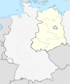
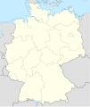
Germany location map July 1993 - December 2009.svg 1,075 × 1,273; 608 KB
-
Germany location map October 1990 - March 1992.svg 1,075 × 1,273; 449 KB
-
Germany, Federal Republic of location map 23 May 1949 - 6 Oct 1949.svg 1,075 × 1,273; 1.12 MB
-
Germany, Federal Republic of location map April 1952 - August 1955.svg 1,073 × 1,272; 858 KB
-
Germany, Federal Republic of location map December 1950 - April 1952.svg 1,075 × 1,273; 502 KB
-
Germany, Federal Republic of location map January 1957 - October 1990.svg 1,075 × 1,273; 490 KB
-
Germany, Federal Republic of location map October 1949 - November 1950.svg 1,075 × 1,273; 501 KB
-
Germany, Federal Republic of location map September 1955 - December 1956.svg 1,075 × 1,273; 497 KB
-
Germany, location map (SBZ perspective) 23 May 1949 - 6 Oct 1949.svg 1,075 × 1,273; 1.14 MB
-
Germany location map 8 Jun 1947 - 22 Apr 1949.svg 1,075 × 1,273; 1.12 MB
-
Germany location map 23 April 1949 - 22 May 1949.svg 1,075 × 1,273; 1.13 MB
-
Germany location map April 1992 - July 1992.svg 1,075 × 1,273; 449 KB
-
Germany location map August 1992 - June 1993.svg 1,075 × 1,273; 450 KB
-
East Germany location map.svg 618 × 789; 966 KB
-
German Democratic Republic - East Germany (1949-1990).png 1,728 × 2,048; 385 KB
-
German Empire 1914 adm location map.svg 1,425 × 1,133; 761 KB
-
German Empire 1914 adm-e location map.svg 1,425 × 1,133; 565 KB
-
German Empire 1937 adm location map.svg 1,425 × 1,133; 763 KB
-
German Empire blank map.svg 1,425 × 1,133; 1,014 KB
-
German Reich 1937 adm location map (Dutch title).png 746 × 593; 189 KB
-
Germany, FRG and GDR location map October 1949 - November 1950.svg 1,075 × 1,273; 492 KB
-
Holy Roman Empire 1250 (location map scheme).svg 8,291 × 10,793; 3.25 MB
-
Location map of Gau Westmark.svg 1,038 × 767; 514 KB
-
Location map of Sportgau Südwest.svg 283 × 195; 183 KB
-
Saar Protectorate Germany location map 8 Jun 1947 - 22 Apr 1949.png 1,729 × 2,047; 521 KB
-
States and City-States of the Federal Republic of Germany - West Germany (1957-1990).png 1,728 × 2,048; 574 KB
-
Weimar Republic (1918-1933); Nazi Germany (1933-1938).png 2,560 × 2,035; 969 KB
-
Weimar Republic blank map.svg 1,425 × 1,133; 967 KB

