Category:Hobkirk (civil parish)
Jump to navigation
Jump to search
Scottish parish in Scottish Borders, Scotland, UK | |||||
| Upload media | |||||
| Instance of | |||||
|---|---|---|---|---|---|
| Part of |
| ||||
| Named after | |||||
| Location |
| ||||
| Population |
| ||||
| Area |
| ||||
 | |||||
Subcategories
This category has the following 3 subcategories, out of 3 total.
Media in category "Hobkirk (civil parish)"
The following 200 files are in this category, out of 299 total.
(previous page) (next page)-

-

-
 A disused quarry at Shankend - geograph.org.uk - 2354852.jpg 640 × 427; 171 KB
-
 A farmland shed near Bedrule - geograph.org.uk - 2150405.jpg 640 × 427; 164 KB
-
 A ladder stile on Bonchester Hill - geograph.org.uk - 6163054.jpg 1,024 × 683; 527 KB
-
 A new plantation on Pike Fell - geograph.org.uk - 941312.jpg 640 × 359; 80 KB
-
 A small stone bridge over the B6399 - geograph.org.uk - 5369232.jpg 2,000 × 1,333; 1.82 MB
-
 A view of Hawthornside Hill - geograph.org.uk - 3071872.jpg 640 × 480; 88 KB
-
 A willow crop at Town-o'-Rule - geograph.org.uk - 1216372.jpg 637 × 388; 141 KB
-
 A6088 - geograph.org.uk - 3467156.jpg 640 × 480; 303 KB
-
 A6088 approaching Bonchester Bridge - geograph.org.uk - 3163301.jpg 800 × 548; 134 KB
-
 A6088 near Hobsburn - geograph.org.uk - 3163293.jpg 800 × 607; 94 KB
-
 Abandoned Cattle grid near Langburnshiels - geograph.org.uk - 5880007.jpg 1,024 × 768; 151 KB
-
 Arable land, Weensmuir - geograph.org.uk - 4998231.jpg 800 × 600; 230 KB
-
 At the feeding station - geograph.org.uk - 1216354.jpg 640 × 427; 141 KB
-
 Attractive haughland near Hobkirk in the Scottish Borders - geograph.org.uk - 6291225.jpg 5,184 × 3,888; 7.35 MB
-
 B6357 by Easter Fodderlee - geograph.org.uk - 3163366.jpg 640 × 459; 53 KB
-
 B6357 near Sclaterford - geograph.org.uk - 3163347.jpg 800 × 551; 67 KB
-
 B6399 just north of Roberts Linn - geograph.org.uk - 3162954.jpg 640 × 504; 39 KB
-
 B6399 north of Langburnshiels - geograph.org.uk - 3162890.jpg 1,024 × 767; 107 KB
-
 B6399 north of Pleaknowe - geograph.org.uk - 3163041.jpg 800 × 526; 74 KB
-
 Bedrule Farm - geograph.org.uk - 2150415.jpg 640 × 427; 146 KB
-
 Beech trees at a field boundary - geograph.org.uk - 1216469.jpg 640 × 431; 132 KB
-
 Bend in new track at Lurgiescleuch near Hobkirk - geograph.org.uk - 6291332.jpg 5,184 × 3,888; 7.19 MB
-

-
 Bonchester Farm from the hill - geograph.org.uk - 3091805.jpg 800 × 530; 124 KB
-
 Bonchester Hill - geograph.org.uk - 1246148.jpg 420 × 640; 90 KB
-
 Bonchester Hill fort from the air - geograph.org.uk - 6158862.jpg 671 × 1,024; 234 KB
-
 Bonchester Hill fort from the air - geograph.org.uk - 6158866.jpg 1,024 × 768; 283 KB
-
 Bonchester Hill from Hobkirk - geograph.org.uk - 3089313.jpg 800 × 530; 91 KB
-
 Border Abbeys Way in Dykesglen Wood - geograph.org.uk - 4177636.jpg 640 × 480; 560 KB
-

-
 Braidhaugh - geograph.org.uk - 1246171.jpg 640 × 327; 69 KB
-
 Break in forestry near Lurgiescleuch - geograph.org.uk - 6291337.jpg 5,184 × 3,888; 7.26 MB
-
-
 Bridge over the Rule Water - geograph.org.uk - 2669278.jpg 800 × 530; 202 KB
-
 Burn running off Wigg Knowe - geograph.org.uk - 4499848.jpg 800 × 533; 439 KB
-
 Burn that goes under the A6088 - geograph.org.uk - 1578758.jpg 640 × 480; 107 KB
-
 Burnside field, Wolfelee - geograph.org.uk - 1523085.jpg 640 × 427; 103 KB
-
 Catlee Burn - geograph.org.uk - 1523091.jpg 640 × 427; 146 KB
-
 Catlee Burn viewed from the bridge at Forkins - geograph.org.uk - 4772850.jpg 4,000 × 3,000; 4.73 MB
-
 Cattle grid on the B6399 - geograph.org.uk - 5879844.jpg 1,024 × 768; 126 KB
-
 Cattle near Dykeheads - geograph.org.uk - 924900.jpg 611 × 426; 150 KB
-
 Causewayfoot Cottage - geograph.org.uk - 1246081.jpg 640 × 427; 131 KB
-
 Clear fell, Wauchope Forest - geograph.org.uk - 4509488.jpg 800 × 533; 366 KB
-

-
 Clearfell of blanket forestry. - geograph.org.uk - 876175.jpg 640 × 485; 77 KB
-

-
 Coming in to land - geograph.org.uk - 5627872.jpg 1,024 × 683; 447 KB
-
 Cooper's Cleuch - geograph.org.uk - 4509516.jpg 800 × 533; 359 KB
-
 Cottage by the junction, Braidhaugh - geograph.org.uk - 3090060.jpg 800 × 530; 156 KB
-

-

-
 Country lane joining country road at Highend - geograph.org.uk - 4772812.jpg 4,000 × 3,000; 3.91 MB
-
 Country road at Hawthornside - geograph.org.uk - 1397293.jpg 640 × 630; 134 KB
-
 Country road at Highend - geograph.org.uk - 4772814.jpg 4,000 × 3,000; 3.64 MB
-
 Country road passing through Midburn - geograph.org.uk - 4772797.jpg 4,000 × 3,000; 3.93 MB
-
 Course of Pines Burn in the Scottish Borders - geograph.org.uk - 6291273.jpg 5,184 × 3,888; 6.84 MB
-
 Crown Plantation - geograph.org.uk - 3899975.jpg 640 × 480; 355 KB
-
 Crown Wood - geograph.org.uk - 909506.jpg 480 × 640; 131 KB
-
 Cuddies - geograph.org.uk - 4511327.jpg 800 × 533; 390 KB
-
 Cuddies - geograph.org.uk - 4511669.jpg 800 × 533; 383 KB
-
 Descent to Kay Wood - geograph.org.uk - 5363504.jpg 1,024 × 678; 199 KB
-
 Edge of the good stuff - geograph.org.uk - 4499018.jpg 800 × 533; 401 KB
-
 Embankment, hill fort on Bonchester Hill - geograph.org.uk - 3091797.jpg 800 × 530; 146 KB
-
 Entrance to a garden - geograph.org.uk - 1915120.jpg 640 × 480; 128 KB
-
 Entrance to Bonchester Bridge - geograph.org.uk - 2684909.jpg 640 × 480; 73 KB
-
 Extraction lane - geograph.org.uk - 4509524.jpg 800 × 600; 520 KB
-
 Fanna Hill - geograph.org.uk - 3305679.jpg 1,600 × 1,200; 1.23 MB
-
 Farm Building, Hawthornside Farm - geograph.org.uk - 3163241.jpg 800 × 524; 94 KB
-
 Farm buildings at East Fodderlee - geograph.org.uk - 2539315.jpg 640 × 480; 69 KB
-
 Farmland along Fodderlee Sike - geograph.org.uk - 2539321.jpg 640 × 480; 73 KB
-
 Farmland at Dykeheads - geograph.org.uk - 924913.jpg 640 × 427; 123 KB
-
 Farmland at Wauchope Common - geograph.org.uk - 924904.jpg 640 × 427; 165 KB
-
 Felling, Wauchope Forest - geograph.org.uk - 4509232.jpg 800 × 533; 405 KB
-
 Field by Bonchester Bridge - geograph.org.uk - 3467153.jpg 640 × 480; 246 KB
-
 Field by Gatehousecote - geograph.org.uk - 3467134.jpg 640 × 480; 247 KB
-
 Field corner below Bonchester Hill - geograph.org.uk - 3090062.jpg 800 × 530; 148 KB
-
 Field track and path to Rubers Law - geograph.org.uk - 5363969.jpg 1,024 × 678; 178 KB
-
 Field track on Rubers Law - geograph.org.uk - 5363519.jpg 1,024 × 678; 251 KB
-
 Flosh Burn - geograph.org.uk - 3652651.jpg 640 × 360; 193 KB
-
 Forest south of Shankendshiel - geograph.org.uk - 2245418.jpg 640 × 480; 53 KB
-
 Forestry beyond the fields, Harwoodmill - geograph.org.uk - 3089652.jpg 800 × 530; 146 KB
-
 Forestry fence, Brown's Sike - geograph.org.uk - 1492570.jpg 640 × 480; 99 KB
-
 Gate and stile, Borders Abbeys Way - geograph.org.uk - 5364373.jpg 1,024 × 678; 245 KB
-
 Gateway to the grazing lands beyond - geograph.org.uk - 3071836.jpg 640 × 480; 91 KB
-
 Gorse and pine trees on Bonchester Hill - geograph.org.uk - 795492.jpg 640 × 480; 144 KB
-
 Grand entrance to the woods - geograph.org.uk - 1915079.jpg 640 × 480; 133 KB
-
 Grass, Hawthornside - geograph.org.uk - 4998211.jpg 800 × 600; 179 KB
-
 Grazing at Easter Fodderlee - geograph.org.uk - 1914998.jpg 640 × 480; 47 KB
-
 Grazing land at Hawthornside - geograph.org.uk - 1397196.jpg 640 × 480; 25 KB
-
 Grey Mare's Sike - geograph.org.uk - 941269.jpg 640 × 480; 69 KB
-
 Guarding the entrance to Crowntailrig - geograph.org.uk - 4772910.jpg 4,000 × 3,000; 3.24 MB
-

-
 Hallrulemull Bridge - geograph.org.uk - 3467140.jpg 640 × 480; 261 KB
-
 Hartshaugh - geograph.org.uk - 3468170.jpg 640 × 480; 287 KB
-
 Harwood big hoose near Hobkirk - geograph.org.uk - 6291098.jpg 5,184 × 3,888; 7.52 MB
-
 Harwood Lake clear of trees near Hobkirk - geograph.org.uk - 6291368.jpg 3,128 × 2,346; 2.75 MB
-
 Hawklawtongues - geograph.org.uk - 4509510.jpg 800 × 533; 362 KB
-
 Hawthornside Hill - geograph.org.uk - 1471576.jpg 640 × 480; 94 KB
-
 Heading south towards Shankend Farm - geograph.org.uk - 2245371.jpg 640 × 480; 48 KB
-
 Hedge and tree-lined minor road at Scaur Plantation - geograph.org.uk - 6001534.jpg 4,000 × 3,000; 3.95 MB
-
 Hedge enclosed minor lane heading towards Town-o'-rule - geograph.org.uk - 6001524.jpg 4,000 × 3,000; 2.87 MB
-

-
 Hedge enclosed minor road heading towards Weensmuir Farm - geograph.org.uk - 6001528.jpg 4,000 × 3,000; 3.22 MB
-
 Hill farmland at Hemlaw Knowes - geograph.org.uk - 924922.jpg 640 × 427; 138 KB
-
 Hill fort ramparts, Bonchester Hill - geograph.org.uk - 3091791.jpg 800 × 530; 124 KB
-
 Hill stream in clear-fell. - geograph.org.uk - 876201.jpg 640 × 485; 111 KB
-
 Hobkirk - geograph.org.uk - 1246161.jpg 640 × 427; 94 KB
-
 Houses at Harwood in the Scottish Borders - geograph.org.uk - 6291232.jpg 5,184 × 3,888; 7.74 MB
-
 Hyndlee Burn - geograph.org.uk - 3899881.jpg 640 × 480; 318 KB
-
 Hyndlee Glen from the air - geograph.org.uk - 5669021.jpg 480 × 640; 131 KB
-

-
 Inside a field of willow saplings - geograph.org.uk - 1216382.jpg 640 × 427; 140 KB
-
 Invisible stile, Donaldson Plantation - geograph.org.uk - 3089597.jpg 800 × 530; 192 KB
-
 Junction at Braidhaugh - geograph.org.uk - 1916214.jpg 640 × 480; 94 KB
-
 Junction of new tracks on Harwood in the Scottish Borders - geograph.org.uk - 6291323.jpg 5,184 × 3,888; 5.59 MB
-
 Junction of two minor roads - geograph.org.uk - 1168221.jpg 640 × 480; 88 KB
-
 Kiln Sike - geograph.org.uk - 3649708.jpg 640 × 360; 209 KB
-
 Kiln Sike - geograph.org.uk - 5447913.jpg 640 × 480; 96 KB
-
 Laidlehope Head - geograph.org.uk - 4509223.jpg 800 × 600; 437 KB
-
 Laidlehope Head - geograph.org.uk - 4509238.jpg 800 × 533; 449 KB
-
 Lambs on the road by Bonchester Farm - geograph.org.uk - 796049.jpg 638 × 462; 116 KB
-
 Langburnshiels - geograph.org.uk - 941214.jpg 640 × 359; 75 KB
-
 Langburnshiels Farm - geograph.org.uk - 1429878.jpg 640 × 480; 125 KB
-
 Langraw - geograph.org.uk - 1246136.jpg 640 × 427; 103 KB
-
 Langraw Tops - geograph.org.uk - 4998220.jpg 800 × 600; 230 KB
-
 Langside Burn valley and Shankend Viaduct from the B6399 - geograph.org.uk - 5118528.jpg 1,600 × 1,011; 363 KB
-
 Log stacks, Wauchope Forest - geograph.org.uk - 4509480.jpg 800 × 533; 369 KB
-
 Logging road out of Hell's Hole - geograph.org.uk - 4498407.jpg 800 × 533; 450 KB
-
 Logging road, Wauchope Forest - geograph.org.uk - 4499838.jpg 800 × 533; 415 KB
-
 Logging road, Wauchope Forest - geograph.org.uk - 4509473.jpg 800 × 533; 406 KB
-
 Logging road, Wauchope Forest - geograph.org.uk - 4509522.jpg 800 × 533; 391 KB
-
 Logging road, Wauchope Forest - geograph.org.uk - 4509528.jpg 800 × 533; 452 KB
-
 Logging road, Wauchope Forest - geograph.org.uk - 4511111.jpg 800 × 533; 412 KB
-

-
 Looking downstream on Harwood Burn in the Scottish Borders - geograph.org.uk - 6291221.jpg 5,184 × 3,888; 7.11 MB
-

-

-

-
 Looking south on the B6399 - geograph.org.uk - 2245392.jpg 640 × 480; 62 KB
-
 Looking towards Hawthornside Hill - geograph.org.uk - 5376417.jpg 2,000 × 1,333; 2.48 MB
-
 Looking towards Rubers Law - geograph.org.uk - 5376427.jpg 2,000 × 1,333; 2.06 MB
-
 Lurgies Burn from the air - geograph.org.uk - 5669022.jpg 640 × 480; 126 KB
-
 Lurgiescleuch near Hobkirk - geograph.org.uk - 6291066.jpg 5,184 × 3,888; 5.56 MB
-
 Lurgiescleuch road crossing Pines Burn by causeway - geograph.org.uk - 6291075.jpg 5,184 × 3,888; 5.94 MB
-
 Mature conifers - geograph.org.uk - 4498402.jpg 800 × 600; 505 KB
-
 Mature conifers, Wauchope Forest - geograph.org.uk - 4511655.jpg 800 × 600; 480 KB
-
 Minor road approaching the A6088 road at Peel Knowe - geograph.org.uk - 6001530.jpg 4,000 × 3,000; 3.6 MB
-
 Minor road at Timberholme - geograph.org.uk - 6001518.jpg 4,000 × 3,000; 3.52 MB
-
 Minor road at Town-o'-rule - geograph.org.uk - 6001523.jpg 4,000 × 3,000; 2.88 MB
-
 Minor road leaving Bonchester Bridge - geograph.org.uk - 1397266.jpg 640 × 480; 71 KB
-
 Minor road to Bedrule - geograph.org.uk - 5364155.jpg 1,024 × 678; 218 KB
-
 Minor road, Bonchester Bridge - geograph.org.uk - 3467148.jpg 640 × 480; 288 KB
-
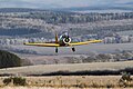
 Model flying enthusiasts at Bonchester Heights - geograph.org.uk - 5627868.jpg 1,024 × 683; 710 KB
-
 Model plane flying at Bonchester Heights - geograph.org.uk - 5627870.jpg 1,024 × 683; 370 KB
-
 Model plane flying at Bonchester Heights - geograph.org.uk - 5627871.jpg 1,024 × 683; 334 KB
-
 More footpath fun near Swanshiel - geograph.org.uk - 3089619.jpg 800 × 530; 174 KB
-
 Mud on the road - geograph.org.uk - 3014741.jpg 640 × 446; 65 KB
-
 New plantation, Lurgiescleuch - geograph.org.uk - 941294.jpg 640 × 359; 81 KB
-
 New Plantations on the B6399 - geograph.org.uk - 829179.jpg 640 × 480; 50 KB
-
 New road, Wauchope Forest - geograph.org.uk - 4509512.jpg 758 × 800; 236 KB
-
 New road, Wauchope Forest - geograph.org.uk - 4509520.jpg 640 × 426; 289 KB
-
 New road, Wauchope Forest - geograph.org.uk - 4511098.jpg 800 × 533; 450 KB
-
 New track crossing Lurgies Burn by causeway - geograph.org.uk - 6291350.jpg 5,184 × 3,888; 7.14 MB
-

-

-
 New track on Harwood near Hobkirk - geograph.org.uk - 6291325.jpg 5,184 × 3,888; 6.24 MB
-
 New track south side of Lurgies Burn near Hobkirk - geograph.org.uk - 6291360.jpg 5,184 × 3,888; 6.32 MB
-
 Newly felled block, Wauchope Forest - geograph.org.uk - 4511297.jpg 800 × 533; 460 KB
-
 Oak wood - geograph.org.uk - 4499816.jpg 800 × 533; 437 KB
-
 Old fank, Lurgies Burn - geograph.org.uk - 941282.jpg 640 × 480; 106 KB
-
 Ordnance Survey Flush Bracket 11418 - geograph.org.uk - 4772886.jpg 4,000 × 3,000; 2.96 MB
-
 Ordnance Survey Flush Bracket 11419 - geograph.org.uk - 4772848.jpg 4,000 × 3,000; 4.02 MB
-
 Ordnance Survey Flush Bracket 11420 - geograph.org.uk - 4772809.jpg 4,000 × 3,000; 3.73 MB
-
 Ordnance Survey Flush Bracket 11421 - geograph.org.uk - 4772793.jpg 4,000 × 3,000; 4.16 MB
-
 Ordnance Survey Flush Bracket 1436 - geograph.org.uk - 4773823.jpg 4,000 × 3,000; 4.13 MB
-
 Ordnance Survey Flush Bracket S7657 - geograph.org.uk - 4772890.jpg 4,000 × 3,000; 2.36 MB
-
 Ordnance Survey Flush Bracket S7658 - geograph.org.uk - 4772829.jpg 4,000 × 3,000; 3.92 MB
-
 Parkland near Bedrule - geograph.org.uk - 4177638.jpg 640 × 480; 462 KB
-
 Pasture near Bedrule - geograph.org.uk - 4997205.jpg 640 × 427; 116 KB
-
 Phantasy Kennels - geograph.org.uk - 1430008.jpg 640 × 480; 82 KB
-
 Pheasant weather vane - geograph.org.uk - 3089304.jpg 800 × 521; 56 KB
-
 Pike Fell - geograph.org.uk - 1492554.jpg 640 × 480; 86 KB
-
 Pike Fell - geograph.org.uk - 3280049.jpg 2,560 × 1,920; 2.71 MB
-
 Pines by the road near Billerwell - geograph.org.uk - 5363971.jpg 1,024 × 678; 286 KB
-
 Plantation near Windy Slack - geograph.org.uk - 4441363.jpg 1,920 × 1,280; 1.79 MB
-
 Plantation on Pike Fell - geograph.org.uk - 1492567.jpg 640 × 359; 84 KB
-
 Pond beside Fernielees Sike - geograph.org.uk - 941307.jpg 640 × 359; 57 KB
-
 Pond near Swanshiel - geograph.org.uk - 3089632.jpg 800 × 530; 139 KB
-
 Pond, Hass Sike - geograph.org.uk - 4499017.jpg 800 × 533; 415 KB
-
 Preparing a field at Langraw Farm - geograph.org.uk - 795101.jpg 640 × 427; 183 KB
-
 Quarry by the B6399 at Shankend - geograph.org.uk - 5960386.jpg 1,024 × 768; 140 KB
-
 Quarry, Shankend - geograph.org.uk - 1479246.jpg 480 × 640; 122 KB
-
 Rashy ground on Lurgies Rig - geograph.org.uk - 941275.jpg 640 × 359; 92 KB
-
 Rashy pasture - geograph.org.uk - 4511701.jpg 800 × 533; 345 KB
-
 Red squirrels and Borders Abbeys Way - geograph.org.uk - 5500175.jpg 1,600 × 1,060; 529 KB
-
 Reentrant, Wauchope Forest - geograph.org.uk - 4511675.jpg 800 × 533; 482 KB
-
 Ride, Wauchope Forest - geograph.org.uk - 4511095.jpg 800 × 533; 512 KB
-
 Ride, Wauchope Forest - geograph.org.uk - 4511303.jpg 800 × 533; 482 KB


&filefrom=Road+%28B6399%29+to+the+west+of+Wilson%27s+Shoulder+heading+down+Lang+Burn+valley+-+geograph.org.uk+-+4774031.jpg#mw-category-media)