Category:Hofanlage Bundesstraße 70 91 (Kluse)
Jump to navigation
Jump to search
| Object location | | View all coordinates using: OpenStreetMap |
|---|
Subcategories
This category has the following 2 subcategories, out of 2 total.
B
- Bundesstraße 70 91 (Kluse) (6 F)
S
Media in category "Hofanlage Bundesstraße 70 91 (Kluse)"
The following 5 files are in this category, out of 5 total.
-
 Kluse - B70 + Hofanlage91 + 91 + 91Scheune 01 ies.jpg 5,616 × 3,744; 25.1 MB
-
 Kluse - B70 + Hofanlage91 + 91 + 91Scheune 02 ies.jpg 5,616 × 3,745; 24.25 MB
-
 Kluse - B70 + Hofanlage91 + 91 01 ies.jpg 5,616 × 3,744; 22.91 MB
-
 Kluse - B70 + Hofanlage91 01 ies.jpg 5,616 × 3,744; 17.62 MB
-
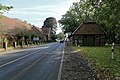
 Kluse - B70 - Hofanlage91 + 91 + 91Scheune 01 ies.jpg 5,616 × 3,744; 26.01 MB


