Category:Hofstraat 12, Dordrecht
Jump to navigation
Jump to search
| Object location | | View all coordinates using: OpenStreetMap |
|---|
 | |||||
| Upload media | |||||
| Instance of |
| ||||
|---|---|---|---|---|---|
| Location | Dordrecht, South Holland, Netherlands | ||||
| Street address |
| ||||
| Located on street | |||||
| Heritage designation |
| ||||
 | |||||
|
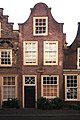
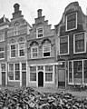
This is a category about rijksmonument number 13444
|
| Address |
|
Media in category "Hofstraat 12, Dordrecht"
The following 6 files are in this category, out of 6 total.
-
 Dordrecht Hofstraat 2-14.jpg 4,000 × 6,000; 19.04 MB
-
 Dordrecht Hofstraat2-4-6-8-10-12-14 018 0470.jpg 8,710 × 5,806; 46.89 MB
-
 Dordrecht Hofstraat8-10-12 018 0352.jpg 6,026 × 5,644; 31.26 MB
-
 Hofstraat12.jpg 2,592 × 3,888; 5.95 MB
-
 Overzicht vanaf nr.4 - Dordrecht - 20062111 - RCE.jpg 1,200 × 955; 250 KB
-
 Voorgevels - Dordrecht - 20062112 - RCE.jpg 964 × 1,200; 268 KB


