Category:Holkerstraat 25, Nijkerk
Jump to navigation
Jump to search
| Object location | | View all coordinates using: OpenStreetMap |
|---|
 | |||||
| Upload media | |||||
| Instance of |
| ||||
|---|---|---|---|---|---|
| Location | Nijkerk, Gelderland, Netherlands | ||||
| Street address |
| ||||
| Located on street |
| ||||
| Heritage designation |
| ||||
 | |||||
|
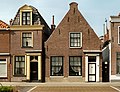
This is a category about rijksmonument number 30983
|
| Address |
|
Media in category "Holkerstraat 25, Nijkerk"
The following 2 files are in this category, out of 2 total.
-
 Nijkerk-Holkerstraat 25.jpg 3,126 × 2,394; 1.22 MB
-
 Voorgevel - Nijkerk - 20166571 - RCE.jpg 805 × 1,200; 197 KB
