Category:Homestake Mine
Jump to navigation
Jump to search
| Object location | | View all coordinates using: OpenStreetMap |
|---|
underground gold mine  La mine de Homestake en 1889. | |||||
| Upload media | |||||
| Instance of | |||||
|---|---|---|---|---|---|
| Location | Lead, Lawrence County, South Dakota | ||||
| Inception |
| ||||
| Dissolved, abolished or demolished date |
| ||||
| Mountain range | |||||
 | |||||
English: Locality: Homestake Mine — Lead District, Lawrence County, South Dakota, U.S.
- An extremely deep underground gold mine in operation from 1878 to 2001, with the nearby Bald Mountain Gold Mill to process ore.
- In 2007 the mine was selected by the National Science Foundation for the new Deep Underground Science and Engineering Laboratory (Sanford Underground Laboratory).
- Locality at mindat.org.
Subcategories
This category has the following 4 subcategories, out of 4 total.
Media in category "Homestake Mine"
The following 101 files are in this category, out of 101 total.
-
 Lead, South Dakota 1.jpg 800 × 533; 247 KB
-
 Aerial view of the Homestake Mine, Lead, SD 2022-07-10.jpg 3,174 × 4,612; 8.15 MB
-
 Air Loco (37287547392).jpg 5,358 × 3,014; 10.97 MB
-

-

-
 Auriferous greenschist 2, Homestake Mine.jpg 2,937 × 1,461; 5.07 MB
-
 Auriferous greenschist, Homestake Mine SD.jpg 1,500 × 614; 217 KB
-

-

-

-

-

-

-

-

-
 Bournonite-Pyrite-Quartz-rhqtz-29a.jpg 507 × 800; 96 KB
-
 Bournonite-Pyrite-Quartz-rhqtz-29b.jpg 400 × 349; 34 KB
-
 Bournonite-Pyrite-Quartz-rhqtz-29c.jpg 312 × 400; 27 KB
-
 Compressed Air Loco.jpg 2,592 × 1,944; 1.87 MB
-
 Dusel diagram.jpg 1,800 × 1,132; 495 KB
-
 GideonMoody.jpg 168 × 216; 17 KB
-

-

-

-

-

-

-
 Gold in quartz (Homestake Mine, Lead, Black Hills, South Dakota, USA) 1 (16540784614).jpg 2,440 × 1,674; 3.45 MB
-
 Gold in quartz (Homestake Mine, Lead, Black Hills, South Dakota, USA) 2 (17161578082).jpg 2,861 × 1,995; 2.77 MB
-
 Gold in quartz (Homestake Mine, Lead, Black Hills, South Dakota, USA) 3 (16540779624).jpg 2,757 × 1,993; 2.56 MB
-
 Gold in quartz (Homestake Mine, Lead, Black Hills, South Dakota, USA) 4 (17161573332).jpg 3,008 × 1,866; 2.63 MB
-

-

-

-
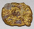 Gold-quartz placer nugget, Lead SD.jpg 570 × 485; 327 KB
-
 Grabill - Clean Up day at the Deadwood Terra Gold Stamp Mill.jpg 5,113 × 4,075; 2.37 MB
-
 Grabill - Lead City Mines and Mills, the Great Homestake Mines and Mills.jpg 5,113 × 4,187; 2.55 MB
-
 Grabill - Open cut in the great Homestake mine, at Lead City, Dakota.jpg 3,560 × 5,077; 2.17 MB
-
 Grabill - Part of the great Homestake works, Lead City, Dakota.jpg 5,113 × 3,821; 2.13 MB
-
 Grabill - Wells Fargo Express.jpg 5,113 × 4,121; 2.43 MB
-
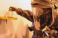 Hazmat team trains at Homestake Mine 121115-A-CW157-015.jpg 4,288 × 2,848; 894 KB
-

-

-
 Homestake Mine compressed locomotive and ore car.jpg 5,312 × 2,988; 4.88 MB
-
 Homestake Mine compressed locomotive No. 1A.jpg 5,312 × 2,988; 6.66 MB
-
 Homestake Mine compressed locomotive No. 35 and one ton ore car.jpg 5,312 × 2,988; 6.54 MB
-
 Homestake Mine compressed locomotive No. 9.jpg 5,312 × 2,988; 5.19 MB
-
 Homestake Mine gold ore closeup.jpg 785 × 690; 279 KB
-

-

-
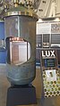 Homestake Mine LUX.jpg 2,988 × 5,312; 3.85 MB
-

-
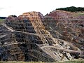
 Homestake Mine open pit, SD.jpg 8,243 × 2,354; 11.06 MB
-
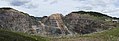
 Homestake Mine Pit.jpg 1,600 × 1,200; 474 KB
-
 Homestake Mine pneumatic drill.jpg 5,312 × 2,988; 7.74 MB
-
 Homestake Mine Ross Shaft Headframe Cage.jpg 2,988 × 5,312; 4.91 MB
-
 Homestake Mine Ross Shaft Headframe.jpg 5,312 × 2,988; 3.81 MB
-
 Homestake Mine slag buggy.jpg 5,312 × 2,988; 8.23 MB
-
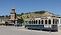 Homestake Mine Visitor Center, Lead, SD 20110822 1.jpg 4,860 × 2,734; 4.82 MB
-
 Homestake Mine water purification plant.jpg 5,312 × 2,988; 6.17 MB
-
 Homestake Mine Yates Shaft Headframe Hoisting Room beveled drum.jpg 2,988 × 5,312; 4.62 MB
-
 Homestake Mine Yates Shaft Headframe Hoisting Room.jpg 5,312 × 2,988; 4.61 MB
-
 Homestake Mine Yates Shaft Headframe.jpg 2,988 × 5,312; 4.81 MB
-
 Homestake Mine, South Dakota, 1900.jpg 7,162 × 5,385; 11.69 MB
-
 Homestake Mine, South Dakota-LCCN2008678263.jpg 7,394 × 5,593; 6.55 MB
-
 Homestake Mine, South Dakota-LCCN2008678263.tif 7,394 × 5,593; 118.34 MB
-
 Homestake Mining 1879.jpg 3,186 × 2,194; 2.45 MB
-
 Homestake Mining Company - 9 (0-4-0CA) (22814552470).jpg 4,073 × 2,436; 3.46 MB
-
 Homestake Mining Company Hydroelectric Plant No. 2.jpg 2,000 × 1,330; 766 KB
-
 Homestake works mine 1889.jpg 973 × 713; 289 KB
-
 Homestake.jpg 483 × 602; 67 KB
-
 Homestake1100506.jpg 2,000 × 1,233; 391 KB
-
 Homestake11005061100507.jpg 5,552 × 1,920; 3.59 MB
-
 Homestake11005061100508.jpg 6,112 × 1,920; 4.53 MB
-
 Homestake11005061100509.jpg 5,472 × 3,648; 7.85 MB
-
 Homestake11005061100510.jpg 2,000 × 1,333; 460 KB
-
 Homestake11005061100511.jpg 2,000 × 1,333; 458 KB
-
 Homestake11005061100512.jpg 2,000 × 1,333; 530 KB
-
 Homestake11005061100513.jpg 5,472 × 3,648; 7.33 MB
-
 Homestake11005061100515.jpg 2,000 × 1,333; 282 KB
-
 Homestake11005061100516.jpg 5,472 × 3,648; 8.67 MB
-
 Homestake11005061100518.jpg 5,792 × 1,920; 4.72 MB
-
 Homestake11005061100522.jpg 2,000 × 3,000; 1.28 MB
-
 Homestake11005061100527.jpg 2,000 × 3,000; 866 KB
-
 Homestake11005061100528.jpg 2,000 × 1,333; 347 KB
-
 Homestake2.jpg 516 × 606; 131 KB
-
 Homestake3.jpg 500 × 604; 107 KB
-

-
 Lead City Mines and Mills. The Great Homestake Mines and Mills LCCN99613856.jpg 5,113 × 4,187; 3.29 MB
-
 Lead Geologic Map Legend.jpg 1,251 × 465; 163 KB
-
 Lead Geologic Map.jpg 1,228 × 591; 594 KB
-
 Lead, South Dakota aerial 02A.jpg 4,288 × 2,848; 8.95 MB
-
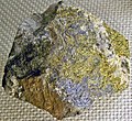
 Molybdenite-pyrite closeup Homestake Mine.jpg 2,831 × 2,460; 3.92 MB
-
 Molybdenite-pyrite Homestake Mine.jpg 1,537 × 1,407; 2.57 MB
-
 Quartz-191723.jpg 261 × 750; 43 KB
-
 Quartz-Bournonite-Pyrite-159833.jpg 507 × 800; 87 KB
-
 Silver-d73a.jpg 452 × 800; 29 KB
-
 Silver-d73b.jpg 236 × 400; 9 KB
-
 Lead, South Dakota aerial 01A.jpg 4,288 × 2,848; 8.41 MB
-
 Lead, South Dakota aerial 01.jpg 4,288 × 2,848; 3.84 MB
-
 Lead, South Dakota aerial 02.jpg 4,288 × 2,848; 4.01 MB


.jpg)
_1_(17053527410).jpg)
_2_(17054879289).jpg)

_1_(17214949526).jpg)
_2_(17240910815).jpg)
_3_(17053357240).jpg)
_4_(16618450984).jpg)
_5_(17240338841).jpg)
_6_(17239160152).jpg)
_7_(17054699819).jpg)
_8_(16618434564).jpg)


_(17207339661).jpg)
_1_(17048653449).jpg)
_2_(17027399647).jpg)
_3_(17234822895).jpg)
_4_(16614618403).jpg)
_5_(17047268430).jpg)
_1_(16540784614).jpg)
_2_(17161578082).jpg)
_3_(16540779624).jpg)
_4_(17161573332).jpg)
_(17204898935).jpg)
_1_(15212113902).jpg)
_2_(15025717909).jpg)


_(14736970735).jpg)
_(14736672692).jpg)

_the_Sanford_Underground_Research_Center.jpg)


_(22814552470).jpg)


