Category:Hong Kong Police Force Kai Tak Operational Base
Jump to navigation
Jump to search
| Object location | | View all coordinates using: OpenStreetMap |
|---|
啟德行動基地
Media in category "Hong Kong Police Force Kai Tak Operational Base"
The following 18 files are in this category, out of 18 total.
-
 Concorde Road 201603.jpg 2,112 × 1,408; 2.19 MB
-
 Concorde Road 201607.jpg 2,112 × 1,408; 2.42 MB
-
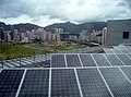 Electrical and Mechanical Services Department Headquarters Photovoltaics.jpg 1,574 × 1,168; 1.8 MB
-
 HK Kln City Regal Oriental Hotel Kwun Tong District 1.JPG 1,600 × 1,200; 1.16 MB
-
 HK San Po Kong 太子道東 Prince Edward Road East blue sky 02.JPG 3,264 × 2,448; 1.62 MB
-
-

-
 Kai Ching Estate and Tak Long Estate 2013.jpg 3,264 × 2,448; 1.58 MB
-
 Kai Tak Airport Site View1 201010.jpg 2,242 × 1,674; 3.19 MB
-
 Kai Tak feb2011.jpg 2,048 × 1,360; 690 KB
-
 Kai Tak OB.JPG 900 × 600; 135 KB
-
 San Po Kong 200906.jpg 1,600 × 1,200; 1.64 MB
-
 San Po Kong 2010.jpg 2,789 × 2,073; 5.06 MB
-
 Tak Long Estate 2012 part2.JPG 4,608 × 3,456; 3.93 MB
-
 啓德 - panoramio (1).jpg 4,000 × 2,250; 3.05 MB
-
 啓睛,啓德 - panoramio.jpg 4,000 × 2,250; 2.7 MB
-
 太子道東 - panoramio (1).jpg 4,000 × 2,250; 2.54 MB
-
 飛鵝山 - panoramio.jpg 2,120 × 1,350; 743 KB


.jpg)

.jpg)
