Category:Hood Grange
Jump to navigation
Jump to search
village in United Kingdom  | |||||
| Upload media | |||||
| Instance of | |||||
|---|---|---|---|---|---|
| Location | Hambleton, North Yorkshire, Yorkshire and the Humber, England | ||||
 | |||||
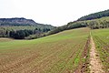
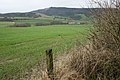
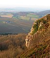
English: Hood Grange is a hamlet and civil parish in the Hambleton district of North Yorkshire, England. It is located near Thirsk at the foot of Sutton Bank, south of the larger village of Sutton-under-Whitestonecliffe. It is notable of consisting of only a single household after its population decreased rapidly in the late 1800s. Hood Grange has existed as a civil parish since 1866, prior to which the area was part of Kilburn.
Media in category "Hood Grange"
The following 26 files are in this category, out of 26 total.
-
 A170 and farm entrance - geograph.org.uk - 4773343.jpg 1,024 × 768; 248 KB
-
 A170 heading west at Kennycow - geograph.org.uk - 2718559.jpg 640 × 418; 76 KB
-
 Across Fields - geograph.org.uk - 4773339.jpg 768 × 1,024; 220 KB
-
 Bridleway to Hood Hill plantation - geograph.org.uk - 3449477.jpg 640 × 427; 325 KB
-

-
 Crop Lines - geograph.org.uk - 165011.jpg 640 × 480; 235 KB
-
 Field, Hood Grange - geograph.org.uk - 349009.jpg 640 × 426; 94 KB
-
 Gate With A view - geograph.org.uk - 4773345.jpg 1,024 × 768; 303 KB
-
 Happy Valley - geograph.org.uk - 6251149.jpg 640 × 480; 94 KB
-
 Harvesting in the vale - geograph.org.uk - 4125462.jpg 1,024 × 768; 209 KB
-
 Hood Grange - geograph.org.uk - 5637741.jpg 1,418 × 711; 166 KB
-
 Hood Grange - geograph.org.uk - 5705860.jpg 640 × 509; 87 KB
-
 Hood Grange - geograph.org.uk - 937649.jpg 640 × 480; 91 KB
-
 Hood Grange Farm - geograph.org.uk - 3449470.jpg 640 × 396; 345 KB
-
 Hood Grange.jpg 640 × 488; 152 KB
-
 Ivy Scar - geograph.org.uk - 1065549.jpg 551 × 640; 85 KB
-
 Leaving Hood Hill plantation - geograph.org.uk - 3449307.jpg 640 × 427; 410 KB
-
 Sheep At Hood Grange - geograph.org.uk - 937694.jpg 640 × 480; 106 KB
-
 Showers over Sutton Brow - geograph.org.uk - 4128048.jpg 1,600 × 1,200; 595 KB
-
 Stile At Hood Grange - geograph.org.uk - 937700.jpg 640 × 480; 87 KB
-
 Towards Hood Grange - geograph.org.uk - 3449465.jpg 640 × 477; 281 KB
-
 View over Happy Valley and Hood Grange - geograph.org.uk - 2754158.jpg 1,024 × 768; 254 KB
-
 View south-west from Sutton Bank - geograph.org.uk - 5832051.jpg 1,024 × 768; 238 KB
-
 View westward from the Cleveland Way - geograph.org.uk - 3526622.jpg 4,608 × 3,456; 6.14 MB
-
 Winter view North from Roulston Scar - geograph.org.uk - 2755638.jpg 1,024 × 768; 229 KB
-
 Roulstone Scar, Hood Grange CP - geograph.org.uk - 84921.jpg 431 × 640; 129 KB


