Category:Hoofdstraat 155, Pieterburen
Jump to navigation
Jump to search
| Object location | | View all coordinates using: OpenStreetMap |
|---|
building in De Marne, Netherlands  | |||||
| Upload media | |||||
| Instance of | |||||
|---|---|---|---|---|---|
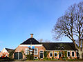
| Location | Pieterburen, Het Hogeland, Groningen, Netherlands | ||||
| Street address |
| ||||
| Located on street |
| ||||
| Heritage designation |
| ||||
 | |||||
Nederlands: Het Brouwershuis
|
This is a category about rijksmonument number 14556
|
| Address |
|
Media in category "Hoofdstraat 155, Pieterburen"
The following 2 files are in this category, out of 2 total.
-
 Hoofdstraat 155 Pieterburen.jpg 3,648 × 2,736; 1.73 MB
-
 Voorgevel - Pieterburen - 20446719 - RCE.jpg 1,200 × 900; 125 KB
