Category:Hoofdweg 8 (Westervelde)
Jump to navigation
Jump to search
| Object location | | View all coordinates using: OpenStreetMap |
|---|
farmhouse in Noordenveld, Netherlands  | |||||
| Upload media | |||||
| Instance of | |||||
|---|---|---|---|---|---|
| Location | Westervelde, Noordenveld, Drenthe, Netherlands | ||||
| Located on street |
| ||||
| Heritage designation |
| ||||
 | |||||
|
This is a category about rijksmonument number 30807
|
| Address |
|
Media in category "Hoofdweg 8 (Westervelde)"
The following 31 files are in this category, out of 31 total.
-
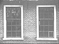 15-ruits schuiframen nr. F 414-40 - Westervelde - 20439025 - RCE.jpg 1,200 × 900; 127 KB
-
 36-ruits schuiframen nr. F 414-41 - Westervelde - 20439035 - RCE.jpg 1,200 × 900; 127 KB
-
 Achtergevel nr. F 414-37 - Westervelde - 20439024 - RCE.jpg 1,200 × 900; 140 KB
-
 Boerderij Hoofdweg 8 v1.jpg 4,608 × 3,456; 3.67 MB
-
 Boerderij Hoofdweg 8 v2.jpg 4,608 × 3,456; 3.5 MB
-
 Boerderij Hoofdweg 8 v3.jpg 4,537 × 3,403; 3.88 MB
-
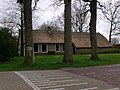
 Exterieur - Westervelde - 20254459 - RCE.jpg 1,200 × 946; 263 KB
-
 Houten muuranker nr. F 414-02 - Westervelde - 20439048 - RCE.jpg 1,200 × 900; 71 KB
-
 Houten muuranker nr. F 414-03 - Westervelde - 20439047 - RCE.jpg 1,200 × 900; 77 KB
-
 Houten topgevel achterkant nr. F 414-17 - Westervelde - 20439036 - RCE.jpg 1,200 × 900; 172 KB
-
 Interieur nr. F 414-11 - Westervelde - 20439041 - RCE.jpg 1,200 × 900; 104 KB
-
 Kop en zijgevel nr. F 414-31 - Westervelde - 20439031 - RCE.jpg 1,200 × 900; 137 KB
-
 Kozijnloos raampje nr. F 414-06 - Westervelde - 20439044 - RCE.jpg 1,200 × 900; 77 KB
-
 Kozijnloos raampje nr. F 414-07 - Westervelde - 20439043 - RCE.jpg 1,200 × 900; 99 KB
-
 Raam met luik nr. F 414-15 - Westervelde - 20439038 - RCE.jpg 1,200 × 900; 172 KB
-
 Schoorsteen op het dak nr. F 414-42 - Westervelde - 20439034 - RCE.jpg 1,200 × 900; 93 KB
-
 Tandlijst nr. F 414-05 - Westervelde - 20439046 - RCE.jpg 1,200 × 900; 105 KB
-
 Voor- en zijgevel nr. F 414-29 - Westervelde - 20439033 - RCE.jpg 1,200 × 900; 106 KB
-
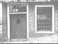 Voordeur en raam nr. F 414-43 - Westervelde - 20439022 - RCE.jpg 1,200 × 900; 137 KB
-
 Woonkamer nr. F 414-14 - Westervelde - 20439039 - RCE.jpg 1,200 × 900; 133 KB
-
 Woonkamer schouw nr. F 414-16 - Westervelde - 20439037 - RCE.jpg 1,200 × 900; 106 KB
-
 Zij- en achtergevel nr. F 141-25 - Westervelde - 20439040 - RCE.jpg 1,200 × 900; 103 KB
-
 Zij- en achtergevel nr. F 414-30 - Westervelde - 20439032 - RCE.jpg 1,200 × 900; 91 KB
-
 Zij- en voorgevel nr. F 414-32 - Westervelde - 20439030 - RCE.jpg 1,200 × 900; 206 KB
-
 Zij- en voorgevel nr. F 414-33 - Westervelde - 20439029 - RCE.jpg 1,200 × 900; 140 KB
-
 Zijgevel nr. F 141-23 - Westervelde - 20439045 - RCE.jpg 1,200 × 900; 145 KB
-
 Zijgevel nr. F 141-24 - Westervelde - 20439042 - RCE.jpg 1,200 × 900; 143 KB
-
 Zijgevel nr. F 414-34 - Westervelde - 20439028 - RCE.jpg 1,200 × 900; 141 KB
-
 Zijgevel nr. F 414-35 - Westervelde - 20439027 - RCE.jpg 1,200 × 900; 195 KB
-
 Zijgevel nr. F 414-36 - Westervelde - 20439026 - RCE.jpg 1,200 × 900; 165 KB
-
 Zijgevel nr. F 414-39 - Westervelde - 20439023 - RCE.jpg 1,200 × 900; 123 KB


