Category:Hook, Pembrokeshire
Jump to navigation
Jump to search
village and community in Pembrokeshire, Wales  Capel Mynydd Seion, Hook | |||||
| Upload media | |||||
| Pronunciation audio | |||||
|---|---|---|---|---|---|
| Instance of | |||||
| Location | Pembrokeshire, Wales, UK | ||||
| Population |
| ||||
 | |||||
Cymraeg: Pentref a chymuned yn ne Sir Benfro yw Hook. Nid ymddengys fod enw Cymraeg iddo. Saif i'r de o dref Hwlffordd ar lan Afon Cleddau Wen. Gelwir tro yn yr afon gerllaw yn Hook Bight.
English: Hook is a medium-sized village and community on the Western Cleddau, Pembrokeshire, Wales. The population of the community was 656 in 2001. Together with the communities of Freystrop and Llangwm, it makes up the Pembrokeshire ward of Llangwm.
Media in category "Hook, Pembrokeshire"
The following 28 files are in this category, out of 28 total.
-
 2010 Wales Pembrokeshire Community Hook map.svg 512 × 393; 1,018 KB
-
 2024 Wales Pembrokeshire Community Hook map.svg 512 × 393; 1.19 MB
-
 Across The Western Cleddau - geograph.org.uk - 1416718.jpg 640 × 480; 175 KB
-
 Bridleway At East Hook Farm - geograph.org.uk - 1416716.jpg 480 × 640; 323 KB
-
 Cleddau River near Boulston - geograph.org.uk - 4307180.jpg 2,957 × 4,435; 1.82 MB
-
 End of Lower Quay Road, Hook - geograph.org.uk - 856012.jpg 640 × 480; 113 KB
-
 Fields Of Maddox Moor - geograph.org.uk - 1416704.jpg 640 × 480; 202 KB
-
 Hook Colliery Quay - geograph.org.uk - 944045.jpg 640 × 480; 87 KB
-
 Hook colliery quay from footpath - geograph.org.uk - 844356.jpg 640 × 480; 96 KB
-
 Houses at Hook - geograph.org.uk - 4307199.jpg 1,600 × 1,066; 308 KB
-
 Houses On Lower Quay Road - geograph.org.uk - 1416713.jpg 640 × 480; 194 KB
-
 Lower Quay Road - geograph.org.uk - 856006.jpg 640 × 480; 85 KB
-
 Lower Quay Road, Hook - geograph.org.uk - 1416712.jpg 640 × 480; 203 KB
-
 Mudflats on the Western Cleddau - geograph.org.uk - 2330178.jpg 640 × 480; 63 KB
-
 New Town Road, Hook - geograph.org.uk - 1416725.jpg 640 × 480; 173 KB
-
 Old wreck at Hook Colliery Quay. - geograph.org.uk - 912688.jpg 640 × 480; 150 KB
-
 Approaching Hook Bridge - geograph.org.uk - 1416729.jpg 640 × 480; 136 KB
-
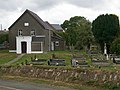
 Chapel and Cemetery, Hook - geograph.org.uk - 1416707.jpg 640 × 480; 198 KB
-
 Dinghy By The Cleddau - geograph.org.uk - 1416721.jpg 640 × 480; 179 KB
-
 Entrance To East Hook Farm - geograph.org.uk - 1416715.jpg 640 × 480; 246 KB
-
 Fields Of East Hook Farm - geograph.org.uk - 1416714.jpg 640 × 480; 216 KB
-
 Footpath Access, Hook - geograph.org.uk - 1416711.jpg 640 × 480; 273 KB
-
 Footpath Somewhere In The Fields, Hook - geograph.org.uk - 1416727.jpg 640 × 480; 242 KB
-
 Hillside At Hook Bridge - geograph.org.uk - 1416731.jpg 640 × 480; 244 KB
-
 Hook - Lane To Underwood - geograph.org.uk - 1416708.jpg 640 × 480; 215 KB
-
 Hook Bridge - geograph.org.uk - 220640.jpg 640 × 480; 100 KB
-
 Hook Colliery quay - geograph.org.uk - 342015.jpg 640 × 482; 101 KB
-
 Mount Zion Chapel, Hook - geograph.org.uk - 220630.jpg 640 × 480; 83 KB


