Category:Hope Bagot
Jump to navigation
Jump to search
village and civil parish in Shropshire, UK  | |||||
| Upload media | |||||
| Instance of | |||||
|---|---|---|---|---|---|
| Location | Shropshire, West Midlands, England | ||||
 | |||||
Subcategories
This category has only the following subcategory.
J
Media in category "Hope Bagot"
The following 44 files are in this category, out of 44 total.
-
 A Hidden Tunnel in The Novers - geograph.org.uk - 2627041.jpg 4,000 × 3,000; 2.11 MB
-
 Access to Mahorall - geograph.org.uk - 2533756.jpg 1,024 × 680; 209 KB
-
 Ash tree - geograph.org.uk - 4544425.jpg 640 × 852; 193 KB
-
 Barn near Whitton Court, Knowbury - geograph.org.uk - 3446326.jpg 1,600 × 1,200; 752 KB
-
 Church of St John the Baptist, Hope Bagot - geograph.org.uk - 4936951.jpg 1,280 × 889; 339 KB
-
 Church of St John the Baptist, Hope Bagot - geograph.org.uk - 4936955.jpg 1,280 × 960; 558 KB
-
 Church of St John the Baptist, Hope Bagot - geograph.org.uk - 4936959.jpg 960 × 1,280; 517 KB
-
 Church of St John the Baptist, Hope Bagot - geograph.org.uk - 4936969.jpg 960 × 1,280; 246 KB
-
 Church of St John the Baptist, Hope Bagot - geograph.org.uk - 4936983.jpg 928 × 1,280; 235 KB
-
 Church of St John the Baptist, Hope Bagot - geograph.org.uk - 4936984.jpg 960 × 1,280; 270 KB
-
 Church of St John the Baptist, Hope Bagot - geograph.org.uk - 4936986.jpg 1,280 × 960; 376 KB
-
 Cumberley Lane - geograph.org.uk - 4575111.jpg 640 × 478; 194 KB
-
 Drive to Mahorall, Bagot Hope - geograph.org.uk - 2533362.jpg 1,024 × 680; 217 KB
-
 Elan Valley Aqueduct At Hope Bagot - geograph.org.uk - 898041.jpg 640 × 427; 97 KB
-
 Farmland at Hope Bagot - geograph.org.uk - 2533407.jpg 1,024 × 680; 238 KB
-
 Ford, Hope Bagot (geograph 6609333).jpg 1,024 × 678; 1.14 MB
-
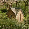 Garden House, Hope Bagot.jpg 1,280 × 1,280; 841 KB
-
 Grazing land near Hope Bagot - geograph.org.uk - 2533398.jpg 1,024 × 680; 218 KB
-
 Hope Bagot - geograph.org.uk - 4575118.jpg 640 × 478; 188 KB
-
 Hope Bagot Bridge (geograph 6608357).jpg 1,024 × 678; 949 KB
-
 Hope Bagot Bridge (geograph 6608360).jpg 1,024 × 678; 927 KB
-
 Hope Bagot Bridge (geograph 6608362).jpg 1,024 × 678; 897 KB
-
 Hope Bagot Bridge and Hope Court Farm House (geograph 6608355).jpg 1,024 × 678; 832 KB
-
 Hope Bagot Bridge Aqueduct - geograph.org.uk - 769150.jpg 640 × 480; 71 KB
-
 Hope Bagot Spring Well - geograph.org.uk - 769639.jpg 640 × 480; 118 KB
-
 Hope Bagot Village Hall (geograph 2533739).jpg 1,024 × 680; 158 KB
-
 Hope Bagot village hall (geograph 6609315).jpg 1,024 × 678; 713 KB
-
 Hope Bagot village hall (geograph 6609316).jpg 1,024 × 678; 867 KB
-
 Hope Bagot Yew Tree (geograph 4434128).jpg 640 × 480; 142 KB
-
 Hope Court, Hope Bagot.jpg 960 × 1,280; 544 KB
-
 Jubilee well, Hope Bagot (geograph 4937034).jpg 1,280 × 960; 728 KB
-
 Knowbury Ford - geograph.org.uk - 4596320.jpg 1,084 × 725; 494 KB
-
 Knowle Rugby Field - geograph.org.uk - 1464465.jpg 640 × 428; 43 KB
-
 Lime Kilns at The Novers Limestone Quarry Clee Hill - geograph.org.uk - 2638247.jpg 4,288 × 3,216; 5.16 MB
-
 No Through Road - geograph.org.uk - 2533412.jpg 680 × 1,024; 266 KB
-
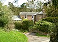 Rectory, Hope Bagot.jpg 1,280 × 931; 603 KB
-
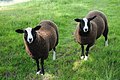 Sheep near Hope Bagot - geograph.org.uk - 2533404.jpg 1,024 × 680; 281 KB
-
 Spring at Hope Bagot - geograph.org.uk - 769629.jpg 480 × 640; 154 KB
-
 Track and footpath to The Grove - geograph.org.uk - 2533385.jpg 1,024 × 680; 207 KB
-
 Track to Mahorall - geograph.org.uk - 2533379.jpg 1,024 × 680; 215 KB
-
 Tunnel in The Novers - geograph.org.uk - 2627059.jpg 4,000 × 3,000; 2.87 MB
-
 Upper House, Hope Bagot.jpg 1,280 × 960; 556 KB
-
 Green and pleasant land. - geograph.org.uk - 212260.jpg 640 × 480; 86 KB
-
 While my shed gently rusts - geograph.org.uk - 212262.jpg 640 × 480; 152 KB


.jpg)


.jpg)
.jpg)
.jpg)
.jpg)


.jpg)
.jpg)
.jpg)
.jpg)

.jpg)


