Category:Horley
Jump to navigation
Jump to search
town in Reigate and Banstead, Surrey, England  | |||||
| Upload media | |||||
| Instance of | |||||
|---|---|---|---|---|---|
| Location | Reigate and Banstead, Surrey, South East England, England | ||||
| Area |
| ||||
| Different from | |||||
| Said to be the same as | Horley (Wikimedia duplicated page, civil parish) | ||||
| official website | |||||
 | |||||
Subcategories
This category has the following 15 subcategories, out of 15 total.
B
- Bus stops in Horley (19 F)
- Buses in Horley (58 F)
C
G
- Grove Meeting Room, Horley (16 F)
H
- Horley Methodist Church (4 F)
- Horley War Memorial (9 F)
L
- Lee Street Church, Horley (6 F)
S
- St Wilfrid's Church, Horley (13 F)
Media in category "Horley"
The following 200 files are in this category, out of 476 total.
(previous page) (next page)-
 A redundant garden finds a new use. - geograph.org.uk - 1728933.jpg 2,560 × 1,920; 2.95 MB
-
 A23 Bonehurst Road - geograph.org.uk - 6099690.jpg 1,024 × 768; 315 KB
-
 A23 Bonehurst Road - geograph.org.uk - 6099727.jpg 1,024 × 768; 240 KB
-
 A23 Brighton Road, Horley - geograph.org.uk - 5673055.jpg 640 × 428; 109 KB
-
 A23 Brighton Road, Horley - geograph.org.uk - 6098794.jpg 1,024 × 684; 207 KB
-
 A23 Brighton Road, Horley - geograph.org.uk - 6098950.jpg 1,024 × 768; 221 KB
-
 A23 Brighton Road, Horley - geograph.org.uk - 6099373.jpg 1,024 × 768; 250 KB
-
 A23 Brighton Road, Horley - geograph.org.uk - 6099397.jpg 1,024 × 768; 187 KB
-
 A23 Brighton Road, Horley - geograph.org.uk - 6099432.jpg 1,024 × 768; 238 KB
-
 A23 Brighton Road, Horley - geograph.org.uk - 6099562.jpg 1,024 × 768; 193 KB
-
 A23 Brighton Road, Horley - geograph.org.uk - 6099579.jpg 1,024 × 768; 243 KB
-
 A23 Brighton Road, Horley, east side - geograph.org.uk - 6098785.jpg 1,024 × 768; 200 KB
-
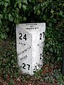 A23 road milestone at Horley, Surrey, England.jpg 450 × 600; 78 KB
-
 Albert Road - geograph.org.uk - 2650778.jpg 640 × 425; 76 KB
-
 Albert Road - geograph.org.uk - 2650806.jpg 640 × 425; 61 KB
-
 Aldeburgh House - geograph.org.uk - 1770165.jpg 640 × 428; 118 KB
-
 Amherst House - geograph.org.uk - 5106329.jpg 1,000 × 662; 731 KB
-
 Approaching The Roundabout - geograph.org.uk - 775946.jpg 640 × 453; 79 KB
-
 Archway Garage - geograph.org.uk - 1754708.jpg 640 × 429; 69 KB
-
 Archway Theatre - geograph.org.uk - 1754697.jpg 640 × 426; 104 KB
-
 Archway Theatre Horley.jpg 1,584 × 882; 262 KB
-
 Archway Theatre, Horley.jpg 2,592 × 1,456; 867 KB
-
 Autumn at Autumn Close, Horley - geograph.org.uk - 3243049.jpg 3,264 × 2,448; 3.86 MB
-
 B2036 Balcombe Road, Horley - geograph.org.uk - 5672984.jpg 640 × 428; 138 KB
-
 Bakehouse Road - geograph.org.uk - 2188696.jpg 640 × 425; 96 KB
-
 Balcombe Gardens - geograph.org.uk - 1755127.jpg 640 × 426; 68 KB
-
 Balcombe Road - geograph.org.uk - 3313577.jpg 640 × 425; 358 KB
-
 Balcombe Road - geograph.org.uk - 3613800.jpg 800 × 530; 481 KB
-
 Balcombe Road - geograph.org.uk - 3614986.jpg 800 × 530; 350 KB
-
 Balcombe Road, Horley - geograph.org.uk - 1838286.jpg 2,048 × 1,536; 1.05 MB
-
 Balcombe Road, Horley - geograph.org.uk - 4405350.jpg 2,560 × 1,920; 1.99 MB
-
 Barns, Meath Green Farm - geograph.org.uk - 1968555.jpg 640 × 428; 103 KB
-
 Bayhorne Lane, Horley - geograph.org.uk - 5261066.jpg 2,304 × 1,728; 1.23 MB
-

-
 Bell tower at the Catholic Church of the English Martyrs - geograph.org.uk - 4810940.jpg 2,048 × 1,536; 1.13 MB
-
 Bend on Meath Green Lane - geograph.org.uk - 4811004.jpg 2,048 × 1,536; 1.42 MB
-
 Benhams Drive - geograph.org.uk - 2188685.jpg 640 × 425; 77 KB
-
 Benhams Drive, Horley - geograph.org.uk - 1955682.jpg 3,072 × 2,304; 2.55 MB
-
 Block of flats by Sangers Drive, Horley - geograph.org.uk - 4812469.jpg 2,048 × 1,536; 1.52 MB
-
 Blundell Avenue - geograph.org.uk - 2812012.jpg 640 × 425; 267 KB
-
 Bolters Road South at the junction of Kingsley Road - geograph.org.uk - 4811149.jpg 2,048 × 1,536; 1.48 MB
-
 Bonehurst Road - geograph.org.uk - 3313565.jpg 640 × 425; 444 KB
-
 Bonehurst Road - geograph.org.uk - 3313569.jpg 640 × 425; 369 KB
-
 Bonehurst Road flood - geograph.org.uk - 3789433.jpg 800 × 530; 549 KB
-
 Bonehurst Road flood - geograph.org.uk - 3789436.jpg 800 × 530; 525 KB
-
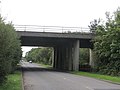
 Bridge carrying M23 of Perrylands Lane, Smallfield - geograph.org.uk - 1920630.jpg 3,072 × 2,304; 2.9 MB
-
-
 Bridge Industrial Estate - geograph.org.uk - 3613814.jpg 800 × 530; 395 KB
-
 Bridge over Gatwick Stream - geograph.org.uk - 3247513.jpg 640 × 428; 183 KB
-
 Brighton Main Line south of Horley - geograph.org.uk - 2937679.jpg 640 × 430; 83 KB
-
 Brighton Road - geograph.org.uk - 3313544.jpg 640 × 425; 376 KB
-
 Brighton Road - geograph.org.uk - 3613391.jpg 800 × 530; 396 KB
-
 Brighton Road - geograph.org.uk - 4750845.jpg 799 × 533; 365 KB
-
 Brookfield Way, The Acres - geograph.org.uk - 1281446.jpg 640 × 426; 92 KB
-
 Burstow Stream at Bonehurst Bridge - geograph.org.uk - 1770187.jpg 640 × 480; 166 KB
-
 Burstow stream having passed under Smallfield Road - geograph.org.uk - 3243072.jpg 3,264 × 2,448; 5.8 MB
-
 Buttercup meadow - geograph.org.uk - 3631215.jpg 640 × 430; 66 KB
-
 Car park by Kingsley Road, Horley - geograph.org.uk - 4811142.jpg 2,048 × 1,536; 1.43 MB
-
 Car park, Ye Olde Six Bells - geograph.org.uk - 4774147.jpg 640 × 480; 50 KB
-
 Castle Drive - geograph.org.uk - 1755275.jpg 640 × 432; 89 KB
-
 Central Parade - geograph.org.uk - 3371731.jpg 640 × 425; 262 KB
-
 Central Parade - geograph.org.uk - 3610153.jpg 800 × 530; 431 KB
-
 Central Parade - geograph.org.uk - 3613405.jpg 800 × 530; 417 KB
-
 Chantry Close - geograph.org.uk - 2811862.jpg 640 × 425; 261 KB
-
 Chantry Close at the junction of Vicarage Lane - geograph.org.uk - 4812470.jpg 2,048 × 1,536; 1,013 KB
-
 Chantry House - geograph.org.uk - 2811928.jpg 425 × 640; 248 KB
-
 Charlesfield Road - geograph.org.uk - 1281555.jpg 640 × 426; 87 KB
-
 Chequers Close - geograph.org.uk - 2742242.jpg 640 × 425; 66 KB
-
 Chequers Close, Horley - geograph.org.uk - 1955639.jpg 3,072 × 2,304; 2.85 MB
-
 Chequers Drive, Horley - geograph.org.uk - 1955631.jpg 3,072 × 2,304; 2.34 MB
-
 Chequers Hotel - geograph.org.uk - 2188687.jpg 640 × 425; 87 KB
-
 Chequers Hotel - geograph.org.uk - 2188688.jpg 640 × 425; 95 KB
-
 Cheyne Walk - geograph.org.uk - 1753577.jpg 640 × 426; 78 KB
-
 Cheyne Walk - geograph.org.uk - 3314433.jpg 640 × 425; 276 KB
-
 Church Road - geograph.org.uk - 2119528.jpg 640 × 426; 91 KB
-
 Church Road - geograph.org.uk - 3121093.jpg 640 × 425; 464 KB
-
 Church Road - geograph.org.uk - 3609727.jpg 800 × 530; 511 KB
-
 Church Road - geograph.org.uk - 3613355.jpg 800 × 530; 569 KB
-
 Church Road, Horley - geograph.org.uk - 3121092.jpg 640 × 425; 369 KB
-
 Church View Close - geograph.org.uk - 4750849.jpg 800 × 533; 457 KB
-
 Clerklands Surgery - geograph.org.uk - 1169207.jpg 640 × 480; 58 KB
-
 Clubhouse at New Defence.JPG 2,048 × 1,356; 570 KB
-
 Collingwood and Batchellor - geograph.org.uk - 1125570.jpg 640 × 426; 67 KB
-
 Collingwood Close - geograph.org.uk - 3844955.jpg 800 × 530; 552 KB
-
 Consort Way - geograph.org.uk - 3610129.jpg 800 × 530; 496 KB
-
 Contrasting houses - geograph.org.uk - 3609820.jpg 800 × 530; 569 KB
-
 Corner eating places, Horley - geograph.org.uk - 1770183.jpg 640 × 428; 92 KB
-
 Countryside north of Gatwick - geograph.org.uk - 2937682.jpg 640 × 430; 57 KB
-
 Court Lodge Estate - geograph.org.uk - 2697547.jpg 640 × 425; 57 KB
-
 Court Lodge Playing Fields - geograph.org.uk - 2697499.jpg 640 × 425; 60 KB
-
 Court Lodge Road - geograph.org.uk - 2625902.jpg 640 × 425; 47 KB
-
 Court Lodge Road - geograph.org.uk - 2625915.jpg 640 × 425; 49 KB
-
 Court Lodge Road - geograph.org.uk - 2811881.jpg 640 × 425; 221 KB
-
 Cross Oak Lane, Horley - geograph.org.uk - 5275706.jpg 2,286 × 1,704; 1.22 MB
-
 Cross Oak Lane, Salfords - geograph.org.uk - 5275607.jpg 2,304 × 1,728; 854 KB
-
 Cycle path subway under the A23 - geograph.org.uk - 3678429.jpg 640 × 480; 104 KB
-
 Demolition, Meath Green Lane Horley - geograph.org.uk - 6085445.jpg 3,264 × 2,448; 2.61 MB
-
 Diverted road on Cross Oak Lane - geograph.org.uk - 5275593.jpg 2,304 × 1,728; 786 KB
-
 Dressage paddock - geograph.org.uk - 3631200.jpg 640 × 430; 66 KB
-
 Drivenet Garage - geograph.org.uk - 3313590.jpg 640 × 425; 393 KB
-
 Electrical sub station - geograph.org.uk - 2937665.jpg 640 × 430; 47 KB
-
 Electricity sub-station on Collendean Lane - geograph.org.uk - 24421.jpg 640 × 480; 149 KB
-
 Emlyn Road - geograph.org.uk - 2625963.jpg 640 × 425; 62 KB
-
 Ex-US Army truck on Balcombe Road, Horley - geograph.org.uk - 6154011.jpg 1,024 × 684; 523 KB
-

-
 Factory in Horley - geograph.org.uk - 4955658.jpg 640 × 426; 32 KB
-
 Factory in Horley - geograph.org.uk - 5419936.jpg 640 × 426; 41 KB
-
 Fairlawns - geograph.org.uk - 1755029.jpg 640 × 426; 82 KB
-
 Fairlawns - geograph.org.uk - 3846014.jpg 800 × 530; 505 KB
-
 Farm Building by at Landens Farm - geograph.org.uk - 1169211.jpg 640 × 480; 96 KB
-
 Farm Building Conversion, Horley - geograph.org.uk - 6085366.jpg 3,264 × 2,448; 2.48 MB
-
 Farmland beside the River Mole, Horley - geograph.org.uk - 1511978.jpg 640 × 427; 507 KB
-
 Farmland north of the A23 - geograph.org.uk - 2937684.jpg 640 × 430; 52 KB
-
 Fennies Day Nursery, Horley - geograph.org.uk - 6099477.jpg 1,024 × 768; 234 KB
-
 Field by A217 Povey Cross - geograph.org.uk - 1584218.jpg 640 × 480; 102 KB
-
 Flowery field - geograph.org.uk - 594984.jpg 640 × 480; 172 KB
-
 Footbridge over Gatwick Stream - geograph.org.uk - 3685267.jpg 640 × 480; 113 KB
-
 Footpath junction - geograph.org.uk - 3631250.jpg 640 × 430; 109 KB
-
 Footpath to Fairlawns - geograph.org.uk - 2786291.jpg 1,024 × 768; 362 KB
-
 Footway alongside A23 - geograph.org.uk - 3678399.jpg 640 × 480; 82 KB
-
 Forge Cottage, Bonehurst Road - geograph.org.uk - 2188693.jpg 640 × 425; 98 KB
-
 Former cinema, Horley - geograph.org.uk - 4153898.jpg 1,394 × 1,600; 351 KB
-

-
 Former engine shed, Horley - geograph.org.uk - 4153724.jpg 1,600 × 1,027; 411 KB
-
 Former fire station, Horley - geograph.org.uk - 4154196.jpg 1,333 × 1,600; 423 KB
-
 Former Meath Green Farm - geograph.org.uk - 6085455.jpg 3,264 × 2,448; 3.49 MB
-
 Former New Pavilion Cinema - geograph.org.uk - 3120981.jpg 640 × 425; 298 KB
-
 Former New Pavilion Cinema - geograph.org.uk - 3371645.jpg 640 × 425; 281 KB
-
 Former post office, Yattendon Road - geograph.org.uk - 2717086.jpg 640 × 425; 71 KB
-
 Former taxi office - geograph.org.uk - 1753886.jpg 640 × 430; 108 KB
-
 Former taxi office - geograph.org.uk - 3273273.jpg 640 × 425; 324 KB
-
 Foundation stone of St Wilfrid's Church - geograph.org.uk - 2808948.jpg 640 × 425; 241 KB
-

-
 Gas Holder, Horley - geograph.org.uk - 201775.jpg 640 × 480; 101 KB
-
 Gasholder - geograph.org.uk - 3614993.jpg 800 × 530; 501 KB
-
 Gatwick Express blocks all lines - geograph.org.uk - 1957628.jpg 640 × 428; 137 KB
-
 Gatwick geese and goslings - geograph.org.uk - 4979017.jpg 800 × 600; 161 KB
-
 Gatwick Inn Hotel on Bonehurst Road, Horley - geograph.org.uk - 4448639.jpg 2,560 × 1,920; 1.95 MB
-
 Gatwick Metro Centre - geograph.org.uk - 3615000.jpg 800 × 530; 380 KB
-
 Gatwick Stream - geograph.org.uk - 3314351.jpg 425 × 640; 345 KB
-

-
 Gault brick houses on A23, Horley - geograph.org.uk - 6099384.jpg 1,024 × 768; 222 KB
-
 Geller Court and Tribbiana Court - geograph.org.uk - 3613484.jpg 800 × 530; 444 KB
-
 Gravestone, Horley Churchyard - geograph.org.uk - 2119484.jpg 453 × 640; 119 KB
-
 Grazing horses, Horley - geograph.org.uk - 3247535.jpg 640 × 428; 108 KB
-

-
 Grovelands - geograph.org.uk - 3846012.jpg 800 × 530; 583 KB
-
 Hailsham Villas - geograph.org.uk - 3613370.jpg 800 × 530; 506 KB
-
 Haroldsea Drive - geograph.org.uk - 1761273.jpg 640 × 426; 126 KB
-
 Haroldsea Poultry Farm - geograph.org.uk - 2343107.jpg 640 × 425; 74 KB
-
 Heavy recovery truck, Balcombe Road, Horley - geograph.org.uk - 6153969.jpg 1,024 × 684; 465 KB
-
 Hevers Avenue, Horley - geograph.org.uk - 1511914.jpg 640 × 427; 336 KB
-
 High House, Church Road - geograph.org.uk - 2119505.jpg 640 × 426; 102 KB
-
 High Street - geograph.org.uk - 1727231.jpg 640 × 426; 100 KB
-
 High Street - geograph.org.uk - 3371616.jpg 640 × 425; 305 KB
-
 High Street - geograph.org.uk - 3609895.jpg 800 × 530; 474 KB
-
 High Street - geograph.org.uk - 3613413.jpg 800 × 530; 504 KB
-
 High Street - geograph.org.uk - 3613447.jpg 800 × 530; 518 KB
-
 Horley - geograph.org.uk - 1138857.jpg 640 × 480; 75 KB
-
 Horley Anderson Centre - geograph.org.uk - 2697525.jpg 640 × 425; 68 KB
-
 Horley Baptist Church - geograph.org.uk - 5106327.jpg 1,000 × 662; 782 KB
-
 Horley Baptist Church - geograph.org.uk - 5106328.jpg 1,000 × 662; 716 KB
-
 Horley Consort Way.JPG 3,712 × 2,088; 3.28 MB
-
 Horley Forge - geograph.org.uk - 2650745.jpg 640 × 425; 95 KB
-
 Horley Health Centre - geograph.org.uk - 1167944.jpg 640 × 480; 65 KB
-
 Horley High Street.JPG 3,712 × 2,088; 3.21 MB
-
 Horley Library - geograph.org.uk - 6111689.jpg 3,264 × 2,448; 1.91 MB
-
 Horley Lidl.JPG 3,712 × 2,088; 2.93 MB
-
 Horley Massetts Road at Victoria Road 2.JPG 3,712 × 2,088; 3.16 MB
-
 Horley Massetts Road at Victoria Road.JPG 3,712 × 2,088; 2.93 MB
-
 Horley Millennium Mosaic - geograph.org.uk - 3609936.jpg 800 × 530; 863 KB
-
 Horley New Churchyard - geograph.org.uk - 2569282.jpg 640 × 425; 97 KB
-
 Horley New Churchyard - geograph.org.uk - 2569295.jpg 640 × 425; 102 KB
-
 Horley One-way - geograph.org.uk - 2242244.jpg 1,528 × 2,296; 3.28 MB
-
 Horley Police Station - geograph.org.uk - 3120984.jpg 640 × 425; 323 KB
-
 Horley Police Station - geograph.org.uk - 3121007.jpg 640 × 425; 346 KB
-
 Horley police station.JPG 3,712 × 2,088; 3.13 MB
-
 Horley Post Office.JPG 3,712 × 2,088; 3.04 MB
-
 Horley Railway Station - geograph.org.uk - 4153710.jpg 1,600 × 988; 387 KB
-
 Horley railway station, Surrey - geograph.org.uk - 4731003.jpg 1,600 × 1,200; 462 KB
-
 Horley Row, Horley - geograph.org.uk - 1955633.jpg 3,072 × 2,304; 2.43 MB
-
 Horley Row, Horley - geograph.org.uk - 1955634.jpg 3,072 × 2,304; 2.76 MB
-
 Horley Row, Horley - geograph.org.uk - 1955680.jpg 3,072 × 2,304; 2.62 MB
-
 Horley Station - geograph.org.uk - 4405343.jpg 2,560 × 1,920; 2.58 MB
-
 Horley Station - geograph.org.uk - 4955665.jpg 640 × 426; 55 KB
-
 Horley Station - geograph.org.uk - 4955672.jpg 640 × 426; 51 KB
-
 Horley Station - geograph.org.uk - 4955674.jpg 640 × 426; 43 KB
-
 Horley Station - geograph.org.uk - 5659997.jpg 640 × 426; 98 KB
-
 Horley Telephone Exchange - geograph.org.uk - 3610144.jpg 800 × 530; 514 KB
-
 Horley Victoria Road at Consort Way East 2.JPG 3,712 × 2,088; 3.26 MB
-
 Horley Victoria Road at Consort Way East.JPG 3,712 × 2,088; 3.19 MB
-
 Horley Victoria Road at Consort Way.JPG 3,712 × 2,088; 3.09 MB
-
 Horley Victoria Road at Massetts Road 2.JPG 3,712 × 2,088; 3.2 MB
-
 Horley Victoria Road at Massetts Road.JPG 3,712 × 2,088; 3.14 MB
-
 Horley Waitrose.JPG 3,712 × 2,088; 2.89 MB
-
 Horley, Albert Road. - geograph.org.uk - 4308923.jpg 4,928 × 3,280; 5.92 MB
-
 Horley, Central Parade - geograph.org.uk - 3275134.jpg 640 × 441; 73 KB
-
 Horley, Former fire station - geograph.org.uk - 3275229.jpg 640 × 477; 62 KB
-

-


