Category:Horton, Berkshire
Jump to navigation
Jump to search
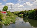
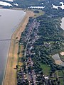
English: Horton is a village in Berkshire, England. It is located between Windsor and Staines. Horton was transferred from Buckinghamshire to Berkshire in 1974. Through the Horton parish flows the Colne Brook which runs to the River Thames from the River Colne.
village and civil parish in Berkshire, UK  | |||||
| Upload media | |||||
| Instance of | |||||
|---|---|---|---|---|---|
| Location | Windsor and Maidenhead, Berkshire, South East England, England | ||||
| Population |
| ||||
 | |||||
Subcategories
This category has the following 3 subcategories, out of 3 total.
H
Media in category "Horton, Berkshire"
The following 162 files are in this category, out of 162 total.
-
 Arthur Jacob Nature Reserve at Horton, Berkshire.jpg 640 × 480; 147 KB
-
 B376 over the railway - geograph.org.uk - 4733961.jpg 640 × 426; 89 KB
-
 B376, southbound - geograph.org.uk - 4733957.jpg 640 × 426; 106 KB
-
 B376, Sunnymead - geograph.org.uk - 4733955.jpg 640 × 426; 87 KB
-
 Banking by Horton Road - geograph.org.uk - 4230331.jpg 2,560 × 1,920; 1.97 MB
-
 Bells Lane, Horton - geograph.org.uk - 4231119.jpg 2,560 × 1,920; 1.78 MB
-
 Berkyn Manor Farm - geograph.org.uk - 3646588.jpg 2,048 × 1,536; 1.64 MB
-
 Berkyn Manor Farm - geograph.org.uk - 5314596.jpg 640 × 476; 110 KB
-
 Blue plaque, Berkyn Manor Farm - geograph.org.uk - 3646594.jpg 2,010 × 1,510; 1.05 MB
-
 Brands Hill from the air - geograph.org.uk - 3989583.jpg 640 × 480; 205 KB
-
 Bridge on the Wraysbury to Horton path - geograph.org.uk - 5491332.jpg 5,202 × 3,465; 3.97 MB
-
 Bungalows, Coppermill Road - geograph.org.uk - 3646519.jpg 2,048 × 1,536; 1.15 MB
-
 Caught in the wire^ - geograph.org.uk - 2710542.jpg 800 × 600; 56 KB
-
 Champney Hall, Horton - geograph.org.uk - 3647062.jpg 2,048 × 1,536; 1.2 MB
-
 Colnbrook, Major's Farm Road - geograph.org.uk - 4463005.jpg 640 × 481; 248 KB
-
 Colne Brook - geograph.org.uk - 3646176.jpg 2,048 × 1,536; 1.38 MB
-
 Colne Brook - geograph.org.uk - 3646536.jpg 2,048 × 1,536; 1.66 MB
-
 Colne Brook - geograph.org.uk - 5462383.jpg 640 × 480; 170 KB
-
 Colne Brook, view upstream - geograph.org.uk - 3458360.jpg 1,024 × 768; 202 KB
-
 Colne Valley Way enters Colnbrook - geograph.org.uk - 5597460.jpg 3,482 × 2,481; 2.58 MB
-
 Colne Valley Way south of Colnbrook - geograph.org.uk - 5597457.jpg 3,888 × 2,592; 2.54 MB
-
 Coppermill Rd - geograph.org.uk - 4734253.jpg 640 × 426; 70 KB
-
 Coppermill Rd - geograph.org.uk - 4734254.jpg 640 × 426; 70 KB
-
 Coppermill Rd - geograph.org.uk - 4734255.jpg 640 × 426; 80 KB
-
 Coppermill Rd - geograph.org.uk - 4734256.jpg 640 × 426; 88 KB
-
 Coppermill Rd - geograph.org.uk - 4734257.jpg 640 × 426; 87 KB
-
 Coppermill Rd, Horton - geograph.org.uk - 4734259.jpg 640 × 426; 82 KB
-
 Coppermill Rd, Horton - geograph.org.uk - 4734260.jpg 640 × 426; 83 KB
-
 Coppermill Rd, Stanwell Rd junction - geograph.org.uk - 4734261.jpg 640 × 426; 97 KB
-
 Coppermill Road - geograph.org.uk - 2648829.jpg 640 × 480; 74 KB
-
 Coppermill Road - geograph.org.uk - 3646103.jpg 2,048 × 1,536; 1.12 MB
-
 Coppermill Road - geograph.org.uk - 3646157.jpg 2,048 × 1,536; 1.46 MB
-
 Coppermill Road from the air - geograph.org.uk - 5145285.jpg 480 × 640; 142 KB
-
 Coppermill Road, Horton - geograph.org.uk - 3646072.jpg 1,998 × 1,499; 558 KB
-
 Coppermill Road, Horton - geograph.org.uk - 4231168.jpg 2,560 × 1,920; 1.9 MB
-
 Coppermill Road, Horton Village - geograph.org.uk - 2981223.jpg 800 × 600; 115 KB
-
 Coppermill Road, Wraysbury - geograph.org.uk - 4230338.jpg 2,560 × 1,920; 2.01 MB
-
 Datchet Road approaching Horton Village - geograph.org.uk - 4470540.jpg 640 × 480; 298 KB
-
 Dinghy sailing, Kingsmead Island Lake - geograph.org.uk - 3460624.jpg 1,024 × 780; 171 KB
-
 Disused access road - geograph.org.uk - 3645643.jpg 2,048 × 1,536; 1.47 MB
-
 Disused gravel pit track - geograph.org.uk - 4083985.jpg 2,048 × 1,536; 1.42 MB
-
 Disused gravel pits, Wraysbury - geograph.org.uk - 4083987.jpg 2,048 × 1,536; 1.35 MB
-
 Driveway to Ashgood Farm - geograph.org.uk - 2710494.jpg 640 × 480; 87 KB
-
 East end of Queen Mother Reservoir from the air - geograph.org.uk - 4589714.jpg 1,024 × 641; 120 KB
-
 Embankment, Wraysbury Reservoir - geograph.org.uk - 4734263.jpg 640 × 426; 46 KB
-
 End of Foundry Lane - geograph.org.uk - 2710557.jpg 800 × 600; 115 KB
-
 Entering Colnbrook - geograph.org.uk - 2981402.jpg 800 × 600; 91 KB
-

-
 Entrance to sailing club on Datchet Road, Horton - geograph.org.uk - 4231024.jpg 2,560 × 1,920; 2.01 MB
-
 Farmland near Heathrow - geograph.org.uk - 2710575.jpg 480 × 640; 27 KB
-
 Field by Colne Valley Way - geograph.org.uk - 2710498.jpg 800 × 600; 95 KB
-
 Fields near Horton - geograph.org.uk - 4083980.jpg 2,031 × 1,522; 1.17 MB
-
 Flats in Pickins Piece - geograph.org.uk - 5294247.jpg 4,608 × 3,456; 6.35 MB
-
 Flats on Datchet Road, Horton - geograph.org.uk - 4229714.jpg 2,560 × 1,920; 1.92 MB
-
 Flooded gravel pit - geograph.org.uk - 4083977.jpg 2,020 × 1,515; 1.1 MB
-
 Flooded gravel pit near Wraysbury - geograph.org.uk - 4083408.jpg 2,048 × 1,536; 1.65 MB
-
 Flying over Heathrow airport - geograph.org.uk - 6222986.jpg 3,024 × 4,032; 1.5 MB
-
 Footbridge on footpath to Horton - geograph.org.uk - 5462364.jpg 640 × 480; 189 KB
-
 Footbridge, Kingsmead Island Lake - geograph.org.uk - 3459063.jpg 762 × 1,024; 205 KB
-
 Footpath Approaching Popes Close - geograph.org.uk - 4470640.jpg 640 × 483; 325 KB
-
 Footpath near Horton - geograph.org.uk - 3647021.jpg 2,048 × 1,536; 1.67 MB
-
 Footpath next to Horton Brook Quarry - geograph.org.uk - 4470614.jpg 640 × 481; 299 KB
-
 Former Chapel(^), Horton Village - geograph.org.uk - 4470590.jpg 640 × 480; 313 KB
-
 Former gravel pit - geograph.org.uk - 4083400.jpg 2,048 × 1,536; 1.33 MB
-
 Foundry Lane - geograph.org.uk - 2710570.jpg 800 × 600; 121 KB
-
 Foundry Lane - Horton - geograph.org.uk - 2710566.jpg 800 × 600; 139 KB
-
 Foundry Lane at the junction of Stanwell Road - geograph.org.uk - 4229788.jpg 2,560 × 1,920; 2.01 MB
-
 Gate on Park Lane, Horton - geograph.org.uk - 5492141.jpg 5,202 × 3,465; 4.56 MB
-
 Gate to Queen Mother Reservoir embankment - geograph.org.uk - 5492159.jpg 5,202 × 3,465; 3.51 MB
-
 Gates at Horton - geograph.org.uk - 5491336.jpg 5,202 × 3,465; 3.41 MB
-
 George3equestrian.jpg 532 × 800; 216 KB
-
 Gravel pit access road - geograph.org.uk - 3646119.jpg 2,048 × 1,536; 1.45 MB
-
 Gravel pit wildflowers, Compositacae seed-heads - geograph.org.uk - 3460671.jpg 723 × 1,024; 226 KB
-
-
 Gravel-pit scenery (1) - geograph.org.uk - 2315033.jpg 1,024 × 768; 136 KB
-
 Gravel-pit scenery (2) - geograph.org.uk - 2315093.jpg 1,024 × 768; 158 KB
-
 Gravel-pit scenery (3) - geograph.org.uk - 2315227.jpg 1,024 × 768; 100 KB
-

-
 Horton - flooded gravel pits looking south west - geograph.org.uk - 5484095.jpg 5,202 × 3,465; 2.9 MB
-
 Horton - flooded gravel pits looking west - geograph.org.uk - 5484100.jpg 5,202 × 3,465; 3.94 MB
-
 Horton - flooded gravel pits looking west towards Heathrow - geograph.org.uk - 5484098.jpg 5,202 × 3,465; 3.17 MB
-
 Horton Brook Quarry - geograph.org.uk - 4470617.jpg 640 × 481; 261 KB
-
 Horton from the air - geograph.org.uk - 4217179.jpg 640 × 413; 122 KB
-
 Horton from the air - geograph.org.uk - 4217180.jpg 640 × 415; 117 KB
-
 Horton Gardens - geograph.org.uk - 4083990.jpg 2,001 × 1,500; 1.19 MB
-
 Horton Road - geograph.org.uk - 4470603.jpg 640 × 481; 391 KB
-
 Horton Road - geograph.org.uk - 4470608.jpg 640 × 480; 384 KB
-
 Horton Road before Colnbrook - geograph.org.uk - 4230332.jpg 2,560 × 1,920; 1.97 MB
-
 Horton Road heading north from Horton - geograph.org.uk - 5462371.jpg 640 × 480; 176 KB
-
 Horton Road towards Colnbrook - geograph.org.uk - 2981397.jpg 800 × 600; 90 KB
-
 Horton Village - geograph.org.uk - 4470546.jpg 640 × 481; 340 KB
-
 Horton Village centre - geograph.org.uk - 3647041.jpg 2,048 × 1,536; 729 KB
-
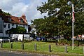
 Horton village green - geograph.org.uk - 2800418.jpg 800 × 543; 111 KB
-
 Horton village green - geograph.org.uk - 4229663.jpg 2,560 × 1,920; 2 MB
-
 Horton village green - geograph.org.uk - 5137041.jpg 640 × 427; 96 KB
-
 Horton village green - geograph.org.uk - 5137043.jpg 640 × 427; 106 KB
-
 Horton Village ^ Lakes - geograph.org.uk - 5249950.jpg 1,050 × 677; 55 KB
-
 Horton, Datchet Road - geograph.org.uk - 4470543.jpg 640 × 484; 339 KB
-
 Houses near the green at Horton - geograph.org.uk - 5137046.jpg 640 × 427; 88 KB
-
 Houses on Coppermill Road, Wraysbury - geograph.org.uk - 4230337.jpg 2,560 × 1,920; 1.91 MB
-
 John Milton Lived Here^ - geograph.org.uk - 5314597.jpg 480 × 640; 95 KB
-
 Junction of Park Lane and Datchet Road - geograph.org.uk - 5492144.jpg 5,202 × 3,465; 3.04 MB
-
 Junction of Welley Road and Datchet Road - geograph.org.uk - 5492161.jpg 5,202 × 3,465; 3.54 MB
-
 Lake between Wraysbury and Horton - geograph.org.uk - 5462273.jpg 640 × 480; 89 KB
-
 Land Adjacent to Horton Brook Quarry - geograph.org.uk - 4470636.jpg 640 × 480; 259 KB
-
 Langley near Slough - geograph.org.uk - 6459121.jpg 5,456 × 3,632; 1.74 MB
-

-
 M4, Queen Mother Reservoir, Langley from the air - geograph.org.uk - 5646675.jpg 3,237 × 1,437; 1.04 MB
-
 Metal gate on gravel pit track - geograph.org.uk - 3647016.jpg 1,989 × 1,491; 1.16 MB
-
 Mill Lane, Horton - geograph.org.uk - 3646556.jpg 2,048 × 1,536; 1.52 MB
-
 Noble Palace, Peking Restaurant - geograph.org.uk - 2981045.jpg 800 × 600; 113 KB
-
 North-West Side of Wraysbury Reservoir - geograph.org.uk - 5247651.jpg 1,015 × 687; 52 KB
-
 Old gate, Wraysbury reservoir - geograph.org.uk - 3646511.jpg 2,048 × 1,536; 727 KB
-

-
 Park Lane, Horton - geograph.org.uk - 3647027.jpg 1,979 × 1,484; 1.08 MB
-
 Park Lane, Horton - geograph.org.uk - 5492136.jpg 5,202 × 3,465; 3.16 MB
-
 Path alongside Horton Brook Quarry - geograph.org.uk - 4470631.jpg 640 × 482; 291 KB
-
 Path next to Horton Road - geograph.org.uk - 4470611.jpg 640 × 481; 318 KB
-
 Path towards Horton - geograph.org.uk - 5491275.jpg 5,202 × 3,465; 4.15 MB
-
 Phone box and shops on Coppermill Road, Wraysbury - geograph.org.uk - 4231179.jpg 2,560 × 1,920; 2.04 MB
-
 Pickins Piece, Horton - geograph.org.uk - 4470598.jpg 640 × 481; 332 KB
-
 Poyle Poplars - geograph.org.uk - 137013.jpg 640 × 480; 114 KB
-
 Pylons - geograph.org.uk - 1445702.jpg 640 × 480; 49 KB
-
 Queen Anne's Ride, Windsor Great Park - geograph.org.uk - 122280.jpg 640 × 481; 198 KB
-
 Reserve car park - geograph.org.uk - 2800419.jpg 800 × 619; 154 KB
-

-
 Roundabout sign on Welley Road, Sunnymeads - geograph.org.uk - 4231188.jpg 2,560 × 1,920; 1.98 MB
-
 Sad looking tree - geograph.org.uk - 2710554.jpg 640 × 480; 56 KB
-
-
 Shops, Horton Village - geograph.org.uk - 3563617.jpg 2,048 × 1,536; 1.06 MB
-
 Side of Queen Mother Reservoir - geograph.org.uk - 4498800.jpg 1,600 × 1,043; 500 KB
-
 Stanwell Rd - geograph.org.uk - 4734262.jpg 640 × 426; 81 KB
-
 Stanwell Rd - geograph.org.uk - 4734264.jpg 640 × 426; 77 KB
-
 Stanwell Road - geograph.org.uk - 3646138.jpg 1,992 × 1,493; 691 KB
-
 Stanwell Road - geograph.org.uk - 3646526.jpg 2,048 × 1,536; 1.15 MB
-
 Stanwell Road - Wraysbury reservoir - geograph.org.uk - 2799465.jpg 800 × 600; 116 KB
-
 Stanwell Road at the junction of Coppermill Road - geograph.org.uk - 4229784.jpg 2,560 × 1,920; 1.97 MB
-
 Stanwell Road West Towards Hornton - geograph.org.uk - 5294266.jpg 4,608 × 3,456; 6.45 MB
-
 Stanwell Road, Horton - geograph.org.uk - 3647072.jpg 2,032 × 1,525; 877 KB
-
 Stanwell Road, Horton - geograph.org.uk - 4231098.jpg 2,560 × 1,920; 1.99 MB
-
 Statue of George III, Snow Hill - geograph.org.uk - 61690.jpg 640 × 480; 63 KB
-
 Suburbia meets country - geograph.org.uk - 3010295.jpg 3,264 × 2,448; 3.53 MB
-
 The Crown Inn, Horton - geograph.org.uk - 4075283.jpg 4,320 × 3,240; 3.89 MB
-
 The Crown, Horton - geograph.org.uk - 2981288.jpg 800 × 600; 140 KB
-
 The Crown, Horton - geograph.org.uk - 2981293.jpg 800 × 600; 102 KB
-
 The Crown, Horton - geograph.org.uk - 4470547.jpg 640 × 480; 298 KB
-
 The Crown, Horton - geograph.org.uk - 5492149.jpg 4,611 × 2,989; 2.67 MB
-
 The entrance to Datchet Sailing Club - geograph.org.uk - 4230333.jpg 2,560 × 1,920; 1.99 MB
-
 The entrance to Horton Manor Farm - geograph.org.uk - 2981212.jpg 800 × 600; 178 KB
-
 The old iron bridge - geograph.org.uk - 3646998.jpg 1,988 × 1,491; 790 KB
-
 The Queen Mother Reservoir - geograph.org.uk - 1309816.jpg 640 × 424; 192 KB
-
 The Queen Mother Reservoir from the air - geograph.org.uk - 3989584.jpg 640 × 480; 103 KB
-
 View north east from the bridge - geograph.org.uk - 3647007.jpg 2,048 × 1,536; 1.01 MB
-
 View north west from the bridge - geograph.org.uk - 3647004.jpg 1,918 × 1,439; 919 KB
-
 Welley Road, Sunnymeads - geograph.org.uk - 4229633.jpg 2,560 × 1,920; 1.89 MB
-
 White Willow, Wraysbury - geograph.org.uk - 4083978.jpg 2,048 × 1,536; 1.64 MB
-
 Wraybury to Horton path - geograph.org.uk - 5491328.jpg 5,202 × 3,465; 7.37 MB
-
 Wraysbury - geograph.org.uk - 4344269.jpg 4,000 × 2,666; 7.67 MB
-
 Wraysbury Lakes - geograph.org.uk - 5249944.jpg 1,031 × 666; 53 KB
-
 Wraysbury reservoir - geograph.org.uk - 3646169.jpg 2,048 × 1,536; 1.32 MB
-
 Wraysbury Reservoir - Service Entrance - geograph.org.uk - 5294276.jpg 4,608 × 3,456; 6.74 MB
-
 The Queen Mother Reservoir - geograph.org.uk - 131066.jpg 640 × 480; 72 KB


,_Horton_Village_-_geograph.org.uk_-_4470590.jpg)


_-_geograph.org.uk_-_2315033.jpg)
_-_geograph.org.uk_-_2315093.jpg)
_-_geograph.org.uk_-_2315227.jpg)
_-_with_shore-line_vegetation_-_geograph.org.uk_-_2315340.jpg)


