Category:Horton Kirby and South Darenth
Aller à la navigation
Aller à la recherche
English: Horton Kirby and South Darenth is a civil parish in the Sevenoaks District of Kent, England. The parish is located in the River Darenth valley between Sevenoaks town and Dartford: it consists of the two villages of Horton Kirby and South Darenth. It was originally known simply as Horton Kirby parish.
localité britannique du comté anglais du Kent | |||||
| Téléverser des médias | |||||
| Nature de l’élément | |||||
|---|---|---|---|---|---|
| Lieu | Sevenoaks, Kent, Angleterre du Sud-Est, Angleterre | ||||
| site officiel | |||||
 | |||||
Sous-catégories
Cette catégorie comprend 2 sous-catégories, dont les 2 ci-dessous.
H
S
Média dans la catégorie « Horton Kirby and South Darenth »
Cette catégorie comprend 154 fichiers, dont les 154 ci-dessous.
-
 Agricultural scene, Darent Valley - geograph.org.uk - 3517553.jpg 640 × 430 ; 59 kio
-
 Alongside Mussenden Lane - geograph.org.uk - 3182871.jpg 4 000 × 3 000 ; 4 Mio
-
 Barn off Franks Lane - geograph.org.uk - 1917510.jpg 1 024 × 768 ; 146 kio
-
 Barns, Court Lodge Farm (geograph 6564751).jpg 1 024 × 684 ; 235 kio
-
 Bend, Darenth Valley Path - geograph.org.uk - 3525928.jpg 640 × 430 ; 114 kio
-
 Bridge over River Darent, Frank's Lane - geograph.org.uk - 3009554.jpg 3 264 × 2 448 ; 2,02 Mio
-
 Bridge over the River Darent - geograph.org.uk - 3510656.jpg 640 × 430 ; 113 kio
-
 Bridge over the River Darent - geograph.org.uk - 3517537.jpg 640 × 430 ; 109 kio
-
 Bridge over the River Darent, Franks Lane - geograph.org.uk - 3517584.jpg 640 × 430 ; 131 kio
-
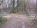
 Bridleway into Horton Wood - geograph.org.uk - 3162759.jpg 4 000 × 3 000 ; 4,18 Mio
-
 Bridleway into Horton Wood - geograph.org.uk - 3162768.jpg 4 000 × 3 000 ; 4,18 Mio
-
 Building by the Darent Valley Path - geograph.org.uk - 3499423.jpg 640 × 430 ; 86 kio
-
 Buildings on Gill's Road - geograph.org.uk - 1248103.jpg 640 × 480 ; 122 kio
-
 Byway on School Lane - geograph.org.uk - 1223026.jpg 640 × 480 ; 113 kio
-
 Canada Farm Road, Pinden - geograph.org.uk - 2877283.jpg 4 320 × 3 240 ; 4,82 Mio
-
 Canada Farm Road, Pinden - geograph.org.uk - 2877289.jpg 4 320 × 3 240 ; 3,48 Mio
-
 Chimney of the former Horton Kirby Paper Mill - geograph.org.uk - 6477794.jpg 3 000 × 4 000 ; 4,17 Mio
-
 Chimney of the former Horton Kirby Paper Mill - geograph.org.uk - 6477801.jpg 3 901 × 2 900 ; 1,25 Mio
-
 Cleared Land - geograph.org.uk - 1223030.jpg 640 × 480 ; 111 kio
-
 Clump of trees - geograph.org.uk - 3517621.jpg 640 × 430 ; 56 kio
-
 Communication mast in Horton Wood - geograph.org.uk - 1314900.jpg 640 × 480 ; 59 kio
-
 Darent Valley Path - geograph.org.uk - 3510659.jpg 640 × 430 ; 130 kio
-
 Darent Valley Path - geograph.org.uk - 3517523.jpg 640 × 430 ; 95 kio
-
 Darent Valley Path - geograph.org.uk - 3517533.jpg 640 × 430 ; 106 kio
-
 Darent Valley Path - geograph.org.uk - 3517551.jpg 640 × 430 ; 73 kio
-
 Darent Valley Path - geograph.org.uk - 3517563.jpg 640 × 430 ; 102 kio
-
 Darent Valley Path - geograph.org.uk - 3517569.jpg 640 × 430 ; 126 kio
-
 Darent Valley Path - geograph.org.uk - 3517573.jpg 640 × 430 ; 154 kio
-
 Darent Valley Path - geograph.org.uk - 3517613.jpg 640 × 430 ; 65 kio
-
 Darent Valley Path - geograph.org.uk - 3517624.jpg 640 × 430 ; 67 kio
-
 Darent Valley Path by the River Darent - geograph.org.uk - 3510662.jpg 640 × 430 ; 119 kio
-
 Darent Valley Path off Franks Lane - geograph.org.uk - 3517607.jpg 640 × 430 ; 103 kio
-
 Darenth Valley Path - geograph.org.uk - 3525922.jpg 640 × 430 ; 91 kio
-
 Devon Rd - geograph.org.uk - 3510072.jpg 640 × 430 ; 105 kio
-
 Digger versus tree - geograph.org.uk - 1223035.jpg 640 × 480 ; 90 kio
-
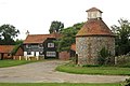 Dovecot at Court Lodge - geograph.org.uk - 2050701.jpg 640 × 427 ; 87 kio
-
 East Hill Road bridge over Railway - geograph.org.uk - 1222960.jpg 480 × 640 ; 130 kio
-
 Eglantine Lane - geograph.org.uk - 3136781.jpg 4 000 × 3 000 ; 4,26 Mio
-
 Electrical fly-tipping by bridge VIR 108 - geograph.org.uk - 2073924.jpg 640 × 428 ; 110 kio
-
 Electricity pylon near Skinney Lane - geograph.org.uk - 1248189.jpg 640 × 480 ; 82 kio
-
 Farm bridge over Railway - geograph.org.uk - 1222948.jpg 640 × 480 ; 99 kio
-
 Farm building on Gill's Road - geograph.org.uk - 3164148.jpg 4 000 × 3 000 ; 4,31 Mio
-
 Farm buildings by Franks Lane - geograph.org.uk - 3517577.jpg 640 × 430 ; 97 kio
-
 Farm road crosses byway - geograph.org.uk - 1223037.jpg 640 × 480 ; 139 kio
-
 Field alongside Rabbits Road - geograph.org.uk - 3162754.jpg 4 000 × 3 000 ; 4,32 Mio
-
 Field and hedge - geograph.org.uk - 3517548.jpg 640 × 430 ; 61 kio
-
 Fields off Mussenden Lane - geograph.org.uk - 1918837.jpg 1 024 × 768 ; 194 kio
-
 Fine tree on the banks of the River Darent - geograph.org.uk - 3510251.jpg 430 × 640 ; 137 kio
-
 Fire Station - geograph.org.uk - 3510111.jpg 640 × 430 ; 69 kio
-
 Fly Tipping on Gill's Road - geograph.org.uk - 5169407.jpg 1 600 × 1 067 ; 544 kio
-
 Footpath alongside Horton Road - geograph.org.uk - 3193527.jpg 4 000 × 3 000 ; 3,81 Mio
-
 Footpath leading from Gill's Road - geograph.org.uk - 2818048.jpg 4 000 × 3 000 ; 4,32 Mio
-
 Footpath off Franks Lane - geograph.org.uk - 3517597.jpg 640 × 430 ; 117 kio
-
 Footpath off Franks Lane - geograph.org.uk - 3517604.jpg 640 × 430 ; 135 kio
-
 Ford on the River Darent between Horton Kirby and South Darenth - geograph.org.uk - 3137528.jpg 4 000 × 3 000 ; 4,15 Mio
-
 Franks Farm Oast, Dartford Road, Horton Kirby - geograph.org.uk - 6490511.jpg 3 649 × 3 649 ; 3,7 Mio
-
 Franks Lane - geograph.org.uk - 3517585.jpg 640 × 430 ; 111 kio
-
 Franks Lane - geograph.org.uk - 3517598.jpg 640 × 430 ; 113 kio
-
 Franks Lane Bridge (geograph 6564800).jpg 1 024 × 684 ; 291 kio
-
 Franks Lane Bridge - geograph.org.uk - 3517587.jpg 640 × 430 ; 122 kio
-
 Franks Lane roadbridge over River Darenth - geograph.org.uk - 1302645.jpg 640 × 480 ; 123 kio
-
 Giffords Cottages - geograph.org.uk - 3510080.jpg 640 × 430 ; 105 kio
-
 Gill's Farm - geograph.org.uk - 1247900.jpg 640 × 480 ; 164 kio
-
 Gill's Road - geograph.org.uk - 5169400.jpg 1 600 × 1 067 ; 813 kio
-
 Grassland in the Darenth Valley - geograph.org.uk - 3525926.jpg 640 × 430 ; 77 kio
-
 Grassy swarth - geograph.org.uk - 3517617.jpg 640 × 430 ; 67 kio
-
 Heading for Fawkham Junction - geograph.org.uk - 1248122.jpg 640 × 480 ; 163 kio
-
 Hedge and field - geograph.org.uk - 3517618.jpg 640 × 430 ; 70 kio
-
 Hedge by the Darent Valley Path - geograph.org.uk - 3517527.jpg 640 × 430 ; 88 kio
-
 Holmesdale Rd - geograph.org.uk - 3499441.jpg 640 × 430 ; 78 kio
-
 Holmesdale Rd - geograph.org.uk - 3499443.jpg 640 × 430 ; 71 kio
-
 Holmesdale Rd - geograph.org.uk - 3510078.jpg 640 × 430 ; 102 kio
-
 Horses by stream below Station Road - geograph.org.uk - 5207615.jpg 640 × 427 ; 116 kio
-
 Horton Rd - geograph.org.uk - 3510133.jpg 640 × 430 ; 68 kio
-
 Hundred Year Wood - geograph.org.uk - 1302632.jpg 640 × 480 ; 124 kio
-
 Kissing Gate on Skinney Lane - geograph.org.uk - 1222973.jpg 640 × 480 ; 82 kio
-
 Lane near Dean Bottom - geograph.org.uk - 2876943.jpg 4 320 × 3 240 ; 4,24 Mio
-
 Little Franks - geograph.org.uk - 3517603.jpg 640 × 430 ; 107 kio
-
 Looking up to Horton Kirby Viaduct - geograph.org.uk - 6477483.jpg 4 000 × 3 000 ; 5,03 Mio
-
 Mulberry Lodge - geograph.org.uk - 3499474.jpg 640 × 430 ; 96 kio
-

-
 New Rd - geograph.org.uk - 3510108.jpg 640 × 430 ; 63 kio
-
 New Track off Mussenden Lane - geograph.org.uk - 1918829.jpg 1 024 × 768 ; 131 kio
-
 Old farm building off Canada Farm Road - geograph.org.uk - 3164191.jpg 4 000 × 3 000 ; 4,21 Mio
-
 Paddocks at Mussenden Farm - geograph.org.uk - 1917529.jpg 1 024 × 768 ; 222 kio
-
 Phone Mast near Wilson Lane - geograph.org.uk - 1222942.jpg 480 × 640 ; 60 kio
-
 Preserving the mill facade - geograph.org.uk - 3147123.jpg 640 × 428 ; 114 kio
-
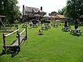 Pub Garden - geograph.org.uk - 1427254.jpg 640 × 480 ; 134 kio
-
 Pylons heading towards the Darent Valley from near Rabbits Farm - geograph.org.uk - 3162748.jpg 4 000 × 3 000 ; 3,61 Mio
-
 Pylons near Longfield - geograph.org.uk - 3164177.jpg 4 000 × 3 000 ; 4,27 Mio
-
 Rabbits Lane, near Dean Bottom - geograph.org.uk - 2876954.jpg 4 320 × 3 240 ; 4,83 Mio
-
 Rabbits Road - geograph.org.uk - 3164182.jpg 4 000 × 3 000 ; 4,3 Mio
-
 Railway cutting from bridge VIR 107 - geograph.org.uk - 2073879.jpg 640 × 428 ; 119 kio
-
 Railway in cutting - geograph.org.uk - 1222953.jpg 640 × 480 ; 107 kio
-
 Railway sub-station at Fawkham Junction - geograph.org.uk - 2073971.jpg 640 × 428 ; 129 kio
-
 Railway to Longfield - geograph.org.uk - 1222944.jpg 640 × 480 ; 100 kio
-
 Rashleigh Court - geograph.org.uk - 1222974.jpg 640 × 480 ; 112 kio
-
 River Darent - geograph.org.uk - 1427247.jpg 640 × 480 ; 171 kio
-
 River Darent - geograph.org.uk - 1433300.jpg 640 × 480 ; 198 kio
-
 River Darent - geograph.org.uk - 3499460.jpg 640 × 430 ; 118 kio
-
 River Darent - geograph.org.uk - 3499477.jpg 640 × 430 ; 92 kio
-
 River Darent - geograph.org.uk - 3510074.jpg 640 × 430 ; 112 kio
-
 River Darent - geograph.org.uk - 3510242.jpg 640 × 430 ; 126 kio
-
 River Darent - geograph.org.uk - 3510244.jpg 640 × 430 ; 131 kio
-
 River Darent - geograph.org.uk - 3510250.jpg 640 × 430 ; 117 kio
-
 River Darent - geograph.org.uk - 3510653.jpg 640 × 430 ; 125 kio
-
 River Darent - geograph.org.uk - 3510663.jpg 640 × 430 ; 126 kio
-
 River Darent - geograph.org.uk - 3510664.jpg 640 × 430 ; 125 kio
-
 River Darent - geograph.org.uk - 3517566.jpg 640 × 430 ; 105 kio
-
 River Darent - geograph.org.uk - 3517570.jpg 640 × 430 ; 111 kio
-
 River Darent - geograph.org.uk - 3517582.jpg 640 × 430 ; 148 kio
-
 River Darent - geograph.org.uk - 3517593.jpg 640 × 430 ; 100 kio
-
 River Darent - geograph.org.uk - 4306733.jpg 640 × 480 ; 139 kio
-
 River Darent - geograph.org.uk - 4897674.jpg 3 264 × 2 448 ; 3,24 Mio
-
 River Darent and path - geograph.org.uk - 3510247.jpg 640 × 430 ; 107 kio
-
 River Darent between Horton Kirby and South Darenth - geograph.org.uk - 3137525.jpg 4 000 × 3 000 ; 4,31 Mio
-
 River Darent between Horton Kirby and South Darenth - geograph.org.uk - 3137536.jpg 4 000 × 3 000 ; 4,4 Mio
-
 River Darent between Horton Kirby and South Darenth - geograph.org.uk - 3137559.jpg 4 000 × 3 000 ; 4,34 Mio
-
 River Darent between Horton Kirby and South Darenth - geograph.org.uk - 3137567.jpg 4 000 × 3 000 ; 4,2 Mio
-
 River Darent from Frank's Lane - geograph.org.uk - 3009550.jpg 3 264 × 2 448 ; 2,07 Mio
-
 River Darent, downstream - geograph.org.uk - 3510657.jpg 640 × 430 ; 128 kio
-
 River Darent, Franks Lane Bridge - geograph.org.uk - 3517589.jpg 640 × 430 ; 117 kio
-
 River Darenth - geograph.org.uk - 3510137.jpg 640 × 430 ; 130 kio
-
 River Darenth and Footpath - geograph.org.uk - 918601.jpg 640 × 480 ; 157 kio
-
 Row of terraced houses - geograph.org.uk - 3510116.jpg 640 × 430 ; 68 kio
-
 Southdown-old boys lodge - geograph.org.uk - 1248180.jpg 640 × 480 ; 155 kio
-
 Southdowns Church - geograph.org.uk - 2207134.jpg 1 145 × 786 ; 567 kio
-
 Spring lambs by Skinney Lane - geograph.org.uk - 1248205.jpg 640 × 480 ; 181 kio
-
 The Barn, Mussenden Farm - geograph.org.uk - 1314902.jpg 640 × 480 ; 88 kio
-
 The Bridges - geograph.org.uk - 3510132.jpg 640 × 416 ; 40 kio
-
 The Darenth Valley Path - geograph.org.uk - 1302641.jpg 640 × 480 ; 119 kio
-
 The Mill - houses for sale - geograph.org.uk - 1248197.jpg 640 × 480 ; 124 kio
-
 The Old Farmhouse, Dean Bottom - geograph.org.uk - 1222937.jpg 640 × 480 ; 129 kio
-
 The Weir on the River Darenth - geograph.org.uk - 1302635.jpg 640 × 480 ; 100 kio
-
 Tipped material in a field off Gills Road - geograph.org.uk - 1247891.jpg 640 × 480 ; 160 kio
-
 Track leading off Rabbits Road - geograph.org.uk - 3164168.jpg 4 000 × 3 000 ; 3,98 Mio
-
 Track off Gill's Road - geograph.org.uk - 3164159.jpg 4 000 × 3 000 ; 4,15 Mio
-
 Underneath Horton Kirby Viaduct - geograph.org.uk - 6477480.jpg 4 000 × 3 000 ; 4,93 Mio
-
 Underneath Horton Kirby Viaduct - geograph.org.uk - 6477481.jpg 3 395 × 2 546 ; 1,5 Mio
-
 View across Saxon Place - geograph.org.uk - 5207546.jpg 640 × 427 ; 80 kio
-
 View from Eglantine Lane - geograph.org.uk - 3136787.jpg 4 000 × 3 000 ; 4,11 Mio
-
 View from Gill's Road - geograph.org.uk - 2818051.jpg 4 000 × 3 000 ; 4,13 Mio
-
 View from Mussenden Lane - geograph.org.uk - 3182599.jpg 4 000 × 3 000 ; 3,97 Mio
-
 View from Mussenden Lane - geograph.org.uk - 3182881.jpg 4 000 × 3 000 ; 3,74 Mio
-
 View from Rabbits Road - geograph.org.uk - 3164197.jpg 4 000 × 3 000 ; 3,91 Mio
-
 View from School Lane - geograph.org.uk - 3135269.jpg 4 000 × 3 000 ; 2,36 Mio
-
 View from Wilson Lane - geograph.org.uk - 3162738.jpg 4 000 × 3 000 ; 4,33 Mio
-
 View through a pylon near Longfield - geograph.org.uk - 3164173.jpg 4 000 × 3 000 ; 4,1 Mio
-
 View towards Dartford Rd - geograph.org.uk - 3517546.jpg 640 × 430 ; 55 kio
-
 View towards Lane End - geograph.org.uk - 5169386.jpg 1 600 × 818 ; 507 kio
-
 Walkers in Field - geograph.org.uk - 4306731.jpg 640 × 480 ; 41 kio
-
 Weir, River Darent - geograph.org.uk - 3499479.jpg 640 × 430 ; 109 kio
-
 Whitefields, Dean Bottom - geograph.org.uk - 1222933.jpg 640 × 480 ; 121 kio
-
 Woodland and field - geograph.org.uk - 3517556.jpg 640 × 430 ; 88 kio


.jpg)


.jpg)


