Category:South Darenth
Jump to navigation
Jump to search
English: South Darenth is a village in the civil parish of Horton Kirby and South Darenth in the Sevenoaks District of Kent, England.
village in Kent, United Kingdom  | |||||
| Upload media | |||||
| Instance of | |||||
|---|---|---|---|---|---|
| Location | Horton Kirby and South Darenth, Sevenoaks, Kent, South East England, England | ||||
 | |||||
Media in category "South Darenth"
The following 28 files are in this category, out of 28 total.
-
 Archaeologia cantiana (1897) (14598119920).jpg 1,978 × 2,922; 482 KB
-
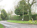
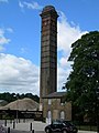 Chimney, South Darenth - geograph.org.uk - 919320.jpg 480 × 640; 70 KB
-
 East Hill. South Darenth - geograph.org.uk - 2877225.jpg 4,320 × 3,240; 3.96 MB
-
 Edge of a rape field - geograph.org.uk - 1247823.jpg 640 × 480; 171 KB
-
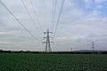 Electricity Pylons - geograph.org.uk - 324251.jpg 640 × 428; 67 KB
-
 Field of rape near South Darenth - geograph.org.uk - 1248187.jpg 640 × 480; 165 KB
-
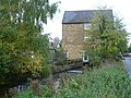 Former mill in South Darenth - geograph.org.uk - 3196515.jpg 4,000 × 3,000; 4.18 MB
-
 Giffords Cottages, South Darenth.jpg 4,032 × 3,024; 12.13 MB
-

-
 Junction of Gorringe Avenue and Rabbits Road, South Darenth - geograph.org.uk - 2877231.jpg 4,320 × 3,240; 4.87 MB
-
 Rabbits Road, South Darenth - geograph.org.uk - 1248183.jpg 640 × 480; 254 KB
-
 Rabbits Road, South Darenth - geograph.org.uk - 2877246.jpg 4,320 × 3,240; 4.73 MB
-
 Rabbits Road, South Darenth - geograph.org.uk - 2877255.jpg 4,320 × 3,240; 3.87 MB
-
 Rabbits Road, South Darenth - geograph.org.uk - 2877262.jpg 4,320 × 3,240; 3.88 MB
-
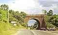
 Railway line at South Darenth - geograph.org.uk - 2877136.jpg 4,320 × 3,240; 4.62 MB
-

-
 River Darent at South Darenth - geograph.org.uk - 3196516.jpg 4,000 × 3,000; 4.03 MB
-
 River Darent near South Darenth - geograph.org.uk - 3137578.jpg 4,000 × 3,000; 4.21 MB
-
 South darenth 1924.png 946 × 359; 120 KB
-
 South Darenth geograph-3513114-by-Ben-Brooksbank.jpg 1,883 × 1,142; 2.87 MB
-
 South Darenth village sign - geograph.org.uk - 3196490.jpg 4,000 × 3,000; 4.07 MB
-
 South Darenth.png 259 × 194; 118 KB
-
 Southdown Church - geograph.org.uk - 1222969.jpg 640 × 480; 90 KB
-
 The Jolly Millers Pub, South Darenth - geograph.org.uk - 919315.jpg 640 × 480; 72 KB
-
 The Salle Building, Esparto Way, South Darenth.jpg 4,032 × 3,024; 4.83 MB
-
 Village sign at South Darenth - geograph.org.uk - 3196491.jpg 3,000 × 4,000; 3.97 MB
-

-

_(14598119920).jpg)


