Category:Houses in County Donegal
Jump to navigation
Jump to search
Subcategories
This category has the following 5 subcategories, out of 5 total.
B
- Buncrana Castle (1 F)
C
- Houses in Cruit Island (21 F)
F
- Farmhouses in County Donegal (20 F)
H
- Houses in Lifford (3 F)
Media in category "Houses in County Donegal"
The following 200 files are in this category, out of 246 total.
(previous page) (next page)-
 A farm house on the N15 north of Ballybullgan - geograph.org.uk - 3247267.jpg 1,024 × 717; 112 KB
-
 A gated road and derelict cottage at Glenree - geograph.org.uk - 3263209.jpg 1,024 × 604; 75 KB
-
 An Coimín - geograph.org.uk - 3321534.jpg 640 × 480; 293 KB
-
 An Coimín - geograph.org.uk - 3321539.jpg 640 × 480; 232 KB
-
 An isolated house - geograph.org.uk - 5507279.jpg 2,000 × 1,333; 2.05 MB
-
 Approaching Portnoo from SW - geograph.org.uk - 1170605.jpg 640 × 427; 57 KB
-

-
 Ardmalin - geograph.org.uk - 1337742.jpg 640 × 479; 57 KB
-
 Ardmalin, Malin Head - geograph.org.uk - 1337755.jpg 640 × 479; 63 KB
-
 Arrested development - geograph.org.uk - 3608796.jpg 640 × 480; 305 KB
-
 At Tullyvoos - geograph.org.uk - 861637.jpg 640 × 480; 117 KB
-
 Baile an Droichid, Bridgetown - geograph.org.uk - 913390.jpg 640 × 480; 105 KB
-
 Barrack - geograph.org.uk - 3996223.jpg 640 × 390; 223 KB
-
 Bayview, Carndonagh - geograph.org.uk - 1381141.jpg 640 × 248; 23 KB
-
 Beach and houses at Doagh Bay - geograph.org.uk - 1932179.jpg 640 × 480; 83 KB
-
 Blue wall and flowers, Frosses - geograph.org.uk - 981120.jpg 427 × 640; 75 KB
-

-
 Building at SE end of Inishkeel Island - geograph.org.uk - 1161356.jpg 640 × 426; 233 KB
-
 Bunbeg Harbour Road - House - geograph.org.uk - 1176564.jpg 640 × 426; 246 KB
-
 Bunbeg Harbour Road - New house - geograph.org.uk - 1176559.jpg 640 × 426; 206 KB
-
 Bunbeg Harbour Road - New house - geograph.org.uk - 1176571.jpg 639 × 426; 275 KB
-
-

-

-
 Bungalow at Balwoges - geograph.org.uk - 1702679.jpg 3,072 × 2,048; 2.51 MB
-
 Bungalow in Cruit Lower - geograph.org.uk - 3230322.jpg 1,024 × 602; 127 KB
-
 Bungalow, Crossogs - geograph.org.uk - 1975953.jpg 640 × 480; 58 KB
-
 Bungalows on Carnmore Road - geograph.org.uk - 3262986.jpg 1,024 × 768; 128 KB
-
 Bunnaton More - geograph.org.uk - 1919639.jpg 640 × 480; 69 KB
-
 Church Manse - geograph.org.uk - 775941.jpg 640 × 360; 77 KB
-
 Clogher - geograph.org.uk - 3190666.jpg 640 × 442; 251 KB
-
 Coach House, Ballymacaward - geograph.org.uk - 1422751.jpg 640 × 479; 67 KB
-
 Concarr's house, West End, Ardara - geograph.org.uk - 1113824.jpg 640 × 442; 76 KB
-
 Cottage - geograph.org.uk - 5086585.jpg 5,184 × 3,456; 3.58 MB
-
 Cottage at Carnatreantagh - geograph.org.uk - 1807383.jpg 640 × 480; 53 KB
-
 Cottage at Carrowcashel - geograph.org.uk - 2566873.jpg 640 × 480; 48 KB
-
 Cottage at Mullagh Dub - geograph.org.uk - 501542.jpg 640 × 479; 51 KB
-
 Cottage beside minor road to Dunglow - geograph.org.uk - 1031809.jpg 640 × 480; 120 KB
-
 Cottage on the R262 at Drumbeagh - geograph.org.uk - 3216549.jpg 1,024 × 701; 73 KB
-
 Cottage surrounded by forestry plantations - geograph.org.uk - 3221440.jpg 991 × 1,024; 102 KB
-
 Cottage under construction - geograph.org.uk - 1031345.jpg 640 × 480; 90 KB
-
 Cottage waiting development - geograph.org.uk - 874395.jpg 640 × 480; 96 KB
-
 Cottage, Arryheernabin - geograph.org.uk - 1918678.jpg 640 × 480; 72 KB
-
 Cottage, Cranford - geograph.org.uk - 1952465.jpg 640 × 480; 52 KB
-
 Cottage, Drumdutton - geograph.org.uk - 1952914.jpg 640 × 480; 52 KB
-
 Cottage, Newmills - geograph.org.uk - 1986649.jpg 640 × 480; 73 KB
-
 Cottage, Newmills - geograph.org.uk - 1986650.jpg 640 × 480; 102 KB
-
 Cottage, Portbane - geograph.org.uk - 1911082.jpg 640 × 480; 82 KB
-
 Cottages - geograph.org.uk - 1031897.jpg 640 × 480; 71 KB
-
 Cottages - Trawenagh Bay - geograph.org.uk - 1031899.jpg 640 × 480; 76 KB
-
 Cottages across rough grazing - geograph.org.uk - 1031349.jpg 640 × 480; 57 KB
-
 Cottages at Crohy - geograph.org.uk - 1031905.jpg 640 × 480; 102 KB
-

-
 Coxtown Manor - geograph.org.uk - 913397.jpg 640 × 480; 96 KB
-

-
-
 Dave Gallagher Park, Ramelton - geograph.org.uk - 4005443.jpg 640 × 480; 165 KB
-
 Derelict cottage on Carnmore Road - geograph.org.uk - 3262973.jpg 1,024 × 590; 122 KB
-
 Derelict cottage south of Lake Meela - geograph.org.uk - 3263001.jpg 1,024 × 760; 69 KB
-
 Derelict cottage, Mullaghduff - geograph.org.uk - 3496733.jpg 640 × 480; 85 KB
-
 Derelict house near Turk - geograph.org.uk - 1359901.jpg 640 × 479; 65 KB
-
 Derelict house, Culdaff - geograph.org.uk - 1331145.jpg 640 × 479; 58 KB
-
 Disused Post Office - geograph.org.uk - 768483.jpg 640 × 360; 60 KB
-
 Disused school,Glenalla - geograph.org.uk - 775896.jpg 640 × 360; 68 KB
-
 Dog and Hairy House - geograph.org.uk - 933024.jpg 640 × 480; 126 KB
-
 Dun Uisce holiday homes - geograph.org.uk - 1048270.jpg 640 × 427; 69 KB
-

-

-
 Empty house, Meenawalla - geograph.org.uk - 3329894.jpg 640 × 480; 267 KB
-
 Eviction Scene - geograph.org.uk - 3447289.jpg 2,592 × 1,944; 2.29 MB
-
 Farmhouse, Creevagh - geograph.org.uk - 1952918.jpg 640 × 480; 70 KB
-
 Garvagh townland - geograph.org.uk - 893738.jpg 640 × 480; 126 KB
-
 Gate Lodge under repair - geograph.org.uk - 1367187.jpg 640 × 480; 98 KB
-

-
 Good Luck Donegal - Limerick - geograph.org.uk - 3967907.jpg 640 × 480; 324 KB
-
 Gortnatraw Bay - geograph.org.uk - 1928919.jpg 640 × 480; 45 KB
-
 Grey Rock Milford - geograph.org.uk - 1194107.jpg 640 × 358; 59 KB
-
 Hairy House at Ballybulgan - geograph.org.uk - 933015.jpg 640 × 480; 106 KB
-
 Hill cottage above Ivy Bridge - geograph.org.uk - 3265128.jpg 860 × 1,024; 103 KB
-
 Hilltop bungalow - geograph.org.uk - 1505577.jpg 640 × 480; 39 KB
-
 Holiday home, Goorey - geograph.org.uk - 1329335.jpg 640 × 479; 89 KB
-
 Holiday homes at Ballyhoorisky - geograph.org.uk - 1885998.jpg 640 × 480; 72 KB
-
 Holiday homes, Culdaff Beach - geograph.org.uk - 1331224.jpg 640 × 479; 53 KB
-
 Holiday homes, Toragh - geograph.org.uk - 2331834.jpg 640 × 480; 82 KB
-
 Homes in Drumkeelan - geograph.org.uk - 916191.jpg 480 × 640; 103 KB
-
 Homes on An Chruach Bheag - geograph.org.uk - 1013231.jpg 427 × 640; 91 KB
-
 Horn Head - House - geograph.org.uk - 1181908.jpg 640 × 426; 180 KB
-
 House almost finished - geograph.org.uk - 1032558.jpg 640 × 480; 96 KB
-
 House among trees - geograph.org.uk - 1030335.jpg 640 × 480; 105 KB
-
 House at Ballylin Point - geograph.org.uk - 1757073.jpg 640 × 480; 68 KB
-
 House at Bracky Bridge, Ardara. - geograph.org.uk - 1113796.jpg 640 × 429; 102 KB
-
 House at Carracknahorna - geograph.org.uk - 884182.jpg 640 × 479; 56 KB
-
 House at Creaghcor - geograph.org.uk - 142009.jpg 640 × 479; 81 KB
-
 House at foot of Clougher Hill - geograph.org.uk - 1071398.jpg 640 × 427; 81 KB
-
 House at Gortmessan - geograph.org.uk - 142002.jpg 640 × 479; 112 KB
-
 House at Rahan overlooks beach - geograph.org.uk - 920798.jpg 640 × 480; 70 KB
-
 House at Skehog - geograph.org.uk - 1390862.jpg 640 × 479; 79 KB
-

-
 House by Lough Eske - geograph.org.uk - 470471.jpg 640 × 480; 123 KB
-
 House for sale - geograph.org.uk - 1032583.jpg 640 × 480; 68 KB
-
 House for sale - geograph.org.uk - 1886070.jpg 640 × 480; 44 KB
-
 House in Trees - geograph.org.uk - 961869.jpg 427 × 640; 126 KB
-
 House near beach in Naran - geograph.org.uk - 1161357.jpg 640 × 426; 138 KB
-
 House near Crohy - geograph.org.uk - 1031904.jpg 640 × 480; 136 KB
-
 House on corner, Frosses road - geograph.org.uk - 2480439.jpg 4,320 × 3,240; 5.9 MB
-
 House on Donegal Road - geograph.org.uk - 1124569.jpg 640 × 480; 97 KB
-
 House on Inishcoo Island - geograph.org.uk - 1164504.jpg 640 × 425; 203 KB
-
 House on Inishcoo Island - geograph.org.uk - 1164507.jpg 639 × 426; 232 KB
-
 House on Road to Foyagh - geograph.org.uk - 913412.jpg 640 × 480; 79 KB
-
 House on road to Maghera - geograph.org.uk - 1403927.jpg 640 × 427; 70 KB
-
 House on the R259 at Keadue - geograph.org.uk - 3261851.jpg 1,024 × 537; 98 KB
-
 House on the R259 south of Leckenagh - geograph.org.uk - 3261967.jpg 1,024 × 549; 92 KB
-
 House on the R262 at Gargrim - geograph.org.uk - 3264165.jpg 1,024 × 530; 183 KB
-
 House on the Road to Malin Head - geograph.org.uk - 5680522.jpg 640 × 480; 452 KB
-
 House overlooking Esky Bay - geograph.org.uk - 5680517.jpg 640 × 427; 383 KB
-

-
 House with railings, Ballintra - geograph.org.uk - 4956955.jpg 640 × 480; 173 KB
-
 House with scaffolding - geograph.org.uk - 892452.jpg 640 × 480; 102 KB
-
 House, Ballykerrigan - geograph.org.uk - 1771040.jpg 640 × 480; 54 KB
-
 House, Carrick - geograph.org.uk - 1929289.jpg 640 × 480; 67 KB
-
 House, Cornaglah - geograph.org.uk - 1422255.jpg 640 × 441; 63 KB
-
 House, Glenieraragh - geograph.org.uk - 1954107.jpg 640 × 480; 65 KB
-
 House, Leat Beg - geograph.org.uk - 1929007.jpg 640 × 480; 76 KB
-
 House, Rutland Island - geograph.org.uk - 4105061.jpg 640 × 640; 115 KB
-

-
 Houses at Bunnagee - geograph.org.uk - 1329077.jpg 640 × 479; 84 KB
-
 Houses at Gortalia - geograph.org.uk - 1939591.jpg 640 × 480; 95 KB
-
 Houses at Mossedge - geograph.org.uk - 5680370.jpg 640 × 480; 357 KB
-
 Houses at Portnoo - geograph.org.uk - 2517687.jpg 640 × 480; 48 KB
-

-
 Houses on Inch Island - geograph.org.uk - 2779143.jpg 640 × 360; 71 KB
-
 Houses on the R262 at Straoughter - geograph.org.uk - 3263085.jpg 1,024 × 576; 107 KB
-
 Houses on the R262 Ballybrollaghan - geograph.org.uk - 3216523.jpg 1,024 × 579; 76 KB
-
 Houses on the R262 north of Drumnacrosh - geograph.org.uk - 3263127.jpg 1,024 × 555; 70 KB
-

-
 Houses, Ballymacool - geograph.org.uk - 1975718.jpg 640 × 450; 42 KB
-
 Houses, Calhame - geograph.org.uk - 1764848.jpg 640 × 480; 56 KB
-
 Houses, Cashelshannaghan - geograph.org.uk - 1757292.jpg 640 × 480; 41 KB
-
 Houses, Castlefinn - geograph.org.uk - 4208367.jpg 640 × 480; 167 KB
-
 Houses, Cloncarney - geograph.org.uk - 1806310.jpg 640 × 480; 67 KB
-
 Houses, Moville - geograph.org.uk - 2588405.jpg 640 × 480; 51 KB
-
 Houses, Portnoo - geograph.org.uk - 2517622.jpg 640 × 480; 50 KB
-
 Houses, Raphoe - geograph.org.uk - 2589808.jpg 640 × 480; 64 KB
-
 Houses, Tonbane Glebe - geograph.org.uk - 1928914.jpg 640 × 480; 56 KB
-
 Housing development at Black Point - geograph.org.uk - 874391.jpg 640 × 480; 77 KB
-

-
 Housing development, Cluain - geograph.org.uk - 1975632.jpg 640 × 480; 60 KB
-
 Inishcoo House restored - geograph.org.uk - 3288017.jpg 800 × 600; 89 KB
-
 Irish cottage - geograph.org.uk - 3447198.jpg 3,072 × 2,304; 7.09 MB
-

-

-

-
 Kincasslagh Peninsula - Main road - geograph.org.uk - 1171554.jpg 639 × 426; 310 KB
-
 Laddan, Fanad - geograph.org.uk - 3588447.jpg 640 × 480; 245 KB
-
 Large country house - geograph.org.uk - 1367937.jpg 640 × 480; 56 KB
-

-
 Last house in Loughros Point. - geograph.org.uk - 1100718.jpg 640 × 480; 83 KB
-
 Local road, Lismulladuff - geograph.org.uk - 3203084.jpg 640 × 480; 272 KB
-
 Long House - geograph.org.uk - 861719.jpg 640 × 480; 59 KB
-
 Lossett National School - geograph.org.uk - 1806157.jpg 640 × 480; 62 KB
-
 Lovely old house in Rossilly - geograph.org.uk - 909515.jpg 640 × 480; 117 KB
-
 Main road, Culdaff - geograph.org.uk - 1331132.jpg 640 × 479; 59 KB
-
 Manor House, Dunkineely - geograph.org.uk - 871279.jpg 640 × 568; 76 KB
-
 Marble Hill Cove - panoramio - Alistair Cunningham.jpg 1,024 × 768; 353 KB
-

-
 Modern bungalows below Benbane - geograph.org.uk - 3263305.jpg 1,024 × 542; 76 KB
-
 Murray's Town - geograph.org.uk - 1805845.jpg 640 × 480; 48 KB
-
 N15 near Laheen - geograph.org.uk - 827460.jpg 640 × 480; 54 KB
-
 New bungalow above the Owenfoker River - geograph.org.uk - 3265205.jpg 1,024 × 766; 99 KB
-
 New bungalow at Bog road, Ardara. - geograph.org.uk - 1111639.jpg 640 × 393; 81 KB
-
 New development near Drumrooske - geograph.org.uk - 1083247.jpg 640 × 427; 86 KB
-

-
 New house at Sleadrin - geograph.org.uk - 1380131.jpg 640 × 479; 68 KB
-
 New house by the River Eske - geograph.org.uk - 799050.jpg 640 × 480; 121 KB
-
 New house on Ballydevitt Hill - geograph.org.uk - 890898.jpg 640 × 480; 79 KB
-
 New houses at Rossilly - geograph.org.uk - 909555.jpg 640 × 480; 96 KB
-
 New housing, Abbeytown - geograph.org.uk - 1638836.jpg 640 × 480; 78 KB
-

-
 Newtowndrumgoran townland - geograph.org.uk - 888797.jpg 640 × 480; 89 KB
-
 Nice house with great view - geograph.org.uk - 1157325.jpg 639 × 426; 236 KB
-
 Old family house Brackey Ardara. - geograph.org.uk - 1094379.jpg 640 × 445; 74 KB
-
 Old House at Miltown - geograph.org.uk - 924778.jpg 640 × 480; 77 KB
-

-
 Old Road to Trumman - geograph.org.uk - 910995.jpg 640 × 481; 84 KB
-
 Old Saw Mill - geograph.org.uk - 888724.jpg 640 × 480; 127 KB
-
 Old Thatched Homestead - geograph.org.uk - 827441.jpg 640 × 480; 62 KB
-

-
 One off housing in Donegal.jpg 604 × 452; 48 KB
-
 Oregon House, Carndonagh - geograph.org.uk - 1381214.jpg 640 × 479; 49 KB
-
 Parochial House, Frosses - geograph.org.uk - 981143.jpg 640 × 427; 63 KB
-
 Pink House in Dromore - geograph.org.uk - 922405.jpg 640 × 480; 107 KB
-
 Porch in Eglish Valley longhouse - geograph.org.uk - 1418221.jpg 427 × 640; 123 KB
-
 Port na Blagh sunset. - geograph.org.uk - 773409.jpg 640 × 480; 314 KB
-
 R238 at Collon - geograph.org.uk - 1381121.jpg 640 × 479; 61 KB
-
 Rannnafeirste.JPG 2,048 × 1,536; 1.55 MB
-
 Ray House - geograph.org.uk - 594092.jpg 640 × 423; 276 KB
-

-
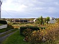
 Retirement village near Millford - geograph.org.uk - 1502507.jpg 640 × 480; 49 KB
-
 Ribbon development on Carnmore Road - geograph.org.uk - 3262998.jpg 1,024 × 565; 80 KB
-
 River and Loughside house - geograph.org.uk - 873678.jpg 640 × 480; 88 KB


