Category:Hoy Lighthouse
Aller à la navigation
Aller à la recherche
| Position de l'objet | | Voir toutes les coordonnées en utilisant : OpenStreetMap |
|---|
English: Also known as Hoy Sound High Lighthouse and Graemsay Rear Range Light.
lighthouse in Orkney Islands, Scotland, UK  | |||||
| Téléverser des médias | |||||
| Nature de l’élément | |||||
|---|---|---|---|---|---|
| Matériau | |||||
| Lieu | |||||
| Baigné par | |||||
| Opérateur | |||||
| Statut patrimonial |
| ||||
| Date de fondation ou de création |
| ||||
| Événement clé |
| ||||
| Hauteur |
| ||||
 | |||||
Média dans la catégorie « Hoy Lighthouse »
Cette catégorie comprend 17 fichiers, dont les 17 ci-dessous.
-
 2009-07-13 14-50-15 50D (14438001204).jpg 4 752 × 3 168 ; 4,41 Mio
-
 Graemsay Hoy High - geograph.org.uk - 1468511.jpg 430 × 640 ; 39 kio
-
 Graemsay Island Hoy High Lighthouse seen from the northwest.jpg 5 880 × 3 820 ; 13,14 Mio
-
 Graemsay lighthouse (4865670850).jpg 3 716 × 2 292 ; 3,82 Mio
-
 Hoy High (15074011147).jpg 5 760 × 3 840 ; 14,66 Mio
-
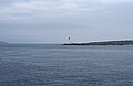
 Hoy High lighthouse taken from the Point of Ness - geograph.org.uk - 343143.jpg 640 × 480 ; 110 kio
-
 Hoy High Lighthouse, Graemsay. - geograph.org.uk - 1422280.jpg 640 × 425 ; 44 kio
-
 Hoy Lighthouse RLH.jpg 575 × 768 ; 53 kio
-
 Hoy Low lighthouse, Graemsay - geograph.org.uk - 4129576.jpg 1 024 × 682 ; 131 kio
-
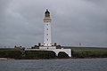 Hoy Sound High Lighthouse.JPG 6 000 × 4 000 ; 5,95 Mio
-
 Lighthouse At Stromness - panoramio.jpg 3 240 × 4 320 ; 3,78 Mio
-
 Lighthouse under a big cloud (37347779306).jpg 3 359 × 1 890 ; 2,84 Mio
-
 Moon over Graemsay (13334694643).jpg 5 184 × 3 456 ; 4,86 Mio
-
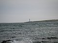
 North Cardinal Buoy and Hoy Sound (High) Lighthouse - geograph.org.uk - 2634487.jpg 2 592 × 1 944 ; 2,09 Mio
-
 PicHoyHigh.jpg 400 × 478 ; 173 kio
-
 Sound of Hoy lighthouses - geograph.org.uk - 819654.jpg 640 × 480 ; 62 kio
-
 Taing of Sandside lighthouse - geograph.org.uk - 2699560.jpg 1 024 × 768 ; 347 kio
.jpg)

.jpg)
.jpg)


.jpg)
.jpg)
_Lighthouse_-_geograph.org.uk_-_2634487.jpg)


Catégories :
- Lighthouses in the Orkney Islands
- Hoy
- Listed lighthouses in Scotland
- Lighthouses built in 1851
- Built in Scotland in 1851
- Lighthouses built by Stevenson family
- Lighthouses in Scotland by name
- Lighthouses by height, 31 to 40 meters
- Category A listed buildings in the Orkney Islands
- Alan Stevenson
- Graemsay
- Lighthouses by range, 20 to 24 nm
- Landfall lights in the United Kingdom