Category:Hoy
Jump to navigation
Jump to search
island in the Orkney Islands group, Scotland, UK   | |||||
| Upload media | |||||
| Instance of | |||||
|---|---|---|---|---|---|
| Part of | |||||
| Location |
| ||||
| Located in or next to body of water | |||||
| Capital | |||||
| Present in work |
| ||||
| Heritage designation | |||||
| Width |
| ||||
| Length |
| ||||
| Highest point | |||||
| Population |
| ||||
| Area |
| ||||
| official website | |||||
 | |||||
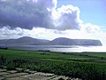
English: Hoy is one of the Orkney Islands, Scotland.

Subcategories
This category has the following 21 subcategories, out of 21 total.
- Maps of Hoy (5 F)
B
- Berriedale Wood (5 F)
C
- Cuilags, Hoy (12 F)
D
- Dwarfie Stane (27 F)
H
- Hoglinns Water (1 F)
- Hoy Lighthouse (17 F)
K
- Knap of Trowieglen (4 F)
L
- Longhope Lifeboat Museum (4 F)
M
- Melsetter House (5 F)
- Moaness Pier (6 F)
R
- Rysa Bay (5 F)
- Rysa Sound (1 F)
S
- Sandy Loch (3 F)
- Scapa Flow Visitor Centre (6 F)
T
- Hoy (text) (2 F)
- Tor Ness Lighthouse (3 F)
W
- Ward Hill, Hoy (35 F)
Media in category "Hoy"
The following 200 files are in this category, out of 301 total.
(previous page) (next page)-
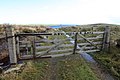 'New White Gate' at Saltness - geograph.org.uk - 1532152.jpg 640 × 427; 75 KB
-
 A Hoy Croft.jpg 2,816 × 2,112; 1.55 MB
-
 A South Hoy Geo - panoramio.jpg 2,640 × 1,650; 3.92 MB
-
 Abandoned building, Hoy - geograph.org.uk - 1030944.jpg 640 × 480; 56 KB
-
 Abandoned Crofthouse, Scorradale - geograph.org.uk - 1117949.jpg 640 × 431; 62 KB
-
 Admiralty Chart No 2162 Scotland Pentland Firth, Published 1858.jpg 8,326 × 6,052; 5.48 MB
-
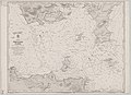
 Admiralty Chart No 2180b Southern portion of the Orkney Islands, Scotland, Published 1886.jpg 11,787 × 8,260; 11.67 MB
-

-
 Admiralty Chart No 2581 Long Hope and Widewall Harbour, Published 1858.jpg 10,100 × 6,644; 21.85 MB
-
 B9047 at The Bring, Hoy - geograph.org.uk - 1069395.jpg 640 × 480; 43 KB
-
 B9047 Shoreline, Hoy - geograph.org.uk - 1030965.jpg 640 × 360; 36 KB
-
 Bay of Creekland - geograph.org.uk - 1363345.jpg 640 × 421; 56 KB
-
 Bay of Creekland - geograph.org.uk - 1363356.jpg 640 × 427; 86 KB
-
 Bay of Creekland - geograph.org.uk - 5815514.jpg 640 × 427; 340 KB
-
 Bay of Quoys - geograph.org.uk - 1128405.jpg 640 × 360; 61 KB
-
 Bay of Quoys - geograph.org.uk - 486143.jpg 640 × 480; 120 KB
-
 Beacon at Skerry of Ness - geograph.org.uk - 1361992.jpg 640 × 423; 50 KB
-
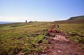
 Beginning of track on Cairn Hill - geograph.org.uk - 1532142.jpg 640 × 427; 99 KB
-
 Berry Seacliffs, Hoy - geograph.org.uk - 915528.jpg 480 × 640; 89 KB
-
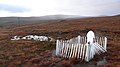 Betty Corigall's Grave - geograph.org.uk - 1037763.jpg 640 × 360; 58 KB
-
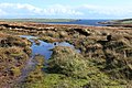
 Boggy pool on Burandie - geograph.org.uk - 1533903.jpg 640 × 427; 69 KB
-
 Bouldered beach of Rackwick - geograph.org.uk - 957785.jpg 640 × 426; 66 KB
-
 Boulders at Rackwick, Hoy - geograph.org.uk - 1069370.jpg 640 × 480; 71 KB
-
 Bre Brough, Hoy - geograph.org.uk - 4129904.jpg 681 × 1,024; 148 KB
-
 Bring Head Trig Point - geograph.org.uk - 1532270.jpg 640 × 427; 92 KB
-
 Bring Head, Hoy - geograph.org.uk - 1532259.jpg 640 × 427; 78 KB
-
 Broughs of the Berry, Hoy - geograph.org.uk - 915509.jpg 640 × 480; 104 KB
-
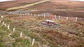
 Bu Cemetery - geograph.org.uk - 1547857.jpg 640 × 427; 94 KB
-
 Buildings at Bulwark - geograph.org.uk - 1720276.jpg 800 × 522; 191 KB
-
-
 Buildings at West Moaness - geograph.org.uk - 1720273.jpg 800 × 564; 159 KB
-
 Burn of Stourdale Waterfall, Hoy, Orkney Islands (6158857016).jpg 3,216 × 2,144; 3.19 MB
-
 Cairn on Lounders Fea - geograph.org.uk - 1032207.jpg 640 × 360; 55 KB
-
 Cairn, Cuilags - geograph.org.uk - 848769.jpg 567 × 378; 230 KB
-
 Cairns on Lounders Fea - geograph.org.uk - 1032200.jpg 640 × 360; 49 KB
-
 Cantick head lighthouse.jpg 1,200 × 800; 241 KB
-
 Children's den at Ha Wick - geograph.org.uk - 1532074.jpg 640 × 427; 65 KB
-
 Church at Stoneyquoy - geograph.org.uk - 1030996.jpg 640 × 360; 41 KB
-
 Cliff tops near Santoo Head - geograph.org.uk - 1498706.jpg 480 × 640; 92 KB
-

-
-
 Cliffs at Geo of Hellia - geograph.org.uk - 2626133.jpg 2,592 × 1,944; 2.08 MB
-
 Cliffs at Santoo Head - geograph.org.uk - 1498719.jpg 640 × 480; 88 KB
-
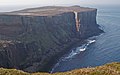
 Cliffs of Hoy - panoramio.jpg 4,000 × 3,000; 4.36 MB
-
 Clouds over Hoy - geograph.org.uk - 819761.jpg 640 × 480; 38 KB
-
 Coast by the Bay of Tongue - geograph.org.uk - 1502333.jpg 640 × 380; 73 KB
-
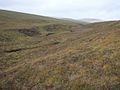
 Coastal moorland on Hoy - geograph.org.uk - 1128446.jpg 640 × 360; 67 KB
-
 Coastline at Ferns - geograph.org.uk - 1496842.jpg 640 × 480; 80 KB
-
 Coastline from Moaness Pier - geograph.org.uk - 1363317.jpg 640 × 427; 75 KB
-
 Crag, Howes of Quoyawa - geograph.org.uk - 1484064.jpg 640 × 425; 81 KB
-
 Damp ground above Dwarfie Hamars - geograph.org.uk - 1533854.jpg 640 × 427; 74 KB
-
 Derelict cottage at Linksness, Hoy - geograph.org.uk - 1363323.jpg 640 × 427; 78 KB
-
 Dunnet Head 01.jpg 4,258 × 2,826; 1.62 MB
-
 Dunnet Head 02.jpg 2,848 × 4,272; 1.86 MB
-
 East ridge of The Berry - geograph.org.uk - 1500246.jpg 640 × 480; 79 KB
-

-
 Empty mountain lochan near Clicknafea - geograph.org.uk - 909011.jpg 640 × 480; 72 KB
-
 Entrance to Wee Fea Oil Storage - geograph.org.uk - 1534208.jpg 640 × 427; 112 KB
-
 Erosion of the topsoil - geograph.org.uk - 1483964.jpg 640 × 448; 114 KB
-
 Expired - panoramio.jpg 4,320 × 3,240; 4.39 MB
-
 Exposed peatbank on Vow Randie - geograph.org.uk - 1533866.jpg 640 × 427; 74 KB
-
 Farahouse.jpg 500 × 375; 50 KB
-
 Farm track, Wee Fea Hill, Hoy - geograph.org.uk - 1030956.jpg 640 × 360; 52 KB
-
 Farmers, Hoy - geograph.org.uk - 1484038.jpg 640 × 425; 89 KB
-
 Farming at Hoy - geograph.org.uk - 486127.jpg 640 × 480; 109 KB
-
 Farmland at Upper Seatter - geograph.org.uk - 1532317.jpg 640 × 427; 49 KB
-
 Farmyard, Hoy - geograph.org.uk - 1030940.jpg 640 × 360; 52 KB
-
 Fire risk indicator - Moaness - geograph.org.uk - 1448625.jpg 640 × 428; 75 KB
-
 Flashes - geograph.org.uk - 1502078.jpg 640 × 480; 71 KB
-
 Flashes - geograph.org.uk - 1502310.jpg 640 × 480; 89 KB
-
 Flashes - geograph.org.uk - 5815528.jpg 640 × 427; 332 KB
-
 Flingi Geo - geograph.org.uk - 855039.jpg 469 × 640; 116 KB
-
 Forestry below Lyrawa Hill - geograph.org.uk - 1496939.jpg 640 × 480; 71 KB
-
 Fähre nach Hoy.jpg 640 × 480; 29 KB
-
-
 Genie Fea - geograph.org.uk - 1497860.jpg 640 × 480; 84 KB
-
 Geo of the Lame - geograph.org.uk - 1498730.jpg 640 × 480; 98 KB
-
 Glaciated valley near South Burn - geograph.org.uk - 1484444.jpg 640 × 425; 80 KB
-
 Going nowhere fast - geograph.org.uk - 1533273.jpg 640 × 427; 86 KB
-
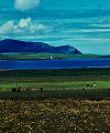
 Graemsay and Hoy from Hoy Sound - geograph.org.uk - 90642.jpg 640 × 480; 62 KB
-
 Grass at Hoy.jpg 2,560 × 1,600; 1.44 MB
-
 Grassy slopes of Withigill - geograph.org.uk - 1497824.jpg 640 × 480; 72 KB
-
 Grazing cattle - geograph.org.uk - 1483920.jpg 640 × 425; 91 KB
-
 Grazing on Hoy - geograph.org.uk - 1031103.jpg 640 × 360; 67 KB
-
 Groups by Braebuster Burn - geograph.org.uk - 1483904.jpg 640 × 425; 59 KB
-
 Haist from Nowt Bield on Hoy - geograph.org.uk - 1037884.jpg 640 × 480; 74 KB
-
 Harper's Patent No1, Aberdeen - geograph.org.uk - 1483968.jpg 425 × 640; 105 KB
-
 Heather topped cliffs near Red Geo - geograph.org.uk - 1496980.jpg 640 × 480; 77 KB
-
 Heathery moorland at Flossy Groups - geograph.org.uk - 1496994.jpg 640 × 480; 105 KB
-
 Heldale Water - geograph.org.uk - 1498919.jpg 640 × 480; 79 KB
-
 Heldale Water with The Har - panoramio.jpg 1,586 × 991; 1.34 MB
-
 Hendry's Holes. - geograph.org.uk - 140839.jpg 640 × 427; 139 KB
-
 Hillside at Blinkbonny - geograph.org.uk - 1496854.jpg 640 × 480; 93 KB
-
 Hillside below Cairn Hill - geograph.org.uk - 1500272.jpg 640 × 480; 80 KB
-
 Hillside below Moi Fea - geograph.org.uk - 1498164.jpg 640 × 480; 73 KB
-
 Housing at The Point - geograph.org.uk - 1532525.jpg 640 × 427; 81 KB
-
 Howes of Quoyawa - geograph.org.uk - 1037823.jpg 640 × 360; 55 KB
-
 Howes of Quoyawa - geograph.org.uk - 1037843.jpg 640 × 360; 55 KB
-
 Hoy beach.jpg 2,559 × 1,600; 1.04 MB
-
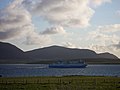
 Hoy ferry.jpg 480 × 640; 61 KB
-
 Hoy from Garth - geograph.org.uk - 54087.jpg 640 × 480; 71 KB
-
 Hoy from Scorradale - geograph.org.uk - 1118011.jpg 640 × 425; 73 KB
-
 Hoy Hillground - geograph.org.uk - 1032393.jpg 640 × 360; 67 KB
-
 Hoy Hotel - panoramio.jpg 4,238 × 2,649; 9.28 MB
-
 Hoy in Orkney - 06042012 (110) (7348230432).jpg 8,400 × 1,277; 6.58 MB
-
 Hoy in Orkney - 06042012 (163) (7348229672).jpg 6,128 × 1,230; 2.78 MB
-
 Hoy in Orkney - 06042012 (19) (7348244338).jpg 4,272 × 2,848; 4.4 MB
-
 Hoy in Orkney - 06042012 (35) (7163019481).jpg 4,911 × 1,138; 2.98 MB
-
 Hoy in Orkney - 06042012 (71) (7348239524).jpg 4,272 × 2,848; 7.18 MB
-
 Hoy Orkney Landesinnere.JPG 1,800 × 1,200; 727 KB
-
 Hoy View - geograph.org.uk - 221461.jpg 640 × 437; 46 KB
-
 Hoy, Orkney, Scotland.jpg 3,214 × 1,640; 1.32 MB
-
 Hoy, view across Bring Deeps - geograph.org.uk - 2608255.jpg 640 × 480; 54 KB
-
 Junction above Longhope, Hoy - geograph.org.uk - 1031035.jpg 640 × 360; 66 KB
-
 Kingie Lang above Scapa Flow - geograph.org.uk - 1533889.jpg 640 × 427; 70 KB
-
 Kingie Lang in the mist - geograph.org.uk - 1496972.jpg 640 × 480; 66 KB
-
 Knap of Trowieglen ridge - geograph.org.uk - 1497644.jpg 640 × 480; 98 KB
-
 Lane to Head - geograph.org.uk - 1483907.jpg 640 × 425; 76 KB
-
 Lang Geo to the east of Rora Head - geograph.org.uk - 957794.jpg 640 × 426; 87 KB
-
 Limpet 'nursery' at Ruberry - geograph.org.uk - 1533297.jpg 640 × 427; 132 KB
-
 Little Rack Wick - geograph.org.uk - 1500117.jpg 640 × 480; 76 KB
-
 Loch of Tor Ness - geograph.org.uk - 1532513.jpg 640 × 427; 50 KB
-
 Lochan on Knap of Trowieglen - geograph.org.uk - 1532527.jpg 640 × 427; 79 KB
-
 Lochan studded ridge - geograph.org.uk - 1497782.jpg 640 × 480; 68 KB
-
 Lochans on Knap of Trowieglen - geograph.org.uk - 1532526.jpg 640 × 427; 71 KB
-
 Lochans on Mel Fea - geograph.org.uk - 1498560.jpg 640 × 480; 69 KB
-
 Lochans on Rievie Hill - geograph.org.uk - 1497723.jpg 640 × 480; 60 KB
-

-
 Lochans on the plateau above Grut Fea - geograph.org.uk - 1429817.jpg 640 × 427; 115 KB
-
 Lochans on the Trowieglen ridge - geograph.org.uk - 1497630.jpg 640 × 480; 79 KB
-
 Lochans on Tongue Vale - geograph.org.uk - 1497888.jpg 640 × 480; 66 KB
-
 Lochans on Withigill - geograph.org.uk - 1497833.jpg 640 × 480; 69 KB
-
 Lochs of Withigill - geograph.org.uk - 1497809.jpg 640 × 480; 73 KB
-
 Longhope, Church of Scotland - geograph.org.uk - 871300.jpg 640 × 428; 32 KB
-
 Longhope.jpg 1,200 × 800; 422 KB
-
 Looking across to Black Pows - geograph.org.uk - 1499010.jpg 640 × 480; 65 KB
-
 Looking down Whitefowl Hill - geograph.org.uk - 1498635.jpg 640 × 480; 70 KB
-
 Looking towards Out Taings - geograph.org.uk - 1483996.jpg 640 × 392; 91 KB
-
 Looking towards Rora Head - geograph.org.uk - 1454772.jpg 640 × 427; 71 KB
-
 Louders Fea, Hoy - geograph.org.uk - 1032354.jpg 640 × 360; 67 KB
-
 Lyrawa Bay - geograph.org.uk - 1031062.jpg 640 × 360; 69 KB
-
 Lyrawa Hill - geograph.org.uk - 14736.jpg 640 × 328; 103 KB
-
 Lyrawa Hill Road - geograph.org.uk - 1031073.jpg 640 × 360; 58 KB
-
 Lyrawa Hill Road - geograph.org.uk - 1031111.jpg 640 × 360; 40 KB
-
 Mainland orkney robben.jpg 1,800 × 1,200; 718 KB
-
 Martello Tower, near Longhope - geograph.org.uk - 1534245.jpg 640 × 427; 83 KB
-
 Mel Fea looking towards Rackwick - geograph.org.uk - 1498537.jpg 640 × 480; 82 KB
-
 Milestone, Lyrawa Hill - geograph.org.uk - 1128438.jpg 640 × 360; 91 KB
-
 Mill Burn - geograph.org.uk - 1498200.jpg 640 × 480; 100 KB
-
 Moaness pier, Hoy, Orkney - geograph.org.uk - 5511748.jpg 800 × 533; 138 KB
-
 Moi Fea - geograph.org.uk - 1498145.jpg 640 × 480; 75 KB
-
 Moorland above the Burn of Ore - geograph.org.uk - 1498916.jpg 640 × 480; 83 KB
-
 Moorland around Loch of Stourdale - geograph.org.uk - 855051.jpg 640 × 432; 100 KB
-
 Moorland beside the South Burn on Hoy - geograph.org.uk - 1533711.jpg 640 × 427; 118 KB
-
 Moorland on ridge to Moi Fea - geograph.org.uk - 1498122.jpg 640 × 480; 82 KB
-
 Mountain Hares, Hoy - geograph.org.uk - 1037815.jpg 640 × 480; 37 KB
-
 Muckle Head - geograph.org.uk - 1502328.jpg 640 × 480; 95 KB
-
 Natural arch - geograph.org.uk - 1432280.jpg 640 × 480; 98 KB
-
 North Coast of Hoy - geograph.org.uk - 1369432.jpg 640 × 480; 43 KB
-
 North east ridge of Cairn Hill - geograph.org.uk - 1500295.jpg 640 × 480; 77 KB
-
 North Hoy before the Old Man - panoramio.jpg 2,203 × 1,377; 3.5 MB
-
 North Hoy Cliff - panoramio.jpg 2,304 × 1,440; 2.8 MB
-
 North Ness, Hoy - geograph.org.uk - 954370.jpg 640 × 426; 55 KB
-
 Northlink ferry in Scapa Flow - geograph.org.uk - 195810.jpg 640 × 480; 43 KB
-
 Nowt Bield on Hoy - geograph.org.uk - 1154905.jpg 640 × 290; 32 KB
-
 Nowt Bield on Ward Hill - geograph.org.uk - 1533817.jpg 640 × 427; 69 KB
-
 Old boathouse and slipway - geograph.org.uk - 1363363.jpg 427 × 640; 67 KB
-
 Old dyke on Melsetter Hill - geograph.org.uk - 1532098.jpg 640 × 427; 65 KB
-
 Old farm buildings, Selwick - geograph.org.uk - 1484035.jpg 640 × 425; 97 KB
-
 Old fence line above Sky Fea - geograph.org.uk - 1497877.jpg 640 × 480; 96 KB
-
 Old green track - geograph.org.uk - 1484036.jpg 640 × 425; 96 KB
-
 Old Milestone by the B9047, Lyrawa Bay, Orkney - geograph.org.uk - 5518054.jpg 768 × 1,024; 263 KB
-
 Oldmanofhoy.jpg 1,124 × 843; 98 KB
-
 Orkney 2.jpg 800 × 531; 175 KB
-
 Orkney Graemsay seen from Hoy.jpg 738 × 395; 201 KB
-
 Orkney-Hoy-02-Berg in Wolken-2009-gje.jpg 3,072 × 2,048; 1.72 MB
-
 Orkney-Hoy-04-Old Man of Hoy-2009-gje.jpg 3,072 × 2,048; 2.09 MB
-
 Orkney-Hoy-06-Steilkueste-2009-gje.jpg 3,072 × 2,048; 2.16 MB
-
 Orkney-Hoy-08-Steilkueste-2009-gje.jpg 3,072 × 2,048; 1.64 MB
-
 Orkney-Hoy-10-Old Man of Hoy-2009-gje.jpg 3,066 × 1,830; 2.09 MB
-
 Orographic cloud - geograph.org.uk - 5403392.jpg 2,560 × 1,920; 2.56 MB
-
 Over Loch of Stenness towards Hoy - geograph.org.uk - 1385582.jpg 640 × 428; 33 KB
-
 Passing Place - geograph.org.uk - 1483955.jpg 640 × 425; 89 KB
-
 Passing Place near South Burn - geograph.org.uk - 1484459.jpg 640 × 425; 102 KB
-
 Path to Burnmouth - geograph.org.uk - 1454029.jpg 640 × 428; 74 KB
-
 Path to Sandy Loch - geograph.org.uk - 1128435.jpg 640 × 360; 64 KB
-
 Pathway to Betty Corigall's Grave - geograph.org.uk - 1037770.jpg 640 × 360; 59 KB
-
 Pathway to the "Old Man" - geograph.org.uk - 737103.jpg 640 × 423; 73 KB
-
 Peat Cuttings - geograph.org.uk - 1484464.jpg 640 × 425; 130 KB
-
 Peaty Pools on Knap of Trowieglen - geograph.org.uk - 1533878.jpg 640 × 427; 75 KB
-
 Pegal Burn - geograph.org.uk - 1497565.jpg 640 × 480; 78 KB
-
 Pegal Burn, Hoy - geograph.org.uk - 1030988.jpg 640 × 360; 75 KB
-
 Pegal Hill - geograph.org.uk - 1497572.jpg 640 × 480; 81 KB
-
 PicHoyHigh.jpg 400 × 478; 173 KB
-
 Picnic Site, Wee Fea Hill - geograph.org.uk - 1030953.jpg 640 × 360; 47 KB
-
 Picnic table, Pegal Burn - geograph.org.uk - 1030981.jpg 640 × 360; 83 KB
-
 Pier at Moaness - geograph.org.uk - 6303533.jpg 5,800 × 3,864; 3.62 MB
-
 Pier at Moaness - geograph.org.uk - 6303542.jpg 6,000 × 4,000; 3.95 MB
-
 Plane wreckage on Cuilags Hill - geograph.org.uk - 1032406.jpg 640 × 360; 106 KB
-
 Plane wreckage on Cuilags Hill - geograph.org.uk - 1032437.jpg 360 × 640; 96 KB


.jpg)


_(7348244338).jpg)
_(7348239524).jpg)


_(7348230432).jpg)
_(7348229672).jpg)
_(7163019481).jpg)