Category:Huby, Hambleton
Jump to navigation
Jump to search
village and civil parish in Hambleton, North Yorkshire, UK  | |||||
| Upload media | |||||
| Instance of | |||||
|---|---|---|---|---|---|
| Location | Hambleton, North Yorkshire, Yorkshire and the Humber, England | ||||
| Population |
| ||||
| Area |
| ||||
 | |||||
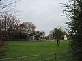
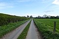
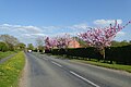
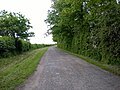
English: Huby is a village and civil parish in the Hambleton district of North Yorkshire, England, about eight miles north of York and four miles south-east of Easingwold.
Subcategories
This category has the following 5 subcategories, out of 5 total.
Media in category "Huby, Hambleton"
The following 138 files are in this category, out of 138 total.
-
 A straight and dusty track - geograph.org.uk - 1867604.jpg 2,448 × 3,264; 2.88 MB
-
 Alcar Farm from footpath to Huby - geograph.org.uk - 3129341.jpg 3,264 × 2,448; 2.07 MB
-
 Along Bull Lane - geograph.org.uk - 3930692.jpg 640 × 427; 67 KB
-
 Approaching Kirk Moor Farm - geograph.org.uk - 5501330.jpg 1,600 × 1,200; 513 KB
-
 Approaching Rosecroft Farm - geograph.org.uk - 3930676.jpg 640 × 427; 84 KB
-

-
 Bales near Rosecroft Farm - geograph.org.uk - 3930694.jpg 640 × 427; 82 KB
-
 Baston Lane - geograph.org.uk - 3354566.jpg 1,024 × 618; 198 KB
-
 Bell Lane - geograph.org.uk - 3930425.jpg 640 × 427; 104 KB
-
 Blackwoods Farm - geograph.org.uk - 5501314.jpg 1,600 × 1,200; 726 KB
-
 Blackwoods House Farm - geograph.org.uk - 5501317.jpg 1,600 × 1,200; 614 KB
-
 Blossom along Sutton Road - geograph.org.uk - 5764968.jpg 640 × 427; 228 KB
-
 Boarded up near Barfs Hill - geograph.org.uk - 1690712.jpg 4,000 × 3,000; 3.57 MB
-
 Brownmoor Lane - geograph.org.uk - 3930480.jpg 640 × 427; 114 KB
-
 Brownmoor Lane - geograph.org.uk - 6451204.jpg 800 × 600; 198 KB
-
 Brownmoor Lane 2 - geograph.org.uk - 4982224.jpg 2,592 × 1,936; 2.12 MB
-
 Building at Blue Bridge Whin - geograph.org.uk - 5469037.jpg 1,600 × 1,200; 981 KB
-
 Bull Lane - geograph.org.uk - 4979682.jpg 2,592 × 1,936; 1.51 MB
-
 Bull Lane - geograph.org.uk - 5764972.jpg 640 × 427; 224 KB
-
 Cass Plantation - geograph.org.uk - 6611362.jpg 5,184 × 3,456; 7.13 MB
-
 Cattery on Baston Lane - geograph.org.uk - 3354568.jpg 1,024 × 722; 307 KB
-
 Cemetery near to Sutton-on-the-Forest - geograph.org.uk - 330742.jpg 640 × 480; 166 KB
-
 Corners on Sand Lane - geograph.org.uk - 3174689.jpg 2,560 × 1,920; 2.16 MB
-
 Crop field off Tollerton Road - geograph.org.uk - 6451232.jpg 800 × 600; 106 KB
-
 Double bend on Sand Lane - geograph.org.uk - 5764962.jpg 640 × 427; 239 KB
-
 Driveway to Ravensdale near Huby - geograph.org.uk - 330757.jpg 640 × 480; 138 KB
-
 Ellingcroft Moor - geograph.org.uk - 4965174.jpg 960 × 717; 149 KB
-
 Empty pig units - geograph.org.uk - 3354588.jpg 1,024 × 768; 285 KB
-
 Empty shelves - geograph.org.uk - 6451239.jpg 800 × 600; 193 KB
-
 Entering Huby - geograph.org.uk - 380873.jpg 640 × 479; 46 KB
-
-
 Evidence of tree felling - geograph.org.uk - 1867609.jpg 3,264 × 2,448; 2.35 MB
-
 Farm building off Brownmoor Lane - geograph.org.uk - 6451201.jpg 640 × 480; 110 KB
-
 Farm track off Sand Lane - geograph.org.uk - 5764963.jpg 640 × 427; 218 KB
-
 Farmland off Brownmoor Lane - geograph.org.uk - 3930489.jpg 640 × 427; 85 KB
-
 Farmland off Brownmoor Lane - geograph.org.uk - 5764970.jpg 640 × 427; 220 KB
-
 Field boundary off Brownmoor Lane - geograph.org.uk - 3930491.jpg 640 × 427; 89 KB
-
 Field off Tollerton Road - geograph.org.uk - 6612458.jpg 5,184 × 3,456; 7.63 MB
-

-

-
 Fields to the east of the A19 - geograph.org.uk - 5232268.jpg 1,024 × 768; 131 KB
-
 Fish and Chips, Huby - geograph.org.uk - 3354576.jpg 1,024 × 768; 224 KB
-
 Footpath and Private Road into Huby - geograph.org.uk - 3129355.jpg 3,264 × 2,448; 2.95 MB
-
 Fordington Lodge Farm - geograph.org.uk - 5469011.jpg 1,600 × 1,200; 660 KB
-
 Fordington Lodge Farmhouse - geograph.org.uk - 5469008.jpg 1,600 × 1,200; 690 KB
-
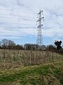
 Giant pylon - geograph.org.uk - 4982240.jpg 2,592 × 1,936; 1.6 MB
-
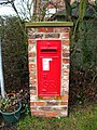 GR Postbox, Huby - geograph.org.uk - 1690136.jpg 3,000 × 4,000; 4.51 MB
-
 Hawthorn Cottage - geograph.org.uk - 6451229.jpg 800 × 600; 109 KB
-
 Huby - geograph.org.uk - 6451213.jpg 800 × 600; 135 KB
-
 Huby Fields Farm - geograph.org.uk - 5501322.jpg 1,600 × 1,200; 636 KB
-
 Huby Hambleton Methodist Church.jpg 640 × 474; 86 KB
-
 Huby Methodist Church - geograph.org.uk - 5501325.jpg 1,600 × 1,200; 675 KB
-
 Huby Methodist Church - geograph.org.uk - 6451226.jpg 800 × 548; 95 KB
-
 Huby Methodist Church - geograph.org.uk - 6612321.jpg 5,184 × 3,456; 5.55 MB
-
 Huby Methodist Church. Main Street. Huby - geograph.org.uk - 3129384.jpg 3,264 × 2,448; 1.66 MB
-
 Huby village hall - geograph.org.uk - 709949.jpg 640 × 418; 57 KB
-
 Imposing Gatepost - geograph.org.uk - 3110285.jpg 3,264 × 2,448; 2.16 MB
-
 Kelsit Grange Farm - geograph.org.uk - 1181623.jpg 640 × 480; 50 KB
-
 Kelsit Grange Farmhouse - geograph.org.uk - 1181629.jpg 640 × 480; 115 KB
-
-
 Laund House - geograph.org.uk - 2709953.jpg 640 × 480; 52 KB
-
 Laund House Farm - geograph.org.uk - 2709939.jpg 640 × 480; 47 KB
-
 Lea Lane - geograph.org.uk - 4965180.jpg 960 × 717; 117 KB
-
 Lea Lane - geograph.org.uk - 6612463.jpg 5,184 × 3,456; 6.97 MB
-
 Looking north along ETL - geograph.org.uk - 2709930.jpg 640 × 480; 67 KB
-
 Lundgreen Lane - geograph.org.uk - 4982231.jpg 2,592 × 1,936; 2.4 MB
-
 Main Street, Huby - geograph.org.uk - 4096990.jpg 1,024 × 768; 116 KB
-
 Main Street, Huby - geograph.org.uk - 6451224.jpg 800 × 600; 115 KB
-
 Manure off Brownmoor Lane - geograph.org.uk - 3930511.jpg 640 × 427; 92 KB
-
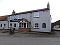
 Mended Drum public house, Huby - geograph.org.uk - 6451218.jpg 800 × 556; 72 KB
-
 Methodist Church, Huby - geograph.org.uk - 3354571.jpg 1,024 × 768; 304 KB
-
 Mobile Boxes - geograph.org.uk - 264846.jpg 640 × 480; 96 KB
-
 Near Batters Rush - geograph.org.uk - 4982271.jpg 2,592 × 1,936; 1.92 MB
-
 Near Kelsit Grange - geograph.org.uk - 4982297.jpg 2,592 × 1,936; 1.47 MB
-
 New Rules For Walkers - geograph.org.uk - 297798.jpg 640 × 480; 103 KB
-
 New village homes - geograph.org.uk - 710000.jpg 640 × 414; 56 KB
-
 Obstructed bridleway near Rosecroft Farm - geograph.org.uk - 5503136.jpg 1,600 × 1,200; 1.02 MB
-
 On Lea Lane - geograph.org.uk - 6613577.jpg 5,184 × 3,225; 7.62 MB
-
 Outskirts of Huby - geograph.org.uk - 5764966.jpg 640 × 427; 223 KB
-
 Ox Close - geograph.org.uk - 4965217.jpg 960 × 717; 132 KB
-
 Oxclose Lane (Track) - geograph.org.uk - 3110295.jpg 3,264 × 2,448; 2.34 MB
-
 Pond in Trees or Trees in Pond - geograph.org.uk - 3110302.jpg 3,264 × 2,448; 3.16 MB
-
 Pond west of Kelsit Grange - geograph.org.uk - 5469016.jpg 1,600 × 1,200; 921 KB
-
 Power lines, Baston Lane - geograph.org.uk - 3354561.jpg 1,024 × 768; 199 KB
-
 Public Footpath heading West to Moss End Farm - geograph.org.uk - 6613591.jpg 5,184 × 3,456; 5.88 MB
-
 Pylon near Burn Bridge - geograph.org.uk - 6452121.jpg 600 × 800; 120 KB
-
 Ravensdale House and Garden - geograph.org.uk - 3110291.jpg 3,264 × 2,448; 2.61 MB
-
 Roadbridge over New Parks Beck - geograph.org.uk - 1181671.jpg 640 × 480; 90 KB
-
 Robin Lane, Huby - geograph.org.uk - 1690129.jpg 4,000 × 3,000; 3.4 MB
-
 Rough Pasture off Lea Lane - geograph.org.uk - 6612474.jpg 5,184 × 3,456; 7.67 MB
-
 Royal Hunting Lodge Farmhouse - geograph.org.uk - 1181659.jpg 640 × 480; 126 KB
-
 Rudimentary Enclosure - geograph.org.uk - 6613636.jpg 5,184 × 3,456; 7.02 MB
-
 Sand Lane in Huby, looking North - geograph.org.uk - 6612323.jpg 5,184 × 3,456; 6.17 MB
-
 Sand Lane in Huby, looking South - geograph.org.uk - 6611396.jpg 5,184 × 3,456; 6.07 MB
-
 Shaw Crescent, Huby - geograph.org.uk - 3354579.jpg 1,024 × 768; 207 KB
-
 Skates Lane, Huby - geograph.org.uk - 6456216.jpg 800 × 573; 82 KB
-
 Skates Lane, Huby - geograph.org.uk - 6456217.jpg 4,435 × 3,347; 4.22 MB
-
 Start of Brownmoor Lane - geograph.org.uk - 3930473.jpg 640 × 427; 133 KB
-
 Surprise pool in Folly Wood - geograph.org.uk - 1867623.jpg 2,448 × 3,264; 2.06 MB
-
 Sutton-in-the-Forest, aerial 2019 - geograph.org.uk - 5767849.jpg 1,024 × 683; 111 KB
-
 The Mended Drum public house, Huby - geograph.org.uk - 6451220.jpg 800 × 600; 80 KB
-
 The Mended Drum, Huby - geograph.org.uk - 6612442.jpg 5,184 × 3,456; 6.75 MB
-
 The New Inn, Huby - geograph.org.uk - 6612332.jpg 5,184 × 3,456; 7.26 MB
-
 The Poplars Farmhouse - geograph.org.uk - 1181633.jpg 640 × 480; 62 KB
-
 The Poplars Farmhouse - geograph.org.uk - 5469020.jpg 1,600 × 1,200; 690 KB
-
 The pub with a new name, The Mended Drum - geograph.org.uk - 3129373.jpg 3,264 × 2,448; 1.47 MB
-
 Tollerton Road - geograph.org.uk - 6451235.jpg 800 × 600; 82 KB
-
 Tollerton Road - geograph.org.uk - 6452124.jpg 800 × 600; 138 KB
-
 Tollerton Road, Huby (geograph 6612450).jpg 5,184 × 3,456; 5.79 MB
-
 Track and barn near Huby - geograph.org.uk - 1867605.jpg 3,264 × 2,448; 1.68 MB
-
 Track from Laund House Farm - geograph.org.uk - 2709936.jpg 640 × 480; 123 KB
-
 Track to Barfs Hill - geograph.org.uk - 3354583.jpg 1,024 × 714; 304 KB
-
 Track to Westfield - geograph.org.uk - 3930501.jpg 640 × 427; 88 KB
-
 View from Oxclose Lane - geograph.org.uk - 4965199.jpg 960 × 717; 142 KB
-
 Woodland path - geograph.org.uk - 1867619.jpg 2,448 × 3,264; 3.29 MB
-
 Young woodland, Huby Burn - geograph.org.uk - 6452118.jpg 800 × 600; 122 KB
-
 Burnfield Farm - geograph.org.uk - 365464.jpg 640 × 480; 125 KB
-
 Converted chapel, Huby - geograph.org.uk - 709924.jpg 640 × 372; 67 KB
-
 Cottages in Huby - geograph.org.uk - 709962.jpg 640 × 535; 90 KB
-
 Double Gated - geograph.org.uk - 297800.jpg 640 × 480; 107 KB
-
 Express deliveries^ - geograph.org.uk - 710010.jpg 640 × 480; 128 KB
-
 Folly Hill - geograph.org.uk - 297763.jpg 640 × 480; 92 KB
-
 Footpath to Ox Close lane - geograph.org.uk - 348477.jpg 640 × 480; 74 KB
-
 Gracious Street, Huby - geograph.org.uk - 709938.jpg 640 × 480; 67 KB
-
 Happy as a Pig in Muck - geograph.org.uk - 348489.jpg 640 × 480; 123 KB
-
 Huby - geograph.org.uk - 380879.jpg 640 × 479; 46 KB
-
 Huby village school - geograph.org.uk - 709903.jpg 640 × 349; 47 KB
-
 Leaving Huby - geograph.org.uk - 297801.jpg 640 × 480; 81 KB
-
 Little Boxes - geograph.org.uk - 264832.jpg 640 × 480; 101 KB
-
 Newly Excavated Pond - geograph.org.uk - 366589.jpg 640 × 480; 80 KB
-
 On Its Own - geograph.org.uk - 297818.jpg 639 × 474; 104 KB
-
 The Entrance To Prospect Farm - geograph.org.uk - 297817.jpg 640 × 480; 100 KB
-
 The Public Footpath To Spring House - geograph.org.uk - 265198.jpg 640 × 480; 97 KB
-
 The Road To Mowbray House - geograph.org.uk - 297796.jpg 640 × 480; 104 KB
-
 The Star, Huby - geograph.org.uk - 709990.jpg 640 × 335; 42 KB
-
 The village shop - geograph.org.uk - 709968.jpg 640 × 452; 74 KB
-
 Towards Huby - geograph.org.uk - 297794.jpg 640 × 480; 99 KB
-
 Unmetalled track near Huby - geograph.org.uk - 330751.jpg 640 × 480; 157 KB


_-_geograph.org.uk_-_3110295.jpg)


.jpg)


