Category:Huddleston with Newthorpe
Jump to navigation
Jump to search
civil parish in Selby, North Yorkshire, England | |||||
| Upload media | |||||
| Instance of | |||||
|---|---|---|---|---|---|
| Location | Selby, North Yorkshire, Yorkshire and the Humber, England | ||||
 | |||||
Subcategories
This category has the following 2 subcategories, out of 2 total.
N
- Newthorpe, North Yorkshire (8 F)
Media in category "Huddleston with Newthorpe"
The following 84 files are in this category, out of 84 total.
-
 A farm next to Huddleston Hall - geograph.org.uk - 2267355.jpg 800 × 600; 165 KB
-
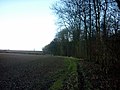 A footpath alongside Huddleston Old Wood - geograph.org.uk - 2267363.jpg 800 × 600; 300 KB
-
 A footpath towards Sherburn in Elmet - geograph.org.uk - 2267318.jpg 800 × 600; 236 KB
-
 A1 Caravans, Micklefield - geograph.org.uk - 6290552.jpg 1,024 × 768; 115 KB
-
 A1(M) - a shallow rock cutting - geograph.org.uk - 2646745.jpg 640 × 428; 60 KB
-
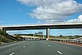 A1(M) - B1222 bridge - geograph.org.uk - 2646728.jpg 640 × 428; 73 KB
-
 A1(M) in a culvert - geograph.org.uk - 2040822.jpg 640 × 480; 55 KB
-
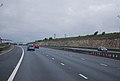 A1(M) in a cutting - geograph.org.uk - 3035253.jpg 640 × 430; 40 KB
-
 A1(M) in a cutting - geograph.org.uk - 4806169.jpg 640 × 380; 24 KB
-
 Approaching Huddleston Hall - geograph.org.uk - 5733504.jpg 1,600 × 1,200; 440 KB
-
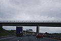
 B1222 Bridge - geograph.org.uk - 4793133.jpg 640 × 426; 33 KB
-
 B1222 bridge over the A1(M) - geograph.org.uk - 2515464.jpg 640 × 430; 30 KB
-
 B1222 Bridge, A1(M) - geograph.org.uk - 3035240.jpg 640 × 430; 38 KB
-
 B1222, Squires cafe - geograph.org.uk - 4614824.jpg 640 × 426; 42 KB
-
 Bench at the south-east corner of Scott's Wood - geograph.org.uk - 3738354.jpg 1,024 × 768; 211 KB
-
 Bends on the B1222 - geograph.org.uk - 2736480.jpg 1,024 × 768; 143 KB
-

-
 Buildings at Huddleston Hall near Sherburn in Elmet - geograph.org.uk - 4093147.jpg 1,600 × 1,064; 483 KB
-
 Buildings at Huddleston Hall near Sherburn in Elmet - geograph.org.uk - 4093223.jpg 1,600 × 1,064; 740 KB
-
 Bus shelter on the B1222, Newthorpe - geograph.org.uk - 2736282.jpg 1,024 × 768; 143 KB
-
 Countryside near Squires Cafe - geograph.org.uk - 4614830.jpg 640 × 426; 42 KB
-
 East towards Sherburn in Elmet - geograph.org.uk - 2267408.jpg 800 × 600; 216 KB
-
 Farm buildings at Huddleston Hall - geograph.org.uk - 3738502.jpg 1,024 × 768; 121 KB
-
 Farm track south of Newthorpe Quarry - geograph.org.uk - 3724595.jpg 1,600 × 1,200; 548 KB
-
 Farmhouse at Huddleston Hall - geograph.org.uk - 4093229.jpg 1,600 × 1,064; 620 KB
-
 Farmland - geograph.org.uk - 4614837.jpg 640 × 426; 41 KB
-
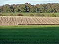
 Farmland near Newthorpe - geograph.org.uk - 2734765.jpg 640 × 408; 51 KB
-
 Farmland near Newthorpe Farm - geograph.org.uk - 2681216.jpg 640 × 480; 30 KB
-
 Farmland north of Huddleston Old Wood - geograph.org.uk - 3738545.jpg 1,024 × 768; 177 KB
-
 Farmland south of Daniel Hartly's Wood - geograph.org.uk - 3738466.jpg 1,024 × 768; 286 KB
-
 Farmland south of Newthorpe - geograph.org.uk - 2736488.jpg 1,024 × 768; 118 KB
-
 Field and county boundary, north of Hartly Wood - geograph.org.uk - 3738458.jpg 1,024 × 768; 269 KB
-
 Footpath alongside Huddleston Old Wood - geograph.org.uk - 4093264.jpg 1,600 × 1,064; 856 KB
-
 Footpath alongside Huddleston Old Wood - geograph.org.uk - 4093268.jpg 1,600 × 1,064; 777 KB
-
 Footpath alongside Huddleston Old Wood - geograph.org.uk - 4093270.jpg 1,600 × 1,064; 856 KB
-
 Footpath alongside Huddleston Old Wood - geograph.org.uk - 4093276.jpg 1,600 × 1,064; 640 KB
-
 Footpath at Hartly Wood - geograph.org.uk - 4093292.jpg 1,600 × 1,064; 906 KB
-
 Footpath at Huddleston Old Wood - geograph.org.uk - 4093232.jpg 1,600 × 1,064; 778 KB
-
 Footpath at Huddleston Old Wood - geograph.org.uk - 4093279.jpg 1,600 × 1,064; 579 KB
-
 Footpath south of Huddleston Hall - geograph.org.uk - 5733506.jpg 1,600 × 1,200; 407 KB
-
 Footpath to Hartley Wood Cottages - geograph.org.uk - 4093285.jpg 1,600 × 1,064; 772 KB
-
 Footpath to Hartley Wood Cottages - geograph.org.uk - 4093288.jpg 1,600 × 1,064; 739 KB
-
 Former entrance to Newthorpe Quarry - geograph.org.uk - 3724603.jpg 1,600 × 1,200; 732 KB
-
 Gated track, southern boundary, Ringhay Wood - geograph.org.uk - 3738345.jpg 1,024 × 768; 192 KB
-
 Gorse Lane, Newthorpe - geograph.org.uk - 2736262.jpg 1,024 × 768; 108 KB
-
 Highfield - geograph.org.uk - 4620571.jpg 640 × 508; 46 KB
-
 Highfield Lane - geograph.org.uk - 3724587.jpg 1,600 × 1,200; 653 KB
-
 Huddleston Grange Mill.jpg 480 × 640; 156 KB
-
 Huddleston Old Wood - geograph.org.uk - 319143.jpg 640 × 480; 102 KB
-
 Huddleston Old Wood casts a long shadow - geograph.org.uk - 3738533.jpg 1,024 × 768; 143 KB
-
 Laith Staid Lane towards Huddleston Hall - geograph.org.uk - 4093092.jpg 1,600 × 1,064; 483 KB
-
 Laith Staid Lane towards Huddleston Hall - geograph.org.uk - 4093127.jpg 1,600 × 1,064; 425 KB
-

-
 Looking east towards Huddleston Old Wood - geograph.org.uk - 2267327.jpg 800 × 600; 278 KB
-
 Looking south along Hartly Wood - geograph.org.uk - 3164604.jpg 2,048 × 1,536; 565 KB
-
 Milford Hotel - geograph.org.uk - 2754992.jpg 640 × 480; 45 KB
-
 Milford Hotel on The Great North Road - geograph.org.uk - 2363590.jpg 800 × 600; 271 KB
-
 Nissen Hut at Huddleston Hall near Sherburn in Elmet - geograph.org.uk - 4093153.jpg 1,600 × 1,064; 682 KB
-
 No access to the riding school - geograph.org.uk - 2736249.jpg 1,024 × 768; 153 KB
-
 Northern edge, Daniel Hartly's Wood - geograph.org.uk - 3738401.jpg 1,024 × 768; 202 KB
-
 Pasture alongside Newthorpe Beck - geograph.org.uk - 2736275.jpg 1,024 × 768; 175 KB
-
 Ploughed field, near Huddleston Grange - geograph.org.uk - 2736244.jpg 1,024 × 768; 145 KB
-
 Private Road to Huddlestone Hall - geograph.org.uk - 252108.jpg 640 × 480; 80 KB
-
 Public footpath to Hartly Wood Cottages - geograph.org.uk - 3738478.jpg 1,024 × 768; 202 KB
-
 Public footpath to Huddleston Hall - geograph.org.uk - 3738497.jpg 1,024 × 768; 161 KB
-
 Railbridge on Laith Staid Lane - geograph.org.uk - 4093103.jpg 1,600 × 1,064; 703 KB
-
 Roadworks on the A1 at Selby Fork - geograph.org.uk - 16421.jpg 640 × 480; 102 KB
-
 Stubble field north-west of the B1222 - geograph.org.uk - 2736252.jpg 1,024 × 768; 133 KB
-
 Stubble field, west of Huddleston Hall - geograph.org.uk - 3738511.jpg 1,024 × 768; 140 KB
-
 Stubbled hillside - geograph.org.uk - 2736255.jpg 1,024 × 768; 130 KB
-
 Telecomms masts at Castle Hills - geograph.org.uk - 3724329.jpg 1,600 × 1,200; 561 KB
-
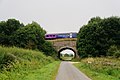
 The Leeds Selby line, Newthorpe - geograph.org.uk - 2736327.jpg 1,024 × 768; 143 KB
-
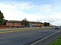
 The Milford Hotel on the A63 - geograph.org.uk - 3070152.jpg 800 × 600; 113 KB
-
 The Milford Hotel, Micklefield - geograph.org.uk - 6290545.jpg 1,024 × 768; 114 KB
-
 The Squires - geograph.org.uk - 1987256.jpg 800 × 600; 279 KB
-
 Track junction and level crossing west of Newthorpe - geograph.org.uk - 3724618.jpg 1,600 × 1,200; 528 KB
-
 Track leading to Huddleston Grange - geograph.org.uk - 4093120.jpg 1,600 × 1,064; 531 KB
-
 Track to Huddleston Grange - geograph.org.uk - 2755038.jpg 640 × 480; 59 KB
-
 Track towards Huddleston Grange - geograph.org.uk - 5733477.jpg 1,600 × 1,200; 448 KB
-
 Turn left for South Milford - geograph.org.uk - 2736494.jpg 1,024 × 768; 108 KB
-
 Walkers welcome, but where's the path - geograph.org.uk - 2267338.jpg 800 × 600; 347 KB
-
 Western edge, Huddleston Old Wood - geograph.org.uk - 3738487.jpg 1,024 × 768; 250 KB
-
 Woodland shadow meets farmland drain - geograph.org.uk - 3738580.jpg 1,024 × 768; 123 KB
-
 X marks the spot - geograph.org.uk - 2736267.jpg 1,024 × 768; 116 KB


_-_a_shallow_rock_cutting_-_geograph.org.uk_-_2646745.jpg)
_-_B1222_bridge_-_geograph.org.uk_-_2646728.jpg)
_in_a_culvert_-_geograph.org.uk_-_2040822.jpg)
_in_a_cutting_-_geograph.org.uk_-_3035253.jpg)
_in_a_cutting_-_geograph.org.uk_-_4806169.jpg)


_-_geograph.org.uk_-_2515464.jpg)
_-_geograph.org.uk_-_3035240.jpg)


