Category:Huerfano County, Colorado
Sari la navigare
Sari la căutare
Counties of Colorado: Adams · Alamosa · Arapahoe · Archuleta · Baca · Bent · Boulder · Chaffee · Cheyenne · Clear Creek · Conejos · Costilla · Crowley · Custer · Delta · Dolores · Douglas · Eagle · El Paso · Elbert · Fremont · Garfield · Gilpin · Grand · Gunnison · Hinsdale · Huerfano · Jackson · Jefferson · Kiowa · Kit Carson · Lake · La Plata · Larimer · Las Animas · Lincoln · Logan · Mesa · Mineral · Moffat · Montezuma · Montrose · Morgan · Otero · Ouray · Park · Phillips · Pitkin · Prowers · Pueblo · Rio Blanco · Rio Grande · Routt · Saguache · San Juan · San Miguel · Sedgwick · Summit · Teller · Washington · Weld · Yuma
City-counties: Broomfield · Denver
City-counties: Broomfield · Denver
comitat din Statele Unite ale Americii    | |||||
| Încarcă multimedia | |||||
| Este un/o | |||||
|---|---|---|---|---|---|
| Numit(ă) după | |||||
| Locul actual | Colorado, SUA | ||||
| Capitală | |||||
| Înființare |
| ||||
| Populație |
| ||||
| Suprafață |
| ||||
| site oficial | |||||
 | |||||
Huerfano County is a county in Colorado, United States.
Subcategorii
Această categorie conține următoarele 10 subcategorii, dintr-un total de 10.
Fișiere media din categoria „Huerfano County, Colorado”
Următoarele 44 fișiere se află în această categorie, dintr-un total de 44.
-
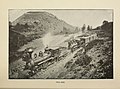 "Around the circle. (1892) (14760680382).jpg 3.440x2.541; 2,14 MB
-
 HEAP(1854) p038 PLATE II. SPANISH PEAKS.jpg 2.152x1.406; 2,03 MB
-
 HEAP(1854) p041 PLATE III. HUERFANO CANON.jpg 2.122x1.394; 1,98 MB
-

-
 BNSF Spanish Peaks Subdivision 1.JPG 6.000x3.000; 12,9 MB
-
 BNSF Spanish Peaks Subdivision 2.JPG 6.000x2.926; 11,21 MB
-
 Carbon dioxide pipeline warning sign.JPG 5.303x3.603; 6,91 MB
-
 Devil’s Stairsteps.JPG 5.631x3.775; 14,89 MB
-
 Gosshomesteadbarn.jpg 792x428; 87 KB
-
 Greenhorn Mountain.JPG 4.951x2.662; 11,36 MB
-
 Huerfano County Fire Protection District Station 2.JPG 6.000x3.729; 13,44 MB
-
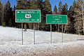
 Huerfano County sign.JPG 4.384x2.648; 8,35 MB
-
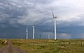 Huerfano River Wind Farm.JPG 5.724x3.609; 11,56 MB
-
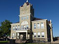 HuerfanoCoCourthLudlowMassacre day.JPG 1.985x1.489; 1.009 KB
-
 HuerfanoCoCourthLudlowMassacre night.JPG 1.756x1.317; 445 KB
-
 La Veta Pass.JPG 5.184x3.456; 16,06 MB
-
 Las Animas, Huerfano and Custer- three Colorado counties on a cultural frontier - a history of the Raton Basin (IA lasanimashuerfan00murr).pdf 1.089 × 1.558, 200 de pagini; 6,19 MB
-
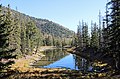 Lower Blue Lake (Huerfano County, Colorado).JPG 5.504x3.623; 15,05 MB
-
 Navajo Western Water District office.JPG 5.087x3.464; 10,83 MB
-
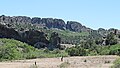
 North and South Rattlesnake Buttes.JPG 5.218x2.960; 8,38 MB
-

-
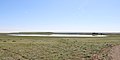 Orlando Reservoir Number 2.JPG 5.378x2.685; 8,25 MB
-
 Parallel magmatic dikes.JPG 4.576x2.592; 12,36 MB
-
 Pass Creek Pass.JPG 5.218x3.475; 13,2 MB
-
 Promontory Divide.JPG 4.991x3.516; 8,74 MB
-
 Sangre de Cristo Pass.JPG 4.772x2.668; 10,39 MB
-
 Silver Mountain (Huerfano County, Colorado).JPG 5.925x3.464; 22,09 MB
-
 Silver Mountain Dike.JPG 5.943x3.389; 17,75 MB
-

-
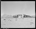
 Spanish Peaks Airfield.JPG 5.637x3.781; 15,26 MB
-
 Spanish Peaks Country sign.JPG 2.220x1.283; 2,12 MB
-
 Spring Creek Fire burn scar.JPG 5.937x2.817; 10,34 MB
-
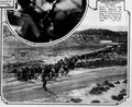 Strikers March on Mine in Huerfano County (1927).png 798x650; 619 KB
-
 Taos Trail.JPG 4.209x3.228; 12,25 MB
-
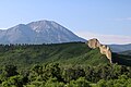
 Trinchera Peak.jpg 4.272x1.991; 4,33 MB
-
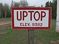 Uptop Elev. 9382.jpg 2.848x2.136; 1,95 MB
-
 USA Huerfano County, Colorado age pyramid.svg 520x600; 7 KB
-
 Variable-message road sign in Huerfano County.JPG 3.650x1.924; 3,64 MB
-
-
 West Spanish Peak and a dike.JPG 6.000x4.000; 13,69 MB
-
 West Spanish Peak, Colorado.jpeg 1.200x1.600; 635 KB
-
 West Spanish Peaks radial dikes.JPG 5.088x2.485; 12,96 MB
-
 Wildflower along US160 between Walsenburg and Fort Garland in Colorado.jpg 2.048x1.360; 2,08 MB
-
 Wolf Springs Ranch.JPG 5.747x2.993; 10,3 MB
_(14760680382).jpg)
_p038_PLATE_II._SPANISH_PEAKS.jpg)
_p041_PLATE_III._HUERFANO_CANON.jpg)


.JPG)


.JPG)


.png)


