Category:Huis Holster
Jump to navigation
Jump to search
| Object location | | View all coordinates using: OpenStreetMap |
|---|
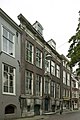
building in Dordrecht, Netherlands  | |||||
| Upload media | |||||
| Instance of | |||||
|---|---|---|---|---|---|
| Location | Dordrecht, South Holland, Netherlands | ||||
| Street address |
| ||||
| Owned by |
| ||||
| Heritage designation |
| ||||
| Inception |
| ||||
 | |||||
|
This is a category about rijksmonument number 14004
|
| Address |
|
Media in category "Huis Holster"
The following 65 files are in this category, out of 65 total.
-
 14004 Huis Rodenburch - achterhuis.jpg 3,000 × 2,058; 3.56 MB
-
 14004 Huis Rodenburch - detail behang.jpg 4,000 × 2,667; 7.05 MB
-
 14004 Huis Rodenburch - detail kluis.jpg 3,000 × 2,250; 3.15 MB
-
 14004 Huis Rodenburch - kelder.jpg 2,000 × 3,000; 2.24 MB
-
 14004 Huis Rodenburch - plafondschildering.jpg 2,989 × 1,765; 4.66 MB
-
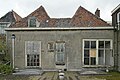
 Achtergevel - Dordrecht - 20409356 - RCE.jpg 1,200 × 800; 280 KB
-
 Achtergevel - Dordrecht - 20409357 - RCE.jpg 800 × 1,200; 235 KB
-
 Dordrecht - Wijnstraat 153.jpg 768 × 1,024; 189 KB
-
 Dordrecht Wijnstraat155.jpg 2,736 × 3,584; 4.19 MB
-
 Hoek Gravenstr. - Dordrecht - 20063207 - RCE.jpg 965 × 1,200; 295 KB
-
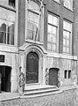 Ingang - Dordrecht - 20063212 - RCE.jpg 889 × 1,200; 222 KB
-
 Interieur kelder met tongewelf - Dordrecht - 20409367 - RCE.jpg 1,200 × 800; 195 KB
-
 Interieur kelder met tongewelf - Dordrecht - 20409368 - RCE.jpg 1,200 × 800; 131 KB
-
 Interieur kelder met tongewelf - Dordrecht - 20409369 - RCE.jpg 1,200 × 800; 144 KB
-
 Interieur, deur in de gang - Dordrecht - 20409353 - RCE.jpg 798 × 1,200; 142 KB
-
 Interieur, deur naar rechter voorkamer - Dordrecht - 20409621 - RCE.jpg 800 × 1,200; 144 KB
-
 Interieur, dubbele deur in de gang - Dordrecht - 20409354 - RCE.jpg 800 × 1,200; 122 KB
-
 Interieur, kachelnis op verdieping - Dordrecht - 20408276 - RCE.jpg 800 × 1,200; 112 KB
-
 Interieur, kast in de rechter achterkamer - Dordrecht - 20409618 - RCE.jpg 800 × 1,200; 122 KB
-
 Interieur, lambisering in de linker voorkamer - Dordrecht - 20408287 - RCE.jpg 1,200 × 800; 152 KB
-
 Interieur, lambrisering in de gang - Dordrecht - 20409352 - RCE.jpg 800 × 1,200; 103 KB
-
 Interieur, overzicht gang op verdieping - Dordrecht - 20408283 - RCE.jpg 800 × 1,200; 99 KB
-
 Interieur, overzicht gang op verdieping - Dordrecht - 20408284 - RCE.jpg 800 × 1,200; 119 KB
-
 Interieur, overzicht rechter voorkamer - Dordrecht - 20409372 - RCE.jpg 800 × 1,200; 173 KB
-
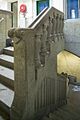
 Interieur, overzicht traphek - Dordrecht - 20408273 - RCE.jpg 1,200 × 800; 142 KB
-
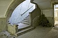
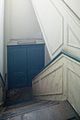
 Interieur, overzicht trappenhuis - Dordrecht - 20408274 - RCE.jpg 800 × 1,200; 89 KB
-
-

-

-
 Interieur, overzicht van de linker voorkamer - Dordrecht - 20409348 - RCE.jpg 1,200 × 800; 203 KB
-
 Interieur, overzicht van de linker voorkamer - Dordrecht - 20409349 - RCE.jpg 1,200 × 800; 160 KB
-
-
-
-

-
-
 Interieur, plafond in de rechter achterkamer - Dordrecht - 20409619 - RCE.jpg 800 × 1,200; 127 KB
-

-
 Interieur, schouw in de linker voorkamer - Dordrecht - 20408286 - RCE.jpg 800 × 1,200; 143 KB
-
 Interieur, schouw in de rechter achterkamer - Dordrecht - 20409374 - RCE.jpg 800 × 1,200; 140 KB
-
 Interieur, schouw in de rechter voorkamer - Dordrecht - 20409371 - RCE.jpg 800 × 1,200; 176 KB
-
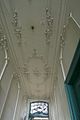 Interieur, stucplafond in de gang - Dordrecht - 20409355 - RCE.jpg 800 × 1,200; 105 KB
-
 Interieur, stucplafond in de linker voorkamer - Dordrecht - 20409343 - RCE.jpg 1,200 × 800; 109 KB
-
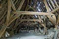
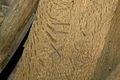
 Interieur, telmerk op balk van kap - Dordrecht - 20408269 - RCE.jpg 1,200 × 800; 165 KB
-

-

-

-

-
-
-

-
-
 Interieur, trappenhuis - Dordrecht - 20408275 - RCE.jpg 800 × 1,200; 94 KB
-
 Interieur, vensterbank in linker voorkamer - Dordrecht - 20409344 - RCE.jpg 800 × 1,200; 148 KB
-
 Interieur, vertrek met kachelnis op verdieping - Dordrecht - 20408282 - RCE.jpg 1,200 × 800; 124 KB
-
 Interieur, vertrek op verdieping - Dordrecht - 20408280 - RCE.jpg 1,200 × 800; 116 KB
-
 Interieur, vertrek op verdieping - Dordrecht - 20408281 - RCE.jpg 1,200 × 800; 113 KB
-

-

-

-
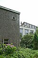
 Overzicht achtergevel met begroeiing - Dordrecht - 20409358 - RCE.jpg 1,200 × 800; 258 KB
-
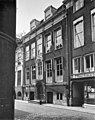 Voorgevel - Dordrecht - 20063211 - RCE.jpg 948 × 1,200; 258 KB
-
 Zicht op achtergevel van de eerste verdieping - Dordrecht - 20408285 - RCE.jpg 1,200 × 800; 184 KB
-
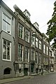 Zicht op de voorgevel met naast gelegen panden - Dordrecht - 20409622 - RCE.jpg 800 × 1,200; 190 KB
-
 Zicht op de voorgevel met naast gelegen panden - Dordrecht - 20409623 - RCE.jpg 800 × 1,200; 173 KB


