Category:Huize de Tripper, Zaltbommel
Jump to navigation
Jump to search
| Object location | | View all coordinates using: OpenStreetMap |
|---|
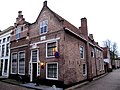
building in Zaltbommel, Netherlands  | |||||
| Upload media | |||||
| Instance of | |||||
|---|---|---|---|---|---|
| Location | Zaltbommel, Gelderland, Netherlands | ||||
| Street address |
| ||||
| Heritage designation |
| ||||
 | |||||
|
This is a category about rijksmonument number 40207
|
| Address |
|
Media in category "Huize de Tripper, Zaltbommel"
The following 21 files are in this category, out of 21 total.
-
 2010-8 mon 1 def; Kerkstraat 30, nr. 40207.jpg 2,712 × 4,230; 2 MB
-
 Achtergevel "De Trippen" - Zaltbommel - 20220420 - RCE.jpg 1,200 × 806; 233 KB
-
 De Ark - Zaltbommel - 20220417 - RCE.jpg 962 × 1,200; 214 KB
-
 De Kerkstraat in Zaltbommel..jpg 4,770 × 3,177; 1.13 MB
-
 Interieur details - Zaltbommel - 20220415 - RCE.jpg 1,200 × 798; 254 KB
-
 Interieur details - Zaltbommel - 20220416 - RCE.jpg 1,200 × 804; 202 KB
-
 Interieur details - Zaltbommel - 20220421 - RCE.jpg 1,200 × 793; 149 KB
-
 Interieur details - Zaltbommel - 20220422 - RCE.jpg 1,200 × 795; 228 KB
-
 Interieur details - Zaltbommel - 20220423 - RCE.jpg 1,200 × 800; 243 KB
-
 Interieur details - Zaltbommel - 20220424 - RCE.jpg 1,200 × 801; 211 KB
-
 Interieur details - Zaltbommel - 20220425 - RCE.jpg 806 × 1,200; 169 KB
-
 Interieur details - Zaltbommel - 20353886 - RCE.jpg 1,200 × 800; 145 KB
-
 Kerkstraat 26 "De Trippe''.jpg 4,000 × 3,000; 895 KB
-

-

-
 Voorgevel, detail, ingangspartij en naamsteen - Zaltbommel - 20344990 - RCE.jpg 800 × 1,200; 273 KB
-
 Voorgevel, detail, naamsteen - Zaltbommel - 20344991 - RCE.jpg 1,195 × 1,200; 437 KB
-
 Voorgevel, detail, trapgevel - Zaltbommel - 20344989 - RCE.jpg 1,190 × 1,200; 375 KB
-
 Zaltbommel, Netherlands - panoramio (14).jpg 2,048 × 1,148; 480 KB
-
 Zaltbommel, Netherlands - panoramio (16).jpg 1,148 × 2,048; 413 KB
-
 Zaltbommel, Netherlands - panoramio (19).jpg 2,048 × 1,148; 453 KB


.jpg)
.jpg)
.jpg)