Category:Humboldthöhe
Jump to navigation
Jump to search
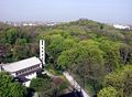
mountain in Berlin, Germany  Гумбольдтская высота. Вид с Густав-Майер-аллее. На первом плане — Вознесенская церковь | |||||
| Upload media | |||||
| Instance of |
| ||||
|---|---|---|---|---|---|
| Location | Humboldthain, Gesundbrunnen, Berlin-Mitte, Berlin, Germany | ||||
| Date of official opening |
| ||||
| Elevation above sea level |
| ||||
 | |||||
Subcategories
This category has the following 4 subcategories, out of 4 total.
F
V
- Views from Humboldthöhe (16 F)
Media in category "Humboldthöhe"
The following 4 files are in this category, out of 4 total.
-
 Around Bornholmer Straße and Gesundbrunnen 4.jpg 2,592 × 1,944; 1.24 MB
-
 Berlin-Gesundbrunnen - geo.hlipp.de - 37984.jpg 640 × 390; 87 KB
-
 Humboldthöhe2.jpg 2,029 × 1,490; 876 KB
-
 S-Bahn Berlin Gesundbrunnen 1980.jpg 2,048 × 1,345; 388 KB


