Category:Hunnecum 1, Nuth
Jump to navigation
Jump to search
| Object location | | View all coordinates using: OpenStreetMap |
|---|
building in Hunnecum near Nuth, Netherlands  | |||||
| Upload media | |||||
| Instance of | |||||
|---|---|---|---|---|---|
| Location | Hunnecum, Nuth, Beekdaelen, Limburg, Netherlands | ||||
| Street address |
| ||||
| Located on street |
| ||||
| Heritage designation |
| ||||
 | |||||
|
This is a category about rijksmonument number 30931
|
| Address |
|
Media in category "Hunnecum 1, Nuth"
The following 11 files are in this category, out of 11 total.
-
 Exterieur VOORGEVEL - Hunnecum - 20282073 - RCE.jpg 1,200 × 1,192; 324 KB
-
 Exterieur VOORGEVEL, RECHTER ZIJGEVEL - Hunnecum - 20282074 - RCE.jpg 1,197 × 1,200; 306 KB
-
 Gevels straatzijde dia 18126 - Hunnecum - 20471929 - RCE.jpg 1,200 × 900; 186 KB
-
 Gevels straatzijde speklagen dia 18125 - Hunnecum - 20471928 - RCE.jpg 1,200 × 900; 154 KB
-
 Hunnecum2003.jpg 401 × 226; 22 KB
-
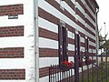 Hunnecumwiki.JPG 820 × 615; 87 KB
-
 Nr. 1 - Hunnecum - 20119040 - RCE.jpg 1,200 × 810; 213 KB
-
 Nr. 1, raamdetail - Hunnecum - 20119041 - RCE.jpg 802 × 1,200; 158 KB
-
 Nuth-Hunnecum 1.JPG 4,000 × 3,000; 4.7 MB
-
 Overzicht - Hunnecum - 20119039 - RCE.jpg 1,200 × 788; 263 KB
-
 Overzicht met boerderij nr. 1 - Hunnecum - 20119038 - RCE.jpg 1,200 × 794; 234 KB


