Category:Hurricane Nora (2021)
Jump to navigation
Jump to search
category 1 Pacific hurricane in 2021  | |||||
| Upload media | |||||
| Instance of |
| ||||
|---|---|---|---|---|---|
| Part of | |||||
| Location | Pacific Ocean, international waters | ||||
| Start time |
| ||||
| End time |
| ||||
| |||||
Media in category "Hurricane Nora (2021)"
The following 20 files are in this category, out of 20 total.
-
 2021 CIMSS 14E Fourteen visible infrared satellite loop.gif 800 × 600; 2.78 MB
-
 2021 CIMSS 14E Nora visible infrared satellite loop.gif 800 × 600; 3.47 MB
-
 2021 JTWC 14E forecast map.ep1421.gif 1,414 × 1,010; 65 KB
-
 2021 JTWC 14E IR satellite imagery.14E 2800sair.jpg 1,024 × 1,024; 787 KB
-
 2021 JTWC 14E IR satellite imagery.14e.jpg 1,024 × 1,024; 804 KB
-
 2021 JTWC 14E IR satellite imagery.jpg 1,024 × 1,024; 800 KB
-
 2021 NHC EP142021 5day cone no line and wind.png 897 × 736; 61 KB
-
 2021 NRL EP142021 FOURTEEN infrared-gray satellite.png 1,400 × 1,400; 569 KB
-
 2021 NRL EP142021 FOURTEEN visible satellite.png 1,400 × 1,400; 540 KB
-
 2021 NRL EP142021 NORA infrared-gray satellite.png 1,400 × 1,400; 787 KB
-
 2021 NRL EP142021 NORA visible satellite.png 1,400 × 1,400; 1.34 MB
-
 2021 NRL EP952021 INVEST infrared-gray satellite.png 1,400 × 1,400; 796 KB
-
 2021 NRL EP952021 INVEST visible satellite.png 1,400 × 1,400; 1.05 MB
-
 GOES 16 2021-08-28 1400Z.jpg 10,000 × 7,726; 13.42 MB
-
 NOAA-20 Nora and Ida August 28 2021.png 3,336 × 2,085; 13.36 MB
-
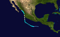 Nora 2021 track.png 2,700 × 1,669; 2.24 MB
-
 Nora 2021-08-28 1810Z.jpg 1,800 × 2,200; 536 KB
-
 Nora 2021-08-28 1900Z.jpg 3,200 × 4,000; 15.27 MB
-
 Nora 2021-08-28 2000Z (Grayscale).jpg 2,000 × 2,665; 1.42 MB
-
 Nora 2021-08-28 2010Z.jpg 6,000 × 8,000; 9.73 MB


.jpg)
