Category:Hyde, Greater Manchester
Jump to navigation
Jump to search
English: Hyde is a town in the Metropolitan Borough of Tameside, Greater Manchester, England. As of the 2001 census, the town had a population of 31,253. Historically part of Cheshire, it is east of Manchester.
Italiano: Hyde è una cittadina di 31.253 abitanti della contea della Greater Manchester, in Inghilterra.
Nederlands: Hyde is een plaats in het bestuurlijke gebied Tameside, in het Engelse graafschap Greater Manchester. De plaats telt 31.253 inwoners.
Română: Hyde este un oraş în comitatul Greater Manchester, regiunea North West, Anglia. Oraşul se află în districtul metropolitan Tameside.
town in the Metropolitan Borough of Tameside, Greater Manchester, England  | |||||
| Upload media | |||||
| Instance of | |||||
|---|---|---|---|---|---|
| Location | Tameside, Greater Manchester, North West England, England | ||||
 | |||||
Subcategories
This category has the following 25 subcategories, out of 25 total.
*
- Backbower (3 F)
G
- Godley Hill War Memorial (10 F)
- Gower Hey Wood (131 F)
H
- Hyde 7 mile road race (39 F)
- Hyde Bus Station (40 F)
- Hyde Central railway station (51 F)
- Hyde market (376 F)
- Hyde North railway station (29 F)
- Hyde Park, Tameside (42 F)
- Hyde War Memorial (25 F)
P
S
T
W
Media in category "Hyde, Greater Manchester"
The following 200 files are in this category, out of 658 total.
(previous page) (next page)-
 110-116 Market Street - geograph.org.uk - 3060286.jpg 640 × 471; 154 KB
-
 20-12 20-12 2012 - geograph.org.uk - 3266636.jpg 640 × 624; 138 KB
-
 201 to Piccadilly - geograph.org.uk - 2385484.jpg 640 × 576; 204 KB
-
 2010 Polling Station - geograph.org.uk - 1843473.jpg 640 × 531; 156 KB
-
 2012 Starts here - geograph.org.uk - 2746720.jpg 640 × 477; 142 KB
-
 21st century bubble-gum - geograph.org.uk - 2812782.jpg 640 × 470; 170 KB
-
 4th Hyde Scouts - geograph.org.uk - 1934456.jpg 640 × 606; 177 KB
-
 A big hole - geograph.org.uk - 2925418.jpg 640 × 480; 190 KB
-
 A cardboard notice - geograph.org.uk - 3992210.jpg 1,000 × 750; 207 KB
-
 A change of direction - geograph.org.uk - 2400672.jpg 640 × 463; 176 KB
-
 A cleared industrial site - geograph.org.uk - 1841063.jpg 3,765 × 2,489; 2.92 MB
-
 A cleared industrial site - geograph.org.uk - 1841069.jpg 3,727 × 2,489; 2.47 MB
-
 A Dinosaur in Hyde - geograph.org.uk - 4416001.jpg 1,000 × 1,151; 944 KB
-
 A fire engine squeezes through - geograph.org.uk - 2373815.jpg 640 × 480; 159 KB
-
 A Glimpse of the Godley Brook - geograph.org.uk - 3323435.jpg 640 × 480; 238 KB
-
 A metal line across the market - geograph.org.uk - 2888197.jpg 640 × 853; 334 KB
-
 A path through the trees - geograph.org.uk - 3932071.jpg 1,000 × 750; 455 KB
-
 A polite notice to dog owners - geograph.org.uk - 3440533.jpg 640 × 480; 120 KB
-
 A quiet corner^ - geograph.org.uk - 1842881.jpg 3,872 × 2,592; 5.03 MB
-
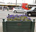 A Show of Blue - geograph.org.uk - 1773360.jpg 640 × 568; 142 KB
-
 A View over Iceland - geograph.org.uk - 2257610.jpg 640 × 424; 109 KB
-
 A weed is a just a flower in the wrong place - geograph.org.uk - 3016914.jpg 2,448 × 3,264; 2.44 MB
-

-
 Abandoned Allotment - geograph.org.uk - 2865497.jpg 640 × 480; 287 KB
-
 Abandoned Allotment - geograph.org.uk - 2865515.jpg 640 × 480; 253 KB
-
 Abandoned Allotments - geograph.org.uk - 4325158.jpg 1,000 × 750; 879 KB
-
 Abbey National - geograph.org.uk - 3029854.jpg 640 × 480; 86 KB
-
 ABC Wax from Morrisons - geograph.org.uk - 4486894.jpg 1,000 × 750; 516 KB
-
 Access to Adamson's Wharf - geograph.org.uk - 4524087.jpg 1,000 × 750; 707 KB
-
 Access to Clarendon Place - geograph.org.uk - 1871720.jpg 640 × 480; 128 KB
-
 Access to Trans Pennine Trail - geograph.org.uk - 1076297.jpg 640 × 481; 107 KB
-
 Across the demolition site - geograph.org.uk - 3971208.jpg 1,000 × 734; 256 KB
-
 Adamson Industrial Estate - geograph.org.uk - 2707492.jpg 640 × 480; 140 KB
-
 After the Fair - geograph.org.uk - 1011145.jpg 640 × 481; 104 KB
-
 After the Storms - geograph.org.uk - 1584685.jpg 640 × 551; 160 KB
-
 Afternoon Moon over Henry Street - geograph.org.uk - 4195947.jpg 1,000 × 714; 492 KB
-
 Alder High School - geograph.org.uk - 11301.jpg 640 × 480; 99 KB
-
 All that's left of Pattrieaux's - geograph.org.uk - 1868378.jpg 3,727 × 2,480; 3.26 MB
-
 Alleyway off Clarendon Place - geograph.org.uk - 2302661.jpg 480 × 640; 153 KB
-
 An old Hyde Corporation signpost - geograph.org.uk - 2847954.jpg 640 × 602; 205 KB
-
 Apethorn to Godley - geograph.org.uk - 1076308.jpg 640 × 457; 103 KB
-
 Apple iPod bus - geograph.org.uk - 3269051.jpg 640 × 489; 161 KB
-
 Astoria Bingo Hall - geograph.org.uk - 2750871.jpg 640 × 409; 117 KB
-
 Astoria Bingo, Hyde - geograph.org.uk - 2719862.jpg 640 × 480; 118 KB
-
 Authorised Crossing Point - geograph.org.uk - 3889947.jpg 1,000 × 750; 292 KB
-
 Automasters factory - geograph.org.uk - 1206904.jpg 640 × 473; 131 KB
-
 Automasters factory - geograph.org.uk - 1206944.jpg 640 × 480; 392 KB
-
 Automasters Site - geograph.org.uk - 1274655.jpg 640 × 490; 129 KB
-
 Autumn leaves - geograph.org.uk - 4716487.jpg 1,000 × 750; 899 KB
-
 Autumn Path - geograph.org.uk - 3727226.jpg 1,000 × 750; 499 KB
-
 Autumn Rain - geograph.org.uk - 3711916.jpg 1,000 × 724; 278 KB
-
 Back entrance to market - geograph.org.uk - 2138581.jpg 640 × 480; 121 KB
-
 Back entrance to market - geograph.org.uk - 2986297.jpg 640 × 480; 149 KB
-
 Back Lane - geograph.org.uk - 2014593.jpg 640 × 411; 103 KB
-
 Back of Dowson Road - geograph.org.uk - 1481482.jpg 606 × 640; 138 KB
-
 Back of shops - geograph.org.uk - 2474263.jpg 640 × 416; 127 KB
-
 Back of Wellington Street - geograph.org.uk - 2959071.jpg 640 × 445; 147 KB
-
 Backbower 342 - geograph.org.uk - 1006695.jpg 640 × 480; 122 KB
-
 Bagged Ice Delivery - geograph.org.uk - 6135233.jpg 1,280 × 947; 799 KB
-
 Balloons and a bin lorry - geograph.org.uk - 4658612.jpg 1,000 × 1,000; 824 KB
-
 Band preparations - geograph.org.uk - 3260716.jpg 640 × 512; 155 KB
-
 Bank Holiday Monday - geograph.org.uk - 6590579.jpg 2,592 × 1,944; 2.91 MB
-
 Behind Donald Avenue - geograph.org.uk - 4195952.jpg 1,000 × 750; 584 KB
-
 Behind St Thomas the Apostle - geograph.org.uk - 2110801.jpg 640 × 480; 166 KB
-
 Behind Steeles Avenue - geograph.org.uk - 2444985.jpg 640 × 576; 194 KB
-
 Bench and Gatepost - geograph.org.uk - 3059269.jpg 640 × 480; 227 KB
-
 Benevolent Buildings 1834 - geograph.org.uk - 2302251.jpg 640 × 480; 141 KB
-
 Bennett Street War Memorial - geograph.org.uk - 5006845.jpg 1,000 × 869; 597 KB
-
 Bent Belisha Beacon - geograph.org.uk - 1329790.jpg 640 × 543; 161 KB
-
 Blue Lamp - geograph.org.uk - 1065022.jpg 640 × 480; 126 KB
-
 Bluebells on Crook Street - geograph.org.uk - 1282023.jpg 640 × 480; 154 KB
-
 Borough Arcade - geograph.org.uk - 2088236.jpg 640 × 534; 143 KB
-
 Boundary markings on Broomstair Bridge - geograph.org.uk - 6063660.jpg 1,280 × 898; 794 KB
-
 Braving the rain - geograph.org.uk - 3897679.jpg 1,000 × 782; 249 KB
-
 Break in the clouds - geograph.org.uk - 3806400.jpg 1,000 × 852; 395 KB
-
 Brick Pillar box (SK14 21) on Welch Road - geograph.org.uk - 5055969.jpg 1,000 × 1,333; 1.28 MB
-
 Bridge BRB WJP 2-129 - geograph.org.uk - 1059721.jpg 640 × 480; 134 KB
-
 Bridge Field Terrace 1872 - geograph.org.uk - 6085379.jpg 1,280 × 1,714; 1.68 MB
-
 Bridge over River Tame - geograph.org.uk - 1493576.jpg 640 × 480; 179 KB
-
 Broadbent Geograph-1472222-by-Mike-Faherty.jpg 640 × 480; 92 KB
-
 Broadway Industrial Estate from the air - geograph.org.uk - 4029349.jpg 640 × 480; 191 KB
-
 Broken bench mended - geograph.org.uk - 4184827.jpg 1,000 × 750; 673 KB
-
 Broken branch in embankment - geograph.org.uk - 4177707.jpg 1,000 × 750; 1 MB
-
 Broken glass - geograph.org.uk - 2959055.jpg 640 × 480; 141 KB
-
 Brokendown Bus - geograph.org.uk - 1315464.jpg 640 × 504; 115 KB
-
 BT Workers - geograph.org.uk - 3268995.jpg 640 × 480; 164 KB
-
 Bulls Eyes - geograph.org.uk - 1081908.jpg 614 × 640; 152 KB
-
 Burgervan in the rain - geograph.org.uk - 3897672.jpg 1,000 × 759; 278 KB
-
 Bus in the rain - geograph.org.uk - 4016769.jpg 1,000 × 774; 322 KB
-
 Bus shelter, Hyde.jpg 640 × 853; 303 KB
-
 Bus stop CC - geograph.org.uk - 6458900.jpg 1,280 × 1,707; 1.7 MB
-
 Businesses on Raglan Street - geograph.org.uk - 4524734.jpg 1,000 × 750; 667 KB
-
 By the former Gasworks - geograph.org.uk - 4521451.jpg 1,000 × 750; 960 KB
-
 Café chairs - geograph.org.uk - 3343877.jpg 640 × 542; 159 KB
-
 Canalside development - geograph.org.uk - 5002005.jpg 1,000 × 750; 666 KB
-
 Captain Clark's Bridge - geograph.org.uk - 1012315.jpg 640 × 481; 153 KB
-
 Captain Clark's Bridge - geograph.org.uk - 1012319.jpg 640 × 481; 149 KB
-
 Car park awaiting demolition - geograph.org.uk - 3897466.jpg 1,000 × 756; 212 KB
-
 Car Park Demolition - geograph.org.uk - 3957745.jpg 1,000 × 750; 339 KB
-
 Car park demolition site - geograph.org.uk - 3963079.jpg 1,000 × 750; 296 KB
-
 Car park on Reynard Street - geograph.org.uk - 6490407.jpg 1,280 × 960; 995 KB
-
 Car park view - geograph.org.uk - 2726981.jpg 640 × 435; 134 KB
-
 Car Parks off Travis Street - geograph.org.uk - 2067107.jpg 640 × 512; 108 KB
-
 Car Wash - geograph.org.uk - 2787074.jpg 640 × 480; 144 KB
-
 Car wash open - geograph.org.uk - 6489501.jpg 1,280 × 960; 1.02 MB
-
 Caravans for Sale - geograph.org.uk - 1066785.jpg 640 × 480; 111 KB
-
 Carol Concert - geograph.org.uk - 1065060.jpg 640 × 480; 126 KB
-
 Carol singers - geograph.org.uk - 3264365.jpg 640 × 501; 158 KB
-
 Carousel still going round - geograph.org.uk - 2921461.jpg 640 × 935; 241 KB
-
 Cat on Guard - geograph.org.uk - 1337402.jpg 640 × 480; 158 KB
-
 Cats on the Steps - geograph.org.uk - 1822595.jpg 640 × 476; 157 KB
-
 Caxton Works Cleared - geograph.org.uk - 1544515.jpg 640 × 511; 131 KB
-
 Caxton Works Demolished - geograph.org.uk - 1435390.jpg 640 × 524; 179 KB
-
 Central Methodist Church - geograph.org.uk - 2415104.jpg 640 × 593; 169 KB
-
 Chained Bicycle - geograph.org.uk - 2888165.jpg 640 × 853; 229 KB
-
 Change of Ownership - geograph.org.uk - 849275.jpg 640 × 480; 117 KB
-
 Change to Last Collection Times - geograph.org.uk - 4233598.jpg 1,000 × 750; 589 KB
-
 Chapel Croft - geograph.org.uk - 2707454.jpg 640 × 480; 190 KB
-
 Chartist Monument - geograph.org.uk - 1074238.jpg 640 × 454; 132 KB
-
 Chartists with Balloons - geograph.org.uk - 1773345.jpg 640 × 480; 141 KB
-
 Cheapside Concrete Jungle - geograph.org.uk - 2473764.jpg 640 × 480; 125 KB
-
 Cheapside Ramp - geograph.org.uk - 2473757.jpg 640 × 480; 125 KB
-
 Cheapside Subway - geograph.org.uk - 1005917.jpg 640 × 480; 158 KB
-
 Cheapside Subway - geograph.org.uk - 1298320.jpg 640 × 480; 105 KB
-
 Cheapside Subway - geograph.org.uk - 4164669.jpg 1,000 × 785; 819 KB
-
 Cherry Blossom on Union Street - geograph.org.uk - 1821987.jpg 640 × 480; 154 KB
-
 Cherry blossom over the fence - geograph.org.uk - 2357239.jpg 640 × 628; 300 KB
-
 Children's Carousel - geograph.org.uk - 1225031.jpg 640 × 440; 131 KB
-
 Children's Play Area - geograph.org.uk - 1141189.jpg 640 × 466; 125 KB
-
 Chinese chimney - geograph.org.uk - 3957831.jpg 1,000 × 1,333; 301 KB
-
 Christmas Day Rooftops - geograph.org.uk - 1632400.jpg 640 × 460; 122 KB
-
 Church Brow - geograph.org.uk - 2137513.jpg 640 × 480; 170 KB
-
 Church Brow - geograph.org.uk - 2137518.jpg 640 × 480; 188 KB
-
 Clarendon Street and Hyde Market - geograph.org.uk - 2921382.jpg 640 × 480; 142 KB
-
 Clarendon Street Roadworks - geograph.org.uk - 2834183.jpg 640 × 548; 213 KB
-
 Clarendon Viaduct Stone - geograph.org.uk - 4351398.jpg 1,517 × 1,517; 1.99 MB
-
 Clark Way - geograph.org.uk - 1182211.jpg 640 × 541; 130 KB
-
 Clock Roundabout - geograph.org.uk - 2014629.jpg 640 × 433; 127 KB
-
 Clock tower plaque - geograph.org.uk - 5316523.jpg 1,024 × 768; 681 KB
-
 Closed car wash at Morrisons - geograph.org.uk - 6135420.jpg 1,280 × 952; 1,015 KB
-
 Clough Fold - geograph.org.uk - 1822776.jpg 640 × 480; 211 KB
-
 Clough Fold - geograph.org.uk - 1822969.jpg 640 × 480; 210 KB
-
 Clough Fold - geograph.org.uk - 1822974.jpg 640 × 480; 215 KB
-
 Clough Fold - geograph.org.uk - 2932773.jpg 640 × 480; 243 KB
-
 Cobbled Path - geograph.org.uk - 2837154.jpg 3,527 × 2,619; 4.83 MB
-
 Cobbled Path - geograph.org.uk - 797069.jpg 640 × 480; 155 KB
-
 Cobbled Steps - geograph.org.uk - 1090798.jpg 640 × 480; 146 KB
-
 Concrete Mix Works - geograph.org.uk - 4524639.jpg 1,000 × 1,000; 635 KB
-
 Cone and broken bench - geograph.org.uk - 4153511.jpg 1,000 × 750; 744 KB
-
 Construction site at former college - geograph.org.uk - 4768981.jpg 1,000 × 750; 589 KB
-
 Corner of Lumn Road and Mottram Road - geograph.org.uk - 4048069.jpg 1,000 × 723; 203 KB
-
 Corner of Mottram Road and Lumn Road - geograph.org.uk - 4048097.jpg 1,000 × 766; 226 KB
-
 Corporation Street - geograph.org.uk - 1012713.jpg 480 × 640; 109 KB
-
 Corporation Street - geograph.org.uk - 1113129.jpg 640 × 480; 59 KB
-
 Corporation Street after Rain - geograph.org.uk - 1409132.jpg 640 × 560; 144 KB
-
 Cotton Mills - geograph.org.uk - 2269575.jpg 640 × 397; 102 KB
-
 Cotton Mills under construction - geograph.org.uk - 2462924.jpg 640 × 429; 123 KB
-
 Croft Millennium Green - geograph.org.uk - 1141169.jpg 640 × 606; 140 KB
-
 Croft Millennium Green - geograph.org.uk - 1141211.jpg 640 × 433; 111 KB
-
 Croft Millennium Green - geograph.org.uk - 1141229.jpg 640 × 472; 140 KB
-
 Croft Millennium Green - geograph.org.uk - 2326877.jpg 640 × 480; 189 KB
-
 Croft Millennium Green - geograph.org.uk - 799691.jpg 640 × 480; 126 KB
-
 Croft Street - geograph.org.uk - 835904.jpg 640 × 480; 110 KB
-
 Croft Street Bridge - geograph.org.uk - 1084291.jpg 640 × 480; 151 KB
-
 Croft Street Bridge - geograph.org.uk - 2707457.jpg 640 × 480; 260 KB
-
 Croft Street bridge - geograph.org.uk - 2707494.jpg 640 × 480; 124 KB
-
 Crown Pole - geograph.org.uk - 4305388.jpg 1,000 × 1,525; 1,015 KB
-
 Crown Pole and Corporation Street - geograph.org.uk - 2770947.jpg 640 × 725; 146 KB
-
 Crown Pole and RBS - geograph.org.uk - 1453364.jpg 374 × 640; 97 KB
-
 Cut Benchmark at the Sportsman - geograph.org.uk - 4022073.jpg 1,000 × 1,000; 318 KB
-
 Cut Benchmark near Broomstair Bridge - geograph.org.uk - 6063735.jpg 1,280 × 1,920; 2.26 MB
-
 D Sharpe and Son - geograph.org.uk - 2703926.jpg 640 × 480; 168 KB
-
 Dandelions in September^ - geograph.org.uk - 1474569.jpg 586 × 640; 183 KB
-
 Dandelions, daisies and daffodils - geograph.org.uk - 2932653.jpg 640 × 427; 174 KB
-
 Date Plate on Hamnett Street - geograph.org.uk - 1196089.jpg 640 × 480; 105 KB
-
 David Orford (1878-1918) - geograph.org.uk - 5971317.jpg 3,780 × 2,834; 5.51 MB
-
 Dawson Street - geograph.org.uk - 948684.jpg 639 × 480; 126 KB
-
 DB Garden Nurseries - geograph.org.uk - 5558632.jpg 1,280 × 960; 1.1 MB
-
 Debris from the former car park - geograph.org.uk - 3963123.jpg 1,000 × 1,000; 312 KB
-
 Delivery and Demolition - geograph.org.uk - 3957765.jpg 1,000 × 1,333; 345 KB
-
 Demolished works - geograph.org.uk - 3535545.jpg 640 × 480; 61 KB
-
 Demolishing Automasters - geograph.org.uk - 1189167.jpg 640 × 480; 170 KB
-
 Demolishing the Multi-storey - geograph.org.uk - 3941005.jpg 1,000 × 657; 251 KB
-
 Demolition clearance work - geograph.org.uk - 3971197.jpg 1,000 × 750; 225 KB
-
 Demolition of Clothes Shop - geograph.org.uk - 1066424.jpg 1,000 × 750; 577 KB
-
 Demolition work on Clarendon Road - geograph.org.uk - 5885468.jpg 1,280 × 978; 1.44 MB
-
 Diamond Row Open Space - geograph.org.uk - 1078568.jpg 481 × 640; 140 KB
-
 Digger at work - geograph.org.uk - 4254081.jpg 1,000 × 792; 748 KB
-
 Donald Avenue Bridge - geograph.org.uk - 1219090.jpg 640 × 474; 144 KB
-
 Doorway to Caxton Works - geograph.org.uk - 1414097.jpg 640 × 480; 122 KB
-
 Double aperture pillar box, Hyde - geograph.org.uk - 1061379.jpg 454 × 640; 70 KB
-
 Double Postbox (SK14 8) - geograph.org.uk - 2360563.jpg 640 × 478; 142 KB
-
 Double postbox - geograph.org.uk - 888804.jpg 640 × 481; 119 KB
-
 Double Rainbow over Hyde - geograph.org.uk - 3138206.jpg 640 × 480; 137 KB
-
 Douglas Street Playing Field - geograph.org.uk - 1973992.jpg 640 × 449; 113 KB
-
 Douglas Street Recreation Ground - geograph.org.uk - 3214775.jpg 640 × 536; 162 KB
-
 Dow Street Green - geograph.org.uk - 3070435.jpg 640 × 480; 136 KB
-
 Dry-stone Walling - geograph.org.uk - 1493539.jpg 640 × 480; 178 KB
-
 Dukinfield Golf Club - geograph.org.uk - 1426452.jpg 640 × 392; 92 KB
-
 Dukinfield Road - geograph.org.uk - 1399936.jpg 640 × 542; 119 KB


_on_Welch_Road_-_geograph.org.uk_-_5055969.jpg)


_-_geograph.org.uk_-_5971317.jpg)


_-_geograph.org.uk_-_2360563.jpg)


