Category:Hydrographic maps of Loir-et-Cher
Jump to navigation
Jump to search
Subcategories
This category has the following 3 subcategories, out of 3 total.
*
M
Media in category "Hydrographic maps of Loir-et-Cher"
The following 7 files are in this category, out of 7 total.
-
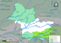 41-Loir-et-Cher-Sage.png 3,507 × 2,480; 1.38 MB
-
 41-SAGE.jpg 3,507 × 2,480; 555 KB
-
 41-Bassins DCE.jpg 3,507 × 2,480; 995 KB
-
 41-Cours eau 50km.jpg 3,507 × 2,480; 562 KB
-
 41-Cours eau.jpg 3,507 × 2,480; 1.54 MB
-
 Carte de l'hydrographie du Domaine national de Chambord.svg 512 × 477; 977 KB
-
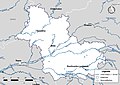
 FR41-SPC.jpg 3,507 × 2,480; 367 KB


