Category:Héaux de Bréhat lighthouse
Jump to navigation
Jump to search
| Object location | | View all coordinates using: OpenStreetMap |
|---|
|
This building is classé au titre des monuments historiques de la France. It is indexed in the base Mérimée, a database of architectural heritage maintained by the French Ministry of Culture, under the reference PA22000031
|
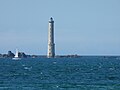
lighthouse in Côtes-d'Armor, France  | |||||
| Upload media | |||||
| Instance of | |||||
|---|---|---|---|---|---|
| Made from material | |||||
| Location | Pleubian, canton of Lézardrieux | ||||
| Architect | |||||
| Heritage designation |
| ||||
| Inception |
| ||||
| Significant event |
| ||||
| Height |
| ||||
| Elevation above sea level |
| ||||
 | |||||
Media in category "Héaux de Bréhat lighthouse"
The following 9 files are in this category, out of 9 total.
-
 Héaux-de-Bréhat.JPG 777 × 572; 131 KB
-
 Leuchtturm Brehat.jpg 1,600 × 900; 128 KB
-
 Phare des Héaux de Bréhat-5074.jpg 2,847 × 1,893; 3.65 MB
-
 Phare des Héaux-de-Bréhat 1.JPG 3,608 × 2,707; 613 KB
-
 Phare des Héaux-de-Bréhat 2.JPG 2,830 × 2,122; 376 KB
-
 Phare Heaux de Bréhat J. Duclos.jpg 916 × 1,174; 746 KB
-
 Phare Héaux de Bréhat.jpg 1,439 × 1,588; 1.17 MB
-
 Pleubian - Phare des Héaux - AD22 - 16FI3771.jpg 1,623 × 1,052; 260 KB
-
 T4- d481 - Fig. 298 — Le phare de Bréhat.png 2,109 × 3,428; 858 KB


Categories:
- Pleubian
- Lighthouses built in 1840
- Lighthouses in France by name
- Stone lighthouses in France
- Lighthouses by height, 51 to 60 meters
- Lighthouses built by Léonce Reynaud
- 19th-century lighthouses in Côtes-d'Armor
- Built in Côtes-d'Armor in 1840
- Lighthouses on wave-washed rocks
- Unpainted lighthouses in France
- Lighthouses by range, 15 to 19 nm
- Landfall lights
- Monuments historiques in Pleubian