Category:Icklesham
Jump to navigation
Jump to search
village and civil parish in East Sussex, United Kingdom  | |||||
| Upload media | |||||
| Instance of | |||||
|---|---|---|---|---|---|
| Location | Rother, East Sussex, South East England, England | ||||
| Population |
| ||||
| Area |
| ||||
| Said to be the same as | Icklesham (Wikimedia duplicated page, civil parish) | ||||
 | |||||
English: Icklesham is a village and civil parish in the Rother District of East Sussex, England. The village is located about six miles (10 km) east of Hastings, on the main A259 Hastings to Rye road.
Italiano: Icklesham è una cittadina e parrocchia civile di 2.804 abitanti della contea dell'East Sussex, in Inghilterra. All'interno della parrocchia si trovano i villaggi di Winchelsea, Winchelsea Beach e Rye Harbour.
Subcategories
This category has the following 10 subcategories, out of 10 total.
B
- Broad Street, Rother (2 F)
H
- Hogg Hill Mill, Icklesham (13 F)
I
N
- New Gate, Winchelsea (3 F)
O
- Oasts in Icklesham (31 F)
R
- Rye Harbour LNR (4 F)
- Rye Harbour Nature Reserve (15 F)
W
- Winchelsea Cutting (5 F)
Media in category "Icklesham"
The following 200 files are in this category, out of 1,803 total.
(previous page) (next page)-
 "Land" stained glass window, St Thomas' church, Winchelsea - geograph.org.uk - 3786110.jpg 1,442 × 2,292; 3.43 MB
-

-
 'Guard Geese' at Lower Snailham - geograph.org.uk - 1163444.jpg 640 × 480; 130 KB
-
 'The Ship', Winchelsea Beach - geograph.org.uk - 5139637.jpg 1,024 × 777; 143 KB
-
 1 ^ 2, Black Lane - geograph.org.uk - 4513127.jpg 1,024 × 683; 338 KB
-
 1-4 Parsonage Lane - geograph.org.uk - 2796377.jpg 640 × 480; 126 KB
-
 1066 Country Walk - geograph.org.uk - 2591202.jpg 640 × 430; 63 KB
-
 1066 Country Walk - Parsonage Lane - geograph.org.uk - 2591239.jpg 640 × 430; 142 KB
-
 1066 Country Walk along the orchard edge - geograph.org.uk - 1852001.jpg 640 × 430; 176 KB
-
 1066 Country Walk descending below Winchelsea - geograph.org.uk - 3452114.jpg 4,320 × 3,240; 4 MB
-
 1066 Country Walk leaves Wickham Rd - geograph.org.uk - 1851916.jpg 640 × 395; 90 KB
-
 1066 Country Walk near Snaylham Farm - geograph.org.uk - 2581771.jpg 640 × 430; 123 KB
-
 1066 Country Walk near Winchelsea - geograph.org.uk - 6579629.jpg 1,600 × 1,067; 382 KB
-
 1066 Country Walk off Workhouse Lane - geograph.org.uk - 1852033.jpg 640 × 430; 211 KB
-
 1066 Country Walk off Workhouse Lane - geograph.org.uk - 2796363.jpg 640 × 480; 123 KB
-
 1066 Country Walk parallel to Wickham Rock Lane - geograph.org.uk - 3449848.jpg 4,320 × 3,240; 5.49 MB
-
 1066 Country Walk sign - geograph.org.uk - 2796372.jpg 640 × 480; 118 KB
-

-

-
 1066 Country Walk to Brook Farm - geograph.org.uk - 2581798.jpg 640 × 430; 93 KB
-
 1066 Country Walk to Snaylham Farm - geograph.org.uk - 2575205.jpg 640 × 430; 134 KB
-
 1066 Country Walk to Snaylham Farm - geograph.org.uk - 2581685.jpg 640 × 430; 100 KB
-
 1066 Country Walk to Snaylham Farm - geograph.org.uk - 2581690.jpg 640 × 430; 115 KB
-
 1066 Country Walk, Brook Farm - geograph.org.uk - 2581825.jpg 640 × 430; 64 KB
-
 1066 Country Walk, Brook Farm - geograph.org.uk - 2581837.jpg 640 × 430; 65 KB
-
 1066 Country Walk, Hog Hill - geograph.org.uk - 1851932.jpg 640 × 430; 128 KB
-
 1066 Country Walk, Icklesham - geograph.org.uk - 2591246.jpg 640 × 430; 115 KB
-
 1066 Country Walk, orchard, Manor Farm - geograph.org.uk - 1851946.jpg 640 × 430; 165 KB
-
 1066 Country Walk, Snaylham Farm - geograph.org.uk - 2581720.jpg 640 × 430; 82 KB
-
 1066 Country Walk, Snaylham Farm - geograph.org.uk - 2581730.jpg 640 × 430; 110 KB
-
 1066 Country Walk, westward - geograph.org.uk - 1851886.jpg 640 × 430; 139 KB
-
 15-16, The Ridge, Winchelsea Beach - geograph.org.uk - 6207002.jpg 640 × 510; 96 KB
-
 20 MPH Along Here - geograph.org.uk - 6580177.jpg 3,888 × 2,592; 2.24 MB
-

-
 A drainage ditch - geograph.org.uk - 1850144.jpg 640 × 430; 146 KB
-

-
 A sad memorial to a lifeboat tragedy - geograph.org.uk - 4048976.jpg 4,000 × 3,000; 4.07 MB
-
 A scene in Winchelsea - geograph.org.uk - 5439818.jpg 4,000 × 3,000; 4.95 MB
-
 A sheep with feeding troughs - geograph.org.uk - 1851894.jpg 640 × 430; 190 KB
-
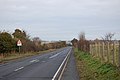
 A259 (Royal Military Road) - geograph.org.uk - 2716472.jpg 640 × 504; 61 KB
-
 A259 - geograph.org.uk - 5187514.jpg 640 × 426; 62 KB
-
 A259 - geograph.org.uk - 5830873.jpg 1,024 × 681; 261 KB
-
 A259 - geograph.org.uk - 5830880.jpg 1,024 × 693; 145 KB
-
 A259 - geograph.org.uk - 5830882.jpg 1,024 × 648; 177 KB
-
 A259 - geograph.org.uk - 5831961.jpg 778 × 1,024; 298 KB
-
 A259 enters Icklesham - geograph.org.uk - 3000359.jpg 3,648 × 2,736; 1.5 MB
-
 A259 enters Icklesham - geograph.org.uk - 3477542.jpg 3,508 × 2,617; 1.63 MB
-
 A259 enters Winchelsea - geograph.org.uk - 3000103.jpg 3,648 × 2,736; 1.94 MB
-
 A259 leaving Icklesham - geograph.org.uk - 5830991.jpg 1,024 × 681; 167 KB
-
 A259 near Winchelsea - geograph.org.uk - 6019346.jpg 1,024 × 681; 208 KB
-
 A259 north of Croft Wood - geograph.org.uk - 3001541.jpg 3,648 × 2,638; 2.64 MB
-
 A259 passes St Nicholas Church - geograph.org.uk - 3000478.jpg 3,200 × 2,549; 1.3 MB
-
 A259 passes The Lodge Motel - geograph.org.uk - 3000136.jpg 3,564 × 2,612; 1.25 MB
-
 A259 passes the Pipewell gate - geograph.org.uk - 3000124.jpg 3,648 × 2,736; 2.18 MB
-
 A259 passes The Robin Hood - geograph.org.uk - 3000777.jpg 3,648 × 2,513; 1.25 MB
-
 A259 passes Windmill Orchard Fruit Farm - geograph.org.uk - 3000150.jpg 3,533 × 2,520; 893 KB
-
 A259 south of Crutches Farm - geograph.org.uk - 3477562.jpg 3,648 × 2,736; 1.36 MB
-
 A259 south of Rye Marsh Farm - geograph.org.uk - 3000092.jpg 3,648 × 2,736; 1.86 MB
-
 A259 to Icklesham - geograph.org.uk - 4995300.jpg 4,606 × 3,454; 4.55 MB
-
 A259 to Rye - geograph.org.uk - 2716475.jpg 640 × 459; 64 KB
-
 A259 to Winchelsea - geograph.org.uk - 4990913.jpg 4,608 × 3,456; 5.16 MB
-
 A259 towards Rye - geograph.org.uk - 2216663.jpg 1,600 × 1,061; 300 KB
-
 A259, heading east, passes The Robin Hood - geograph.org.uk - 3477548.jpg 3,317 × 2,627; 904 KB
-
 A259, Icklesham - geograph.org.uk - 1852011.jpg 640 × 430; 165 KB
-
 A259, Icklesham, westward - geograph.org.uk - 1852012.jpg 640 × 430; 160 KB
-
 A259, Workhouse Lane junction - geograph.org.uk - 1852013.jpg 640 × 430; 162 KB
-
 Abandoned fields at Rye Harbour Nature Reserve - geograph.org.uk - 5375071.jpg 2,223 × 1,648; 777 KB
-
 Abandoned House - geograph.org.uk - 2339069.jpg 640 × 480; 94 KB
-
 Abandoned House - geograph.org.uk - 2339070.jpg 640 × 480; 109 KB
-
 Abandoned yard - geograph.org.uk - 4348187.jpg 1,024 × 768; 250 KB
-
 Abandoned yard - geograph.org.uk - 4348188.jpg 1,024 × 768; 214 KB
-
 Access road at Rye Harbour Nature Reserve - geograph.org.uk - 5555562.jpg 4,896 × 3,672; 7.46 MB
-
 Access Road to Little Fannel Farm - geograph.org.uk - 5555578.jpg 4,896 × 3,672; 5.54 MB
-

-

-
 Across Brede Level - geograph.org.uk - 3468673.jpg 424 × 640; 359 KB
-
 Across Brede Level - geograph.org.uk - 3470122.jpg 640 × 424; 308 KB
-
 Across Brede Level - geograph.org.uk - 3471739.jpg 640 × 424; 310 KB
-
 Across the river to Rye Harbour wharf - geograph.org.uk - 2061934.jpg 922 × 691; 201 KB
-
 Alards, Barrack Square - geograph.org.uk - 4704272.jpg 4,000 × 3,000; 4.24 MB
-
 Alexanders at Rye Harbour - geograph.org.uk - 5195794.jpg 2,073 × 1,527; 1.06 MB
-

-
 All Saints, Icklesham, churchyard (b) - geograph.org.uk - 6208837.jpg 480 × 640; 103 KB
-

-
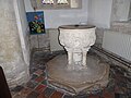 All Saints, Icklesham, font - geograph.org.uk - 6208856.jpg 640 × 480; 65 KB
-

-
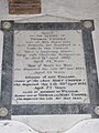 All Saints, Icklesham, memorial (1) - geograph.org.uk - 6208859.jpg 480 × 640; 61 KB
-
 All Saints, Icklesham, memorial (2) - geograph.org.uk - 6208864.jpg 640 × 480; 52 KB
-
 All Saints, Icklesham, memorial (3) - geograph.org.uk - 6208866.jpg 480 × 640; 53 KB
-
 All Saints, Icklesham, organ - geograph.org.uk - 6208854.jpg 480 × 640; 59 KB
-
 All Saints, Icklesham, pulpit - geograph.org.uk - 6208858.jpg 640 × 480; 60 KB
-

-

-
 Allotment by Back Lane - geograph.org.uk - 4514539.jpg 1,024 × 683; 361 KB
-
 An attractive house in Winchelsea - geograph.org.uk - 5438336.jpg 3,942 × 2,956; 2.98 MB
-
 An inquisitive sheep and her lamb - geograph.org.uk - 1852586.jpg 640 × 430; 165 KB
-
 Apartments on Harbour Road - geograph.org.uk - 4404217.jpg 1,440 × 1,080; 443 KB
-
 Approaching Camber Castle - geograph.org.uk - 6578313.jpg 3,513 × 2,090; 1.34 MB
-
 Approaching Camber Castle from the south - geograph.org.uk - 5344363.jpg 1,024 × 768; 234 KB
-
 Approaching hairpin, A259 - geograph.org.uk - 5830860.jpg 1,024 × 681; 228 KB
-
 Arable farming, Brede Level - geograph.org.uk - 4001881.jpg 2,814 × 2,010; 968 KB
-
 Atlas Business Park, Rye - geograph.org.uk - 2071220.jpg 870 × 653; 182 KB
-
 Back Lane - geograph.org.uk - 4708747.jpg 3,000 × 4,000; 5.8 MB
-
 Back Lane - geograph.org.uk - 5830868.jpg 1,024 × 681; 227 KB
-
 Back Lane, Winchelsea - geograph.org.uk - 4310594.jpg 1,600 × 767; 332 KB
-
 Back Lane, Winchelsea - geograph.org.uk - 6175938.jpg 480 × 640; 83 KB
-
 Bakehouse Field - geograph.org.uk - 6230292.jpg 640 × 480; 65 KB
-
 Bank House - geograph.org.uk - 3470323.jpg 640 × 424; 370 KB
-
 Bank House - geograph.org.uk - 3470347.jpg 640 × 424; 443 KB
-
 Barn by Rookery Lane - geograph.org.uk - 4514543.jpg 1,024 × 683; 306 KB
-
 Barn Meadow - geograph.org.uk - 6226574.jpg 640 × 480; 62 KB
-
 Barn on Pett Level - geograph.org.uk - 2670310.jpg 640 × 427; 33 KB
-
 Barn ^ sheepfold, Pett Level - geograph.org.uk - 5322281.jpg 640 × 426; 55 KB
-
 Barn, Castle Farm - geograph.org.uk - 1850160.jpg 640 × 430; 128 KB
-
 Barn, Castle Farm - geograph.org.uk - 1850183.jpg 640 × 430; 117 KB
-
 Barn, Float Farm - geograph.org.uk - 5426791.jpg 640 × 426; 49 KB
-
 Barn, Pett Level - geograph.org.uk - 5376173.jpg 640 × 384; 44 KB
-
 Barn, Pett Level - geograph.org.uk - 5830847.jpg 1,024 × 681; 134 KB
-
 Barn, Pett Level - geograph.org.uk - 6019352.jpg 1,024 × 681; 103 KB
-
 Barn, Pett Level - geograph.org.uk - 6525029.jpg 1,024 × 684; 148 KB
-
 Barn, Snaylham Farm - geograph.org.uk - 2581760.jpg 640 × 430; 85 KB
-
 Barns by Nook Drain - geograph.org.uk - 4348964.jpg 1,024 × 768; 200 KB
-
 Barns by Nook Drain - geograph.org.uk - 4348966.jpg 1,024 × 768; 179 KB
-
 Barns, Castle Farm - geograph.org.uk - 3022257.jpg 640 × 480; 86 KB
-
 Barrack Square - geograph.org.uk - 3471575.jpg 640 × 424; 333 KB
-
 Barrack Square, Winchelsea - geograph.org.uk - 6176125.jpg 640 × 480; 69 KB
-
 Barrels at The Queen's Head - geograph.org.uk - 2796381.jpg 640 × 480; 68 KB
-
 Beach at low tide, Rye Bay - geograph.org.uk - 3022143.jpg 640 × 480; 88 KB
-
 Beach at Rye - geograph.org.uk - 5555513.jpg 4,608 × 3,456; 1.54 MB
-
 Beach at Rye Bay - geograph.org.uk - 4050539.jpg 4,000 × 3,000; 4.32 MB
-
 Beach at Rye Harbour - geograph.org.uk - 1329566.jpg 640 × 480; 124 KB
-
 Beach at Rye Harbour - geograph.org.uk - 1329567.jpg 640 × 427; 101 KB
-
 Beach at Rye Harbour - geograph.org.uk - 2358277.jpg 1,061 × 1,600; 511 KB
-
 Beach at Rye Harbour - geograph.org.uk - 4348230.jpg 1,024 × 411; 109 KB
-
 Beach at Rye Harbour Nature Reserve - geograph.org.uk - 3939841.jpg 4,000 × 3,000; 4 MB
-
 Beach at Rye Harbour Nature Reserve - geograph.org.uk - 3942813.jpg 4,000 × 3,000; 4.23 MB
-
 Beach at Winchelsea Beach - geograph.org.uk - 3019024.jpg 640 × 320; 72 KB
-
 Beach café - geograph.org.uk - 3099684.jpg 640 × 425; 366 KB
-
 Beach Field - geograph.org.uk - 6174464.jpg 640 × 480; 79 KB
-
 Beach fishermen - geograph.org.uk - 4045484.jpg 4,912 × 3,264; 5.41 MB
-
 Beach near Pett Level Road - geograph.org.uk - 5423307.jpg 4,896 × 3,672; 5.78 MB
-
 Beach near Pett Level Road - geograph.org.uk - 5423312.jpg 4,896 × 3,672; 5.98 MB
-
 Beach Road - geograph.org.uk - 909372.jpg 479 × 640; 79 KB
-
 Beached at Rye Harbour - geograph.org.uk - 2210628.jpg 640 × 379; 204 KB
-
 Beacon and remains of St Leonard's Mill - geograph.org.uk - 4703924.jpg 4,000 × 3,000; 3.98 MB
-
 Beacon by the Harbour Entrance - geograph.org.uk - 6576658.jpg 2,943 × 1,812; 1.09 MB
-
 Beacon Hill, Winchelsea - geograph.org.uk - 4012375.jpg 2,814 × 2,010; 881 KB
-
 Beacon, River Rother - geograph.org.uk - 5644001.jpg 640 × 426; 33 KB
-
 Bee orchid in flower on Rye Harbour Nature Reserve - geograph.org.uk - 5363303.jpg 1,316 × 1,704; 311 KB
-
 Bend in Sea Rd - geograph.org.uk - 1850280.jpg 640 × 430; 127 KB
-
 Bend in the road - geograph.org.uk - 2716473.jpg 640 × 475; 60 KB
-
 Bend in The Royal Military Canal - geograph.org.uk - 1850338.jpg 640 × 430; 142 KB
-
 Bend on Wickham Rock Lane - geograph.org.uk - 3024755.jpg 640 × 480; 171 KB
-
 Bend, Royal Military Road, A259 - geograph.org.uk - 4255042.jpg 640 × 430; 79 KB
-
 Bike on the Beach - geograph.org.uk - 6576477.jpg 1,600 × 1,067; 774 KB
-
 Bird Hide, Rye Harbour Nature Reserve - geograph.org.uk - 2358251.jpg 1,600 × 1,061; 449 KB
-

-

-

-
 Black mustard at Rye Harbour Nature Reserve - geograph.org.uk - 5363237.jpg 2,205 × 1,653; 574 KB
-
 Bleaching Ground - geograph.org.uk - 6132037.jpg 640 × 480; 59 KB
-
 Bleaching Ground - geograph.org.uk - 6132044.jpg 640 × 480; 65 KB
-

-
 Boardwalk at Rye Harbour Nature Reserve - geograph.org.uk - 5555569.jpg 3,672 × 4,896; 5.24 MB
-
 Boat and tank - geograph.org.uk - 4404370.jpg 1,440 × 1,080; 408 KB
-

-

-
 Bones of a tree, Winchelsea - geograph.org.uk - 6395378.jpg 1,024 × 768; 602 KB
-
 Breakwater - geograph.org.uk - 3560139.jpg 4,214 × 2,774; 4.31 MB
-
 Breakwater at entrance to Rye Harbour - geograph.org.uk - 2358393.jpg 1,600 × 1,061; 333 KB
-

-
 Brede Level - geograph.org.uk - 3471745.jpg 640 × 424; 291 KB
-
 Brede Level - geograph.org.uk - 3471787.jpg 640 × 424; 358 KB
-
 Brede Level - geograph.org.uk - 3471793.jpg 640 × 424; 336 KB
-
 Brede Level - geograph.org.uk - 3471798.jpg 640 × 424; 292 KB
-
 Brede Level - geograph.org.uk - 3471801.jpg 640 × 424; 344 KB
-
 Brede Level - geograph.org.uk - 4001872.jpg 2,814 × 2,010; 923 KB
-
 Brede Level - geograph.org.uk - 4703893.jpg 4,000 × 3,000; 3.42 MB
-
 Brede Level - geograph.org.uk - 4703894.jpg 4,000 × 3,000; 4.04 MB
-
 Brede level - geograph.org.uk - 5422071.jpg 640 × 426; 55 KB
-
 Brede Level - geograph.org.uk - 5422088.jpg 640 × 426; 45 KB
-
 Brede Level - geograph.org.uk - 5422113.jpg 640 × 426; 43 KB
-
 Brede Level - geograph.org.uk - 5426789.jpg 640 × 426; 59 KB
-
 Brede Level, Winchelsea - geograph.org.uk - 4703952.jpg 4,000 × 3,000; 3.94 MB
-
 Brede Level, Winchelsea - geograph.org.uk - 4703953.jpg 4,000 × 3,000; 3.98 MB
-
 Brede Levels - geograph.org.uk - 1362861.jpg 640 × 424; 51 KB
-
 Brede Levels looking West - geograph.org.uk - 1362854.jpg 640 × 424; 60 KB
-
 Brede Valley from Winchelsea - geograph.org.uk - 3038758.jpg 2,816 × 2,112; 2.36 MB
-
 Bridge Field - geograph.org.uk - 6132050.jpg 640 × 480; 60 KB
-
 Bridge Field - geograph.org.uk - 6132052.jpg 640 × 479; 50 KB
-
 Bridge House, The Strand, Winchelsea - geograph.org.uk - 6173618.jpg 640 × 486; 73 KB
-
 Bridge over The Royal Military Canal - geograph.org.uk - 1850911.jpg 640 × 430; 121 KB
-
 Bridleway south of Knockbridge Farm - geograph.org.uk - 1852557.jpg 640 × 430; 161 KB
-
 Bridleway to Knockbridge Farm - geograph.org.uk - 1852567.jpg 640 × 430; 157 KB
-
 Bridleway towards Castle Farm - geograph.org.uk - 2071207.jpg 896 × 672; 185 KB
-
 British white cattle, Pannell Valley marshes - geograph.org.uk - 5290604.jpg 2,111 × 1,749; 1.65 MB
-
 Broad Street, Icklesham - geograph.org.uk - 3118514.jpg 4,320 × 3,240; 4.24 MB
-
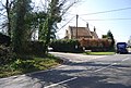
 Broad Street, junction with A259, Icklesham - geograph.org.uk - 3118516.jpg 4,320 × 3,240; 4.32 MB
-
 Broken footbridge at Roughters - geograph.org.uk - 2840755.jpg 427 × 640; 150 KB
-
 Brook Farm - geograph.org.uk - 1330234.jpg 640 × 424; 66 KB


_-_geograph.org.uk_-_2716472.jpg)


_-_geograph.org.uk_-_6208836.jpg)
_-_geograph.org.uk_-_6208837.jpg)


_-_geograph.org.uk_-_6208859.jpg)
_-_geograph.org.uk_-_6208864.jpg)
_-_geograph.org.uk_-_6208866.jpg)


_-_geograph.org.uk_-_6208852.jpg)
_-_geograph.org.uk_-_6208853.jpg)


_-_geograph.org.uk_-_5527537.jpg)
_sheep_by_the_1066_Country_Walk_-_geograph.org.uk_-_1851890.jpg)


_-_geograph.org.uk_-_5527523.jpg)


