Category:Idaho State Highway 47
Jump to navigation
Jump to search
 | number: | (fourty-seven) |
|---|---|---|
| State highways in Idaho: | 27 · 28 · 29 · 31 · 32 · 33 · 34 · 36 · 37 · 38 · 39 · 40 · 41 · 43 · 44 · 45 · 46 · 47 · 48 · 50 · 51 · 52 · 53 · 54 · 55 · 57 · 58 · 60 · 61 · 62 · 64 · 66 · 67 |
state highway in Fremont County, Idaho, United States | |||||
| Upload media | |||||
| Instance of | |||||
|---|---|---|---|---|---|
| Location | Fremont County, Idaho | ||||
| Located in or next to body of water |
| ||||
| Transport network | |||||
| Connects with | |||||
| Owned by | |||||
| Maintained by | |||||
| Length |
| ||||
| |||||
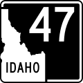
English: Media related to Idaho State Highway 47, a 12.420-mile (19.988 km) state highway in Fremont County, Idaho, United States, that connects U.S. Route 20 in Ashton with the Mesa Falls Scenic Byway (northeast of Warm River).
Subcategories
This category has only the following subcategory.
Media in category "Idaho State Highway 47"
The following 2 files are in this category, out of 2 total.
-
 Idaho 47.svg 601 × 601; 2 KB
-
 ID-47.svg 600 × 600; 31 KB
