Category:Idaho State Highway 78
Jump to navigation
Jump to search
 | number: | (seventy-eight) |
|---|---|---|
| State highways in Idaho: | 58 · 60 · 61 · 62 · 64 · 66 · 67 · 69 · 71 · 72 · 74 · 75 · 77 · 78 · 79 · 81 · 87 · 97 |
state highway in Owyhee and Elmore counties in Idaho, United States  | |||||
| Upload media | |||||
| Instance of | |||||
|---|---|---|---|---|---|
| Location |
| ||||
| Transport network | |||||
| Connects with | |||||
| Owned by | |||||
| Maintained by | |||||
| Length |
| ||||
| Terminus | |||||
| Partially coincident with | |||||
| |||||
English: Media related to Idaho State Highway 78, a 99.72-mile (160.48 km) state highway in Elmore and Owyhee counties in Idaho, United States, that roughly follows the course of the Snake River and connects Idaho State Highway 55 in Marsing with Interstate 84/U.S. Route 26/U.S. Route 30 (north of Hammett).
Subcategories
This category has only the following subcategory.
Media in category "Idaho State Highway 78"
The following 8 files are in this category, out of 8 total.
-
 Idaho 78.svg 601 × 601; 3 KB
-
 Cafe (Murphy, Idaho).jpg 6,000 × 4,000; 3.68 MB
-
 Givens Hot Springs, Idaho.jpg 6,000 × 4,000; 5.08 MB
-
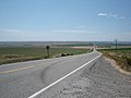 HWY 78 between Farming land Hammett Idaho - panoramio.jpg 2,304 × 1,728; 1.67 MB
-
 ID-78.svg 600 × 600; 32 KB
-
 Idaho Street (Murphy, Idaho).jpg 6,000 × 4,000; 4.92 MB
-

-
 Outpost Days (Murphy, Idaho).jpg 6,000 × 3,375; 3.45 MB
.jpg)


.jpg)
_-_NARA_-_68886311_(page_2).gif)
.jpg)