Category:Ie Island (Okinawa)
Jump to navigation
Jump to search
English: Category for Ie-jima (Ie Island) in Okinawa Prefecture, Japan
日本語: 沖縄県・伊江島に関するカテゴリ
| Object location | | View all coordinates using: OpenStreetMap |
|---|
island within Ryukyu Islands    | |||||
| Upload media | |||||
| Instance of | |||||
|---|---|---|---|---|---|
| Part of | |||||
| Location | Ie, Kunigami District, Okinawa Prefecture, Japan | ||||
| Located in or next to body of water | |||||
| Width |
| ||||
| Length |
| ||||
| Highest point |
| ||||
| Area |
| ||||
 | |||||
Subcategories
This category has the following 8 subcategories, out of 8 total.
Media in category "Ie Island (Okinawa)"
The following 17 files are in this category, out of 17 total.
-
 Danketsu-Dojo in Iejima.jpg 450 × 338; 64 KB
-
 Ie Family Materials.jpg 1,485 × 1,075; 1.59 MB
-
 Ie island - panoramio.jpg 2,336 × 3,504; 1.71 MB
-
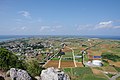 Ie Island seen from the top of Mount Gusuku 201910 01.jpg 6,000 × 4,000; 11.35 MB
-
 Ie Island seen from the top of Mount Gusuku 201910 02.jpg 6,000 × 4,000; 14.28 MB
-
 Ie Island seen from the top of Mount Gusuku 201910 03.jpg 6,000 × 4,000; 13.72 MB
-
 Ie Port.jpg 1,024 × 768; 125 KB
-
 Ie Village Agricultural Environment Inprovement Center 201910.JPG 6,000 × 4,000; 11.38 MB
-
 Iejima Airport Aerial Photograph 2018.jpg 4,468 × 3,222; 9.59 MB
-
 Iejima March 1955.jpg 600 × 400; 36 KB
-
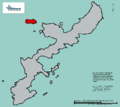 JP Okinawa Ie-jima Location.png 1,351 × 1,206; 35 KB
-
 Map of Motobu Peninsula.png 3,712 × 2,520; 1.16 MB
-
 Niiyatiya.jpg 450 × 338; 76 KB
-
 USMC-100410-M-6890P-208.jpg 3,504 × 2,336; 6.22 MB
-
 View from gusukuyama.jpg 1,024 × 768; 94 KB
-
 View from WAJI (The springwater goes out) Okinawa,JAPAN.jpg 1,600 × 1,200; 962 KB
-
 ヌチドゥタカラの家 反戦平和資料館.jpg 3,929 × 2,946; 2.5 MB


_Okinawa,JAPAN.jpg)
