Category:Igeler Mühle
Jump to navigation
Jump to search
| Object location | | View all coordinates using: OpenStreetMap |
|---|
 | |||||
| Upload media | |||||
| Instance of | |||||
|---|---|---|---|---|---|
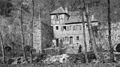
| Location | Bergisch Gladbach, Rhein-Berg District, Cologne Government Region, North Rhine-Westphalia, Germany | ||||
 | |||||
Media in category "Igeler Mühle"
The following 3 files are in this category, out of 3 total.
-
 Igeler Mühle alt.jpg 1,276 × 714; 745 KB
-
 Igeler Mühle Won.jpg 1,276 × 957; 1.17 MB
-
 Igeler Mühle.jpg 1,417 × 987; 1.4 MB

