Category:Ilchester
Jump to navigation
Jump to search
Cymraeg: Pentref hanesyddol yn ne Gwlad yr Haf, de-orllewin Lloegr, yw Ilchester. Mae'n gorwedd ar lan Afon Yeo ger yr A303, tua 14 milltir i'r de-ddwyrain o Bridgwater.
English: Ilchester is a village and civil parish, situated on the River Yeo or Ivel, five miles north of Yeovil, in the English county of Somerset. The parish, which includes the village of Sock Dennis (also known as Stock-Dennis), has a population of 2,021.
Polski: Ilchester - wieś w Anglii, w hrabstwie Somerset położona nad rzeką Yeo osiem kilometrów na północ od Yeovil. Populacja wsi liczy 1 2000 mieszkańców.
village and civil parish in Somerset, England  | |||||
| Upload media | |||||
| Instance of | |||||
|---|---|---|---|---|---|
| Location | South Somerset, Somerset, South West England, England | ||||
| Different from | |||||
| Said to be the same as | Ilchester (Wikimedia duplicated page, civil parish) | ||||
 | |||||
Subcategories
This category has the following 4 subcategories, out of 4 total.
Media in category "Ilchester"
The following 200 files are in this category, out of 220 total.
(previous page) (next page)-
 3 oak trees at Three Oaks Farm - geograph.org.uk - 5608645.jpg 1,024 × 793; 189 KB
-
 A303 - geograph.org.uk - 3023626.jpg 640 × 430; 39 KB
-
 A303 approaching A37 junction - geograph.org.uk - 3761091.jpg 1,204 × 789; 488 KB
-

-
 A303 approaching Ilchester - geograph.org.uk - 5686695.jpg 1,280 × 720; 582 KB
-

-
 A303 crosses the River Yeo - geograph.org.uk - 3847677.jpg 3,648 × 2,736; 1.22 MB
-
 A303 eastbound, 59 miles to Andover - geograph.org.uk - 3761109.jpg 1,981 × 1,266; 1.16 MB
-
 A303 heading west - geograph.org.uk - 6261129.jpg 1,024 × 684; 137 KB
-
 A303 heading west - geograph.org.uk - 6261169.jpg 1,024 × 684; 152 KB
-
 A303 heading west - geograph.org.uk - 6261287.jpg 1,024 × 684; 182 KB
-
 A303 heading west - geograph.org.uk - 6261296.jpg 1,024 × 684; 154 KB
-
 A303 Ilchester Bypass - geograph.org.uk - 3504651.jpg 640 × 480; 85 KB
-
 A303 Looking East - geograph.org.uk - 2547883.jpg 640 × 480; 164 KB
-
 A303 near Ilchester - geograph.org.uk - 5686711.jpg 1,280 × 720; 631 KB
-
 A303 north of Troutbridge Park - geograph.org.uk - 3847671.jpg 3,648 × 2,736; 1.36 MB
-
 A303 Old and New at Ilchester - geograph.org.uk - 5396446.jpg 640 × 427; 61 KB
-
 A303, A37 junction bridge - geograph.org.uk - 3761099.jpg 1,826 × 1,180; 961 KB
-
 A303, eastbound - geograph.org.uk - 4770317.jpg 640 × 377; 35 KB
-
 A303, Ilchester bypass - geograph.org.uk - 4770322.jpg 640 × 374; 38 KB
-
 A303, Ilchester bypass - geograph.org.uk - 5301476.jpg 640 × 386; 46 KB
-
 A303, Ilchester bypass - geograph.org.uk - 5301484.jpg 640 × 426; 81 KB
-
 A303, westbound - geograph.org.uk - 5301488.jpg 640 × 426; 60 KB
-
 A37 Bridge, A303 - geograph.org.uk - 3023605.jpg 640 × 430; 37 KB
-
 A37 flyover crossing A303 - geograph.org.uk - 4115700.jpg 1,600 × 1,200; 1.34 MB
-
 A37 flyover, A303 - geograph.org.uk - 4770318.jpg 640 × 345; 38 KB
-
 A37 meets A303 - geograph.org.uk - 3004012.jpg 640 × 480; 48 KB
-
 A37 meets A303 - geograph.org.uk - 3004028.jpg 640 × 462; 49 KB
-
 A37 northbound - geograph.org.uk - 3003871.jpg 640 × 456; 48 KB
-
 A37 off the A303 - geograph.org.uk - 4753918.jpg 640 × 208; 17 KB
-
 A37 turn off, A303 - geograph.org.uk - 5301486.jpg 640 × 452; 43 KB
-
 A37 turning, A303 - geograph.org.uk - 3023602.jpg 640 × 377; 26 KB
-
 A37 west bound - geograph.org.uk - 3003965.jpg 640 × 412; 60 KB
-
 A37 westbound - geograph.org.uk - 3004007.jpg 640 × 480; 58 KB
-
 Advance warning for the turn-off for Ilchester - geograph.org.uk - 4115690.jpg 1,600 × 1,200; 1.28 MB
-
 An Ilchester Farm - geograph.org.uk - 2204551.jpg 3,648 × 2,736; 2.26 MB
-
 Approaching A372 junction on A303 - geograph.org.uk - 3761187.jpg 1,667 × 1,031; 907 KB
-
 Approaching the A37 turning, A303 - geograph.org.uk - 3023597.jpg 640 × 415; 29 KB
-
 B3151 bridge over A303 - geograph.org.uk - 2903968.jpg 800 × 533; 256 KB
-
 B3151 bridge, A303 - geograph.org.uk - 5301480.jpg 640 × 490; 56 KB
-
 Bare wet field in Yeo Valley - geograph.org.uk - 5608109.jpg 1,024 × 768; 194 KB
-
 Bearley Brook - geograph.org.uk - 5396436.jpg 640 × 427; 83 KB
-
 Bend in the River Yeo near Ilchester - geograph.org.uk - 5608219.jpg 1,024 × 768; 192 KB
-
 Blocking the gate - geograph.org.uk - 6180628.jpg 4,320 × 3,240; 4.43 MB
-
 Bondhip Hill Bridge, A303 - geograph.org.uk - 3023608.jpg 640 × 430; 38 KB
-
 Boundary of Ilchester - geograph.org.uk - 1412173.jpg 640 × 480; 235 KB
-
 Bridge over the A303, near Ilchester - geograph.org.uk - 5608111.jpg 1,024 × 768; 258 KB
-
 Buildings in High Street, Ilchester - geograph.org.uk - 2760831.jpg 800 × 600; 105 KB
-
 Bus stop outside Northover Church - geograph.org.uk - 3692507.jpg 640 × 480; 94 KB
-
 Cattle by the A303 - geograph.org.uk - 5366855.jpg 640 × 425; 38 KB
-
 Cattle near Pill Bridge - geograph.org.uk - 1914392.jpg 640 × 480; 117 KB
-
 Church Street Ilchester - geograph.org.uk - 1412160.jpg 640 × 480; 166 KB
-
 Church Street, Ilchester - geograph.org.uk - 3659703.jpg 640 × 539; 109 KB
-
 Colour-washed cottages, High Street, Ilchester - geograph.org.uk - 5047884.jpg 2,043 × 1,953; 1.75 MB
-

-
 Cottage on Church Street - geograph.org.uk - 5607966.jpg 1,024 × 813; 173 KB
-
 Cottages, Church Rd, Ilchester - geograph.org.uk - 2401904.jpg 4,000 × 3,000; 1.43 MB
-
 Cottages, Ilchester Mead - geograph.org.uk - 875981.jpg 640 × 442; 92 KB
-
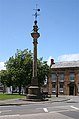
 Damaged Market Cross, Ilchester - geograph.org.uk - 5551465.jpg 1,280 × 720; 1.21 MB
-
 Damaged Market Cross, Ilchester - geograph.org.uk - 5551469.jpg 1,280 × 720; 1.27 MB
-
 Damaged Market Cross, Ilchester - geograph.org.uk - 5551470.jpg 1,280 × 720; 1.27 MB
-
 Damaged Market Cross, Ilchester - geograph.org.uk - 5551473.jpg 1,280 × 720; 1.15 MB
-
 Datestone seen in Church Street - geograph.org.uk - 3694569.jpg 640 × 480; 139 KB
-
 Ditch at the side of the A303 - geograph.org.uk - 5396438.jpg 640 × 427; 61 KB
-
 Drain cover, Ilchester - geograph.org.uk - 3659700.jpg 640 × 431; 138 KB
-
 Eastern Approach to Pill Bridge - geograph.org.uk - 5643156.jpg 640 × 427; 222 KB
-
 Entering Ilchester from the south - geograph.org.uk - 6257925.jpg 1,600 × 900; 580 KB
-
 Entrance, gas power infrastructure - geograph.org.uk - 5607987.jpg 1,024 × 768; 254 KB
-
 Estate field protected by dykes - geograph.org.uk - 5608223.jpg 1,024 × 764; 240 KB
-
 Farm gateway in Yeo valley - geograph.org.uk - 5607990.jpg 1,024 × 768; 263 KB
-
 Field by the A303 - geograph.org.uk - 5301479.jpg 640 × 426; 23 KB
-
 Fields on Pill Bridge Lane - geograph.org.uk - 5643485.jpg 640 × 427; 232 KB
-
 Flooding at Ilchester Sportsfield - geograph.org.uk - 3082848.jpg 640 × 480; 69 KB
-
 Flush Bracket, Ilchester - geograph.org.uk - 3659697.jpg 640 × 640; 220 KB
-

-
 Former Church of St Andrew, Northover - geograph.org.uk - 5358521.jpg 1,024 × 767; 228 KB
-
 Former Wesleyan chapel - Ilchester - geograph.org.uk - 1232672.jpg 640 × 480; 77 KB
-
 Free St, Ilchester - geograph.org.uk - 2401895.jpg 4,000 × 3,000; 1.79 MB
-
 Gas Plant - geograph.org.uk - 5643199.jpg 640 × 427; 174 KB
-
 Gas Works - geograph.org.uk - 214862.jpg 640 × 480; 53 KB
-
 Hainbury Farm - geograph.org.uk - 5728597.jpg 1,024 × 790; 174 KB
-
 High Street Ilchester - geograph.org.uk - 1231755.jpg 640 × 480; 67 KB
-
 High Street Ilchester - geograph.org.uk - 1232698.jpg 640 × 480; 61 KB
-
 High street, Ilchester - geograph.org.uk - 4302058.jpg 640 × 436; 79 KB
-
 High Street, Ilchester - geograph.org.uk - 5047899.jpg 2,239 × 1,956; 1.85 MB
-
 High Street, Ilchester - geograph.org.uk - 5607968.jpg 1,024 × 802; 149 KB
-
 Ilchester - geograph.org.uk - 1506884.jpg 640 × 421; 60 KB
-
 Ilchester Bridge - geograph.org.uk - 431597.jpg 640 × 480; 137 KB
-
 Ilchester Bridge.jpg 640 × 480; 115 KB
-
 Ilchester buildings (10) (geograph 7512220).jpg 4,320 × 3,240; 6.31 MB
-
 Ilchester buildings (11) (geograph 7512942).jpg 3,188 × 4,251; 2.82 MB
-
 Ilchester buildings (12) (geograph 7512962).jpg 3,152 × 4,203; 3.09 MB
-
 Ilchester buildings (7) (geograph 7511475).jpg 4,193 × 3,145; 3 MB
-
 Ilchester buildings (8) (geograph 7512154).jpg 4,118 × 3,166; 5.6 MB
-
 Ilchester buildings (9) (geograph 7512156).jpg 3,240 × 4,320; 4.61 MB
-
 Ilchester features (2) (geograph 7511449).jpg 3,932 × 2,950; 2.76 MB
-
 Ilchester features (7) (geograph 7511462).jpg 4,290 × 3,218; 4.17 MB
-
 Ilchester houses (10) (geograph 7511466).jpg 2,944 × 3,926; 2.7 MB
-
 Ilchester houses (11) (geograph 7511467).jpg 3,171 × 4,228; 3 MB
-
 Ilchester houses (12) (geograph 7511468).jpg 4,232 × 3,174; 2.8 MB
-
 Ilchester houses (13) (geograph 7512229).jpg 3,112 × 4,148; 2.35 MB
-
 Ilchester houses (14) (geograph 7512233).jpg 4,046 × 3,034; 2.56 MB
-
 Ilchester houses (15) (geograph 7512235).jpg 4,318 × 2,429; 4.29 MB
-
 Ilchester houses (16) (geograph 7512236).jpg 3,104 × 4,139; 2.52 MB
-
 Ilchester houses (17) (geograph 7512240).jpg 3,790 × 2,842; 2.93 MB
-
 Ilchester houses (18) (geograph 7512244).jpg 3,121 × 3,121; 4.18 MB
-
 Ilchester houses (19) (geograph 7512251).jpg 4,320 × 3,240; 4.79 MB
-
 Ilchester houses (20) (geograph 7512939).jpg 4,261 × 3,196; 2.57 MB
-
 Ilchester houses (21) (geograph 7512941).jpg 3,940 × 2,955; 3.13 MB
-
 Ilchester houses (4) (geograph 7510453).jpg 4,320 × 3,240; 4.68 MB
-
 Ilchester houses (5) (geograph 7510470).jpg 4,075 × 3,057; 3.19 MB
-
 Ilchester houses (6) (geograph 7510474).jpg 4,094 × 3,071; 3.16 MB
-
 Ilchester houses (7) (geograph 7511435).jpg 4,291 × 2,414; 2.28 MB
-
 Ilchester houses (8) (geograph 7511439).jpg 4,205 × 2,365; 2.43 MB
-
 Ilchester houses (9) (geograph 7511446).jpg 4,022 × 3,017; 4.26 MB
-
 Ilchester Mead , Houses ^ Fence - geograph.org.uk - 3127056.jpg 4,288 × 2,848; 5.35 MB
-
 Ilchester, Almshouse Lane - geograph.org.uk - 3018184.jpg 640 × 427; 357 KB
-
 Ilchester, Back Lane - geograph.org.uk - 3018048.jpg 640 × 427; 405 KB
-
 Ilchester, below Ilchester Bridge - geograph.org.uk - 3018084.jpg 640 × 427; 466 KB
-
 Ilchester, by the Yeo - geograph.org.uk - 3018042.jpg 640 × 427; 422 KB
-
 Ilchester, Capazzolis Restaurant - geograph.org.uk - 3018073.jpg 640 × 427; 379 KB
-
 Ilchester, Church Street - geograph.org.uk - 3018066.jpg 640 × 423; 344 KB
-
 Ilchester, Church Street - geograph.org.uk - 3018187.jpg 640 × 427; 375 KB
-
 Ilchester, Darlington House - geograph.org.uk - 3018140.jpg 640 × 418; 346 KB
-

-
 Ilchester, Georgian house in High Street - geograph.org.uk - 3018051.jpg 640 × 427; 379 KB
-
 Ilchester, High Street - geograph.org.uk - 3018067.jpg 640 × 427; 361 KB
-
 Ilchester, High Street - geograph.org.uk - 3018173.jpg 640 × 427; 360 KB
-
 Ilchester, Ilchester Arms - geograph.org.uk - 3018063.jpg 640 × 417; 382 KB
-

-
 Ilchester, Manor House - geograph.org.uk - 3018180.jpg 429 × 640; 348 KB
-
 Ilchester, Market Cross - geograph.org.uk - 3018079.jpg 424 × 640; 325 KB
-
 Ilchester, Market Square - geograph.org.uk - 3018164.jpg 640 × 427; 394 KB
-
 Ilchester, Northover - geograph.org.uk - 3018087.jpg 640 × 413; 266 KB
-

-
 Ilchester, river Yeo - geograph.org.uk - 3018098.jpg 640 × 427; 468 KB
-
 Ilchester, river Yeo - geograph.org.uk - 3018162.jpg 640 × 427; 398 KB
-
 Ilchester, stile by Vicarage Farm - geograph.org.uk - 3018147.jpg 640 × 427; 456 KB
-
 Ilchester, The Bull Inn - geograph.org.uk - 3047961.jpg 640 × 427; 176 KB
-
 Ilchester, The Dolphin Inn - geograph.org.uk - 3018168.jpg 640 × 432; 360 KB
-
 Ilchester, the Fosse Way - geograph.org.uk - 3047975.jpg 640 × 427; 161 KB
-
 Ilchester, The Market Cross - geograph.org.uk - 431687.jpg 640 × 480; 103 KB
-
 Ilchester, the Yeo - geograph.org.uk - 3018045.jpg 640 × 427; 414 KB
-
 Ilchester, the Yeo at Ilchester Bridge - geograph.org.uk - 3018157.jpg 640 × 427; 463 KB
-
 Ilchester, towards the Yeo - geograph.org.uk - 3018034.jpg 640 × 427; 499 KB
-
 Ilchester- towards the Post Office (geograph 3018059).jpg 640 × 430; 401 KB
-
 Ilchester. Situation.gif 140 × 225; 4 KB
-
 Ilchester.jpg 640 × 417; 80 KB
-
 Junction on the A303 - geograph.org.uk - 5608114.jpg 1,024 × 768; 151 KB
-
 Market Place Ilchester - geograph.org.uk - 1232690.jpg 640 × 480; 85 KB
-
 Milestone - Ilchester - geograph.org.uk - 1231783.jpg 480 × 640; 127 KB
-
 Milestone, Ilchester - geograph.org.uk - 3684047.jpg 525 × 640; 173 KB
-
 Monarch's Way - geograph.org.uk - 5799290.jpg 1,024 × 768; 207 KB
-
 Northover Churchyard (A) - geograph.org.uk - 3692508.jpg 640 × 480; 106 KB
-
 Northover Churchyard (B) - geograph.org.uk - 3692511.jpg 640 × 480; 136 KB
-
 Northover Manor - geograph.org.uk - 1412991.jpg 640 × 480; 142 KB
-

-
 Ordnance Survey Flush Bracket 10816 - geograph.org.uk - 3929917.jpg 4,000 × 3,000; 4.3 MB
-
 Outbuildings at Hainbury Farm - geograph.org.uk - 5728600.jpg 1,024 × 786; 147 KB
-
 Over the new road - geograph.org.uk - 6180621.jpg 4,320 × 3,240; 3.8 MB
-
 Over the stile - geograph.org.uk - 6180625.jpg 3,240 × 4,320; 3.22 MB
-
 Parish church (8) (geograph 7512954).jpg 4,320 × 3,240; 4.4 MB
-
 Pedestrian overbridge on the A37, near Ilchester - geograph.org.uk - 5358530.jpg 1,024 × 823; 180 KB
-
 Pill Bridge - geograph.org.uk - 5643178.jpg 640 × 427; 209 KB
-
 Pill Bridge Lane - geograph.org.uk - 5607981.jpg 1,024 × 768; 247 KB
-
 Pill Bridge Lane - geograph.org.uk - 5643495.jpg 640 × 427; 260 KB
-
 Pill Bridge Lane Bridge, A303 - geograph.org.uk - 3023606.jpg 640 × 430; 38 KB
-
 Postbox and phonebox, Northover - geograph.org.uk - 4302114.jpg 640 × 385; 103 KB
-
 Postbox, Ilchester - geograph.org.uk - 4302060.jpg 640 × 455; 119 KB
-
 River Yeo (Ivel) near Ilchester - geograph.org.uk - 1914384.jpg 640 × 480; 136 KB
-
 River Yeo - geograph.org.uk - 214866.jpg 640 × 480; 53 KB
-
 River Yeo in Ilchester.jpg 640 × 480; 131 KB
-
 River Yeo near Ilchester - geograph.org.uk - 5608221.jpg 1,024 × 768; 205 KB
-
 Road to Three Oaks Farm - geograph.org.uk - 5608225.jpg 1,024 × 768; 162 KB
-
 Roundabout at Northover - geograph.org.uk - 5358523.jpg 1,024 × 749; 182 KB
-
 Sign, Ilchester - geograph.org.uk - 6250557.jpg 1,200 × 1,600; 254 KB
-
 Skate park, Ilchester - geograph.org.uk - 2479499.jpg 640 × 480; 61 KB
-
 Sock Dennis Farm.jpg 640 × 393; 60 KB
-
 South Somerset , Grassy Field - geograph.org.uk - 3127060.jpg 4,288 × 2,848; 4.87 MB
-
 South Somerset , The A303 - geograph.org.uk - 3104410.jpg 4,288 × 2,848; 5.03 MB
-
 South Somerset , The A303 - geograph.org.uk - 3127051.jpg 4,288 × 2,848; 4.71 MB
-
 South Somerset , The A303 - geograph.org.uk - 3127053.jpg 4,288 × 2,848; 6.18 MB
-
 South Somerset , The A303 ^ Road Bridge - geograph.org.uk - 3104404.jpg 4,288 × 2,848; 5 MB
-
 Sports field (1) - geograph.org.uk - 6180613.jpg 4,177 × 3,133; 2.07 MB
-
 Sports field (2) - geograph.org.uk - 6180615.jpg 4,320 × 3,240; 2.98 MB
-
 Sports field (3) (geograph 6180617).jpg 4,320 × 3,240; 2.57 MB
-
 Thatched house - Northover - geograph.org.uk - 1233101.jpg 640 × 434; 91 KB
-
 The A303, near Ilchester - geograph.org.uk - 5358518.jpg 1,024 × 766; 174 KB
-
 The Bull Inn, Ilchester - geograph.org.uk - 5608216.jpg 1,024 × 811; 200 KB
-
 The Dolphin Inn, Ilchester - geograph.org.uk - 5608214.jpg 1,024 × 779; 161 KB
-
 The Fosse Way , The Old A303 - geograph.org.uk - 5396428.jpg 640 × 427; 66 KB
-
 The Ilchester Arms - geograph.org.uk - 5608660.jpg 1,024 × 809; 154 KB
-
 The Market Cross, Ilchester - geograph.org.uk - 1459823.jpg 480 × 640; 57 KB
-
 The Old School House, Ilchester - geograph.org.uk - 5607977.jpg 1,024 × 768; 235 KB
-
 The pharmacy - Ilchester - geograph.org.uk - 1232708.jpg 640 × 480; 93 KB
-
 The Three Oaks of Three Oak Farm - geograph.org.uk - 5636749.jpg 640 × 433; 192 KB
-
 The Yeo at Northover, Ilchester - geograph.org.uk - 2398248.jpg 3,296 × 2,472; 1.92 MB
-
 Three Oaks Farm - geograph.org.uk - 2113321.jpg 640 × 480; 134 KB
-
 Town Square, Ilchester - geograph.org.uk - 5358525.jpg 1,024 × 806; 166 KB
-
 War memorial (geograph 7512956).jpg 2,920 × 3,893; 3.1 MB


,_Pill_Bridge_-_geograph.org.uk_-_1914424.jpg)


_(geograph_7512220).jpg)
_(geograph_7512942).jpg)
_(geograph_7512962).jpg)
_(geograph_7511475).jpg)
_(geograph_7512154).jpg)
_(geograph_7512156).jpg)
_(geograph_7511449).jpg)
_(geograph_7511462).jpg)
_(geograph_7511466).jpg)
_(geograph_7511467).jpg)
_(geograph_7511468).jpg)
_(geograph_7512229).jpg)
_(geograph_7512233).jpg)
_(geograph_7512235).jpg)
_(geograph_7512236).jpg)
_(geograph_7512240).jpg)
_(geograph_7512244).jpg)
_(geograph_7512251).jpg)
_(geograph_7512939).jpg)
_(geograph_7512941).jpg)
_(geograph_7510453).jpg)
_(geograph_7510470).jpg)
_(geograph_7510474).jpg)
_(geograph_7511435).jpg)
_(geograph_7511439).jpg)
_(geograph_7511446).jpg)


.jpg)


_-_geograph.org.uk_-_3692508.jpg)
_-_geograph.org.uk_-_3692511.jpg)


_(geograph_7512954).jpg)


_near_Ilchester_-_geograph.org.uk_-_1914384.jpg)


_-_geograph.org.uk_-_6180613.jpg)
_-_geograph.org.uk_-_6180615.jpg)
_(geograph_6180617).jpg)


.jpg)