Category:Ilhéu das Rolas
Jump to navigation
Jump to search
| Object location | | View all coordinates using: OpenStreetMap |
|---|
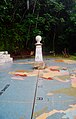
island  L'equador marcat amb unes creus a Ilhéu das Rolas, a São Tomé i Príncipe.  | |||||
| Upload media | |||||
| Instance of | |||||
|---|---|---|---|---|---|
| Location | Caué, São Tomé and Príncipe | ||||
| Located in or next to body of water | |||||
| Population |
| ||||
| Area |
| ||||
| Elevation above sea level |
| ||||
 | |||||
Subcategories
This category has the following 2 subcategories, out of 2 total.
E
R
- Resort Pestana Equador (13 F)
Media in category "Ilhéu das Rolas"
The following 68 files are in this category, out of 68 total.
-
 2011-SaoTome-36 (8084198701).jpg 3,869 × 1,935; 4.79 MB
-
 Arbre à feuilles rouges sur l'îlot de Rolas (São Tomé).jpg 3,648 × 5,472; 8.09 MB
-
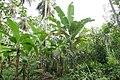 Bananiers et hibiscus sur l'îlot de Rolas (São Tomé) (1).jpg 5,472 × 3,648; 7.2 MB
-
 Bananiers et hibiscus sur l'îlot de Rolas (São Tomé) (2).jpg 3,648 × 5,472; 7.1 MB
-
 Cafés du Brésil et de São Tomé.jpg 3,648 × 5,472; 5.26 MB
-
 Cais (4238092395).jpg 1,840 × 1,232; 932 KB
-
 Corossol sur l'île de Rolas (São Tomé).jpg 3,648 × 5,472; 4.93 MB
-
 Crabes de Rolas (São Tomé) (1).jpg 4,320 × 3,240; 3.83 MB
-
 Crabes de Rolas (São Tomé) (2).jpg 4,320 × 3,240; 4.28 MB
-
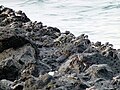 Crabes de Rolas (São Tomé) (3).jpg 4,320 × 3,240; 4.02 MB
-
 Embarcadère de l'îlot de Rolas (São Tomé) (1).jpg 5,472 × 3,648; 3.21 MB
-
 Embarcadère de l'îlot de Rolas (São Tomé) (2).jpg 5,472 × 3,648; 4.72 MB
-
 Embarcadère de l'îlot de Rolas (São Tomé) (3).jpg 5,472 × 3,648; 2.95 MB
-
 Embarcadère de l'îlot de Rolas (São Tomé) (4).jpg 5,472 × 3,648; 5.33 MB
-
 Embarcadère de l'îlot de Rolas (São Tomé) (5).jpg 5,472 × 3,648; 7.45 MB
-
 Embarcadère de l'îlot de Rolas (São Tomé) (6).jpg 5,472 × 3,648; 10.01 MB
-
 Fromager au milieu des cocotiers sur l'île de Rolas (São Tomé).jpg 3,648 × 5,472; 6.13 MB
-
 Fromager sur l'île de Rolas (São Tomé) (1).jpg 3,648 × 5,472; 8.54 MB
-
 Fromager sur l'île de Rolas (São Tomé) (2).jpg 3,648 × 5,472; 8.89 MB
-
 Fruit de l'arbre à pain sur l'île de Rolas (São Tomé).jpg 3,648 × 5,472; 4.16 MB
-
 Ilheu das Rolas (4056240841).jpg 1,840 × 1,232; 671 KB
-
 Ilheu das Rolas (4056981634).jpg 1,840 × 1,232; 621 KB
-
 Ilhéu das Rolas depuis la plage de Porto Alegre (SãoTomé) (1).jpg 5,472 × 3,648; 4.86 MB
-
 Ilhéu das Rolas depuis la plage de Porto Alegre (SãoTomé) (2).jpg 5,472 × 3,648; 3.89 MB
-
 Ilhéu das Rolas depuis la plage de Porto Alegre (SãoTomé) (3).jpg 5,472 × 3,648; 2.79 MB
-
 Ilhéu das Rolas vu depuis le N'Guembu Beach Resort (São Tomé) (1).jpg 5,472 × 3,648; 3.89 MB
-
 Ilhéu das Rolas vu depuis le N'Guembu Beach Resort (São Tomé) (2).jpg 5,472 × 3,648; 3.57 MB
-
 Ilhéu das Rolas vu depuis le N'Guembu Beach Resort (São Tomé) (3).jpg 5,472 × 3,648; 4.31 MB
-
 Ilhéu das Rolas vu depuis le N'Guembu Beach Resort (São Tomé) (4).JPG 5,472 × 3,648; 9.02 MB
-
 Maison sur pilotis sur l'îlot de Rolas (São Tomé).jpg 5,472 × 3,648; 7.35 MB
-
 Maisons sur l'îlot de Rolas (São Tomé).jpg 5,472 × 3,648; 9.72 MB
-
 Mimosa pudica à São Tomé (7).jpg 5,472 × 3,648; 5.13 MB
-
 Plage sur l'îlot de Rolas (São Tomé) (1).jpg 5,472 × 3,648; 7.01 MB
-
 Plage sur l'îlot de Rolas (São Tomé) (2).jpg 5,472 × 3,648; 4.86 MB
-
 Plage à Rolas (São Tomé).jpg 4,320 × 3,240; 3.92 MB
-
 Roches basaltiques sur l'île de Rolas (São Tomé) (1).jpg 5,472 × 3,648; 10.42 MB
-
 Roches basaltiques sur l'île de Rolas (São Tomé) (2).jpg 5,472 × 3,648; 10.61 MB
-
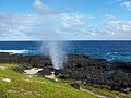 Rolas Furnas Geysir Sao Tome e Principe.jpg 2,304 × 1,728; 1.29 MB
-
 Ruche sauvage sur l'îlot de Rolas (São Tomé) (1).jpg 3,648 × 5,472; 5.56 MB
-
 Ruche sauvage sur l'îlot de Rolas (São Tomé) (2).jpg 3,648 × 5,472; 5.83 MB
-
 Ruche sauvage sur l'îlot de Rolas (São Tomé) (3).jpg 4,320 × 3,240; 3.56 MB
-
 S. Tomé 1 017 (2269888320).jpg 768 × 1,024; 254 KB
-
 S. Tomé 1 023 (2269889386).jpg 1,024 × 768; 295 KB
-
 S. Tomé 1 132 (2269885166).jpg 1,024 × 768; 172 KB
-
 S. Tomé 2 021 (2269886032).jpg 1,024 × 768; 176 KB
-
 S. Tomé 2 105 (2269100115).jpg 1,024 × 768; 190 KB
-
 Sao Tome Ilheu das Rolas 1 (16061564730).jpg 4,000 × 3,000; 2.26 MB
-
 Sao Tome Ilheu das Rolas 2 (16248950665).jpg 4,000 × 3,000; 2.24 MB
-
 Sao-tome-u-principe-karte-politisch-sao-tome.png 624 × 255; 56 KB
-
 Saotome-Belle-20 (8083822644).jpg 3,008 × 2,000; 3.27 MB
-
 Saotome-Belle-21 (8083818454).jpg 3,008 × 2,000; 3.7 MB
-
 Saotome-Belle-23 (8083813800).jpg 2,900 × 1,929; 3.88 MB
-
 Saotome-Belle-24 (8083813699).jpg 3,008 × 2,000; 5.06 MB
-
 Saotome-Belle-25 (8083802382).jpg 2,924 × 1,943; 3.74 MB
-
 Saotome-Belle-27 (8083797818).jpg 3,008 × 2,000; 4.04 MB
-
 Saotome-Belle-32 (8083786580).jpg 2,000 × 3,008; 4.44 MB
-
 Saotome-Belle-37 (8083778032).jpg 3,008 × 2,000; 4.81 MB
-
 Sol jonché de noix de coco sur l'îlot de Rolas (São Tomé) (1).jpg 5,472 × 3,648; 5.17 MB
-
 Sol jonché de noix de coco sur l'îlot de Rolas (São Tomé) (2).jpg 5,472 × 3,648; 8.08 MB
-
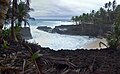 São Tomé - Ilhéu das Rolas - Depois da Tempestade.jpg 1,024 × 635; 408 KB
-
 São Tomé - Ilhéu das Rolas - Praia de Santo António (3).jpg 1,024 × 768; 412 KB
-
 São Tomé - Ilhéu das Rolas - spiaggia.jpg 3,862 × 2,578; 2.38 MB
-
 São Tomé - Ilhéu das Rolas HDR.jpg 1,024 × 356; 200 KB
-
 São Tomé - Ilhéu das Rolas Linha do Equador.jpg 2,386 × 3,744; 2.6 MB
-
 São Tomé - Ilhéu das Rolas.jpg 3,868 × 2,586; 3.75 MB
-
 São Tomé - Praia Café 2.jpg 1,024 × 768; 176 KB
-
 São Tomé - Praia Café.jpg 1,024 × 768; 164 KB
-
 Vente d'artisanat sur l'îlot de Rolas (São Tomé).jpg 5,472 × 3,648; 4.43 MB
.jpg)
.jpg)
_(1).jpg)
_(2).jpg)

.jpg)
.jpg)
_(1).jpg)
_(2).jpg)
_(3).jpg)
_(1).jpg)
_(2).jpg)
_(3).jpg)
_(4).jpg)
_(5).jpg)
_(6).jpg)
.jpg)
_(1).jpg)
_(2).jpg)
.jpg)
.jpg)
.jpg)
_(1).jpg)
_(2).jpg)
_(3).jpg)
_(1).jpg)
_(2).jpg)
_(3).jpg)
_(4).JPG)
.jpg)
.jpg)
.jpg)
_(1).jpg)
_(2).jpg)
.jpg)
_(1).jpg)
_(2).jpg)

_(1).jpg)
_(2).jpg)
_(3).jpg)
.jpg)
.jpg)
.jpg)
.jpg)
.jpg)
.jpg)
.jpg)
.jpg)
.jpg)
.jpg)
.jpg)
.jpg)
.jpg)
.jpg)
.jpg)
_(1).jpg)
_(2).jpg)

.jpg)


.jpg)