Category:Illyrians
Jump to navigation
Jump to search
ancient Western Balkanic tribes  | |||||
| Upload media | |||||
| Instance of | |||||
|---|---|---|---|---|---|
| Subclass of |
| ||||
| |||||
Subcategories
This category has the following 17 subcategories, out of 17 total.
A
- Alb-Salem culture (1 F)
C
G
- Glaucias of Taulantii (5 F)
- Great Illyrian Revolt (5 F)
I
J
- Japodes (10 F)
K
- Kingdom of Dardania (59 F)
L
- Liburnians (8 F)
M
- Maps of Illyrian tribes (31 F)
- Monunius of Taulanti (3 F)
R
W
Media in category "Illyrians"
The following 61 files are in this category, out of 61 total.
-
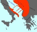
 Adriatic Coast 201 BC 3rd century (English).svg 1,600 × 1,600; 8.65 MB
-
 Adriatic Coast 201 BC 3rd century (Portuguese).svg 1,600 × 1,600; 8.64 MB
-
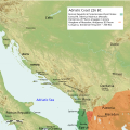
 Adriatic Coast 210 BC 3rd century (English).svg 1,600 × 1,600; 8.65 MB
-
 Adriatic Coast 210 BC 3rd century (Portuguese).svg 1,600 × 1,600; 8.65 MB
-
 Adriatic Coast 220 BC 3rd century (English).svg 1,600 × 1,600; 8.66 MB
-
 Adriatic Coast 220 BC 3rd century (Portuguese).svg 1,600 × 1,600; 8.66 MB
-
 Adriatic Coast 226 BC 3rd century (English).svg 1,600 × 1,600; 8.66 MB
-
 Adriatic Coast 228 BC 3rd century (English).svg 1,600 × 1,600; 8.7 MB
-
 Adriatic Coast 230 BC 3rd century (English).svg 1,600 × 1,600; 8.68 MB
-
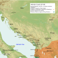 Adriatic Coast 237 BC 3rd century (English).svg 1,600 × 1,600; 8.64 MB
-
 Adriatic Coast 240 BC 3rd century (English).svg 1,600 × 1,600; 8.65 MB
-
 Chromolithographie replica of belt belonging to the Hallstatt culture.jpg 3,000 × 752; 917 KB
-
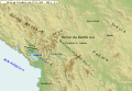
 Dardanian Kingdom (English).svg 837 × 582; 1.62 MB
-
 Dardanian Kingdom (late 3rd century BC).png 3,190 × 3,086; 4.85 MB
-
 Dardanian Kingdom (Portuguese).svg 837 × 582; 1.62 MB
-
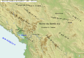
 Dardanian Kingdom under Bardyllis I (English).svg 837 × 582; 1.62 MB
-
 Dardanian Kingdom under Bardyllis I (Portuguese).svg 837 × 582; 1.62 MB
-
 Dardanian Kingdom under Bardyllis II (English).svg 837 × 582; 1.62 MB
-
 Dardanian Kingdom under Bardyllis II (Portuguese).svg 837 × 582; 1.62 MB
-
 Dardanian Kingdom under Bato (English).svg 837 × 582; 1.62 MB
-
 Dardanian Kingdom under Bato (Portuguese).svg 837 × 582; 1.62 MB
-
 Dardanian Kingdom under Cleitus (English).svg 837 × 582; 1.62 MB
-
 Dardanian Kingdom under Cleitus (Portuguese).svg 837 × 582; 1.62 MB
-
 Dardanian Kingdom under Longarus (English).svg 837 × 582; 1.62 MB
-
 Dardanian Kingdom under Longarus (Portuguese).svg 837 × 582; 1.62 MB
-
 Dardanian Kingdom under Monunius I (English).svg 837 × 582; 1.62 MB
-
 Dardanian Kingdom under Monunius I (Portuguese).svg 837 × 582; 1.62 MB
-
 Dardanian Kingdom under Monunius II (English).svg 837 × 582; 1.62 MB
-
 Dardanian Kingdom under Monunius II (Portuguese).svg 837 × 582; 1.62 MB
-
 Dardanian Kingdom under Mytilus (English).svg 837 × 582; 1.63 MB
-
 Dardanian Kingdom under Mytilus (Portuguese).svg 837 × 582; 1.62 MB
-
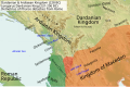 Illyria and Dardania Kingdoms (228 BC) (English).svg 1,037 × 686; 2.1 MB
-
 Illyria and Dardania Kingdoms (228 BC) (Portuguese).svg 1,037 × 686; 2.1 MB
-
 Illyria and Dardania Kingdoms (230 BC) (English).svg 1,037 × 686; 2.08 MB
-
 Illyria and Dardania Kingdoms (230 BC) (Portuguese).svg 1,037 × 686; 2.08 MB
-
 Illyrian colonies in Italy 550 BC (Portuguese) (simple map).svg 675 × 579; 255 KB
-
 Illyrians in the 1st-2nd centuries CE.png 4,613 × 4,196; 8.19 MB
-
 Illyrians in the 7th-4th centuries BC.png 3,129 × 2,713; 4.16 MB
-
 Illyrischer Grenzstein FRANCONIA AUSTRIA 1808, Steuerberg, Kärnten, Österreich.jpg 3,249 × 2,818; 4.99 MB
-
 Indo Europeans Vojvodina map-sr.png 983 × 923; 78 KB
-
 Indo Europeans Vojvodina map.png 983 × 923; 84 KB
-
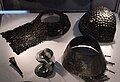 Japodske kape i druga materijalna kultura.jpg 1,600 × 1,095; 228 KB
-
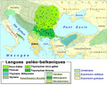 LangThraco-Illyri.png 636 × 509; 88 KB
-
 Map of ancient Epirus and environs (Deutsch).svg 1,422 × 1,614; 1.76 MB
-
 Map of ancient Epirus and environs (English) alternate contrast.svg 1,278 × 1,470; 6.06 MB
-
 Map of ancient Epirus and environs (English).svg 1,303 × 1,500; 495 KB
-
 Map of ancient Epirus and environs (Español).svg 1,303 × 1,500; 5.44 MB
-
 Map of ancient Epirus and environs (Français).svg 1,303 × 1,500; 381 KB
-
 Map of ancient Epirus and environs (Italiano).svg 1,303 × 1,500; 383 KB
-
 Map of ancient Epirus and environs (Português).svg 1,303 × 1,500; 379 KB
-
 Map of ancient Epirus and environs (Pусский).svg 1,303 × 1,500; 378 KB
-
 Map of ancient Epirus and environs (Shqipe).svg 1,303 × 1,500; 380 KB
-
 Map of ancient Epirus and environs (Български).svg 1,303 × 1,500; 378 KB
-
 Map of ancient Epirus and environs (Македонски).svg 1,303 × 1,500; 378 KB
-
 Map of ancient Epirus and environs (Српски-srpski).svg 1,303 × 1,500; 379 KB
-
 Painting of Nesactium of the Histri from museum in Pola (Nazario).jpg 3,182 × 1,521; 1.18 MB
-

-

-
 Prehistoric Illyrians Sites & Cultures by Wilkes.png 1,030 × 892; 147 KB
-
 Taulanti kingdom flag.png 368 × 328; 14 KB
-
 The Illyrian empire at its peak.jpg 256 × 191; 26 KB
.svg)
.svg)
.svg)
.svg)
.svg)
.svg)
.svg)
.svg)
.svg)
.svg)
.svg)
.svg)
.png)
.svg)
.svg)
.svg)
.svg)
.svg)
.svg)
.svg)
.svg)
.svg)
.svg)
.svg)
.svg)
.svg)
.svg)
.svg)
.svg)
.svg)
_(English).svg)
_(Portuguese).svg)
_(English).svg)
_(Portuguese).svg)
_(simple_map).svg)


.svg)
_alternate_contrast.svg)
.svg)
.svg)
.svg)
.svg)
.svg)
.svg)
.svg)
.svg)
.svg)
.svg)
.jpg)


