Category:Ilminster
Jump to navigation
Jump to search
English: Ilminster is a country town and civil parish in the countryside of south west Somerset, England, with a population of 4,781. Bypassed a few years ago, the town now lies just east of the intersection of the A303 (London to Exeter) and the A358 (Taunton to Chard and Axminster). The parish includes the village of Peasmarsh and the hamlet of Sea.
Nederlands: Ilminster is een plaats en civil parish in het bestuurlijke gebied South Somerset, in het Engelse graafschap Somerset. De plaats telt 4.781 inwoners.
Polski: Ilminster - miasto w Wielkiej Brytanii, w Anglii w hrabstwie Somerset. Położone 10 km od stolicy hrabstwa Taunton, leży przy krajowej drodze Exeter - Londyn. Jedno z najstarszych miast regiony, pierwsze zapisy sięgają roku 725, jest wymienione również w kronice Domesday Book (1086).
Română: Ilminster este un oraş în comitatul Somerset, regiunea South West, Anglia. Oraşul se află în districtul South Somerset.
Simple English: Ilminster is a town in the county of Somerset. It is in the South Somerset District.
town in Somerset, England  Eglwys y Santes Fair, Ilminster | |||||
| Upload media | |||||
| Instance of | |||||
|---|---|---|---|---|---|
| Location | South Somerset, Somerset, South West England, England | ||||
| Population |
| ||||
| Said to be the same as | Ilminster (Wikimedia duplicated page, civil parish) | ||||
 | |||||
 | |||||


Subcategories
This category has the following 3 subcategories, out of 3 total.
B
- The Bell Inn, Ilminster (2 F)
M
- Market House, Ilminster (3 F)
Media in category "Ilminster"
The following 149 files are in this category, out of 149 total.
-
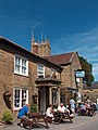 "The Dolphin Inn", Ilminster - geograph.org.uk - 1966390.jpg 1,952 × 2,608; 1.33 MB
-
 A small wood by the B3168 - geograph.org.uk - 4190994.jpg 1,600 × 1,200; 1.16 MB
-
 A303 approaching Southfields Roundabout - geograph.org.uk - 3784414.jpg 1,024 × 682; 130 KB
-
 A303, Southfields Roundabout - geograph.org.uk - 5305245.jpg 640 × 381; 86 KB
-
 A303, westbound - geograph.org.uk - 5305241.jpg 640 × 439; 62 KB
-
 B3168 north-east of Ilminster - geograph.org.uk - 4190997.jpg 1,600 × 1,200; 1.08 MB
-
 Beacon, The B3168 out of Ilminster - geograph.org.uk - 6007897.jpg 640 × 481; 252 KB
-
 Bridge across River Isle - geograph.org.uk - 1308419.jpg 480 × 640; 109 KB
-
 Cadet hut, Ilminster - geograph.org.uk - 3402803.jpg 800 × 491; 154 KB
-
 Canal Way, Ilminster - geograph.org.uk - 2473573.jpg 640 × 480; 81 KB
-
 Car dealers, Ilminster - geograph.org.uk - 4190974.jpg 1,204 × 1,600; 1.07 MB
-
 Cars parked on Beacon - geograph.org.uk - 1841648.jpg 640 × 480; 148 KB
-
 Church Walk - geograph.org.uk - 5148305.jpg 1,024 × 768; 207 KB
-
 Cricket Malherbie and Ilminster (geograph 3067091).jpg 3,888 × 2,592; 7.68 MB
-
 Cultivated land, Knott Oak - geograph.org.uk - 2474190.jpg 640 × 480; 92 KB
-
 Derelict houses near Hort Bridge - geograph.org.uk - 1308074.jpg 640 × 480; 79 KB
-
 Disused railway bridge at Ilminster - geograph.org.uk - 2753196.jpg 3,888 × 2,592; 1.19 MB
-
 Disused railway. Ilminster to Donyatt - geograph.org.uk - 2753209.jpg 3,888 × 2,592; 1.52 MB
-
 Ditton Street, Ilminster - geograph.org.uk - 2473583.jpg 640 × 480; 106 KB
-
 East Street Ilminster - geograph.org.uk - 2048145.jpg 640 × 496; 79 KB
-
 East Street, Ilmininster - geograph.org.uk - 1111503.jpg 640 × 480; 92 KB
-
 East Street, Ilminster - geograph.org.uk - 1167695.jpg 640 × 480; 77 KB
-
 East Street, Ilminster - geograph.org.uk - 1307828.jpg 640 × 480; 73 KB
-
 East Street, Ilminster - geograph.org.uk - 2473591.jpg 640 × 480; 80 KB
-
 Eroded bank on the River Isle - geograph.org.uk - 2753200.jpg 3,888 × 2,592; 1.24 MB
-
 Ex-Ilminster Grammar School - geograph.org.uk - 1069089.jpg 640 × 428; 74 KB
-
 Farm entrance, Knott Oak, near Kingstone - geograph.org.uk - 1961787.jpg 640 × 480; 219 KB
-
 Fields by Pretwood Hill - geograph.org.uk - 2278569.jpg 640 × 480; 53 KB
-
 Fields south of Ilminster - geograph.org.uk - 3402798.jpg 1,600 × 1,200; 461 KB
-
 Fingerpost, Ilminster - geograph.org.uk - 2474177.jpg 640 × 853; 155 KB
-
 Footbridge over the River Isle - geograph.org.uk - 2753187.jpg 3,888 × 2,592; 6.75 MB
-
 Footpath through Rose Mills - geograph.org.uk - 2753188.jpg 2,592 × 3,888; 984 KB
-
 Footpath through Rose Mills - geograph.org.uk - 2753189.jpg 2,592 × 3,888; 1.56 MB
-
 Footpath through Rose Mills - geograph.org.uk - 2753190.jpg 2,592 × 3,888; 4.47 MB
-
 Former A303 near Ilminster - geograph.org.uk - 2474194.jpg 640 × 480; 92 KB
-
 Former Clarks factory at Dowlish Ford - geograph.org.uk - 4174510.jpg 1,600 × 1,064; 546 KB
-
 Former Clarks shoe factory at Dowlish Ford - geograph.org.uk - 4174523.jpg 1,600 × 1,064; 496 KB
-
 Greenfylde School Ilminster.jpg 6,000 × 3,429; 12.47 MB
-
 Historic shop - geograph.org.uk - 4178270.jpg 1,600 × 1,064; 316 KB
-
 Hort Bridge, Ilminster - geograph.org.uk - 4190961.jpg 1,600 × 1,200; 1.14 MB
-
 Houses on Beacon - geograph.org.uk - 1841646.jpg 640 × 480; 208 KB
-
 Housing south of Ilminster - geograph.org.uk - 3715411.jpg 1,920 × 1,440; 461 KB
-

-

-
 Ilminster buildings (3) (geograph 7514819).jpg 4,127 × 3,095; 2.13 MB
-
 Ilminster buildings (4) (geograph 7515475).jpg 3,227 × 2,421; 1.48 MB
-
 Ilminster buildings (5) (geograph 7515478).jpg 3,107 × 4,142; 2.73 MB
-
 Ilminster buildings (6) (geograph 7515481).jpg 3,168 × 4,136; 2.6 MB
-
 Ilminster buildings (7) (geograph 7515484).jpg 2,686 × 2,737; 1.34 MB
-
 Ilminster Carnival 2010 - geograph.org.uk - 2472238.jpg 1,600 × 1,067; 260 KB
-
 Ilminster Cottages - geograph.org.uk - 1069123.jpg 640 × 428; 59 KB
-
 Ilminster features (2) (geograph 7515488).jpg 1,465 × 1,953; 838 KB
-
 Ilminster fire station.jpg 640 × 427; 193 KB
-
 Ilminster from Cricket Malherbie - geograph.org.uk - 3067087.jpg 3,888 × 2,592; 7.25 MB
-
 Ilminster Library - geograph.org.uk - 157129.jpg 640 × 480; 104 KB
-
 Ilminster Market Square - geograph.org.uk - 2241835.jpg 640 × 462; 80 KB
-
 Ilminster sign at Hort Bridge - geograph.org.uk - 2753193.jpg 3,888 × 2,592; 1.08 MB
-
 Ilminster Town FC (8640650821).jpg 2,345 × 1,762; 3.01 MB
-
 Ilminster Town FC (8641751002).jpg 3,491 × 2,730; 5.37 MB
-
 Ilminster Town FC (8641758856).jpg 3,600 × 2,672; 6.48 MB
-
 Ilminster, 1987 - geograph.org.uk - 4304906.jpg 2,111 × 1,476; 3.42 MB
-
 Ilminster, 1987 - geograph.org.uk - 4304913.jpg 2,390 × 1,298; 3.59 MB
-
 Ilminster, Butts - geograph.org.uk - 4190986.jpg 1,600 × 1,200; 1.15 MB
-

-
 Ilminster, looking down North Street - geograph.org.uk - 1133323.jpg 640 × 480; 63 KB
-

-
-
 Ilminster, the post office - geograph.org.uk - 1133310.jpg 480 × 640; 73 KB
-
 Ilminster, town centre - geograph.org.uk - 1133303.jpg 640 × 480; 64 KB
-

-

-
 Interior, St Mary's church, Ilminster - geograph.org.uk - 4142675.jpg 3,696 × 2,448; 2.23 MB
-
 Into the furnace - April 2011 - geograph.org.uk - 2474181.jpg 640 × 480; 134 KB
-

-
 Junction of Station Road and Winterhay Lane - geograph.org.uk - 4107870.jpg 3,008 × 2,000; 1.4 MB
-
 Junctions on Lister's Hill - geograph.org.uk - 4107875.jpg 640 × 431; 58 KB
-
 K6 Ilminster.jpg 6,000 × 4,000; 14.58 MB
-
 Knott Oak - geograph.org.uk - 6007913.jpg 640 × 425; 153 KB
-
 Lane from Ilminster to Kingstone - geograph.org.uk - 1961784.jpg 640 × 480; 213 KB
-
 Let's go shopping - geograph.org.uk - 5148266.jpg 1,024 × 768; 117 KB
-
 Listers Hill approaching Moolham Lane junction - geograph.org.uk - 4107896.jpg 2,742 × 1,813; 2.26 MB
-
 Main entrance, Gooch and Housego PLC - geograph.org.uk - 5024921.jpg 1,024 × 768; 180 KB
-
 Market house, Ilminster - geograph.org.uk - 3715694.jpg 1,920 × 1,440; 522 KB
-
 Middlefield Farmhouse.jpg 4,608 × 3,072; 7.53 MB
-
 Monument to Humphrey Walrond, St Mary's church, Ilminster - geograph.org.uk - 4143277.jpg 2,656 × 4,752; 5.39 MB
-
 National Cycle Network route 33 - geograph.org.uk - 2473578.jpg 640 × 480; 118 KB
-
 New houses at Knott Oak - geograph.org.uk - 4438296.jpg 1,024 × 768; 168 KB
-
 New Road, Ilminster - geograph.org.uk - 1470314.jpg 640 × 428; 64 KB
-
 North Street, Ilminster - geograph.org.uk - 1166734.jpg 640 × 480; 69 KB
-
 Old Boundary Marker on the B3168 in Ilminster (geograph 6947455).jpg 2,131 × 3,074; 2.81 MB
-

-

-
 Old Road, Ilminster - geograph.org.uk - 1470325.jpg 640 × 428; 92 KB
-
 Old self -closing gate by the River Isle - geograph.org.uk - 2753197.jpg 2,592 × 3,888; 1.66 MB
-
 Old Toll House, Bay Hill, Ilminster (geograph 6115176).jpg 640 × 474; 137 KB
-
 Old Toll House, Station Road, Ilminster (geograph 6114491).jpg 640 × 446; 126 KB
-
 On Pretwood Hill - geograph.org.uk - 3715515.jpg 1,920 × 1,440; 531 KB
-
 Ordnance Survey Drawings - Ilminster (OSD 46A).jpg 1,208 × 4,000; 1.2 MB
-
 Ordnance Survey Drawings - Ilminster (OSD 46B).jpg 1,048 × 4,000; 1.11 MB
-
 Path steps south of Ilminster - geograph.org.uk - 3715436.jpg 1,920 × 2,560; 974 KB
-
 Pillbox near Coldharbour Farm - geograph.org.uk - 2753207.jpg 2,665 × 2,055; 632 KB
-
 Potter at work, soup bowls (4514832971).jpg 2,592 × 3,888; 4.69 MB
-
 Pretwood - geograph.org.uk - 3715453.jpg 1,920 × 1,457; 568 KB
-
 Pretwood Copse - geograph.org.uk - 3715701.jpg 1,920 × 1,440; 542 KB
-

-
 River Isle - geograph.org.uk - 513260.jpg 640 × 480; 98 KB
-
 River Isle at Ilminster - geograph.org.uk - 2753194.jpg 3,888 × 2,592; 1.7 MB
-
 River Isle from Hort Bridge - geograph.org.uk - 1308091.jpg 640 × 448; 83 KB
-
 River Isle, Winterhay and Beacon - geograph.org.uk - 2753204.jpg 3,888 × 2,592; 1,015 KB
-
 Rose Mills at Ilminster - geograph.org.uk - 2753191.jpg 3,888 × 2,592; 978 KB
-
 Sara's Dairy in Ilminster - geograph.org.uk - 1966401.jpg 1,952 × 2,608; 1.69 MB
-
 Silver Street - Ilminster - geograph.org.uk - 4739161.jpg 640 × 480; 80 KB
-
 Silver Street, Ilminster - geograph.org.uk - 1307850.jpg 640 × 480; 78 KB
-
 Silver Street, Ilminster - geograph.org.uk - 2439322.jpg 3,088 × 2,056; 1.03 MB
-
 Silver Street, Ilminster - geograph.org.uk - 3465791.jpg 1,600 × 1,178; 369 KB
-
 Station Road, Ilminster - geograph.org.uk - 1166680.jpg 640 × 480; 81 KB
-
 Station Road, Ilminster - geograph.org.uk - 2473732.jpg 640 × 427; 86 KB
-
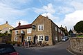 The Dolphin pub Ilminster.jpg 4,608 × 3,072; 6.45 MB
-
 The Dolphin, Ilminster - geograph.org.uk - 2241819.jpg 640 × 480; 72 KB
-
 The Meeting House - Ilminster (geograph 2048130).jpg 640 × 480; 107 KB
-
 The Meeting House, Ilminster - geograph.org.uk - 1111506.jpg 640 × 480; 113 KB
-
 The Minster Church of St Mary the Virgin, Ilminster - geograph.org.uk - 4142585.jpg 4,928 × 3,264; 6.57 MB
-
 The New Buildings, Dowlish Ford - geograph.org.uk - 3020243.jpg 5,916 × 2,574; 2.74 MB
-
 The Recreation Ground, home of Ilminster Town FC - geograph.org.uk - 3402808.jpg 1,600 × 1,251; 388 KB
-
 The Shrubbery Hotel - geograph.org.uk - 4265816.jpg 640 × 480; 71 KB
-
 The Shrubbery Hotel - geograph.org.uk - 4265817.jpg 640 × 480; 78 KB
-
 The Shrubbery Hotel, Ilminster - geograph.org.uk - 2789269.jpg 640 × 480; 61 KB
-
 Track in Autumn - geograph.org.uk - 126798.jpg 337 × 500; 254 KB
-
 Traffic in Ilminster High Street - geograph.org.uk - 4190980.jpg 1,600 × 1,202; 1.2 MB
-

-
 Wadham tomb, St Mary's church, Ilminster - geograph.org.uk - 4143262.jpg 3,056 × 4,592; 6.41 MB
-
 Warehouse Theatre, Ilminster - geograph.org.uk - 1307869.jpg 480 × 640; 100 KB
-
 Weir on the River Isle - geograph.org.uk - 2753184.jpg 3,888 × 2,592; 6.32 MB
-

-

-
 Winterhay Farm at Ilminster - geograph.org.uk - 2753202.jpg 3,888 × 2,592; 933 KB
-

-
 Ashwell Farm from Mill Lane - geograph.org.uk - 510649.jpg 640 × 480; 102 KB
-
 Atherstone Hill - geograph.org.uk - 510681.jpg 640 × 480; 69 KB
-
 B3168 Station Road, Ilminster - geograph.org.uk - 1471184.jpg 640 × 480; 148 KB
-
 B3168 Station Road, Ilminster - geograph.org.uk - 1471189.jpg 640 × 480; 194 KB
-
 Cottages at Knott Oak - geograph.org.uk - 157131.jpg 640 × 480; 68 KB
-
 Dillington Park Farm - geograph.org.uk - 492352.jpg 640 × 477; 123 KB
-
 Ilminster - geograph.org.uk - 9531.jpg 640 × 480; 160 KB
-
 Pretwood Hill - geograph.org.uk - 156856.jpg 640 × 480; 157 KB
-
 River Isle at Winterhay Farm - geograph.org.uk - 513269.jpg 640 × 480; 118 KB
-
 Sculpture at Dillington House - geograph.org.uk - 492401.jpg 473 × 640; 115 KB
-
 Sluices at Eames Mill - geograph.org.uk - 513334.jpg 480 × 640; 134 KB
-
 Townsend Farm, Ilminster - geograph.org.uk - 157130.jpg 640 × 480; 75 KB


.jpg)


_(geograph_7514819).jpg)
_(geograph_7515475).jpg)
_(geograph_7515478).jpg)
_(geograph_7515481).jpg)
_(geograph_7515484).jpg)


_(geograph_7515488).jpg)


.jpg)
.jpg)
.jpg)


.jpg)


.jpg)
.jpg)

.jpg)
.jpg)


.jpg)


.jpg)


