Category:Images by Alan O'Dowd
Jump to navigation
Jump to search

Media in category "Images by Alan O'Dowd"
The following 87 files are in this category, out of 87 total.
-

-
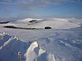
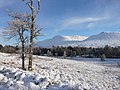
 A crisp winter day on Carnethy Hill - geograph.org.uk - 1238409.jpg 640 × 480; 96 KB
-
-
 An Stuc from near Meall Garbh summit - geograph.org.uk - 1228710.jpg 640 × 480; 40 KB
-
-
 Ascending Steel Edge on Wetherlam - geograph.org.uk - 1733152.jpg 640 × 480; 79 KB
-

-
 Beginning the ascent of Steel Edge - geograph.org.uk - 1731181.jpg 640 × 480; 79 KB
-
 Beinn Iutharn Mhor from Mam nan Carn - geograph.org.uk - 1230858.jpg 640 × 480; 70 KB
-
-
 Boghead House, near Cairnie - geograph.org.uk - 1237507.jpg 640 × 440; 48 KB
-
 Burn with 'roof' of snow - geograph.org.uk - 1232533.jpg 640 × 480; 107 KB
-
 Cairn on Meall Nan Araich - geograph.org.uk - 1368333.jpg 640 × 480; 75 KB
-
 Choire a' Dheirg - geograph.org.uk - 1415682.jpg 640 × 480; 87 KB
-
 Closer view of the 'rock garden' - geograph.org.uk - 1260881.jpg 640 × 480; 101 KB
-
 Coo looking through the gorse - geograph.org.uk - 1237515.jpg 640 × 428; 69 KB
-
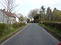
 Cottage at Ramsburn - geograph.org.uk - 1236404.jpg 640 × 480; 101 KB
-
 Crags west of Ben A'an summit - geograph.org.uk - 1241138.jpg 640 × 480; 88 KB
-
 Creag Pitridh from the east - geograph.org.uk - 1228667.jpg 640 × 480; 90 KB
-
 Danger Sign at Glencoe Ski Centre - geograph.org.uk - 1232521.jpg 640 × 480; 94 KB
-
 Dead tree on Glen Etive track - geograph.org.uk - 1232522.jpg 640 × 480; 110 KB
-
 Deer on the horizon - Creag Loisgte - geograph.org.uk - 1231247.jpg 640 × 480; 56 KB
-
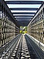 Detail of old railway bridge, Ballindalloch (geograph 5020165).jpg 3,672 × 4,896; 6.35 MB
-

-
 Dry stane dyke on Bent Rig - geograph.org.uk - 1659363.jpg 640 × 480; 51 KB
-
 End of track leading into Coire Earb - geograph.org.uk - 1260937.jpg 640 × 480; 85 KB
-
 Farm track near Horntowie - geograph.org.uk - 1236417.jpg 640 × 480; 103 KB
-
 Fences on Hart Fell summit plateau - geograph.org.uk - 1733184.jpg 640 × 480; 54 KB
-
 Flat Expanse of Rannoch Moor - geograph.org.uk - 1242292.jpg 640 × 480; 68 KB
-
 Frozen River Calder - geograph.org.uk - 1659273.jpg 640 × 480; 55 KB
-

-
 Frozen Strathclyde Loch - geograph.org.uk - 1659229.jpg 640 × 480; 24 KB
-
 Geese in the yard of Mill of Botary - geograph.org.uk - 1236104.jpg 640 × 480; 98 KB
-

-

-
 Grassy path in Glen Feshie - geograph.org.uk - 1507955.jpg 640 × 480; 64 KB
-

-
 Green Knowes wind farm - geograph.org.uk - 1520286.jpg 640 × 480; 42 KB
-
 Heather in bloom in Sma'Glen - geograph.org.uk - 1241158.jpg 640 × 437; 73 KB
-

-
 Hills of Upper Clydesdale in winter - geograph.org.uk - 1733230.jpg 640 × 480; 43 KB
-
 Little Langdale from Crinkle Gill - geograph.org.uk - 1273925.jpg 640 × 480; 53 KB
-
 Lochan with no name - geograph.org.uk - 1232537.jpg 640 × 480; 111 KB
-

-

-
 Looking towards Benvane summit - geograph.org.uk - 1745239.jpg 640 × 480; 40 KB
-
 Meander in River Deveron - geograph.org.uk - 1237480.jpg 640 × 435; 76 KB
-
 Mid-Stream Island in River Feshie - geograph.org.uk - 1507917.jpg 640 × 480; 85 KB
-
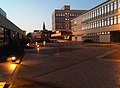 Motherwell Civic Centre.jpg 640 × 468; 50 KB
-

-

-
 Near summit of Craighorn - geograph.org.uk - 1604459.jpg 640 × 480; 74 KB
-
 No more off-roading^ - geograph.org.uk - 1520340.jpg 640 × 480; 52 KB
-

-
 Old lead-mining bing - geograph.org.uk - 1236440.jpg 640 × 480; 95 KB
-

-
 Ptarmigan blending in to the terrain - geograph.org.uk - 1261709.jpg 640 × 480; 86 KB
-

-
 Rime on wire fence, Meall Garbh - geograph.org.uk - 1232541.jpg 640 × 480; 40 KB
-
 Rock Garden^ - geograph.org.uk - 1260859.jpg 640 × 480; 86 KB
-
 Sail Mor of Beinn Eighe, Torridon - geograph.org.uk - 1433376.jpg 640 × 480; 98 KB
-
 Scree slopes on Stac na h-Iolaire - geograph.org.uk - 1415700.jpg 640 × 480; 106 KB
-
 Sheepfold above Bleakfield - geograph.org.uk - 1659322.jpg 640 × 480; 50 KB
-
 Site of former Douglas West railway station (geograph 6916522).jpg 5,184 × 3,888; 5.7 MB
-
 Sma'Glen, early autumn - geograph.org.uk - 1241152.jpg 640 × 430; 83 KB
-
-
 Snowmobile! - geograph.org.uk - 1236452.jpg 640 × 480; 44 KB
-
 Stob Dubh summit cone - geograph.org.uk - 1242328.jpg 640 × 480; 76 KB
-

-

-
 The infant River Dee - geograph.org.uk - 1242279.jpg 640 × 480; 75 KB
-

-
-
 Track leading to memorial bench - geograph.org.uk - 1242307.jpg 640 × 480; 77 KB
-
 Trees on Black Mount estate - geograph.org.uk - 1231251.jpg 640 × 480; 95 KB
-
 Upper reaches of Crinkle Gill - geograph.org.uk - 1274585.jpg 595 × 640; 155 KB
-
 View down Rossett Gill - geograph.org.uk - 1273950.jpg 640 × 480; 26 KB
-
 View north up Gleann Taitneach - geograph.org.uk - 1232527.jpg 640 × 480; 90 KB
-
 View north-west along Wanlock Water - geograph.org.uk - 1227561.jpg 640 × 480; 76 KB
-
 View South-West from Bynack More - geograph.org.uk - 1421246.jpg 640 × 480; 75 KB
-
 Wanlockhead in the snow - geograph.org.uk - 1227591.jpg 640 × 480; 39 KB
-
 Warroch Glen on Dumyat - geograph.org.uk - 1604475.jpg 640 × 480; 60 KB
-
 Waterfall on Allt Elrig - geograph.org.uk - 1232526.jpg 640 × 480; 105 KB
-
 West of Bynack More summit - geograph.org.uk - 1415611.jpg 640 × 480; 91 KB
-
 Western flanks of A'Mharconaich - geograph.org.uk - 1242301.jpg 640 × 480; 94 KB
-
 Wind turbines at Greenknowes - geograph.org.uk - 1520271.jpg 640 × 480; 54 KB
-


.jpg)


.jpg)


