Category:Images by Dylan Moore
Jump to navigation
Jump to search

Media in category "Images by Dylan Moore"
The following 200 files are in this category, out of 1,157 total.
(previous page) (next page)-
 "Menhir" at Rhoose Point - geograph.org.uk - 981204.jpg 640 × 480; 114 KB
-
 A487 near Pant-y-grwndy, Cardigan - geograph.org.uk - 1616135.jpg 640 × 480; 111 KB
-
 A487 near Pont Baldwyn - geograph.org.uk - 1754051.jpg 2,000 × 1,500; 1.02 MB
-
 A487 west of Eglwyswrw, dusk - geograph.org.uk - 1754043.jpg 2,000 × 1,500; 1.04 MB
-
 A487, West end of Sarnau village - geograph.org.uk - 791243.jpg 640 × 454; 79 KB
-

-
 Aber-cych - geograph.org.uk - 682758.jpg 640 × 480; 93 KB
-
 Aber-cych - geograph.org.uk - 682761.jpg 640 × 480; 110 KB
-
 Aberthaw Cement Works1.jpg 640 × 480; 104 KB
-

-
 Afon Cywyn near Llys Onnen, Meidrim - geograph.org.uk - 1212982.jpg 640 × 480; 131 KB
-
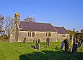
 Aldbury Parish Church (geograph 3827418).jpg 1,920 × 2,560; 2.45 MB
-
 Alley- London Street, Swindon (geograph 2397057).jpg 1,865 × 2,518; 1.69 MB
-
 Allt-banc-sina Plantation - geograph.org.uk - 682748.jpg 640 × 480; 129 KB
-
 Allt-y-cordde, Penbryn - geograph.org.uk - 986039.jpg 640 × 480; 126 KB
-

-
-
 Ammonite casts on limestone. - geograph.org.uk - 981201.jpg 640 × 424; 148 KB
-
 Anglers on Llys-y-frân reservoir (geograph 3619711).jpg 2,560 × 1,895; 2 MB
-
 Anglers’ boats on Llys-y-frân reservoir (geograph 3619475).jpg 2,560 × 1,920; 2.18 MB
-
 Angling place near Llys-y-frân dam (geograph 3619691).jpg 2,560 × 1,920; 1.95 MB
-
 Approach to Teemore, Co. Fermanagh - geograph.org.uk - 1385831.jpg 640 × 393; 89 KB
-
 Ardcrony, Co. Tipperary - geograph.org.uk - 1386796.jpg 640 × 453; 76 KB
-
 Avenue to Nantyreglwys, Llanboidy - geograph.org.uk - 1020105.jpg 640 × 420; 136 KB
-
 Avenue to Penrallt, Aberporth - geograph.org.uk - 898307.jpg 640 × 468; 129 KB
-
 B4329 at Bwlch-gwynt - geograph.org.uk - 1010190.jpg 640 × 477; 83 KB
-
 B4329 south of Bwlch-gwynt - geograph.org.uk - 1753634.jpg 2,400 × 1,577; 834 KB
-
 B4329 south of Bwlch-gwynt - geograph.org.uk - 1753639.jpg 2,400 × 1,600; 1.01 MB
-
 B4333 near Rhyd-y-gwîn, Cynwyl Elfed - geograph.org.uk - 1207465.jpg 640 × 445; 81 KB
-
 Bagpiper, Beverley Minster - geograph.org.uk - 1317243.jpg 480 × 640; 88 KB
-
 Bailey and keep, Richmond Castle - geograph.org.uk - 1318287.jpg 640 × 480; 91 KB
-
 Bales in a field, Tynewydd, Castellan - geograph.org.uk - 925536.jpg 640 × 480; 90 KB
-

-
 Ballivor, Co. Meath - geograph.org.uk - 1390016.jpg 640 × 457; 102 KB
-
 Ballybrittas, Co. Laois - geograph.org.uk - 1390773.jpg 640 × 467; 96 KB
-
 Banks of Castell Mawr, Trelech - geograph.org.uk - 969954.jpg 640 × 472; 100 KB
-

-
 Barley field near Hafod, Clydau - geograph.org.uk - 958247.jpg 640 × 480; 100 KB
-
 Barley field, Blaenhalen, Penboyr - geograph.org.uk - 958097.jpg 640 × 480; 97 KB
-

-

-

-
 Barn Street, Haverfordwest - geograph.org.uk - 1538974.jpg 428 × 640; 98 KB
-
 Barton cement plant - geograph.org.uk - 1318144.jpg 640 × 480; 123 KB
-
 Battered gate, Rhandir, Troed-yr-aur - geograph.org.uk - 997358.jpg 640 × 435; 132 KB
-

-
 Bellananagh, Co. Cavan - geograph.org.uk - 1389374.jpg 640 × 466; 101 KB
-

-
 Sundial, Beverley Minster - geograph.org.uk - 1317293.jpg 640 × 480; 128 KB
-

-
 Bilingual Phonebox - geograph.org.uk - 655924.jpg 462 × 640; 70 KB
-

-
 Blaen-bryn, Aber-nant - geograph.org.uk - 1185499.jpg 640 × 447; 94 KB
-
 Blaen-ffos, Cenarth - geograph.org.uk - 957909.jpg 640 × 480; 95 KB
-
 Blaen-ffrwd, Eglwysnewydd - geograph.org.uk - 1185512.jpg 640 × 480; 101 KB
-
 Blaengilfach-isaf, West Cilrhedyn - geograph.org.uk - 932095.jpg 640 × 469; 102 KB
-
 Blaenmorw Farm - geograph.org.uk - 682770.jpg 640 × 480; 116 KB
-
 Blaenwaun Chapel - geograph.org.uk - 1613750.jpg 640 × 466; 92 KB
-
 Blue Ball, Co. Offaly - geograph.org.uk - 1386820.jpg 640 × 453; 95 KB
-
 Blue Lias cliff, Rhoose - geograph.org.uk - 981193.jpg 640 × 480; 108 KB
-
 Blue Lias, closeup - geograph.org.uk - 981202.jpg 480 × 640; 102 KB
-

-
 Boat house, Wardown Park, Luton - geograph.org.uk - 978317.jpg 640 × 476; 114 KB
-
 Boats in Tenby Harbour - geograph.org.uk - 1491520.jpg 640 × 480; 117 KB
-
-

-

-

-
 Borrisokane, Co. Tipperary - geograph.org.uk - 1386798.jpg 640 × 469; 79 KB
-

-
 Brewer Street, Oxford (geograph 4722832).jpg 1,920 × 2,560; 2.98 MB
-
 Brickfield Bridge, Slebech - geograph.org.uk - 800409.jpg 640 × 480; 148 KB
-
 Brickwork, St Peters churchyard, Barton - geograph.org.uk - 1318130.jpg 480 × 640; 151 KB
-
 Bridell Parish Church - geograph.org.uk - 650500.jpg 640 × 464; 75 KB
-
 Bridge at Penty Park Mill, Wiston - geograph.org.uk - 793604.jpg 640 × 480; 151 KB
-
 Bridge near Pant-y-ffynnon, Meidrim - geograph.org.uk - 1020128.jpg 640 × 427; 121 KB
-

-
 Bridge over Afon Ceri, Dol-gôch - geograph.org.uk - 997374.jpg 640 × 480; 159 KB
-

-

-

-
 Bridge over Afon Dulas, Cwm Cych - geograph.org.uk - 958235.jpg 640 × 480; 146 KB
-
-

-
 Bridge over Nant Berllan - geograph.org.uk - 1335149.jpg 640 × 480; 146 KB
-
-
 Bridge Street, Cardigan - geograph.org.uk - 1544340.jpg 640 × 458; 111 KB
-

-
 Bridleway near Rath Farm, Camrose - geograph.org.uk - 1010140.jpg 640 × 480; 90 KB
-
 Bridleway near Spittal - geograph.org.uk - 704975.jpg 640 × 480; 145 KB
-
 Bridleway near Ty-gwyn, Lampeter Velfrey - geograph.org.uk - 960141.jpg 640 × 480; 154 KB
-
 Bron-haul, Meidrim - geograph.org.uk - 1020123.jpg 640 × 427; 84 KB
-
 Brongest from Troed-yr-aur - geograph.org.uk - 997355.jpg 640 × 428; 115 KB
-
 Bronorwen, Llandyfrïog - geograph.org.uk - 991646.jpg 505 × 640; 74 KB
-
 Bronze Age cairn, Foel Eryr - geograph.org.uk - 930743.jpg 640 × 480; 110 KB
-
 Brook near Cwm-coy, Blaenpennal - geograph.org.uk - 1032570.jpg 640 × 480; 143 KB
-
 Bryn Bethel Cemetery, Pant-y-groes - geograph.org.uk - 1616176.jpg 640 × 450; 101 KB
-
 Bryn-gwyn Cottages, Eglwyswrw - geograph.org.uk - 921768.jpg 640 × 480; 118 KB
-
 Bryn-y-mor, Cardigan - geograph.org.uk - 1613766.jpg 640 × 427; 72 KB
-

-
 Brynmanod, Cynwyl Elfed - geograph.org.uk - 1184909.jpg 640 × 443; 84 KB
-
 Bulford Close, Johnston - geograph.org.uk - 775665.jpg 640 × 480; 65 KB
-
 Bush Cottage, Crosshands, Llanboidy - geograph.org.uk - 655865.jpg 640 × 438; 113 KB
-
 Buzzard, Eglwyswrw - geograph.org.uk - 1435948.jpg 524 × 640; 59 KB
-
 Bwlch Farm, Meidrim - geograph.org.uk - 1212989.jpg 640 × 420; 70 KB
-
 Bwlchgwyn, Rhydlewis - geograph.org.uk - 991249.jpg 640 × 486; 108 KB
-
 Caemorgan Road, Cardigan - geograph.org.uk - 689120.jpg 640 × 480; 74 KB
-
 Caffi Beca, Efailwen - geograph.org.uk - 650275.jpg 640 × 480; 105 KB
-
 Capel Bethania near Talog, Aber-nant - geograph.org.uk - 1020149.jpg 640 × 427; 91 KB
-
 Capel Cendy, Aber-nant - geograph.org.uk - 1185544.jpg 640 × 480; 71 KB
-
 Capel Coed-y-bryn - geograph.org.uk - 991627.jpg 489 × 640; 109 KB
-
 Capel Sion, Pont-seli - geograph.org.uk - 683982.jpg 640 × 480; 93 KB
-
 Capel y Cwm, Meidrim - geograph.org.uk - 1212999.jpg 640 × 480; 116 KB
-
 Car park at Bwlch-gwynt - geograph.org.uk - 930746.jpg 640 × 480; 98 KB
-
 Cardigan Guildhall clock tower (geograph 6370131).jpg 1,905 × 2,560; 3.43 MB
-
 Cardigan Integrated Care Centre (geograph 6607477).jpg 2,560 × 1,708; 3.55 MB
-
 Careg Wylan, Moylgrove - geograph.org.uk - 1803721.jpg 2,000 × 1,500; 1.03 MB
-
 Careg Wylan, Moylgrove - geograph.org.uk - 942981.jpg 640 × 480; 83 KB
-
 Carn Breseb - geograph.org.uk - 919060.jpg 640 × 480; 98 KB
-
 Carn Menyn from Carn Ingli - geograph.org.uk - 1753622.jpg 1,600 × 1,063; 538 KB
-
 Carn Menyn from Eglwyswrw - geograph.org.uk - 1435904.jpg 640 × 423; 83 KB
-
 Carnalw - geograph.org.uk - 919049.jpg 640 × 473; 84 KB
-
 Carnau Lladron - geograph.org.uk - 1491158.jpg 640 × 480; 92 KB
-
 Carnedd Meibion Owen from Eglwyswrw - geograph.org.uk - 1435912.jpg 640 × 427; 70 KB
-
 Carningli from Eglwyswrw, Sunset - geograph.org.uk - 1754040.jpg 640 × 480; 45 KB
-
 Carningli Tramway - geograph.org.uk - 1754058.jpg 2,000 × 1,500; 996 KB
-
 Castell Henllys in the snow - geograph.org.uk - 1152602.jpg 640 × 502; 122 KB
-

-

-

-

-
 Cattle, Eglwyswrw - geograph.org.uk - 1754047.jpg 2,000 × 1,500; 1.02 MB
-
 Cave near Pwll y Wrach, Moylgrove - geograph.org.uk - 943009.jpg 640 × 468; 111 KB
-
 Cefel Valley, Llandysul - geograph.org.uk - 998094.jpg 640 × 480; 94 KB
-
 Cefn Cottage, Llantood - geograph.org.uk - 729714.jpg 640 × 469; 128 KB
-

-
 Cemetery, Birr, Co. Offaly - geograph.org.uk - 1386805.jpg 640 × 463; 125 KB
-
 Cemetery, Daingean, Co. Offally - geograph.org.uk - 1388033.jpg 640 × 453; 93 KB
-
 Cemetery, Edgeworthstown, Co. Longford - geograph.org.uk - 1389366.jpg 640 × 480; 116 KB
-
 Cemetery, Leachestown, Co. Wexford - geograph.org.uk - 1385928.jpg 640 × 480; 137 KB
-
 Cemetery, Milltownpass, Co. Westmeath - geograph.org.uk - 1386828.jpg 640 × 475; 105 KB
-
 Chapel at Church Hill, Wiston - geograph.org.uk - 793682.jpg 640 × 464; 106 KB
-
-
 Chapel, Llangybi - geograph.org.uk - 791259.jpg 640 × 480; 104 KB
-
 Church - Rathmolyon, Co. Meath - geograph.org.uk - 1390011.jpg 480 × 640; 86 KB
-
 Church near Croghan, Co. Offaly - geograph.org.uk - 1388030.jpg 640 × 464; 106 KB
-
 Church ruin near Adare, Co. Limerick - geograph.org.uk - 1389052.jpg 640 × 469; 69 KB
-
 Church Street, Newport, Pembrokeshire - geograph.org.uk - 1803622.jpg 2,000 × 1,500; 818 KB
-
 Church, Ballinabrackey, Co. Meath - geograph.org.uk - 1389232.jpg 640 × 437; 61 KB
-
 Church, Edgeworthstown, Co. Longford - geograph.org.uk - 1388010.jpg 640 × 480; 70 KB
-
 Church, Eglish, Co. Offaly - geograph.org.uk - 1386809.jpg 640 × 475; 108 KB
-
 Church, Granard, Co. Longford - geograph.org.uk - 1389370.jpg 480 × 640; 80 KB
-
 Church, Killucan, Co. Westmeath - geograph.org.uk - 1390038.jpg 496 × 640; 89 KB
-
 Church, Kilsheelan, Co. Tipperary - geograph.org.uk - 1388522.jpg 640 × 480; 90 KB
-
 Church, Knockainy, Co. Limerick - geograph.org.uk - 1389017.jpg 640 × 446; 115 KB
-
 Church, Moynalvy, Co. Meath - geograph.org.uk - 1389975.jpg 640 × 473; 103 KB
-
 Church, Newtown Gore, Co. Leitrim - geograph.org.uk - 1389403.jpg 640 × 468; 103 KB
-
 Church, Rathowen, Westmeath - geograph.org.uk - 1388000.jpg 640 × 454; 68 KB
-
 Church, Rathowen, Westmeath - geograph.org.uk - 1388003.jpg 640 × 463; 119 KB
-
 Cil-hir Isaf, Trelech - geograph.org.uk - 1020139.jpg 640 × 427; 70 KB
-
 Cilgwyn Chapel - geograph.org.uk - 645410.jpg 640 × 480; 137 KB
-
 Cilgwyn Mawr from Carn Ingli - geograph.org.uk - 1753627.jpg 1,600 × 1,067; 575 KB
-
 Cilrhue Upper Lodge - geograph.org.uk - 682779.jpg 640 × 483; 106 KB
-
 Cliff face, Rhoose - geograph.org.uk - 981196.jpg 640 × 480; 108 KB
-
 Cliff Hotel, Gwbert - geograph.org.uk - 1491581.jpg 640 × 425; 82 KB
-
 Cliff near Blaenmeini - geograph.org.uk - 728333.jpg 640 × 480; 87 KB
-
 Clifford's Tower, York - geograph.org.uk - 3983305.jpg 640 × 423; 79 KB
-
 Cliffs near Pwll y Wrach, Moylgrove - geograph.org.uk - 943001.jpg 640 × 480; 93 KB
-
 Cliffs near Waterwynch, Tenby - geograph.org.uk - 1491162.jpg 640 × 427; 72 KB
-
 Climbers and kayaks, Porthclais - geograph.org.uk - 827213.jpg 640 × 474; 111 KB
-
 Clover field, Aber-Cefel, Llandysul - geograph.org.uk - 998093.jpg 640 × 480; 113 KB
-
 Coast Path approaching Cemaes Head - geograph.org.uk - 1742463.jpg 1,600 × 1,157; 783 KB
-
 Coast Path near Cemaes Head - geograph.org.uk - 1742543.jpg 1,600 × 1,049; 684 KB
-
 Coast path near Foel Goch, eastward - geograph.org.uk - 728340.jpg 640 × 480; 99 KB
-
 Coast path near Foel Goch, westward - geograph.org.uk - 728345.jpg 640 × 471; 73 KB
-
 Coast path north of Pen Pistyll - geograph.org.uk - 729658.jpg 640 × 480; 80 KB
-
 Coast Path on Cemaes Head - geograph.org.uk - 1742469.jpg 1,600 × 1,067; 522 KB
-
 Coastal path, Dinas Island - geograph.org.uk - 1207965.jpg 480 × 640; 157 KB
-
 Coastal path, Dinas Island - geograph.org.uk - 1207976.jpg 640 × 480; 98 KB
-
 Coed Pencelli, Eglwysfairachurig - geograph.org.uk - 982430.jpg 640 × 480; 87 KB
-
 Coed-parc - geograph.org.uk - 791262.jpg 640 × 480; 104 KB
-
 Coed-y-bryn, Llangynllo - geograph.org.uk - 991624.jpg 640 × 465; 104 KB
-

-
 Copper beech, Beverley Minster - geograph.org.uk - 1316730.jpg 480 × 640; 133 KB
-
 Copse near Castellan Chapel - geograph.org.uk - 925533.jpg 640 × 480; 102 KB
-
 Copse near Glaspant, Blaenporth - geograph.org.uk - 967728.jpg 640 × 480; 109 KB
-
 Copse, Pensarn-fawr, Dihewyd - geograph.org.uk - 828479.jpg 640 × 480; 96 KB
-
 Cormorants on the weir - geograph.org.uk - 1522889.jpg 640 × 435; 121 KB
-
 Cottages at Pont Herws - geograph.org.uk - 682766.jpg 640 × 463; 142 KB
-
 Court Lane, Durham - geograph.org.uk - 1522876.jpg 640 × 480; 132 KB
-
 Cows at Abystree, Robeston Wathen - geograph.org.uk - 800507.jpg 640 × 480; 94 KB
-
 Cows near Troed-yr-aur - geograph.org.uk - 997354.jpg 640 × 467; 125 KB
-
 Cows, Llwynduris, Llandygwydd - geograph.org.uk - 898292.jpg 640 × 480; 127 KB
-
 Crackwell Street, Tenby - geograph.org.uk - 1491165.jpg 640 × 480; 110 KB
-
 Cribyn, Ceredigion.jpg 640 × 480; 118 KB
-
 Crinow Parish Church - geograph.org.uk - 3753333.jpg 2,560 × 1,866; 1.98 MB
-
 Cross Inn, Glandy Cross - geograph.org.uk - 650281.jpg 640 × 451; 75 KB
-
 Cross roads at Kilmurry, Co. Laois - geograph.org.uk - 1390777.jpg 640 × 455; 94 KB
-
 Cross, Carriganurra, Co. Kilkenny - geograph.org.uk - 1387890.jpg 640 × 465; 96 KB
-
 Crossdoney, Co. Cavan - geograph.org.uk - 1389379.jpg 640 × 445; 100 KB


.jpg)
.jpg)


.jpg)
.jpg)
.jpg)


.jpg)


.jpg)
.jpg)


