Category:Images by John Phillips
Jump to navigation
Jump to search

Media in category "Images by John Phillips"
The following 78 files are in this category, out of 78 total.
-
-
-
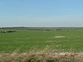
 Arable land, Folkton Wold Farm. - geograph.org.uk - 394902.jpg 640 × 480; 67 KB
-
-
 Arable land, Willy Howe Farm - geograph.org.uk - 394980.jpg 640 × 480; 56 KB
-
 Argam from Finley Hill - geograph.org.uk - 404919.jpg 640 × 480; 71 KB
-
 Argam Village site - geograph.org.uk - 404925.jpg 640 × 480; 82 KB
-
 Beech trees at Pockthorpe - geograph.org.uk - 403656.jpg 480 × 640; 126 KB
-
 Beverley Minster from the Westwood.jpg 640 × 480; 122 KB
-
 Broach Dale, Kilham - geograph.org.uk - 393036.jpg 640 × 480; 71 KB
-
 Broach Dale, Kilham - geograph.org.uk - 393038.jpg 640 × 480; 69 KB
-
 Burdale - Thixendale road - geograph.org.uk - 402592.jpg 480 × 640; 138 KB
-
-
 Crop marks - geograph.org.uk - 356587.jpg 640 × 480; 77 KB
-
 Dale near Huggate - geograph.org.uk - 402574.jpg 640 × 480; 91 KB
-

-
 Danes Graves, Kilham - geograph.org.uk - 356393.jpg 640 × 480; 170 KB
-

-
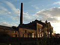
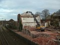 Driffield Sugar Mills - Demolition - geograph.org.uk - 356477.jpg 640 × 480; 91 KB
-
 Earthwork viewed north east - geograph.org.uk - 402566.jpg 640 × 480; 89 KB
-
 East Street, Kilham - geograph.org.uk - 356635.jpg 480 × 640; 68 KB
-
-

-
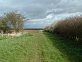
 Farm track above Langtoft - geograph.org.uk - 356600.jpg 640 × 480; 90 KB
-
 Farmland south of Finley Hill - geograph.org.uk - 404929.jpg 640 × 480; 110 KB
-
 Field Boundary - geograph.org.uk - 393076.jpg 640 × 480; 93 KB
-

-

-
 Fields at Swaythorpe - geograph.org.uk - 393043.jpg 640 × 480; 82 KB
-

-
 Fields east of Burton Fleming - geograph.org.uk - 393093.jpg 640 × 480; 64 KB
-
 Fields east of Refuge Farm - geograph.org.uk - 393083.jpg 640 × 480; 73 KB
-
-

-

-
 Gallows Hill, Kilham - geograph.org.uk - 356277.jpg 640 × 480; 104 KB
-
 General view looking NE - geograph.org.uk - 402568.jpg 640 × 480; 95 KB
-
 General view of Kilham from SE - geograph.org.uk - 356383.jpg 640 × 480; 61 KB
-

-

-
 Hill Farm, Burton Fleming - geograph.org.uk - 394964.jpg 640 × 480; 93 KB
-
 Hill Farm, Burton Fleming - geograph.org.uk - 394967.jpg 640 × 480; 111 KB
-
 Huggate Dykes - geograph.org.uk - 401675.jpg 640 × 480; 80 KB
-
 Huggate Dykes - geograph.org.uk - 402561.jpg 640 × 480; 94 KB
-
 Huggate Dykes - geograph.org.uk - 402570.jpg 640 × 480; 100 KB
-

-
 Kilham Cemetery - geograph.org.uk - 356271.jpg 640 × 480; 87 KB
-
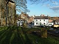
 Kilham Church from East Street - geograph.org.uk - 356593.jpg 480 × 640; 126 KB
-
 Kilham from the south west - geograph.org.uk - 403651.jpg 640 × 480; 70 KB
-
 Kilham Springs - geograph.org.uk - 403648.jpg 640 × 480; 103 KB
-
 Langtoft from the top of the wold. - geograph.org.uk - 356404.jpg 640 × 480; 90 KB
-
 Linear earthwork north of Huggate - geograph.org.uk - 402585.jpg 640 × 480; 85 KB
-
 Linear earthwork, Huggate Dykes - geograph.org.uk - 402578.jpg 480 × 640; 117 KB
-

-

-
 Milestone B1253 Octon - geograph.org.uk - 356575.jpg 640 × 480; 159 KB
-

-

-
 Rape Fields north of Kilham - geograph.org.uk - 394212.jpg 640 × 480; 92 KB
-

-

-
 Rural landscape - Dale - geograph.org.uk - 356447.jpg 640 × 480; 145 KB
-
 Rural landscape - Dale - geograph.org.uk - 356450.jpg 640 × 480; 108 KB
-
 Sugar Mills - Driffield - geograph.org.uk - 356472.jpg 640 × 480; 68 KB
-
 Swaythorpe deserted medieval village.jpg 640 × 480; 99 KB
-
 Swaythorpe Deserted Village - geograph.org.uk - 393134.jpg 640 × 480; 95 KB
-

-

-
 View from Raven Hill looking NW - geograph.org.uk - 393151.jpg 640 × 480; 51 KB
-
 View of Kilham from SE - geograph.org.uk - 356378.jpg 640 × 480; 83 KB
-
-
 Wansford Lock - geograph.org.uk - 356463.jpg 480 × 640; 131 KB
-
 West Dale, Fordon - geograph.org.uk - 403652.jpg 640 × 480; 106 KB
-
 Willy Howe.jpg 640 × 480; 84 KB
-

-
 Dale between Thixendale and Burdale - geograph.org.uk - 402588.jpg 640 × 480; 101 KB
-
 Sharpe Howe, Flixton Wold - geograph.org.uk - 394890.jpg 640 × 480; 80 KB
-


