Category:Images from Barry Lawrence Ruderman Antique Maps Inc.
Jump to navigation
Jump to search
Subcategories
This category has only the following subcategory.
M
Media in category "Images from Barry Lawrence Ruderman Antique Maps Inc."
The following 200 files are in this category, out of 419 total.
(previous page) (next page)-
 'Femme dansant, Iles Sandwich' by Jacques Arago, published 1840.jpg 843 × 1,280; 1.27 MB
-
 0 0 1611 76 Theatre.jpg 1,365 × 2,059; 3.95 MB
-
 12 star charts of the signs of the Zodiac by John Bevis.jpg 37,374 × 23,945; 175.95 MB
-
 1500s illustration of Native Americans by Johann Froschauer.jpg 8,496 × 6,363; 11.65 MB
-
 1570 edition of Sebastian Münster's Chart of Sea Monsters.jpg 9,043 × 7,034; 17.99 MB
-
 1583 portrait of Sir Francis Drake.jpg 7,454 × 9,498; 17.66 MB
-
 1584 portrait of Abraham Ortelius.jpg 6,363 × 9,679; 15.11 MB
-
 1624 imaginary view of Daphne in Antioch by Abraham Ortelius.jpg 12,119 × 9,167; 31.46 MB
-
 1671 portait of Christopher Columbus by John Ogilby.jpg 5,167 × 7,886; 6.25 MB
-
 1683 illustration - Ruines de Tschelminare.jpg 800 × 1,234; 242 KB
-
 1732 illustration of Blocksberg.jpg 14,017 × 12,060; 25.49 MB
-
 1762 view of the Blue Mosque in Istanbul.jpg 2,211 × 1,764; 718 KB
-
 1778 French print - L'Amerique Independante Dediee au Congres des Etats unis de l'Amerique.jpg 8,874 × 11,697; 34.84 MB
-
 1780s view of Paris with hot air balloons.jpg 8,292 × 4,844; 13.74 MB
-
 1800 Northern and Southern Celestial Hemisphere maps.jpg 17,455 × 9,212; 36.88 MB
-
 1809 French chart of history by Édouard Hocquart.jpg 2,800 × 5,114; 2.85 MB
-
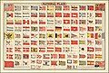
 1837 flag chart - The Flags of The Principal Nations In the World.jpg 13,038 × 10,603; 41.03 MB
-
 1840s British cartoon strips.jpg 1,973 × 3,336; 1.11 MB
-
 1851 chart of maritime flags of the world by Charles Copley.jpg 8,394 × 5,646; 5.61 MB
-
 1851 map of Germany.jpg 6,164 × 8,476; 12.72 MB
-
 1853 illustration of the Şehzade Mosque in Istanbul.png 2,778 × 2,271; 12.62 MB
-

-
-
 1860 comparative chart of mountains & rivers.jpg 15,235 × 10,759; 29.74 MB
-
 1864 Russian print against the participants of the January Uprising.jpg 4,348 × 9,081; 6.29 MB
-
 1865 Johnson's New Chart of National Emblems.jpg 14,382 × 10,598; 33.89 MB
-
 1868 Colton chart of national flags.jpg 14,185 × 9,547; 25.74 MB
-
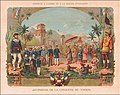 1885 chromolithograph celebrating the French conquest in Indochina.jpg 17,332 × 13,661; 55.65 MB
-
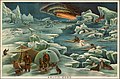 1893 chromolithograph - Arctic Zone.jpg 3,026 × 2,000; 1.43 MB
-

-
 1893 chromolithograph - Geographical Definitions Illustrated.jpg 2,837 × 1,900; 1.11 MB
-
 1893 chromolithograph - Geological Chart.jpg 2,685 × 1,800; 1.1 MB
-
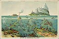 1893 chromolithograph - Nature in Descending Regions.jpg 3,143 × 2,100; 1.29 MB
-
 1893 chromolithograph - View of Nature in Ascending Regions.jpg 3,166 × 2,100; 1.39 MB
-
 1929 Soviet Flyers.jpg 9,396 × 6,235; 9.11 MB
-
 1930 reprint of the view of Venice from the Nuremberg Chronicle (cropped).jpg 5,791 × 2,219; 2.5 MB
-
 1930 reprint of the view of Venice from the Nuremberg Chronicle.jpg 7,131 × 5,290; 5.81 MB
-

-
 Adam & Eve in the Garden of Eden.jpg 1,200 × 1,495; 484 KB
-

-
 Alger Ville Capitale d'Afrique dans la Barbarie.jpg 8,273 × 5,936; 15.28 MB
-
 Altare - Corbinian Thomas.jpg 3,575 × 3,405; 2.69 MB
-
 Andromeda - Corbinian Thomas.jpg 5,420 × 3,741; 5.69 MB
-
 André Thevet.jpg 900 × 1,144; 1.67 MB
-
 Ansicht der Stadt Macao in China.jpg 21,464 × 11,023; 52.02 MB
-
 Ansicht der Stadt Nangasaky.jpg 19,148 × 12,574; 55.13 MB
-

-
 Aquarius - Johann Bayer.jpg 10,319 × 7,778; 18.58 MB
-
 Arago – 'Supplice Sandwich'.jpg 1,320 × 864; 1.31 MB
-
 Arago – Guerrier Sandwichien.jpg 800 × 1,200; 1.05 MB
-
 Arago – Iles Sandwich - Vue du Morai du Roi a Kayakakoua.jpg 1,200 × 840; 1.47 MB
-
 Arago – Les Isles Sandwich (supplice).jpg 1,280 × 840; 1.3 MB
-
 Ardebil, Olfert Dapper.jpg 8,089 × 6,381; 15.87 MB
-
 Argo Navis - Corbinian Thomas.jpg 5,233 × 3,589; 5.56 MB
-
 Aries - Johann Bayer.jpg 9,987 × 7,499; 15.24 MB
-
 Astrorum Uraniae Cursus, Variosque Recursus, Oculis Notans, Futura Mente Praevidet.jpg 6,945 × 5,677; 15.14 MB
-
 Atlas Novus Sive Tabulae Geographicae Totius Orbis Taciem - Title page.jpg 6,836 × 11,694; 28.22 MB
-
 Auriga - Johann Bayer.jpg 10,129 × 7,651; 17.42 MB
-
 Bambus...Wortelboom...Durioens.jpg 2,698 × 2,163; 1.45 MB
-
-
 Bangkok - American President Lines.jpg 15,434 × 21,987; 89.77 MB
-
 Bermuda By Air or Sea.jpg 15,105 × 26,319; 105.47 MB
-
 Bilbaoko emakumezkoak 1575.jpg 557 × 470; 468 KB
-

-
 Birds Eye View of the Holy Land.jpg 8,149 × 6,503; 17.7 MB
-
 Birmah - 1865 Johnson's New Chart of National Emblems (cropped).jpg 1,056 × 913; 194 KB
-
 Blason province Canada.svg 600 × 660; 69 KB
-
 Bootes - Johann Bayer.jpg 10,356 × 7,819; 16.4 MB
-
 Brandenburg - Ca. 1760 flag chart by Tobias Lotter (cropped).jpg 976 × 1,098; 260 KB
-
 Ca. 1568 etching by Pieter Bruegel - The Drunkard Pushed into the Pigsty.jpg 1,400 × 1,414; 567 KB
-
 Ca. 1700 illustration - Callipolis.png 2,916 × 2,239; 11.45 MB
-

-
 Ca. 1737 chart illustrating various lunar and celestial theories.jpg 14,170 × 12,267; 27.75 MB
-
 Ca. 1742 celestial model illustrating the satellite systems of Jupiter and Saturn.jpg 14,123 × 12,106; 25.04 MB
-
 Ca. 1750 chart of naval flags of the world.jpg 5,928 × 5,038; 6.58 MB
-
 Ca. 1760 flag chart by Tobias Lotter.jpg 14,177 × 12,138; 40.81 MB
-
 Ca. 1770 allegorical mezzotint of Africa.jpg 12,727 × 10,274; 28.47 MB
-
 Ca. 1770 allegorical mezzotint of America.jpg 12,671 × 10,193; 28.83 MB
-
 Ca. 1770 allegorical mezzotint of Asia.jpg 12,801 × 10,270; 30.01 MB
-
 Ca. 1770 allegorical mezzotint of Europe.jpg 12,676 × 10,199; 28.9 MB
-
 Ca. 1770 allegorical mezzotints of Africa, Asia, America and Europe on one page.jpg 25,485 × 20,537; 114.5 MB
-
 Ca. 1820 ilustration - En Turquie - Le Bosphore.png 5,041 × 3,861; 37.96 MB
-
 Ca. 1830 image of Piazza della Signoria Goauche, Florence.jpg 7,230 × 1,992; 1.94 MB
-
 Ca. 1839 comparative chart of the mountains and rivers of the world.jpg 15,804 × 11,924; 32.12 MB
-
 Ca. 1850 illustration of the moon.jpg 6,637 × 5,377; 10.78 MB
-
 Ca. 1853 Kawaraban - Commodore Perry's Arrival in Edo Bay.jpg 13,657 × 8,962; 17.99 MB
-
 Ca. 1853 Kawaraban - Illustration of the Steam Locomotive.jpg 7,041 × 5,225; 5.72 MB
-

-
 Ca. 1854 Kawaraban - Foreign ship.jpg 4,357 × 6,069; 3.54 MB
-
 Ca. 1854 Kawaraban - Illustration of a Dutch Ship.jpg 9,444 × 7,319; 10.52 MB
-
 Ca. 1854 Kawaraban - Illustration of a Foreign Ship.jpg 7,756 × 5,650; 7.18 MB
-
 Ca. 1855 Kawaraban - American lady and Chinese man from Nanjing.jpg 5,490 × 7,348; 5.54 MB
-
-
 Ca. 1860 Kawaraban - USS Powhatan Carrying the First Japanese Embassy to America.jpg 8,266 × 6,575; 7.37 MB
-
 Ca. 1863 comparative chart of mountains & rivers.jpg 15,336 × 10,837; 50.09 MB
-
 Ca. 1870 watercolored lithograph of a Black-Billed Mountain Toucan (Andigena nigrirostris).jpg 8,748 × 13,098; 16.89 MB
-
 Ca. 1870 watercolored lithograph of a Central American aracari.jpg 8,749 × 13,081; 14.87 MB
-

-
-
 Ca. 1880 chart showing the Copernican model of the Solar System.jpg 5,696 × 6,975; 5.76 MB
-
 Ca. 1900 constellation map - Libra.jpg 11,085 × 9,166; 16.22 MB
-
 Ca. 1930 Dispensationalist chart of world history.jpg 19,191 × 7,170; 26.6 MB
-
 Ca.1570 chart of terrestrial and sea monsters by Sebastian Munster.jpg 9,199 × 7,345; 20.27 MB
-
 Cancer - Corbinian Thomas.jpg 3,679 × 3,561; 3.68 MB
-
 Cancer - Johann Bayer.jpg 10,280 × 7,869; 18.64 MB
-
 Candia, Corphu.jpg 9,094 × 7,114; 17.85 MB
-
 Canis Major - Johann Bayer.jpg 10,206 × 7,689; 15.59 MB
-
 Capricorn - Johann Bayer.jpg 10,184 × 7,665; 16.41 MB
-
 Capture of El Caney, El Paso & Fortifications of Santiago. Charge of the Rough Riders.jpg 15,227 × 11,607; 69.8 MB
-
 Carte educatif de geometrie des fortifications.jpg 5,485 × 3,113; 4.46 MB
-
 Carte educatif des fortifications et sièges.jpg 5,038 × 5,151; 7.43 MB
-

-
 Cassiopeia - Johann Bayer.jpg 7,804 × 10,216; 16.4 MB
-
 Cepheus - Corbinian Thomas.jpg 3,671 × 3,727; 3.84 MB
-
 Chase & Bachelder's American Museum of Art (cropped).jpg 15,668 × 13,630; 51.55 MB
-
 Chase & Bachelder's American Museum of Art.jpg 16,339 × 22,163; 75.86 MB
-
 Chromolithograph centered on the Kaaba.jpg 13,103 × 9,242; 42.36 MB
-
 Clusters, Nebulae, and Comets.jpg 8,487 × 9,380; 22.43 MB
-
 Coat of Arms of Principato Citra (variant, or-gules shield).svg 830 × 1,190; 677 KB
-
 Comparative Heights of the Principal Rivers and other Elevations in the World - verso.jpg 8,014 × 6,310; 5.33 MB
-

-
 Comparative Heights of the Principal Rivers and other Elevations in the World.jpg 7,678 × 5,947; 8.8 MB
-
 Comparative Lengths of Rivers (cropped).jpg 4,752 × 3,759; 2.29 MB
-
 Comparative Lengths of the Principal Rivers throughout the World.jpg 8,191 × 6,429; 5.78 MB
-
 Constantinopolis.jpg 25,541 × 9,206; 81.6 MB
-

-
 Cornelis de Bruyn, Ierusalem.jpg 29,503 × 7,086; 66.28 MB
-
 Corona Australis - Corbinian Thomas.jpg 3,700 × 3,454; 2.59 MB
-
 Corporum Coelestium Magnitudines.jpg 13,564 × 11,534; 46.59 MB
-
 Cosmographica - Wolverine.jpg 1,230 × 1,017; 635 KB
-
 Cosmographie Generale.jpg 16,003 × 12,269; 40.92 MB
-
 Costantinopoli.jpg 12,539 × 8,959; 25.49 MB
-
 Costumes Mexicains00.jpg 1,600 × 1,200; 2.27 MB
-
 Crater, Johann Bayer.jpg 10,242 × 7,764; 16.88 MB
-

-

-
 Das Planeten=System. Nach v. Littrow, Mulder u. A. Bearbeitet von L. Eward 1845.jpg 10,529 × 8,837; 23.89 MB
-
 De Kermis-Kraam, van de Actie-Knaapen, Schaft Vreugde en Droefheid onder t Kaapen.jpg 9,161 × 11,165; 36.42 MB
-

-

-
 Der Bisago oder Iapanische Fischfalke.jpg 18,097 × 14,206; 71.34 MB
-
 Des Waerelds doen en doolen, Is maar een Mallemoolen.jpg 11,045 × 8,634; 29.93 MB
-
 Die Nördliche Halbkugel für die Zeit der alten Griechen und Römer entworfen.jpg 5,775 × 4,727; 3.84 MB
-
 Die Nördliche Halbkugel für gegenwärtige Zeit entworfen.jpg 5,799 × 4,730; 4.08 MB
-
 Die Südliche Halbkugel für die Zeit der alten Griechen und Römer entworfen.jpg 5,682 × 4,608; 3.58 MB
-
 Die Südliche Halbkugel für gegenwärtige Zeit entworfen.jpg 5,764 × 4,742; 3.99 MB
-
 Die Südlichen Gestirne nach de la Caillee.jpg 5,934 × 4,882; 4.13 MB
-
 Distribution of Vegatables and Snow Line with Comparative Lengths of Rivers.jpg 5,537 × 6,756; 4.84 MB
-
 Double Stars and Clusters.jpg 8,431 × 9,018; 21.37 MB
-
 Dreams of the Sultan. Scene 2.jpg 15,424 × 12,292; 45.91 MB
-
 Dresde, Ville du Marquis de Misnie, sur la Riviere d'Elbe dans le Cercle de Haute Saxe.jpg 8,356 × 5,816; 14.56 MB
-

-
 Dubrovnik - Ragusa, Negroponte (cropped).jpg 7,242 × 2,781; 6.84 MB
-
 Emancipator -- Extra. Slave Market of America.jpg 13,089 × 16,899; 47.76 MB
-
 En 1788 Mirabeau disait deja - La Guerre est l’industrie Nationale de la Prusse.jpg 18,990 × 14,040; 77.75 MB
-
 Equuleus - Johann Bayer.jpg 7,765 × 10,224; 17.62 MB
-
 Eridanus - Johann Bayer.jpg 10,088 × 7,578; 16.43 MB
-
 Europa Volgens de nieuwste Verdeeling.jpg 4,292 × 5,870; 7.07 MB
-
 Fascism vs. Democracy - The Need For Collective Action.jpg 29,547 × 24,454; 95.15 MB
-
 Fig. Reyheriana C. et No. 56 B. No. 57.jpg 4,701 × 4,711; 6.07 MB
-
 Fighting for the Dunghill - or - Jack Tar settling Buonaparte.jpg 9,448 × 6,876; 18.17 MB
-

-

-
 First Landing of Americans in Japan Under Commodore M. C. Perry At Gore-Hama July 14th 1853.jpg 21,124 × 15,180; 57.94 MB
-
 Flag of Turkey - 1868 Colton chart of national flags (cropped).jpg 1,085 × 912; 217 KB
-
 Flag of Turkey - Flaggkarta (cropped).jpg 675 × 532; 98 KB
-
 Flaggkarta.jpg 17,394 × 13,473; 57.5 MB
-

-
 Florentz.jpg 9,417 × 8,031; 21.92 MB
-
 Fly By Clipper To Guatemala.jpg 15,288 × 19,855; 42.6 MB
-

-
 Flying visit of Truth to Berlin in the form of an R.A.F. leaflet raid here fancifully depicted.jpg 11,926 × 8,094; 30.01 MB
-
 François Spierre, Nomen idem, at maior virtus, facit ausibus artem.jpg 6,516 × 8,781; 21.49 MB
-
 Gedenk-boog, ter begraaf-plaats der uitgeteerde Actionisten.jpg 12,413 × 10,713; 42.46 MB
-
 Gemini - Johann Bayer.jpg 10,307 × 7,772; 16.81 MB
-
 Geographical Definitions Illustrated.jpg 21,019 × 14,110; 111.79 MB
-
 Geographie Astronomique La Terre -- La Lune -- Le Soleil.jpg 12,302 × 15,447; 42.79 MB
-
 Gerardo Mercatore - Gerardus Mercator.jpg 779 × 1,032; 332 KB
-
 Globes - Societatis Missiones Indicae (cropped).jpg 3,360 × 2,563; 2.79 MB
-
 Globi Coelestis in Sex Tabulas Planas Redacti Descriptio.jpg 27,522 × 25,519; 152.58 MB
-
 Globi Coelestis In Tabulas Planas Redacti Pars IV.jpg 14,621 × 12,609; 45.38 MB
-
 Globi Coelestis In Tabulas Planas Redacti Pars V.jpg 14,669 × 12,644; 49.61 MB
-
 Globi Coelestis In Tabulas Planas Redacti Pars VI.jpg 14,690 × 12,615; 45.92 MB
-
 Globus Aerostaticus - Johann Elert Bode.jpg 2,832 × 3,784; 3.19 MB
-
 Grus - Corbinian Thomas.jpg 3,562 × 3,311; 2.47 MB
-

-
 Guillaume de L'Isle Geb. zu Paris .d 28 Febr. 1675. gest. ebendas d. 25 Jan 1726.jpg 2,498 × 4,328; 1.91 MB
-

-
 Hawaii - Fly Northwest Orient Airlines.jpg 16,340 × 25,743; 67.1 MB
-
 Heinrich Bünting's view of the Temple of Solomon.jpg 9,184 × 6,964; 12.89 MB
-

-
 Hemisphaerium Coeli Boreale in quo Fixarum loca secundum Eclipticae ductum ad anum 1730.jpg 14,856 × 12,628; 46.67 MB
-
 Hemisphere Austral et Hemisphere Boreal.jpg 11,947 × 5,083; 12.57 MB
-
 Heraklion - Candia, Corphu (cropped).jpg 8,341 × 2,968; 7.74 MB
-
 Hercule, La Couronne.jpg 6,194 × 5,104; 6.52 MB
-
 Hercules - Johann Bayer.jpg 10,320 × 7,808; 16.7 MB
-
 Hiroshima Pre-Strike Mosaic - Hiroshima Post Strike Mosaic 6 Aug 45.jpg 25,820 × 11,252; 70.12 MB
-
 Histoire de la Guerre en Images d'apres le revue americaine le Bystander.jpg 3,916 × 5,779; 6.39 MB
-

-
 Hong Kong - Cruises to Pacific Isles.jpg 17,281 × 25,378; 76.87 MB


.jpg)


.jpg)


.jpg)


.jpg)


.jpg)

.jpg)
.jpg)


.jpg)


.svg)


.jpg)


.jpg)


.jpg)


.jpg)


.jpg)
.jpg)

.jpg)


.jpg)


.jpg)


.jpg)
.jpg)
.jpg)