Category:Images from Wiki Loves Earth 2015 in Spain by Mabelcalabuig
Jump to navigation
Jump to search
Media in category "Images from Wiki Loves Earth 2015 in Spain by Mabelcalabuig"
The following 96 files are in this category, out of 96 total.
-
 Afloramientos rocosos en la Cala La Carolina.JPG 4,608 × 3,456; 4.73 MB
-
 Aguilas y el Cabo Cope desde la Cala La Carolina.jpg 2,560 × 1,536; 1.31 MB
-
 Alameda en la laguna de El Tobar.JPG 2,304 × 1,728; 791 KB
-
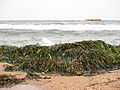
 Algas en la Playa El Rafal.JPG 4,608 × 3,456; 6.03 MB
-
 Antiguo deposito de esparto en la Cala de los Cocederos.JPG 3,456 × 4,608; 4.8 MB
-
 Arranque del Rio Cuervo.JPG 2,304 × 1,728; 829 KB
-
 Arroyo en Solan de Cabras.JPG 2,304 × 1,728; 897 KB
-
 Arroyo entre Las Majadas y Poyatos.JPG 1,728 × 2,304; 835 KB
-
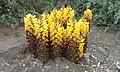
 Berros en la fuente del Estudiante.JPG 2,304 × 1,728; 993 KB
-
 Bosquecillo cerca de Cabo Cope.JPG 4,608 × 3,456; 5.96 MB
-
 Cabo Cope, desde el Cabezo de la Cruz.JPG 4,608 × 3,456; 2.92 MB
-
 Cabo Cope, desde el noroeste.JPG 4,608 × 3,456; 3.33 MB
-
 Cabo Cope, desde el oeste.JPG 4,608 × 3,456; 3.33 MB
-
 Cabo Cope, desde la Cala del Charco.JPG 4,608 × 3,456; 2.93 MB
-
 Cabo Cope, desde la playa del Charco.JPG 4,608 × 3,456; 3.98 MB
-
 Cabo Cope, Punta del Cerro de la Cruz o de las Cabricas.JPG 4,608 × 3,456; 4.37 MB
-
 Cala Cerrada o de los Cocederos, en el Paraje Protegido Las Cuatro Calas.JPG 4,608 × 3,456; 3.71 MB
-
 Cala La Carolina, en el Paraje Protegido Las Cuatro Calas, Murcia.jpg 2,560 × 1,536; 1.4 MB
-
 Cala La Higuerica, en el Paraje Protegido Las Cuatro Calas.JPG 4,608 × 3,456; 4.37 MB
-
 Calarreona, afloramientos rocosos.Las Cuatro Calas.JPG 4,608 × 3,456; 3.69 MB
-
 Calarreona, algas en la playa. (Las Cuatro Calas).JPG 4,608 × 3,456; 5.25 MB
-
 Calarreona, flores en la arena (Las Cuatro Calas).jpg 2,560 × 1,536; 1.28 MB
-
 Calarreona, lado norte, en las Cuatro Calas.JPG 4,608 × 3,456; 3.25 MB
-
 Calarreona, lado sur, en Las Cuatro Calas.JPG 4,608 × 3,456; 3.39 MB
-
 Calarreona, vista al sur, en Las Cuatro Calas.JPG 4,608 × 3,456; 4.5 MB
-
 Calarreona,vista norte, en las Cuatro Calas.jpg 2,560 × 1,536; 1.35 MB
-
 Camino de Fuentescusa.JPG 2,304 × 1,728; 771 KB
-
 Cascada del rio Cuervo.JPG 1,728 × 2,304; 834 KB
-
 Cañaverales en la Laguna del Tobar.JPG 2,304 × 1,728; 791 KB
-
 Caños de la Fuente del Estudiante.JPG 1,728 × 2,304; 1,008 KB
-
 Centro de la Cala de los Cocederos.JPG 4,608 × 3,456; 4.19 MB
-
 Charcos de marea en la Playa El Rafal.JPG 4,608 × 3,456; 5.72 MB
-
 Comienza la lluvia en la Cala La Carolina.JPG 3,456 × 4,608; 9.88 MB
-
 Construcciones en la isla del Fraile, en la ensenada del Hornillo.JPG 4,608 × 3,456; 3.9 MB
-
 Costa norte de Calarreona, en las Cuatro Calas.JPG 4,608 × 3,456; 3.63 MB
-
 Costa sur de la Cala de los Cocederos, ya en la provincia de Almería.JPG 4,608 × 3,456; 3.02 MB
-
 Costa sur de la Isla del Fraile.JPG 4,608 × 3,456; 4.73 MB
-
 Cruce de caminos en la Marina de Cope.JPG 4,608 × 3,456; 3.15 MB
-
 Depositos excavados en el acantilado, Cala de los Cocederos.JPG 4,608 × 3,456; 3.87 MB
-
 Embocadura de la Cala de los Cocederos.JPG 4,608 × 3,456; 3.44 MB
-
 Emparrado decimononico en Solan de Cabras.JPG 2,304 × 1,728; 822 KB
-
 Entrada a la Cala La Carolina.jpg 2,560 × 1,536; 1.32 MB
-
 Fauna salvaje en el río Cuervo.JPG 2,304 × 1,728; 769 KB
-
 Flores de primavera, Cala de los Cocederos.JPG 3,456 × 4,608; 4.86 MB
-
 Fuente de la Tia Perra, ganado en libertad.JPG 2,304 × 1,728; 908 KB
-
 Fuente de la Tia Perra.JPG 2,304 × 1,728; 909 KB
-
 Fuente del Estudiante.JPG 1,728 × 2,304; 995 KB
-
 Gaviotas en la Marina de Cope.JPG 4,608 × 3,456; 3.71 MB
-
 Gravilla multicolor, Calarreona, en las Cuatro Calas.jpg 1,536 × 2,560; 1.46 MB
-
 Isla del Fraile y Cabo Cope, desde el mirador del Hornillo.JPG 4,608 × 3,456; 3.21 MB
-
 Isla del Fraile y Cabo Cope, desde la playa del Hornillo.JPG 4,608 × 3,456; 3.07 MB
-
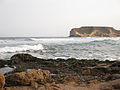
 Isla del Fraile y el Cabezo de la Aguilica.JPG 4,608 × 3,456; 4.14 MB
-
 Isla del Fraile y embarcadero del Hornillo.JPG 4,608 × 3,456; 4.21 MB
-
 Isla del Fraile, desde el mirador del Hornillo.JPG 4,608 × 3,456; 4.46 MB
-
 Isla del Fraile, desde la playa de Calabardina.JPG 4,608 × 3,456; 4.13 MB
-
 Jardin del Balneario de Solan de Cabras.JPG 2,304 × 1,728; 897 KB
-
 La Cala de los Cocederos, vista desde el norte.JPG 4,608 × 3,456; 3.43 MB
-
 La fuente del Caño, Bronchales.jpg 2,560 × 1,536; 1.43 MB
-
 La huella del viento sobre la arena en la Cala La Carolina.JPG 3,456 × 4,608; 7.82 MB
-
 La isla del Fraile desde el embarcadero de El Hornillo.JPG 4,608 × 3,456; 4.53 MB
-
 La Isla del Fraile desde la playa Los Cocederos del Hornillo, Aguilas, Murcia.JPG 4,608 × 3,456; 5.69 MB
-
 La Isla del Fraile, en la ensenada del Hornillo.JPG 4,608 × 3,456; 3.93 MB
-
 La Loma de Bas, cerca del final del Parque.JPG 4,608 × 3,456; 3.19 MB
-
 La Paramera, al pie de los Montes Universales.jpg 2,560 × 1,536; 1.23 MB
-
 Lado norte de la Cala La Carolina, al fondo La Cala de la Higuerica.JPG 4,608 × 3,456; 3.6 MB
-
 Lado Norte de la Cala los Cocederos, con los acantilados de marga amarilla.JPG 4,608 × 3,456; 4.29 MB
-
 Lado Sur de la Cala de los Cocederos.JPG 4,608 × 3,456; 4.03 MB
-
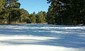
 Laguna de El Tobar.JPG 2,304 × 1,728; 737 KB
-
 Las Corralizas, Montes Universales.jpg 1,536 × 2,560; 1.37 MB
-
 Mañana de invierno, Bronchales.jpg 1,536 × 2,560; 1.4 MB
-
 Medusas arrastradas por la tormenta.JPG 4,608 × 3,456; 9.15 MB
-
 Monumento a la madera.JPG 2,304 × 1,728; 940 KB
-
 Musgo y nieve.jpg 1,536 × 2,560; 1.42 MB
-
 Paso del Diablo, Fuertescusa.JPG 2,304 × 1,728; 842 KB
-
 Pequeña cascada en el arroyo de Solan de Cabras.JPG 2,304 × 1,728; 932 KB
-
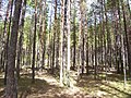
 Pinar, Poyatos.JPG 2,304 × 1,728; 718 KB
-
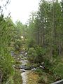
 Pinares en el río Cuervo.JPG 2,304 × 1,728; 838 KB
-
 Piscinas de agua somera en la Cala de los Cocederos.JPG 4,608 × 3,456; 4.33 MB
-
 Piscinas naturales en Calarreona, Las Cuatro Calas.JPG 4,608 × 3,456; 3.6 MB
-
 Pitera (Agave Americana) en la Cala La Carolina.jpg 1,536 × 2,560; 1.34 MB
-
 Playa del Charco.JPG 4,608 × 3,456; 4.22 MB
-
 Plaza de la Iglesia, Bronchales.jpg 1,536 × 2,560; 1.29 MB
-
 Posidonia en la Cala La Higuerica, Paraje Protegido Las Cuatro Calas.JPG 4,608 × 3,456; 5.84 MB
-
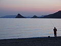
 Primavera en la playa del Charco.jpg 2,560 × 1,536; 1.46 MB
-
 Primera nevada, Las Corralizas.jpg 2,560 × 1,536; 1.33 MB
-
 Primera Nevada, Orihuela del Tremedal.jpg 2,560 × 1,536; 1.34 MB
-
 Punta Parda, lado norte de la Cala de los Cocederos.JPG 3,456 × 4,608; 3.37 MB
-
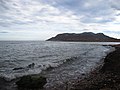
 Puntas de Calnegre, desde el sur.JPG 4,608 × 3,456; 3.32 MB
-
 Puntas de Calnegre, desde Piedras Negras.JPG 4,608 × 3,456; 3.45 MB
-
 Remanso, Calarreona, en las Cuatro Calas.JPG 4,608 × 3,456; 3.98 MB
-
 Restos de Posidonia, Calarreona, en las Cuatro Calas.JPG 4,608 × 3,456; 4.85 MB
-
 Ribera de la laguna de El Tobar.JPG 2,304 × 1,728; 812 KB
-
 Rocas en la arena, Calarreona, las Cuatro Calas.JPG 4,608 × 3,456; 4.29 MB
-
 Suelo del bosque, Montes Universales.jpg 2,560 × 1,536; 1.46 MB
-
 Torre de Cope.JPG 4,608 × 3,456; 3.74 MB
-
 Zona recreativa,Fuente del Estudiante.JPG 1,728 × 2,304; 885 KB


.JPG)
.jpg)


_en_la_Cala_La_Carolina.jpg)


