Category:Images of physical geography of Aragon (by User Lascorz)
Jump to navigation
Jump to search
This is an user category that links the files included to the user's main page. If you are an administrator doing any maintainance tasks, please notify me (User page | Talk) before removing it.
Pages in category "Images of physical geography of Aragon (by User Lascorz)"
This category contains only the following page.
Media in category "Images of physical geography of Aragon (by User Lascorz)"
The following 105 files are in this category, out of 105 total.
-
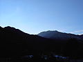
 07.La man pocina (sierra d'As Zucas) - Pineta.jpg 640 × 480; 255 KB
-
 00.Tartera en Pineta.jpg 640 × 480; 230 KB
-
 102.Cementerio de Muro de Bellos.jpg 2,272 × 1,292; 325 KB
-
 000.Seis Marías.JPG 2,272 × 1,704; 1.39 MB
-
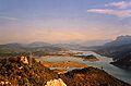
 006.Valle del Cinca.jpg 5,184 × 3,064; 2.12 MB
-
 008.Valle de Broto.JPG 2,272 × 1,704; 538 KB
-
 01.Garganta Escuaín.JPG 3,456 × 5,184; 2.73 MB
-
 01.La Fueva.JPG 5,184 × 3,456; 2.15 MB
-
 01.Lenera.JPG 1,974 × 1,290; 432 KB
-
 012.Río d'A Nata.jpg 5,184 × 3,456; 2.68 MB
-
 018.Río Ara a su paso por Broto.JPG 2,272 × 1,704; 3.39 MB
-
 02.Garganta Escuaín.JPG 5,184 × 3,456; 1.85 MB
-
 02.Glera.JPG 2,816 × 2,112; 823 KB
-
 02.O Portiello d'as Valles.JPG 2,816 × 2,112; 2.71 MB
-
 026.A Fueva Bruis.jpg 5,184 × 3,456; 1.74 MB
-
 027.Plan de l'Uviar - Llanos de Plandeluviar.jpg 2,272 × 1,704; 594 KB
-
 03.Valle de Tella.JPG 5,184 × 3,456; 1.81 MB
-
 033.Río Chate - aman de Sarvisé.jpg 1,600 × 1,200; 1.03 MB
-
 033.Río Chate - aman de Sarvisé 02.jpg 1,600 × 1,200; 437 KB
-
 042.Chistén Collada Sagún.jpg 1,600 × 1,200; 234 KB
-
 053.Buil sierra de Bruello Partara.jpg 2,336 × 1,344; 232 KB
-
 061.Puerto de Foradada.JPG 5,184 × 3,456; 1.06 MB
-
 067.Chistén praus.jpg 2,816 × 2,112; 745 KB
-
 07.Sierra de Campanué.JPG 5,184 × 3,456; 2.29 MB
-
 07.Valle de Tella; San Juan y San Pablo.JPG 1,600 × 1,200; 266 KB
-
 074.Sant Chuan de Plan.jpg 2,816 × 2,112; 3.97 MB
-
 077.Plan 02.JPG 2,816 × 2,112; 2.8 MB
-
 080.Hibierno.jpg 1,600 × 1,200; 1.25 MB
-
 080.Plan 05.JPG 1,600 × 1,200; 1,008 KB
-
 091.La Comuna 01.JPG 1,600 × 1,200; 362 KB
-
 098.Puyarruego - Gorgas d'o Bellós.jpg 1,600 × 1,200; 1.39 MB
-
 102.La Comuna 02.JPG 1,600 × 1,200; 297 KB
-
 103.La Comuna 03.JPG 1,600 × 1,200; 486 KB
-
 104.Boca d'Añisclo I.JPG 1,200 × 1,600; 881 KB
-
 106.As Sestrals dende Sant Úrbez.jpg 1,600 × 1,200; 914 KB
-
 109.Barranco d'el Mont.JPG 1,200 × 1,600; 368 KB
-
 110.Mallarruego.JPG 2,272 × 1,704; 398 KB
-
 111.Cinqueta per Saravillo.JPG 1,200 × 1,600; 361 KB
-
 112.Penya Lierga.jpg 1,600 × 1,200; 941 KB
-
 119.Val d'o río Cinca dende Puértolas.jpg 1,600 × 1,200; 1.07 MB
-
 124.San Vicente de Labuerda nieve.JPG 2,672 × 1,616; 569 KB
-
 124.Sestrals.JPG 1,600 × 1,200; 725 KB
-
 125.Castiel Mayor.jpg 1,600 × 1,200; 949 KB
-
 128.Tozal de Puértolas y Penya Montanyesa.jpg 1,600 × 1,200; 683 KB
-
 131.Faixetas de Bestué.JPG 1,600 × 1,200; 848 KB
-
 133.A Fueva desde Troncedo.jpg 5,184 × 3,456; 1.89 MB
-
 135.Río Formigals.jpg 5,184 × 3,456; 4.12 MB
-
 136.A Fueva.jpg 5,184 × 3,456; 1.97 MB
-
 136.Tozal de Charo.jpg 1,859 × 1,271; 345 KB
-
 143.Portiello de Sercué dende As Fuevas.jpg 1,200 × 1,600; 1.01 MB
-
 146.Sierra Ferrera.JPG 5,152 × 3,144; 2.69 MB
-
 146.Sierra Muro de Roda.jpg 4,169 × 2,799; 1.44 MB
-
 153.Valle de Tella.JPG 1,530 × 678; 125 KB
-
 155.O Puntón y Peña Solano.JPG 724 × 520; 37 KB
-
 158.Val d'o río Cinca (de maitín).jpg 1,600 × 1,200; 840 KB
-
 17.Dolmen de Tella.JPG 1,600 × 1,200; 1.71 MB
-
 19.Valle de Tella.JPG 5,184 × 3,456; 2.9 MB
-
 200.Valle de Tella.JPG 1,537 × 677; 140 KB
-
 211.O Pueyo d'Araguás - Peña Montañesa.JPG 1,600 × 1,200; 779 KB
-
 217.Recolons d'o río Ena y Viello Sobrarbe dende Guaso.jpg 1,600 × 1,200; 797 KB
-
 218.Baixa val de l'Ara dende Guaso.jpg 1,600 × 1,200; 1.05 MB
-
 221.Punta Mener.jpg 4,072 × 2,824; 1.44 MB
-
 222.Río Barrosa.jpg 5,184 × 3,456; 2.89 MB
-
 228.Chisagüés.JPG 5,184 × 3,456; 2.19 MB
-
 24.Ara en Boltaña.JPG 2,816 × 2,112; 945 KB
-
 240.Rio Susía.JPG 5,184 × 3,456; 3.48 MB
-
 241.Roca valle Susía.JPG 5,184 × 3,456; 3.1 MB
-
 242.Terreros valle Susía.JPG 5,184 × 3,456; 3.16 MB
-
 243.Carretera HU-V-3611.jpg 3,454 × 2,486; 1.34 MB
-
 250.Río Barrosa.JPG 5,184 × 3,456; 2.49 MB
-
 261.Valle de Bielsa.JPG 5,184 × 3,456; 1.74 MB
-
 262.Bielsa e la suya valle.jpg 5,184 × 3,456; 5.87 MB
-
 262.Bielsa en a valle.jpg 3,704 × 2,592; 1.36 MB
-
 32.Poza del Yaga.JPG 1,600 × 1,200; 486 KB
-
 33.Cascada del Yaga 01.JPG 1,200 × 1,600; 398 KB
-
 35.Trillo.JPG 5,184 × 3,456; 987 KB
-
 37.Sierra Ferrera.JPG 4,336 × 2,536; 836 KB
-
 38.Rio Yaga en Estaroniello.JPG 1,600 × 1,200; 560 KB
-
 75.Entremont.JPG 5,022 × 3,190; 1.09 MB
-
 85.Barranco O Plano.JPG 5,184 × 3,456; 1.63 MB
-
 94.Congosto d'as Cambras - Río Bellós.JPG 1,600 × 1,200; 1.34 MB
-
 96.Congosto d'as Cambras - Cambras y esplugas.JPG 1,200 × 1,600; 1.36 MB
-
 97.Labuerda. Valle del Cinca.JPG 1,600 × 1,200; 365 KB
-
 97.Tres Marías.JPG 2,272 × 1,704; 301 KB
-
 As Cortz - Val d'A Fueva dende o lugar.jpg 1,517 × 597; 168 KB
-
 Bielsa - Amanecer.jpg 640 × 480; 79 KB
-
 Bielsa - Plaza Mayor.jpg 640 × 480; 150 KB
-
 Boltaña (2).JPG 2,560 × 1,920; 884 KB
-
 Boltaña.JPG 2,560 × 1,920; 719 KB
-
 Broto (bis).JPG 2,560 × 1,920; 1.03 MB
-
 Forato d'As Devotas.jpg 640 × 480; 130 KB
-
 Geografía.Puértolas-Fanlo.JPG 1,333 × 938; 129 KB
-
 La Infortunada - Pantano.jpg 640 × 480; 316 KB
-
 Pan.Morillo(3).JPG 2,272 × 1,704; 1.11 MB
-
 Panorámica de Muro Completa.JPG 4,255 × 649; 550 KB
-
 Pineta - Cascada en el nacimiento del cinca.jpg 480 × 640; 309 KB
-
 Pineta - fabera.jpg 640 × 480; 382 KB
-
 Samitier - Congosto d'Entremont.jpg 1,967 × 1,295; 225 KB
-
 Samitier - Congosto Entremont Modif.JPG 1,967 × 1,295; 328 KB
-
 Samitier - Embalse de El Grado.jpg 1,974 × 1,301; 125 KB
-
 Samitier - Embalse de Mediano Modif.jpg 1,962 × 1,290; 221 KB
-
 Samitier - Embalse de Mediano.jpg 1,962 × 1,290; 161 KB
-
 Sequía - Nivel Histórico del Cinca.jpg 480 × 640; 239 KB
-
 Toponimia Peña Montañesa.JPG 1,164 × 538; 117 KB
-
 Valle de La Comuna.01.JPG 1,600 × 1,200; 369 KB
_-_Pineta.jpg)


.jpg)


.JPG)

.JPG)


.JPG)


