Category:Inca Empire
Jump to navigation
Jump to search
English: The Inca Empire (1438–1533) — dominant in 15th and early 16th century western South America.
Español: Imperio incaico.
empire demolished by Francisco Pizarro in the 16th century   .svg) | |||||
| Upload media | |||||
| Instance of | |||||
|---|---|---|---|---|---|
| Capital | |||||
| Basic form of government |
| ||||
| Official language | |||||
| Head of state |
| ||||
| Inception |
| ||||
| Dissolved, abolished or demolished date |
| ||||
| Religion or worldview | |||||
| Follows |
| ||||
| Followed by | |||||
 | |||||
Subcategories
This category has the following 10 subcategories, out of 10 total.
Media in category "Inca Empire"
The following 200 files are in this category, out of 315 total.
(previous page) (next page)-
 "El General Quisquis" (s. XIX), óleo sobre lienzo de autor anónimo. MuNa, Quito.jpg 2,092 × 2,846; 1.27 MB
-
 Algemeine Geschichte der Länder und Völker von America (1752) (14760443336).jpg 1,868 × 2,588; 1.86 MB
-
 Algemeine Geschichte der Länder und Völker von America (1752) (14760443916).jpg 2,570 × 1,526; 1.62 MB
-
Antara.mid 0.0 s; 22 KB
-
 Armas-incas.jpg 300 × 377; 9 KB
-
 Atabalipa Roy Du Peru (s. XVII), óleo sobre lienzo. Anónimo.jpg 1,955 × 2,534; 1.16 MB
-
 Auca Runa.png 178 × 268; 89 KB
-
 Baluarte de Rumicucho.jpg 1,912 × 1,080; 629 KB
-
 Calle Hatunrumiyoc del Cusco.jpg 1,200 × 1,600; 242 KB
-
 Catarata de Tecsecocha en Ccorca.jpg 1,200 × 1,600; 419 KB
-
 Cerro la costilla1.jpg 371 × 254; 14 KB
-
 Chacana method.png 557 × 542; 8 KB
-
 Chakana.jpg 205 × 206; 6 KB
-
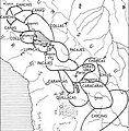 Chefferies et états altiplaniens pré-incas.jpg 1,246 × 1,267; 582 KB
-
 Chsqui or the Inca messenger.jpg 830 × 1,186; 213 KB
-
 Ciudadela de Machu Picchu 2019.jpg 1,080 × 1,080; 178 KB
-
 Coat of Arms of the Kingdom of Peru completed in 1616.jpg 1,921 × 2,999; 2.27 MB
-
 Diagrama ayllu.png 295 × 403; 81 KB
-
 Edificios de Rumicucho.jpg 1,912 × 1,080; 563 KB
-
 El incario y la conquista española, mural de Oswaldo Guayasamín.jpg 3,180 × 1,808; 943 KB
-
 El rey INCA- The Inca King.jpg 2,740 × 3,780; 3.99 MB
-
 Emperadores del Peru Parte1 - AHG.jpg 10,179 × 14,198; 12.24 MB
-
 Emperadores del Peru Parte2 - AHG.jpg 10,066 × 14,220; 21.61 MB
-
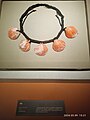
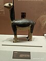
 Estatuilla antropomorfa inca. MuNa, Quito.jpg 768 × 1,024; 170 KB
-
 Famtarcohuaman.jpg 799 × 476; 95 KB
-
 First Coat of Arms of the Kingdom of the Incas (1615).jpg 382 × 549; 75 KB
-
 Hatun Chasqui POMA0825.jpg 382 × 549; 48 KB
-
-

-
 Herbert M. Herget, Give us, o sun, thy pure and sacred fire.jpg 715 × 1,018; 294 KB
-
 Herbert M. Herget, Relays of swift post-runners linked the Empire.jpg 487 × 650; 196 KB
-
-
 HUARILAPHAJ.jpg 1,641 × 693; 120 KB
-
 Inca Empire South America.svg 485 × 553; 56 KB
-
 Inca graves in Peru.jpg 480 × 387; 61 KB
-
 Inca punishment.png 404 × 541; 173 KB
-
 Inca Tunic.jpg 3,527 × 4,000; 4.39 MB
-
 Incallajta.jpg 2,592 × 3,888; 2.59 MB
-
 Incan brain surgery.jpg 2,304 × 3,072; 1.18 MB
-
 Machu Picchu , the lost city of the inca empire.jpg 4,608 × 3,456; 3.44 MB
-
 Machu Picchu station, Aguas Calientes, Peru (Unsplash).jpg 3,072 × 2,048; 1.94 MB
-
 Makana-Pukayaku.jpg 872 × 680; 268 KB
-
 Murallas de Rumicucho1.jpg 4,608 × 3,456; 6.8 MB
-
 Murallas de Rumicucho2.jpg 1,910 × 1,080; 704 KB
-
 Objects from Americas.jpg 3,000 × 4,000; 3.67 MB
-
 Overlooking spacious courtyards and narrow lanes of Cuzco, City of the Sun, Peru (cropped).tif 2,313 × 2,240; 14.83 MB
-
 Overlooking spacious courtyards and narrow lanes of Cuzco, City of the Sun, Peru.tif 5,970 × 3,105; 53.05 MB
-
 Pachacamac121.jpg 1,080 × 719; 387 KB
-
 Parte-primera-de-la-cronica-del-Peru-al-ruso-2009.jpg 964 × 1,517; 363 KB
-
 Pikillaqta walls.jpg 3,024 × 4,032; 5.62 MB
-
 Piramide clases incas.jpg 454 × 547; 21 KB
-
 POMA0159.jpg 383 × 549; 70 KB
-
 POMA0434v.jpg 720 × 1,104; 222 KB
-
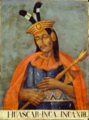 Portrait de Huascar sapa Inca.png 354 × 479; 359 KB
-
 Portrait de Tupac Yupanqui Inca.png 274 × 401; 217 KB
-
 Puente Inca Pucayaku 2.jpg 960 × 720; 549 KB
-
 Puente Inca Pucayaku.jpg 960 × 720; 484 KB
-
 Pumapungo.jpg 1,024 × 768; 502 KB
-
 Qoricancha (vista del patio).jpg 1,125 × 1,382; 168 KB
-
 Qoricancha fachada.jpg 1,125 × 604; 95 KB
-
 Qoricancha lateral.jpg 1,126 × 1,217; 207 KB
-
 Qoricancha patio.jpg 1,125 × 622; 156 KB
-
 Qoricancha portada.jpg 1,125 × 1,403; 210 KB
-
 Qullqa (Inca Warehouse) by Guaman Poma.jpg 379 × 549; 69 KB
-
 Ruinas Incas a los pies del volcán Licancabur Bolivia.jpg 1,024 × 768; 683 KB
-
 Ruinas incas de Pikillaqta.jpg 960 × 1,280; 176 KB
-
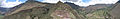 Sacred Valley Panorama.jpg 6,611 × 1,064; 5.78 MB
-
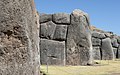 Sacsayhuaman-Inca wall.jpg 960 × 600; 192 KB
-
Sikuri.mid 0.0 s; 10 KB
-
 Skromnitsky The state management system of economy of Inka Empire rus.png 2,400 × 1,600; 429 KB
-
 Système Urco-Uma Suyu altiplanien.jpg 751 × 796; 148 KB
-
-

-

-

-

-

-

-
-

-

-
-

-
-

-

-

-

-

-

-

-
-
-

-
-
-

-

-

-

-
-
-

-
-

-
-
-

-

-
-

-
-

-

-

-

-

-

-

-
-

-

-

-

-

-

-
-

-

-
-

-

-

-

-

-
-

-

-

-

-
-

-

-

-

-
-
-
-

-

-

-

-
-
-

-

-

-
-
-

-

-
-

-

-

-

-

-
-

-

-

-
-

-
-

-
-

-
-
-

-
-

-

-

-

-

-

-
-
-
-

-

-

-
-

-

-

-

-

-
,_%C3%B3leo_sobre_lienzo_de_autor_an%C3%B3nimo._MuNa,_Quito.jpg)
_(14760443336).jpg)
_(14760443916).jpg)

,_%C3%B3leo_sobre_lienzo._An%C3%B3nimo.jpg)


.jpg)


.jpg)


.jpg)


_by_Guaman_Poma.jpg)


Categories:
- History of the Incas
- History of Argentina
- Chile in the 16th century
- History of Bolivia
- History of Ecuador
- Empires by name
- Former countries of South America
- Former monarchies
- 15th-century establishments in South America
- States and territories disestablished in the 16th century
- Inca
- History of indigenous peoples of South America