Category:Information boards in Burgenland
Jump to navigation
Jump to search
Media in category "Information boards in Burgenland"
The following 111 files are in this category, out of 111 total.
-
 20200705 Dreiländerecke A H SLO Infotafel.jpg 3,904 × 2,958; 8.23 MB
-

-
 Awarischer Greif in Zillingtal-Celindof.jpg 5,568 × 3,712; 9.05 MB
-
 Awarischer Greif, Zillingtal-Celindof, Beschreibung (I).jpg 5,568 × 3,712; 7.52 MB
-
 Awarischer Greif, Zillingtal-Celindof, Beschreibung (II).jpg 5,568 × 3,712; 7.03 MB
-
 Awarischer Greif, Zillingtal-Celindof, Beschreibung (III).jpg 5,568 × 3,712; 7.59 MB
-
 Awarischer Greif, Zillingtal-Celindof, Beschreibung (IV).jpg 5,568 × 3,712; 10.31 MB
-
 Bernsteinstraße-Radweg - Deutschkreutz.jpg 5,436 × 2,494; 3.44 MB
-
 Bernsteinstraße-Radweg - Großmutschen.jpg 3,575 × 1,558; 2.38 MB
-
 Bernsteinstraße-Radweg - Großwarasdorf.jpg 5,389 × 2,315; 2.92 MB
-
 Bernsteinstraße-Radweg - Horitschon.jpg 5,571 × 2,294; 2.7 MB
-
 Bernsteinstraße-Radweg - Nebersdorf.jpg 3,435 × 1,474; 1.95 MB
-
 Bernsteinstraße-Radweg - Neckenmarkt.jpg 3,544 × 1,501; 1.67 MB
-
 Bernsteinstraße-Radweg - Raiding.jpg 5,795 × 2,532; 3.04 MB
-
 Bernsteinstraße-Radweg - Strebersdorf.jpg 2,366 × 3,491; 1.42 MB
-
 Brunnenschild in der Ruine Landsee.jpg 1,033 × 2,591; 587 KB
-
 Brücke von Andau Gedenktafel.jpg 2,048 × 3,072; 4.7 MB
-
 Ehrenfeld Donnerskirchen Tafel.jpg 5,184 × 3,888; 5.5 MB
-
 Erläuterungen Bartolomäusquelle Illmitz.jpg 1,282 × 2,882; 990 KB
-
 EU-120 Zürgelbaum CF9A1769.jpg 3,333 × 2,222; 1.61 MB
-
 Filmkulisse für Die Brücke von Andau.jpg 3,072 × 2,048; 4 MB
-
 Forchtenstein - Ortsplan (01).jpg 4,500 × 3,000; 2.28 MB
-
 Freilichtmuseum Gerersdorf 6616.JPG 5,184 × 3,456; 8.38 MB
-
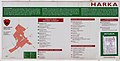 Gemeinde-Werbetafel HU-Harka (Harkau), Grenze zu AT-Neckenmarkt (220912).jpg 1,867 × 942; 1.22 MB
-
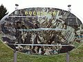
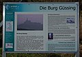 Güssing-3008.jpg 2,764 × 1,923; 1.02 MB
-
 Harlingkreuz, Markt Sankt Martin - infoboard 01.jpg 3,176 × 3,855; 6.21 MB
-
 Harlingkreuz, Markt Sankt Martin - infoboard 02.jpg 1,931 × 2,815; 826 KB
-
 Hügelgräberfeld Birich Ausstellungsraum 01.jpg 4,166 × 3,124; 2.65 MB
-
 Illmitz Geologie der Bartolomäusquelle.jpg 1,944 × 2,896; 901 KB
-
 Illmitz-Bartholomäusquelle 1421.JPG 3,456 × 5,184; 5.33 MB
-
 Illmitz-Bartholomäusquelle 1422.JPG 3,456 × 5,184; 4.7 MB
-
 Illmitz-Bartholomäusquelle 1423.JPG 3,456 × 5,184; 4.6 MB
-
 Info board at St. Martin, Deutsch Schützen (cropped).jpg 3,965 × 2,742; 5.7 MB
-
 Info board at St. Martin, Deutsch Schützen.jpg 4,300 × 3,078; 5.1 MB
-
 Infotafeln Wanderwege im öko Energie Land.jpg 3,712 × 5,568; 5.84 MB
-
 Kirche-Winden a. See-0002.jpg 2,003 × 1,544; 1.94 MB
-
 Klostermarienberg-Romanische Klosteranlage.jpg 4,928 × 3,264; 1.91 MB
-
 Kobersdorf Synagoge Geschichte Aushang (021016).jpg 1,380 × 1,770; 2.38 MB
-
 Komitatsburg ArD-1-027 in A-7361 Lutzmannsburg.jpg 2,500 × 1,746; 1.18 MB
-
 Leithaprodersdorf 5789.JPG 5,184 × 3,456; 5.06 MB
-
 Leithaprodersdorf 5826.JPG 5,184 × 3,456; 6.5 MB
-
 Leithaprodersdorf 5828.JPG 5,184 × 3,456; 6.34 MB
-
 Loipersbach im Burgenland - Ortsplan (01).jpg 3,000 × 2,000; 1.33 MB
-
 Maria-Theresien-Stein Oe-RS I 277-01 (02).jpg 3,415 × 2,530; 4.96 MB
-
 Mattersburg - Jüdischer Friedhof (04).jpg 3,000 × 2,000; 1.19 MB
-
 Mattersburg - Karte der Region Rosalia (01).jpg 3,000 × 2,000; 1.42 MB
-
 Moerbisch03Seepanorama.JPG 3,646 × 2,046; 4.95 MB
-
 Moschendorf Der Uhudler 50369.JPG 1,536 × 2,048; 2.22 MB
-
 Museum für Holz und Handwerk St. Kathrein im Burgenland 01.jpg 4,752 × 3,168; 5.69 MB
-
 Nationalpark Neusiedler See-Seewinkel - 20 - Infoboard beim Ziehbrunnen an der Zicklacke.jpg 5,877 × 3,918; 12.93 MB
-
 Nationalpark Neusiedler See-Seewinkel - 22 - Pflanzen bei Illmitzer Zicklacke.jpg 6,000 × 4,000; 19.77 MB
-

-
 Naturpark Landseer Berge in Weingraben 02.jpg 3,880 × 2,984; 5.81 MB
-
 Neudoerfl - Ortsplan (01).jpg 3,000 × 2,000; 1.46 MB
-
 Neudoerfl - Plan Region Rosalia (01).JPG 3,000 × 2,000; 1.5 MB
-
 Neutal - Museum für Baukultur (Bild1).jpg 2,048 × 3,072; 3.34 MB
-
 NSG 1021 Mattersburger Kogel CF9A1699.jpg 3,333 × 2,222; 1.9 MB
-
 Oberloisdorf-Dogmenkreuz-02.jpg 2,000 × 1,500; 1.49 MB
-
 Orientierungsplatte zur Aussicht Landsee.jpg 2,343 × 1,253; 386 KB
-
 Parndorf Kuruzzenwall Erklärungstafel Signatur.jpg 2,896 × 1,944; 4.64 MB
-
 Parndorf Kuruzzenwall Erklärungstafel.jpg 2,896 × 1,944; 5.42 MB
-
 Pinkafeld Lampelfeld 5.jpg 2,209 × 1,693; 721 KB
-
 Poettsching - Bildtafel Gedächtnisweg.jpg 2,000 × 3,000; 679 KB
-
 Poettsching - Geschichtstafel.jpg 2,600 × 3,900; 2.45 MB
-
 Poettsching - Grabverzeichnis (01).jpg 2,000 × 3,000; 1.04 MB
-
 Pöttsching 5089.JPG 5,184 × 3,456; 3.12 MB
-
 Rosalienkapelle Beschreibung.jpg 966 × 1,250; 968 KB
-
 Sankt Michael im Burgenland Ortsplan.jpg 3,090 × 2,075; 3.79 MB
-
 Schandorf - Information board for Tumulis in Bauernwald (08).jpg 3,000 × 2,000; 1.45 MB
-
 Schandorf - Information board for Tumulis in Bauernwald (09).jpg 1,400 × 1,540; 403 KB
-
 Schandorf - Information board for Tumulis in Bauernwald (10).jpg 3,000 × 2,000; 1.54 MB
-
 Schandorf - Information board for Tumulis in Bauernwald (11).jpg 1,200 × 1,500; 399 KB
-
 Schandorf - Information board for Tumulis in Bauernwald (12).jpg 3,000 × 2,000; 1.33 MB
-
 Schandorf - Information board for Tumulis in Bauernwald (13).jpg 3,000 × 2,000; 1,007 KB
-
 Schandorf - Information board for Tumulis in Bauernwald (14).jpg 3,000 × 2,000; 1.38 MB
-
 Schandorf - Information board for Tumulis in Bauernwald (15).jpg 3,000 × 2,000; 1.43 MB
-
 Schandorf - Information board for Tumulis in Bauernwald (16).jpg 1,400 × 2,000; 1.01 MB
-
 Schattendorf - Ortsplan (01).jpg 3,000 × 2,000; 1.45 MB
-
 Schildtafel Komplett.jpg 1,280 × 960; 203 KB
-
 Schildtafel Links.jpg 960 × 1,280; 231 KB
-
 Schildtafel Rechts.jpg 960 × 1,280; 200 KB
-
 Schloss Esterhazy Eisenstadt Burgenland Österreich.jpg 2,516 × 1,468; 1.25 MB
-
 Siegendorf - Übersicht Wanderweg (01).jpg 3,000 × 2,000; 977 KB
-
 Siegendorf - Hügelgräber (01).jpg 3,000 × 2,000; 1.27 MB
-
 St Margarethen im Burgenland - Tafel zu Jiri Seiferts Glockenturm.jpg 6,000 × 4,000; 15.2 MB
-
 Stadtschlaining-0013.jpg 3,216 × 5,088; 7.79 MB
-
 Tadten - Infotafel Tadten & Fakten - 1.jpg 5,000 × 3,333; 6.07 MB
-
 Tadten - Infotafel Tadten & Fakten - 2.jpg 6,000 × 4,000; 6.34 MB
-
 Trausdorf-Hutweide.JPG 5,184 × 3,456; 2.99 MB
-
 Trausdorf-Kunstmeile 4821.JPG 3,456 × 5,184; 4.34 MB
-
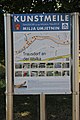 Trausdorf-Kunstmeile 4822.JPG 3,456 × 5,184; 2.89 MB
-
 Treppenhaus Landsee Erklärungsschild.jpg 1,446 × 1,978; 482 KB
-
 Tromejnik 01.jpg 5,841 × 3,894; 8.14 MB
-
 Tschardake 4.jpg 2,377 × 3,264; 864 KB
-
 Turmbauer VordereBurg 03.jpg 4,608 × 3,456; 2.4 MB
-
 Ulrichskapelle Tafel 27471 in A-7522 Heiligenbrunn.jpg 4,503 × 3,197; 2.49 MB
-
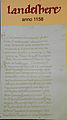 Urkundentext Landesehre-Landsee groß.jpg 1,386 × 2,482; 617 KB
-
 Urkundenzeilen Landeshere.jpg 2,793 × 1,821; 2.15 MB
-
 Wiesen - Ortsplan (01).jpg 2,000 × 3,000; 1.35 MB
-
 Zagersdorf - Hügelgräberfeld Urbarialwald (02).jpg 3,000 × 2,000; 1.64 MB
-
 Zagersdorf - Hügelgräberfeld Urbarialwald (03).jpg 3,648 × 2,736; 7.42 MB
-
 Zagersdorf - Weinwanderwegtafel (01).jpg 3,000 × 2,000; 1.1 MB
-
 Zagersdorf - Weinwanderwegtafel (02).jpg 2,000 × 3,000; 991 KB
-
 Zagersdorf - Weinwanderwegtafel (03).JPG 3,648 × 2,736; 2.94 MB
-
 Zagersdorf - Weinwanderwegtafel (04).JPG 2,736 × 3,648; 5.28 MB
-
 Zilli-Skulptur, Zillingtal 03.jpg 3,456 × 5,184; 4.16 MB
-
 Zilli-Skulptur, Zillingtal 04.jpg 3,456 × 5,184; 4.04 MB
-
 Zillingtal - Tiefenbohrung (01).jpg 3,000 × 2,000; 1.18 MB
-
 Zilliskulptur, Infotafel (I).jpg 3,712 × 5,568; 5.9 MB
-
 Zilliskulptur, Infotafel (II).jpg 3,712 × 5,568; 5.89 MB
-
 Ödes Schloß CF9A9995.jpg 3,009 × 2,006; 1.14 MB

_Mattes_2022-07-18.jpg)

.jpg)
.jpg)
.jpg)
.jpg)


.jpg)

,_Grenze_zu_AT-Neckenmarkt_(220912).jpg)


.jpg)


.jpg)


.jpg)
.jpg)
.jpg)
.jpg)


.jpg)
.JPG)
.jpg)


.jpg)


.jpg)
.jpg)
.jpg)
.jpg)
.jpg)
.jpg)
.jpg)
.jpg)
.jpg)
.jpg)


.jpg)
.jpg)


.jpg)
.jpg)
.jpg)
.jpg)
.jpg)
.JPG)
.JPG)


.jpg)
.jpg)
.jpg)
