Category:Information boards in Rheinbreitbach
Jump to navigation
Jump to search

Media in category "Information boards in Rheinbreitbach"
The following 67 files are in this category, out of 67 total.
-
 Rheinbreitbach Am Grendel Literarischer Simrock-Freiligrath-Weg.jpg 2,939 × 4,182; 1.96 MB
-
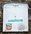 Rheinbreitbach Breitbach Informationstafel.jpg 642 × 712; 128 KB
-
 Rheinbreitbach Breite Heide Bleibtreu-Waldweg.jpg 2,951 × 2,274; 1.57 MB
-
 Rheinbreitbach Breite Heide Bleibtreuweg.jpg 3,095 × 4,301; 3.19 MB
-
 Rheinbreitbach Burgstraße 2 Informationstafel.jpg 2,999 × 2,202; 1.69 MB
-
 Rheinbreitbach Burgstraße 9 Informationstafel.jpg 3,854 × 2,258; 1.59 MB
-
 Rheinbreitbach Großer Büchel 5–7 Informationstafel.jpg 3,514 × 2,291; 1.65 MB
-
 Rheinbreitbach Hauptstraße 38 Informationstafel.jpg 3,660 × 2,696; 2.37 MB
-
 Rheinbreitbach Hauptstraße Denkmal Separatisten-Schlacht Informationstafel.jpg 3,733 × 2,703; 2.17 MB
-
 Rheinbreitbach Hauptstraße Heimatmuseum Innenhof Wandgemälde Informationstafeln.jpg 4,128 × 2,356; 2.8 MB
-
 Rheinbreitbach Hauptstraße 5 Informationstafel.jpg 2,322 × 3,812; 1.81 MB
-
 Rheinbreitbach Hauptstraße 11 Informationstafel Gedenktafel.jpg 3,826 × 4,035; 4.04 MB
-
 Rheinbreitbach Hauptstraße 12 Informationstafel.jpg 2,245 × 1,605; 898 KB
-
 Rheinbreitbach Hauptstraße 14 Informationstafel.jpg 3,945 × 2,910; 2.66 MB
-
 Rheinbreitbach Hauptstraße 18 Informationstafel.jpg 4,140 × 2,925; 2.2 MB
-
 Rheinbreitbach Hauptstraße 21 Informationstafel.jpg 2,821 × 2,088; 1.21 MB
-
 Rheinbreitbach Hauptstraße 23 Informationstafel.jpg 3,263 × 2,419; 1.88 MB
-
 Rheinbreitbach Hauptstraße 29 Heimatmuseum Informationstafel.jpg 1,903 × 1,375; 840 KB
-
 Rheinbreitbach Hauptstraße 45 Informationstafel.jpg 3,377 × 2,279; 1.69 MB
-
 Rheinbreitbach Hauptstraße 59 Informationstafel.jpg 3,506 × 2,618; 1.54 MB
-
 Rheinbreitbach Hauptstraße Informationstafel Villa Biesenbach.jpg 3,985 × 2,632; 1.6 MB
-
 Rheinbreitbach Im Sand 8-10 Informationstafel.jpg 3,430 × 2,288; 1.97 MB
-
 Rheinbreitbach Infotafel Reste einer Kupfererz-Aufbereitungsanlage fd (7).jpg 3,888 × 5,184; 6.43 MB
-
 Rheinbreitbach Wegekreuz Josefstraße Grabenstraße Informationstafel.jpg 2,973 × 2,252; 1.29 MB
-
 Rheinbreitbach Kirchgasse Informationstafel Altes Pfarrhaus.jpg 2,562 × 1,833; 978 KB
-
 Rheinbreitbach Kirchplatz Informationstafel.jpg 4,997 × 3,648; 3.9 MB
-
 Rheinbreitbach Kirchplatz 2 Informationstafel.jpg 3,270 × 2,349; 1.54 MB
-
 Rheinbreitbach Kirchplatz 4 Informationstafel.jpg 3,300 × 2,240; 1.53 MB
-
 Rheinbreitbach Koppel Aussichtspunkt Informationstafel.jpg 4,978 × 3,318; 3.86 MB
-
 Rheinbreitbach Koppel Informationstafel Koppel.jpg 3,279 × 2,137; 1.22 MB
-
 Rheinbreitbach Koppel Informationstafel Koppelkreuz.jpg 2,175 × 3,585; 3.13 MB
-
 Rheinbreitbach Koppel Informationstafel Rheinbreitbach um 1900.jpg 4,027 × 2,888; 2.32 MB
-
 Rheinbreitbach Koppel Informationstafel „Rätselhafter Stein“.jpg 3,465 × 3,099; 2.71 MB
-
 Rheinbreitbach Koppel Informationstafel.jpg 3,960 × 2,322; 3.05 MB
-
 Rheinbreitbach Koppel Inschrift (2).jpg 3,420 × 2,290; 2.24 MB
-
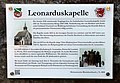 Rheinbreitbach Leonarduskapelle Informationstafel.jpg 3,178 × 2,203; 1.72 MB
-
 Rheinbreitbach Mühlenweg Informationstafel Flugfeld 1945.jpg 1,325 × 1,874; 484 KB
-
 Rheinbreitbach Mühlenweg Informationstafel Kalkbrennofen.jpg 4,541 × 3,492; 3.8 MB
-
 Rheinbreitbach Obere Burg Informationstafel.jpg 4,095 × 2,245; 2.71 MB
-
 Rheinbreitbach Obere Burg Informationstafel (2).jpg 4,145 × 2,979; 3.31 MB
-
 Rheinbreitbach Renesse-Platz Förderwagen Grube Virneberg.jpg 4,338 × 3,408; 4.19 MB
-
 Rheinbreitbach Reste Kupfererz-Aufbereitungsanlage Informationstafel.jpg 3,339 × 4,337; 3.29 MB
-
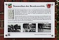 Rheinbreitbach Rheinstraße Stauweiher Bendenmühle.jpg 3,336 × 2,242; 1.98 MB
-
 Rheinbreitbach Rheinstraße 16 Informationstafel.jpg 3,509 × 2,115; 1.72 MB
-
 Rheinbreitbach Rheinstraße 16 Informationstafel „Witwenhaus“.jpg 3,282 × 2,265; 1.71 MB
-
 Rheinbreitbach Rheinstraße 29 Informationstafel.jpg 3,013 × 2,142; 4.12 MB
-
 Rheinbreitbach Rheinstraße 62 Bendenmühle Informationstafel.jpg 3,336 × 2,297; 1.55 MB
-
 Rheinbreitbach Rolandsmühle Informationstafel.jpg 2,413 × 2,258; 1.47 MB
-
 Rheinbreitbach Simrockstraße 7 Burg Steineck Informationstafel.jpg 3,478 × 2,678; 2.2 MB
-
 Rheinbreitbach Simrockstraße 8 Informationstafel.jpg 2,925 × 2,103; 1.33 MB
-
 Rheinbreitbach Simrockstraße 47 Informationstafel.jpg 2,892 × 2,315; 1.68 MB
-
 Rheinbreitbach St. Maria Magdalena Informationstafel.jpg 3,047 × 2,212; 1.5 MB
-
 Rheinbreitbach St. Maria Magdalena Informationstafel Tempelhof.jpg 2,231 × 1,635; 1.01 MB
-
 Rheinbreitbach Untere Burg Informationstafel.jpg 2,897 × 2,067; 2.47 MB
-
 Rheinbreitbach Untere Burg Wappenstein (2).jpg 3,847 × 2,946; 3.49 MB
-
 Rheinbreitbach Virneberger Kreuz Informationstafel.jpg 3,818 × 4,860; 3.4 MB
-
 Rheinbreitbach Vonsbach 2 Informationstafel.jpg 4,728 × 3,389; 4.26 MB
-
 Rheinbreitbach Weinbergsweg Informationstafel Breitbach.jpg 2,738 × 2,288; 1.01 MB
-
 Rheinbreitbach Weinbergsweg Österreicherdenkmal Informationstafel.jpg 4,587 × 3,591; 3.21 MB
-
 Rheinbreitbach Weinbergsweg 2 Informationstafel.jpg 4,329 × 3,811; 3.01 MB
-
 Rheinbreitbach Westerwaldstraße Informationstafel Waldschwimmbad.jpg 3,266 × 3,881; 3.66 MB
-
 Rheinbreitbach Westerwaldstraße 6 Informationstafel.jpg 3,459 × 2,144; 1.91 MB
-
 Rheinbreitbach Westerwaldstraße 8–10 Informationstafel.jpg 2,717 × 2,001; 1.36 MB
-
 Rheinbreitbach Westerwaldstraße 12 Informationstafel.jpg 2,749 × 1,993; 1.46 MB
-
 Rheinbreitbach Westerwaldstraße 13 Informationstafel Untere Mühle.jpg 2,954 × 2,195; 1.38 MB
-
 Rheinbreitbach Westerwaldstraße 24 Informationstafel.jpg 3,214 × 2,292; 2.05 MB
-
 Rheinbreitbach Westerwaldstraße Informationstafel Naturpark.jpg 2,660 × 3,804; 3.26 MB


.jpg)


.jpg)


.jpg)


.jpg)


