Category:Interpretive signs of the U.S. National Park Service
Jump to navigation
Jump to search
English: Interpretive signs of the United States National Park Service, including wayside exhibits. [1]
Subcategories
This category has the following 13 subcategories, out of 13 total.
C
I
Media in category "Interpretive signs of the U.S. National Park Service"
The following 200 files are in this category, out of 251 total.
(previous page) (next page)-

-
 16-20-031, casements and cannon - panoramio.jpg 2,048 × 1,366; 1.83 MB
-

-

-
-

-

-

-

-
-
 2018-06-27 spring opening Sunrise (42167365235).jpg 2,000 × 1,333; 681 KB
-

-

-
-

-

-
 A Canal to the West (373fcc5d-ab26-4d70-a270-34d390198811).jpg 1,080 × 810; 386 KB
-
 A Desert Oasis sign, Oct 16.jpg 2,592 × 1,944; 2.34 MB
-

-
 A Story of Courage and Resilience (f4055034-0aaa-4edf-baa4-27e2193490c7).jpg 3,000 × 4,000; 2.23 MB
-

-

-
 Alcatraz, Wikiexp 72.jpg 3,877 × 2,730; 3.23 MB
-
 Alcatraz, Wikiexp 75.jpg 4,719 × 3,136; 5.08 MB
-
 Alcatraz, Wikiexp 77.jpg 3,264 × 4,912; 5.31 MB
-
 Alcatraz, Wikiexp 78.jpg 3,264 × 4,912; 5.47 MB
-
 Allegheny Portage Railroad To Staple Bend Tunnel sign.jpg 6,016 × 4,000; 6.47 MB
-
 American Monuments sign at Staple Bend Tunnel.jpg 6,016 × 4,000; 5.97 MB
-
 American Samoa National Park sign for natural landmarks.jpg 5,312 × 2,988; 4.81 MB
-
 American Samoa National Park sign for Pola Island.jpg 5,312 × 2,988; 6.26 MB
-
 Area Map, Golden Spike National Historical Park, Promontory, Utah (31449206768).jpg 5,184 × 3,888; 4.65 MB
-
 Artillery - War in the Pacific National Historical Park (Ga'an Point) - DSC00879.JPG 4,320 × 3,240; 4.85 MB
-
 Avalanche Chute exhibit, June 2013 (9240491048).jpg 2,736 × 3,648; 1.22 MB
-
 Battleground National Cemetery (43756403-3f03-4b5b-8e98-88d34751b7e2).jpg 1,080 × 810; 326 KB
-
 Birthplace 19-10-18 596.jpg 4,608 × 3,072; 4.19 MB
-
 Bolivar Heights sign.png 740 × 555; 819 KB
-
 Book-Hawaii-Vtorov-Kauai-1200-001.jpg 1,423 × 800; 792 KB
-
 Boundary Oak Walk 19-10-18 631.jpg 4,608 × 3,072; 6.08 MB
-
 Bryce Canyon National Park 1989 01.jpg 1,021 × 541; 465 KB
-
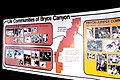 Bryce Canyon National Park 1989 02.jpg 1,057 × 705; 739 KB
-
 Bryce Canyon National Park 1989 03.jpg 1,057 × 637; 889 KB
-
 Bulletin board in Fort Yellowstone.jpg 3,069 × 1,945; 469 KB
-
 C&O Canal NHP waysideamphipods (7074475013).jpg 1,280 × 960; 317 KB
-
 Cabin 19-10-18 706.jpg 4,608 × 2,592; 3.41 MB
-
 Canal Flood of 1996.jpg 601 × 800; 82 KB
-
 Canyon Overlook, Zion National Park - panoramio (5).jpg 4,000 × 3,000; 4.71 MB
-
-

-
 Changing Size and Colors P9121109.jpg 3,072 × 2,304; 1.04 MB
-
 Civil War Defenses of Washington (Fort Stevens) FSTV CWDW-0010.jpg 3,008 × 2,000; 878 KB
-
 Civil War Defenses of Washington (Fort Stevens) FSTV CWDW-0017.jpg 3,008 × 2,000; 2.84 MB
-
 Civil War Defenses of Washington (Fort Stevens) FSTV CWDW-0018.jpg 3,008 × 2,000; 2.97 MB
-
 Civil War Defenses of Washington (Fort Stevens) FSTV CWDW-0048.jpg 3,008 × 2,000; 844 KB
-
 Columbiad at Fort Sumter.jpg 5,312 × 2,988; 6.44 MB
-
 Coot Bay Pond^ - panoramio (1).jpg 1,792 × 1,312; 1.03 MB
-
 Coot Bay Pond^ - panoramio.jpg 1,792 × 1,312; 1.08 MB
-
 Court of the Patriarchs, Abraham, Isaac, Moroni.jpg 8,396 × 5,770; 15.7 MB
-
 Crawford Arch sign, Zion National Park, Oct 16.jpg 2,592 × 1,944; 2.42 MB
-
 Crop Field 19-10-18 713.jpg 4,608 × 3,072; 4.79 MB
-
 Crop Field 19-10-18 714.jpg 4,608 × 3,072; 5.27 MB
-
 Crop Field 19-10-18 715.jpg 4,608 × 3,072; 3.85 MB
-
 Crossing Over wayside in Columbus, KY (5ec71a39-6663-401b-86fe-acd9c2a1020c).JPG 6,000 × 4,000; 6.04 MB
-
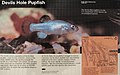 Death Valley National Park sign - The Devils Hole Pupfish (5628756233) (cropped).jpg 2,289 × 1,440; 1.19 MB
-
 Descriptive plaque 20211014 181124518.jpg 4,032 × 3,024; 2 MB
-
 Dixon Cave & info. (Mammoth Cave National Park, Kentucky, USA) (8330434138).jpg 4,000 × 3,000; 2.65 MB
-
 Driven by Rain, Pa-hay-okee Trail, Everglades National Park, Florida (51130488153).jpg 5,184 × 3,888; 5.99 MB
-
 DSC05722 (21895436759).jpg 5,456 × 3,632; 5.69 MB
-
 Fairfax County - Fort Marcy - 20200412143025.jpg 1,908 × 4,032; 2.52 MB
-
 Fairfax County - Fort Marcy - 20200412143615.jpg 4,032 × 1,908; 2.9 MB
-
 Fairfax County - Fort Marcy - 20200412143941.jpg 4,032 × 1,908; 3.47 MB
-
 Finns Point Rear Range Light, Pennsville Township, NJ - information sign.jpg 3,075 × 2,050; 1.44 MB
-
 Flash Flood Potential!, Oct 16.jpg 1,944 × 2,592; 1.67 MB
-
 Floating Forest, Everglades National Park, Florida (51130680209).jpg 5,184 × 3,888; 6.87 MB
-
 Fort Barrancas Trench (3161c0e1-043d-49b1-9088-c4f69bfe59ce).jpg 4,032 × 3,024; 3.02 MB
-
 Fort sumter (bombarding).jpg 600 × 400; 56 KB
-
 Fort Sumter National Monument marker (2).jpg 5,312 × 2,988; 5.24 MB
-
-
 Friendship Hill National Historic Site - Point Marion, Pennsylvania (8481243095).jpg 3,072 × 2,304; 741 KB
-
 Friendship Hill National Historic Site - Point Marion, Pennsylvania (8481244089).jpg 3,072 × 2,304; 751 KB
-
 Friendship Hill National Historic Site - Point Marion, Pennsylvania (8481245239).jpg 3,072 × 2,304; 712 KB
-
 Friendship Hill National Historic Site - Point Marion, Pennsylvania (8482328610).jpg 3,072 × 2,304; 786 KB
-
 Friendship Hill National Historic Site - Point Marion, Pennsylvania (8482330532).jpg 3,072 × 2,304; 759 KB
-
 Friendship Hill National Historic Site - Point Marion, Pennsylvania (8482336824).jpg 3,072 × 2,304; 818 KB
-
 Ft San Carlos 2018-08-01 369.jpg 4,608 × 3,072; 3.33 MB
-
 Ft San Carlos 2018-08-01 370.jpg 4,608 × 3,072; 4.25 MB
-
 George Washington Headquarters, Valley Forge, PA.jpg 3,024 × 4,032; 3.88 MB
-
 George Washington Headquarters, Valley Gorge, Pennsylvania.jpg 4,032 × 3,024; 2.81 MB
-
 Gettysburg Battlefield (3440759263).jpg 1,024 × 768; 316 KB
-
 Gettysburg Battlefield (3440798635).jpg 1,024 × 768; 306 KB
-
 Gettysburg Battlefield (3440806405).jpg 1,024 × 768; 305 KB
-
 Gettysburg Battlefield (3440813927).jpg 1,024 × 768; 307 KB
-
 Gettysburg Battlefield (3441614124).jpg 1,024 × 768; 304 KB
-
 Grant's Canal, plaque and map.jpg 3,600 × 2,400; 3.98 MB
-
 Grassy Waters, Pa-hay-okee Trail, Everglades National Park, Florida (51131387270).jpg 5,184 × 3,888; 5.79 MB
-
 Halemaumau Crater, Kīlauea Caldera, Hawaiʻi Volcanoes National Park, Hawaii (4529315656).jpg 2,816 × 2,112; 2.31 MB
-
 Harpers Ferry National Historical Park HAFE0013.jpg 1,536 × 2,048; 649 KB
-
 Hell's Half Acre.JPG 3,216 × 2,136; 3.02 MB
-
 Hoh Rainforest - Olympic National Park - Washington State (9780179775).jpg 3,072 × 2,304; 764 KB
-
 Horseshoe Bend NMP DSC 0246 (5586391902).jpg 3,872 × 2,592; 1.26 MB
-
 How Arches are Formed, Arches National Park, Utah (2438543073).jpg 2,048 × 1,536; 517 KB
-
 IMG 3938 - panoramio.jpg 1,280 × 960; 275 KB
-
 Impassable Barrier, sign for Zion-Mount Carmel Tunnel, Oct.jpg 2,592 × 1,944; 2.36 MB
-
 Information 720.jpg 4,608 × 3,072; 3.43 MB
-

-

-

-
-
-

-

-
 Kenilwoth Park and Aquatic Garden views 02.jpg 4,032 × 3,024; 3.37 MB
-
 Kenilwoth Park and Aquatic Garden views 03.jpg 4,032 × 3,024; 2.21 MB
-
 Kentucky 723.jpg 4,608 × 3,072; 5.65 MB
-
 Kīlauea Caldera, Hawaiʻi Volcanoes National Park, Hawaii (4528685941).jpg 2,816 × 2,112; 2.35 MB
-
 Landscape arch sign - arches national park, ut.jpg 3,264 × 2,448; 2.3 MB
-
 Landscape Arch, Arches National Park, Moab, Utah (9101887078).jpg 4,000 × 3,000; 2.92 MB
-
 Last Spike Driven, Golden Spike National Historical Park, Promontory, Utah (30383439417).jpg 5,184 × 3,888; 6.46 MB
-
 Lava Tube Sign (24366838322).jpg 6,000 × 4,000; 10.05 MB
-
 Lewis & Clark PA140773.JPG 3,048 × 1,807; 660 KB
-
 Lincoln Boyhood National Memorial - Indiana - 7724413908.jpg 2,304 × 3,072; 965 KB
-
 Lincoln Boyhood National Memorial - Indiana - 7724414614.jpg 3,072 × 2,304; 952 KB
-
 Lincoln Boyhood National Memorial - Indiana - 7724420638.jpg 3,072 × 2,304; 1.03 MB
-
 Lincoln Knob Creek Gollaher Cabin.JPG 1,600 × 1,200; 600 KB
-
 Lockkeeper's House, C & O Canal Extension, Washington, D.C. (2012) - 2.JPG 4,000 × 3,000; 2.07 MB
-

-
 Mazie Hirono at Kilauea Military Camp 03.jpg 4,096 × 2,730; 1.5 MB
-
 Mesa Verde National Park - Mancos Valley - panoramio.jpg 5,184 × 3,456; 3.91 MB
-
 Mission San Jose, Texas, USA - panoramio (3).jpg 3,701 × 2,837; 3.09 MB
-
 Mission San Jose, Texas, USA - panoramio (7).jpg 2,470 × 1,495; 1.01 MB
-
 Mission San Juan Capistrano San Antonio, TX, United States - panoramio (10).jpg 2,948 × 3,727; 2.7 MB
-
-
 Monument Dedication Display.jpg 4,000 × 6,000; 4.3 MB
-
 Monument Row Battleground Guilford Courthouse National Military Park - panoramio.jpg 1,536 × 2,048; 1.17 MB
-

-
 Mount Pleasant - Charles Pinckney National Historic Site - 20220618085622.jpg 4,032 × 3,024; 4.21 MB
-
 Mt Welby and Root Cellar Oxon Hill Manor Dec 10.JPG 2,592 × 1,944; 707 KB
-
 Nancy Lincoln Inn 19-10-18 643.jpg 4,608 × 3,072; 3.3 MB
-
 Narada Falls.jpg 1,519 × 1,200; 1.67 MB
-
 National Christmas Tree (28e66a88-9d07-4217-b029-dfba76365d12).jpg 1,080 × 810; 337 KB
-
 National park marker for Annaberg school.jpg 4,032 × 1,960; 3.91 MB
-
 NPS - Erie Canal.JPG 1,600 × 1,200; 922 KB
-
 NPS Garthright House marker.jpg 5,312 × 2,988; 6.72 MB
-
 NPS Sand Cave Carnival Sunday Marker.jpg 2,181 × 1,394; 958 KB
-
 NPS sign Building Fort Necessity.jpg 4,032 × 1,960; 3.51 MB
-
 NPS sign Fort Necessity British Defenses.jpg 4,032 × 1,960; 3.53 MB
-
 NPS sign Fort Necessity French Attack.jpg 4,032 × 1,960; 3.38 MB
-
 NPS sign Fort Necessity Surrender.jpg 4,032 × 1,960; 4.1 MB
-

-

-
 Oak Hill Seminole Rest other house sign01.jpg 3,264 × 2,448; 2.78 MB
-
 Oak Hill Seminole Rest sign01.jpg 3,264 × 2,448; 2 MB
-
 Oak Hill Seminole Rest sign02.jpg 3,264 × 2,448; 2.09 MB
-
 Oak Hill Seminole Rest sign03.jpg 3,264 × 2,448; 2.39 MB
-
 Oak Hill Seminole Rest sign04.jpg 3,264 × 2,448; 2.08 MB
-
 Old Saint Augustine City Gate; Interpretive sign.jpg 3,648 × 2,736; 2.06 MB
-
 Oxon Hill Farm, Oxon Hill, Maryland (14311317930).jpg 3,000 × 4,000; 2.6 MB
-
 Oxon Hill Farm, Oxon Hill, Maryland (14311362620).jpg 4,000 × 3,000; 3.35 MB
-
 Oxon Hill Farm, Oxon Hill, Maryland (14311366890).jpg 4,000 × 3,000; 2.6 MB
-
 Oxon Hill Farm, Oxon Hill, Maryland (14311436918).jpg 4,000 × 3,000; 2.2 MB
-
 Oxon Hill Farm, Oxon Hill, Maryland (14474923696).jpg 4,000 × 3,000; 2.53 MB
-
 Oxon Hill Farm, Oxon Hill, Maryland (14494585521).jpg 4,000 × 3,000; 2.35 MB
-
 Oxon Hill Farm, Oxon Hill, Maryland (14496745304).jpg 4,000 × 3,000; 2.49 MB
-
 Oxon Hill Farm, Oxon Hill, Maryland (14496777802).jpg 3,000 × 4,000; 2.47 MB
-
 Oxon Hill Farm, Oxon Hill, Maryland (14498057385).jpg 4,000 × 3,000; 2.76 MB
-
 Panels describing events of that day 2.JPG 4,000 × 3,000; 4.87 MB
-
 Panels describing events of that day 3.JPG 2,572 × 3,125; 3.13 MB
-
 Panels describing events of that day 4.JPG 3,000 × 4,000; 4.79 MB
-
 Panels describing events of that day.JPG 4,000 × 3,000; 4.99 MB
-
 Park Service Historic Marker 20230924 103207.jpg 4,000 × 3,000; 3.63 MB
-
 Part of Saratoga National Historical Park - Schuylers House - display.JPG 2,592 × 1,944; 1.54 MB
-
 Patterns in Stone, Checkerboard Mesa sign, Oct 16.jpg 2,592 × 1,944; 2.4 MB
-
 Pender County - Moores Creek National Battlefield - 20220617095313.jpg 4,032 × 3,024; 3.5 MB
-
 Pensacola FL Fort Barrancas Redoubt sign01.jpg 3,264 × 2,448; 2.83 MB
-
 Petrified Forest (31589956035).jpg 3,264 × 2,448; 3.23 MB
-
 Pinacles P9040353 sign.JPG 2,048 × 1,536; 631 KB
-
 Pinnacle Overlook Shelter, Cumberland Gap, KY - 53042912649.jpg 4,032 × 3,024; 5.02 MB
-
 Pinnacles P9040373 CCC.JPG 1,536 × 2,048; 641 KB
-
 Prince George's County - Fort Foote - 20180903113635.jpg 2,988 × 5,312; 4.93 MB
-

-
 Ricksecker Point Wayside 2 (ea6d4e11-99fa-4caa-b3c1-96162efd1014).jpg 3,502 × 2,779; 3.88 MB
-
 Riverfront Exhibit P7280464.JPG 2,048 × 1,536; 570 KB
-
 Riverfront Exhibit P7280465.JPG 2,048 × 1,536; 566 KB
-

-
 Roadtrip-097 (50203567282).jpg 5,520 × 3,680; 9.68 MB
-
 Rock Rivers sign at Horsehead Mountain Overlook.jpg 6,016 × 4,000; 6.82 MB
-
 Roebling's Delaware Aqueduct.jpg 720 × 720; 228 KB
-
 Roeblings Bridge P6270140 cable anchorage sign.jpg 2,919 × 1,519; 440 KB
-
 Sagamore Hill NHS; Housing the Staff Sign.jpg 3,648 × 2,736; 2.05 MB
-
 Sagamore Hill NHS; Old Orchard Sign.jpg 3,648 × 2,736; 2.09 MB
-
 Sagamore Hill NHS; Working the Fields Sign.jpg 3,648 × 2,736; 2.07 MB
-
 Scotts Bluff National Monument - Nebraska (14439470982).jpg 3,072 × 2,304; 840 KB
-
 Scotts Bluff National Monument - Nebraska (14439696474).jpg 3,072 × 2,304; 823 KB
-
 Scotts Bluff National Monument - Nebraska (14460942633).jpg 3,072 × 2,304; 936 KB
-
 Shaw's Point Archeological District sign.jpg 2,000 × 1,496; 2.97 MB
-
 Siege of Vicksburg (10474159454).jpg 4,752 × 3,168; 2.34 MB
-
 Signs at Puʻu Loa Petroglyphs (2926485453).jpg 3,892 × 2,586; 11.58 MB
-
 Signs at Puʻu Loa Petroglyphs (2927329826).jpg 3,892 × 2,586; 10.18 MB
-
 Signs at Puʻu Loa Petroglyphs (2927333274).jpg 3,299 × 2,201; 6.92 MB
-
 South Beach - Olympic National Park - Washington State (9784043334).jpg 3,072 × 2,304; 649 KB
-
 South Carolina - Ninety Six National Historic Site - 20220621082850.jpg 4,032 × 3,024; 6.61 MB
.jpg)


_crossing_the_New_River_between_Fayette_and_South_Fayette_in_Fayette_County,_West_Virginia.jpg)
_crossing_the_New_River_between_Fayette_and_South_Fayette_in_Fayette_County,_West_Virginia.jpg)


.jpg)


.jpg)

.jpg)
.jpg)
.JPG)
.JPG)


.jpg)
_-_DSC00879.JPG)
.jpg)
.jpg)


.jpg)


.jpg)
.jpg)
.jpg)

_FSTV_CWDW-0010.jpg)
_FSTV_CWDW-0017.jpg)
_FSTV_CWDW-0018.jpg)
_FSTV_CWDW-0048.jpg)

.jpg)


.JPG)
_(cropped).jpg)

_(8330434138).jpg)
.jpg)
.jpg)


.jpg)
.jpg)
.jpg)
.jpg)
.jpg)
.jpg)
.jpg)
.jpg)
.jpg)
.jpg)
.jpg)


.jpg)
.jpg)
.jpg)
.jpg)
.jpg)

.jpg)
.jpg)


.jpg)
.jpg)
.jpg)


.JPG)
.jpg)
.jpg)
.jpg)
.jpg)
.jpg)
.jpg)


.jpg)

.jpg)
.jpg)
.jpg)


_-_2.JPG)
.jpg)


.jpg)
.jpg)
.jpg)


.jpg)


.jpg)


.JPG)
.JPG)


.jpg)
.jpg)
.jpg)
.jpg)
.jpg)
.jpg)
.jpg)
.jpg)
.jpg)


.jpg)


.jpg)
.jpg)


.jpg)
.jpg)


.jpg)
.jpg)
.jpg)

.jpg)
.jpg)
.jpg)
.jpg)
.jpg)
